A Central America map turns a narrow isthmus that is easily compressed on a world map into a readable sequence of seven countries. The supplied views show the region from Belize and Guatemala beside Mexico to Panama beside Colombia, with the North Pacific Ocean on one side and the Caribbean Sea on the other. Enlarging that chain makes the shared borders, two-coast setting, and north-to-south order much easier to understand.
The collection provides three treatments of the same regional extent: a color country map, a black-and-white labeled map, and a blank outline map. They are arranged for an A3 layout and delivered through the preserved ZIP download, which contains the available image files. Teachers, students, travel writers, presentation designers, and bloggers can therefore start with the version that matches the task instead of removing unwanted detail from a road map.
Each image emphasizes national boundaries rather than highways, cities, or physical relief. That deliberate limit is useful: a reader can trace the mainland connection, compare the relative positions of the countries, or add a route without competing layers. The same Central America map footprint also makes it practical to switch between a finished reference, a printer-friendly handout, and an unlabelled activity sheet.
Table of Contents
Central America map Overview
Central America forms the southern part of the North American landmass and links toward South America at the Panama–Colombia boundary. In the supplied maps, Mexico provides context at the northwest edge and Colombia appears at the southeast edge. Those neighboring labels prevent the seven-country strip from floating without orientation, while the surrounding water explains why the region reads as a long coastal corridor rather than a compact block.
From northwest to southeast, the mapped countries are Belize, Guatemala, El Salvador, Honduras, Nicaragua, Costa Rica, and Panama. Their arrangement is not a simple straight line. Belize occupies the Caribbean side north of Guatemala; El Salvador is a small Pacific-facing country; Honduras projects toward the Caribbean; and Nicaragua, Costa Rica, and Panama continue the narrowing connection toward Colombia. A dedicated regional view gives these relationships enough room to remain legible.
The images are political reference maps, not navigation charts. They show country names and borders in the color and monochrome editions, but they do not supply roads, distances, capitals, elevation, or travel conditions. Use them to explain location and sequence, then pair them with an appropriate current travel or thematic source when a project requires operational detail.
Included Map Styles
All three images share a 1200-by-856-pixel landscape composition. The regional frame stays consistent, so notes or highlights developed on one version can be transferred to another without relearning the layout. Mexico and Colombia are shaded as neighboring context, and the main Central American country boundaries remain the visual anchor.
- The color edition combines labels, borders, distinct country fills, and blue water.
- The black-and-white edition retains country and water labels while removing the colored fills.
- The outline edition retains the country shapes and border network but removes the geographic labels.
This shared framing matters when preparing a lesson or slide sequence. A presenter can introduce the labeled Central America map, move to the monochrome view for discussion, and finish with the outline for audience recall. A teacher can follow the same progression from reference sheet to guided worksheet to independent labeling activity.
Color Central America Country Map
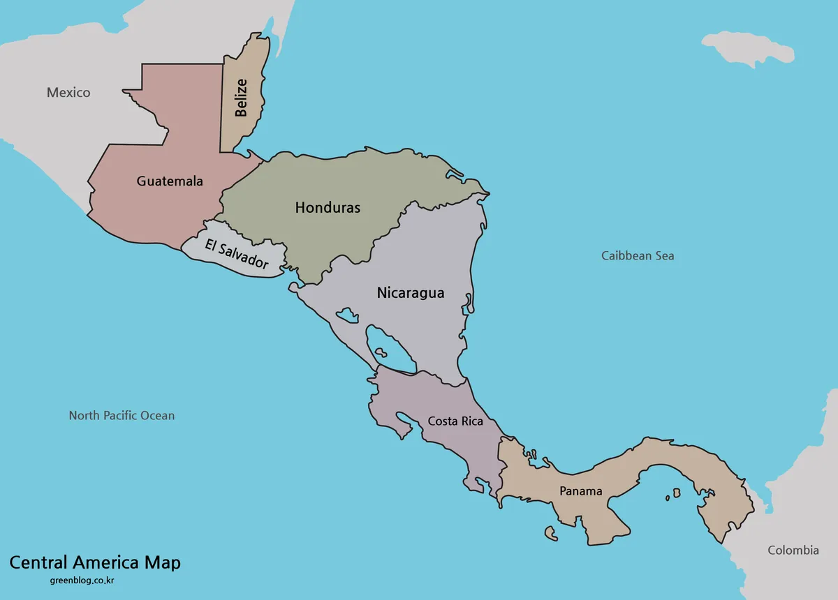
Color separation makes the compact northern cluster especially easy to scan. Guatemala, Belize, Honduras, and El Salvador meet within a relatively small portion of the frame, yet their contrasting fills keep adjacent shapes distinct. Farther southeast, different fills help the eye follow Nicaragua, Costa Rica, and Panama without losing the border sequence.
Use this version when the map must communicate immediately, such as on an introductory slide, a blog graphic, or a geography reference page. The blue water also clarifies the two maritime sides, while the subdued neighboring land establishes the link to Mexico and Colombia. Country color is categorical rather than thematic, so it should not be interpreted as representing population, politics, climate, or any other dataset.
For a presentation, place the color view on screen before adding arrows or callouts. Its existing labels support quick recognition, and the open water provides visual room for short annotations. Keep any added legend separate from the country colors unless the new colors genuinely encode information.
Black and White Printable Version
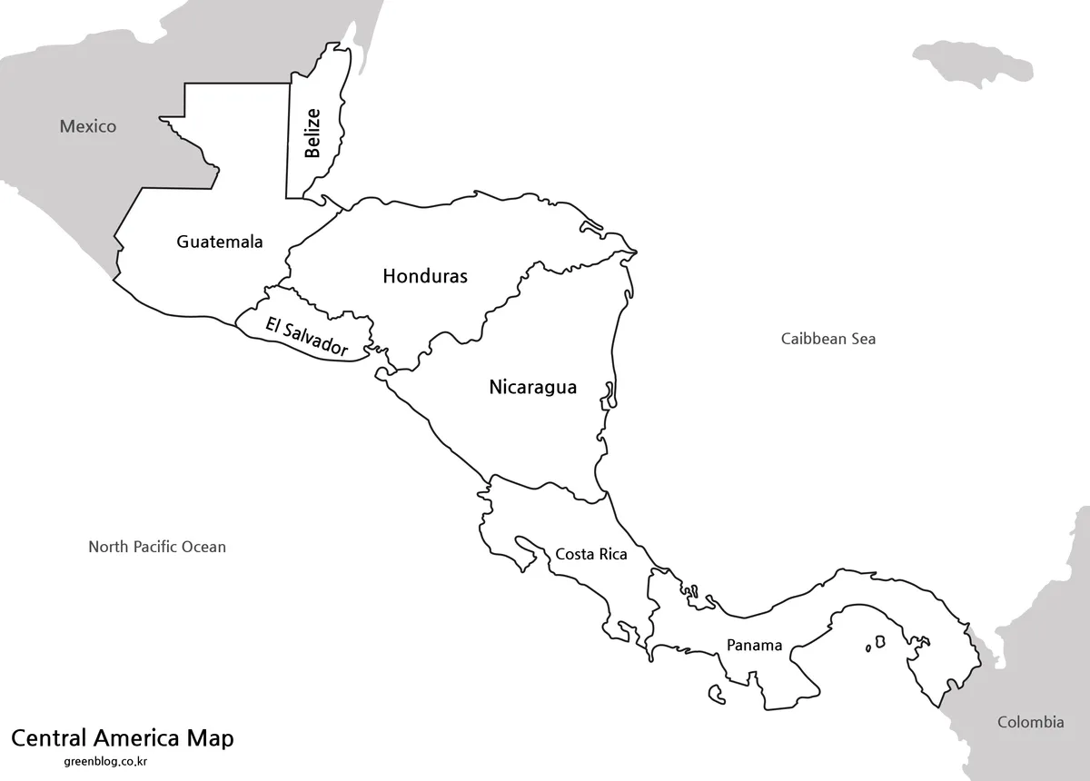
The monochrome Central America map keeps the same country names, border lines, neighboring context, and ocean labels while leaving the interiors white. That restraint suits photocopies, reports, and classroom packets where colored ink is unnecessary. It also gives handwritten notes more contrast than the filled edition.
This is the strongest choice for a labeled worksheet that students will annotate rather than complete from memory. They can circle the smaller countries, draw a directional line toward Panama, shade selected nations, or compare Pacific and Caribbean access while the printed names remain available. Because it is already labeled, it also works as an answer key for an exercise based on the outline map.
Before producing a full class set, print one test page at the intended scale. Select landscape orientation, preserve the image proportions, and avoid stretching it to fill margins. A3 provides more room for the narrow borders and rotated labels, but smaller output may still be adequate if the printer preserves line clarity.
Blank Central America Outline Map for Editing
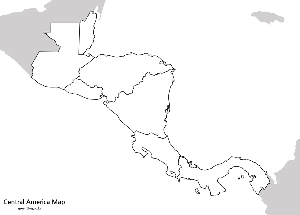
The outline file removes place and water labels but preserves the seven-country boundary pattern and the adjacent silhouettes at both ends. It is therefore a blank political base rather than a blank sheet: learners still receive the shapes and border clues, but must supply the names, directions, or categories themselves.
Classroom tasks can ask students to label every country, identify the two neighboring countries beyond the region, or use two colors to distinguish Pacific and Caribbean coasts. Designers can build a simple route diagram by adding points and arrows, while researchers can shade countries according to a clearly cited dataset. The unlabelled Central America map is also helpful for quizzes because no answer text appears inside the country areas.
When adding information digitally, work on a duplicate and keep the original image unchanged. Use short labels, a high-contrast typeface, and a legend placed in open water rather than over a narrow country. Any added border status, statistics, or route information should be dated and sourced separately; the supplied outline alone does not establish those details.
Regional Features That Make the Map Useful
The region’s elongated form creates a map-reading challenge that a world view rarely solves. Several countries are small relative to the surrounding continents, and some labels need different orientations to fit. Enlarging the isthmus allows Belize and El Salvador to remain visible while preserving the broader transition from Mexico through Panama to Colombia.
Coastlines provide a second organizing idea. Guatemala, Honduras, Nicaragua, Costa Rica, and Panama reach across or toward both maritime sides, while Belize faces the Caribbean and El Salvador faces the Pacific. The Central America map makes that pattern visible without introducing relief or transport layers, which is useful for an initial regional lesson before moving to more specialized maps.
The frame also reveals why country order should not be taught as a memorized list alone. Honduras lies beside Guatemala, El Salvador, and Nicaragua; Costa Rica sits between Nicaragua and Panama; and Panama bends eastward toward Colombia. Tracing those contacts on the image supports spatial recall more effectively than reading the names without their shapes.
Practical Uses for the Map Collection
Choose by the amount of guidance the finished page should provide. Use color for quick orientation and projected display, monochrome when labels must remain visible on economical printouts, and outline when the reader needs to supply information. That decision is more useful than treating the three files as interchangeable styles.
For a geography lesson, begin with the color reference and ask learners to trace the land connection and locate the two seas. Follow with the black-and-white sheet for notes, then use the outline as a retrieval exercise. For a travel or logistics graphic, use the labeled version as context but verify routes, crossings, and conditions through current authoritative sources before publishing.
In design work, the wide composition suits landscape slides, report inserts, and horizontal web graphics. Leave enough margin around the narrow southern arc so Panama is not cropped, and do not place text over small countries. If the Central America map is reduced substantially, check Belize and El Salvador first because their compact shapes and labels will lose legibility sooner than the larger areas.
Frequently Asked Questions
What is included in the Central America map collection?
The collection includes a color map, a black and white map, and an outline map.
Which countries are shown on the Central America map?
The map focuses on the Central American region, including countries such as Guatemala, Belize, Honduras, El Salvador, Nicaragua, Costa Rica, and Panama.
Can I print the Central America map in A3 size?
Yes. The map is prepared for A3 high-resolution printing, making it suitable for classroom materials, posters, handouts, and presentations.
What is the outline map best for?
The outline version works well for editing, coloring, route marking, country labeling, infographic work, and classroom activities.
Which version should I use for a presentation?
The color map is usually best for presentations because it separates countries quickly and makes the regional flow easier to understand.
Map File Information
The download provides three views of the same seven-country regional layout for reference, printing, labeling, and annotation.
- Included Versions: Color, black and white, and outline maps
- Printable Size: A3 layout
- File Type: JPG / PNG / ZIP
- Intended Use: Lessons, handouts, presentations, route graphics, and country-labeling activities
Related Maps
Additional Resources
- Library of Congress Central America Map — Explore a cataloged regional map and its bibliographic record for additional geographic context.
Green Map creates custom-edited map images using open geographic data sources such as geoBoundaries, Natural Earth, OpenStreetMap, and government open data.
These maps are edited visual materials, not raw data files, and are provided for education, documents, presentations, and graphic reference.