A Korean version of this map page is available. View Korean Page
The Uganda map in this collection was prepared for users who need a clear printable reference for East Africa. Uganda is a landlocked country bordered by Kenya, Tanzania, Rwanda, the Democratic Republic of the Congo, and South Sudan. Because the country is closely connected to large lakes such as Lake Victoria, Lake Albert, Lake Edward, and Lake Kyoga, a map is especially helpful when explaining its regional layout and surrounding geography.
This printable Uganda map collection includes three versions: a color map, a black and white map, and an outline map. The files are designed for A3 layout use and general image-based projects, making them suitable for classroom handouts, presentation slides, blog graphics, geography worksheets, infographic layouts, and editable visual materials. The color map works well when users want quick visual separation between regions. The black and white version is cleaner for printing and document insertion. The outline version gives teachers, students, and designers a simple base for adding their own information.
Uganda’s layout is not only about its land borders. The presence of large lakes gives the country a distinctive map shape and makes it useful for lessons about East African geography, water resources, regional travel routes, and neighboring countries. While preparing this map set, the layout was kept simple so that the main regions, surrounding countries, and selected lakes could be understood without making the page visually crowded.
For English-speaking users, this map can be used as a printable study resource, a visual aid in presentations, a blog image, or a base map for design projects. It is especially useful when a plain country silhouette is not enough and users need a labeled, readable, and editable Uganda regional map.
Table of Contents
What Is Included
This Uganda map set includes three practical map styles. Each version has a different purpose, so users can choose the one that fits their project instead of editing one finished image repeatedly.
The color version is best for quick explanation and visual comparison. The black and white map is useful for printing, worksheets, and reports where clean boundaries and labels matter more than color. The outline map is designed as a working base for custom edits, including coloring, route marking, data labels, and infographic annotations.
Regional Layout and Lakes
Uganda is often introduced as an East African landlocked country, but its map is strongly shaped by water. Lake Victoria sits along the southern side, while Lake Albert and Lake Edward help define important western areas. Lake Kyoga is also useful as a visual reference inside the country.
For this map collection, the layout focuses on major regional divisions rather than showing every smaller district. Uganda has many district-level divisions, but including too much detail can make a printable map harder to read. A simpler regional structure works better for classroom use, presentation slides, and general reference materials.
Neighboring countries are kept visually simple so the map does not become too crowded. This helps the viewer focus on Uganda itself while still understanding its position between Kenya, Tanzania, Rwanda, the Democratic Republic of the Congo, and South Sudan.
Color Uganda Regional Map
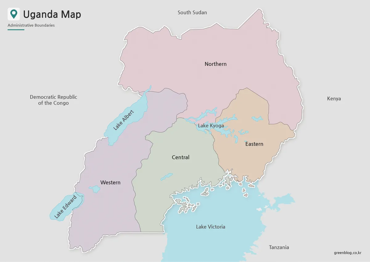
Designed for quick visual reading, the color Uganda map separates the main regional areas while keeping the lake layout easy to notice. This is helpful because Uganda’s geography is closely tied to Lake Victoria and other large lakes, so the map needs to show both land divisions and water features clearly.
The color version works well in presentation slides, educational materials, and blog posts where readers need to understand the country’s position in East Africa. It can also support regional comparison materials, especially when explaining Uganda’s relationship with Kenya, Tanzania, Rwanda, South Sudan, and the Democratic Republic of the Congo.
During the map preparation process, the color balance was kept moderate so that the regions remain readable without overpowering the lake labels and neighboring-country names. This makes the map useful as a finished visual image rather than only as a background graphic.
Black and White Uganda Map
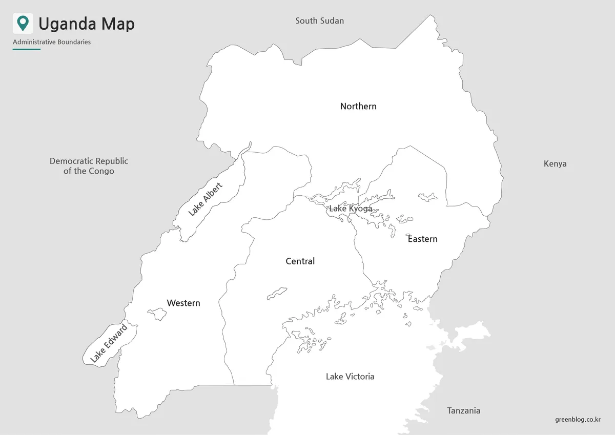
For printed documents, the black and white Uganda map provides a cleaner layout with reduced visual weight. Without color blocks, the focus moves to labels, boundary lines, and the overall shape of the country. This makes it a good option for worksheets, school reports, classroom packets, and document inserts.
Because Uganda includes several important lake areas, a clean black and white map can be easier to copy, print, and annotate. Students can mark nearby countries, circle Lake Victoria, or add short notes without the page becoming too visually busy.
The line thickness and label visibility were checked with A3 printing in mind. The goal was to keep the map readable when printed large, while still allowing it to be reduced for smaller documents or presentation handouts.
Blank Uganda Outline Map for Editing
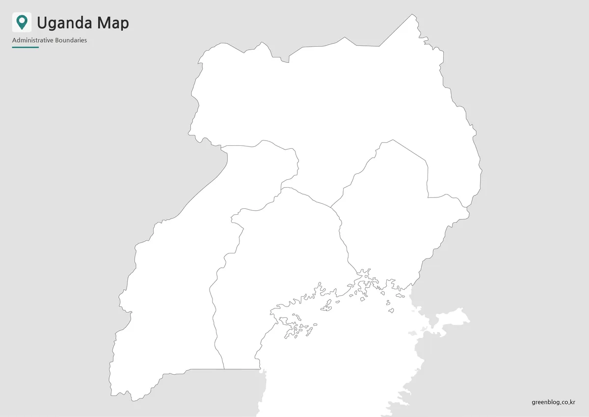
The blank outline version is the most flexible option for editing. It removes color and unnecessary visual elements, leaving a simple base map that can be customized for different projects. Teachers can use it for coloring activities, students can label regions and lakes, and designers can build infographic layouts on top of it.
This version is useful when users want to add their own information, such as travel routes, lake markers, neighboring-country arrows, population notes, resource data, or regional comparison labels. It also works well for blog graphics where the final design needs a custom color scheme.
Instead of removing colors from a finished map, users can begin with the outline version and build the visual style they need. For projects involving East Africa or lake-based geography, this blank format gives more control over what appears on the final image.
Practical Uses for This Uganda Map
A printable Uganda map can be used in many different contexts. Teachers may use it for East Africa geography lessons, lake identification activities, and regional comparison worksheets. Students can include it in school assignments, country reports, or presentation boards.
Bloggers and infographic creators may use the map as a visual reference when writing about East African countries, Lake Victoria, travel routes, or regional geography. Presentation creators can use the color map for quick explanation, while the black and white version works better when the map needs to fit into a clean document layout.
The three-version structure makes the resource easier to reuse. A finished visual is available through the color map, a clean printable layout is available through the black and white map, and a customizable working base is available through the outline map.
Frequently Asked Questions
What is included in this Uganda map collection?
The collection includes a color map, a black and white map, and an outline map of Uganda. Each version is designed for a different use, including printing, classroom reference, presentation design, and graphic editing.
Can I print the Uganda map in A3 size?
Yes. The map set is prepared for A3 layout printing, making it suitable for larger classroom handouts, reference sheets, and presentation materials.
Why does the map focus on larger regional divisions?
A simplified regional layout is easier to read on a printable map. Showing every smaller district can make the page too crowded, especially for classroom or presentation use.
Does the map include lakes?
Yes. The map includes selected major lakes such as Lake Victoria, Lake Albert, Lake Edward, and Lake Kyoga to help readers understand Uganda’s geographic layout.
Which version is best for editing?
The outline map is the best choice for editing. It provides a clean boundary layout that can be used for coloring, labels, data overlays, travel routes, and infographic work.
Download Uganda Map
This download includes printable Uganda map versions for educational use, presentation design, document printing, and editable graphic projects.
- Included Versions: Color map, black and white map, outline map
- Printable Size: A3 layout
- File Type: Image files
- Intended Use: Classroom handouts, presentations, blog graphics, infographic editing, and printable reference materials
Additional Resources
- UN Geospatial : A useful reference for general geographic context and map-related information for countries and regions.
Related Maps
- Tanzania Map with Regional Boundaries – High Resolution A3 Layout
- Sudan Map Files – Printable Reference and Blank Outline Versions
- South Africa Map Download – Printable Administrative Maps
- Sierra Leone Map for Presentations, Worksheets, and Infographic Projects
Green Map creates custom-edited map images using open geographic data sources such as geoBoundaries, Natural Earth, OpenStreetMap, and government open data.
These maps are edited visual materials, not raw data files, and are provided for education, documents, presentations, and graphic reference.