This Nebraska Map collection includes color, black and white, and outline versions designed for printing, classroom reference, presentation slides, blog graphics, and editable map projects. Nebraska is located in the central United States and borders South Dakota, Iowa, Missouri, Kansas, Colorado, and Wyoming, so a clear county map is useful when explaining how the state connects with the broader Great Plains region.
Nebraska may look simple on a national map because of its broad rectangular shape, but the state covers a large area of about 200,356 square kilometers. Its population is relatively small compared with its land area, which means many counties are spread across wide agricultural plains rather than dense urban corridors. For that reason, a printable Nebraska Map is more useful than a small location image when users need to compare county areas, prepare educational materials, or explain regional relationships across the Midwest and Great Plains.
This map set was prepared as a practical visual resource rather than a road or tourism map. The color version helps separate counties quickly, the black and white version is easier to print and annotate, and the blank outline version gives designers and teachers a clean base for custom work. The original map files are prepared in JPG format and arranged for A3 high-resolution use, making them suitable for enlarged viewing, classroom handouts, presentation boards, document layouts, and infographic projects.
While preparing the map collection, special attention was given to county label placement. Nebraska has many counties across a wide state area, so labels can easily feel crowded if the map is reduced too much or if the colors compete with the text. The final layout keeps the county structure readable while removing unnecessary road and facility details, allowing the map to focus on boundaries, names, and overall state geography.
Table of Contents
Nebraska Map Overview
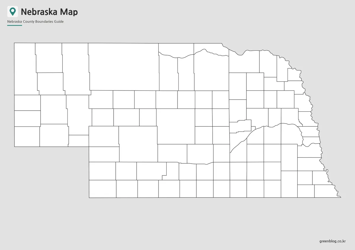
The Nebraska Map is designed around county boundaries and regional readability. Instead of presenting every road, city, or physical feature, the layout focuses on the state’s administrative structure so users can quickly understand how counties are arranged from east to west.
This is especially helpful for comparing Nebraska with surrounding states. The eastern side connects toward Iowa and Missouri, the south borders Kansas, and the western side leads toward Colorado and Wyoming. A county-based map makes these relationships easier to explain in classroom lessons, state comparison posts, and presentation materials.
Included Map Versions
This printable Nebraska map collection includes three main versions:
- Color county map
- Black and white basic map
- Blank outline map
Each version has a different purpose. The color map works best when users need quick visual separation, the black and white version is better for printing and note-taking, and the outline map is useful for editing, coloring, and custom data projects.
Color Nebraska County Map
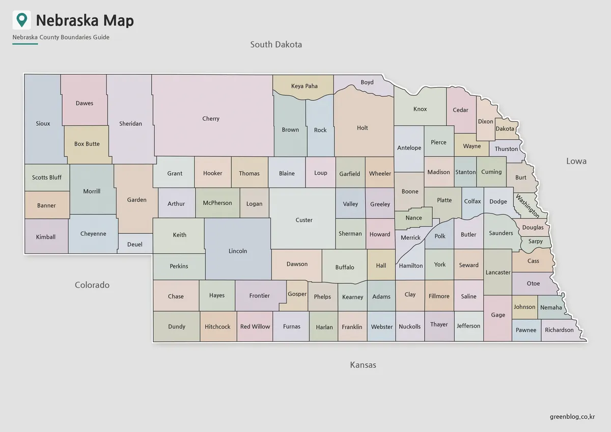
The color Nebraska Map helps readers understand the county layout at a glance. Because Nebraska covers a wide plains area with many county divisions, color separation makes it easier to compare regions without relying only on thin boundary lines.
This version is a good choice for presentation slides, classroom geography materials, blog images, and regional comparison graphics. The color-coded layout helps viewers follow county groupings across the state, especially when explaining Nebraska in relation to Kansas, Iowa, South Dakota, Wyoming, and Colorado.
The map also includes Korean and English place-name labeling in the original design. That makes it useful for bilingual reference materials or for users who want to recognize both local English names and Korean explanations in one visual resource.
Black and White Printable Version
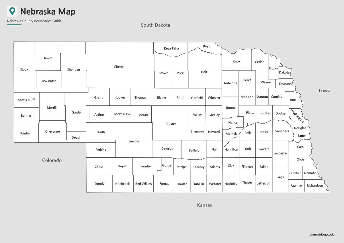
For printed materials, the black and white Nebraska map offers a cleaner layout with the color fills removed. This helps reduce ink use and keeps county labels easier to read when the map is placed inside reports, worksheets, or classroom handouts.
Nebraska’s wide shape means that label clarity matters more than decorative detail. A simpler background gives users room to write notes, mark selected counties, or highlight areas by hand. It also works well in documents where a neutral map image is easier to combine with paragraphs, tables, or presentation text.
This version is especially practical for teachers, students, and anyone preparing printed study resources. It keeps the focus on county names and boundaries while avoiding visual clutter.
Blank Nebraska Outline Map for Editing
The blank outline version removes both color and labels, leaving only the Nebraska county boundary structure. This format works as a flexible base map for custom projects.
Designers can add colors, icons, data labels, agricultural regions, population notes, travel routes, or county-specific highlights. Teachers can use the same outline map for coloring activities, quiz sheets, or geography worksheets where students identify counties themselves.
During preparation, the boundary lines were checked so the outline version can be used more easily for color filling and graphic editing. That makes it useful for infographic projects where users need a clean starting point rather than a finished labeled map.
Practical Uses for This Nebraska Map
This Nebraska Map collection can be used in many real-world settings. In classrooms, the labeled and black and white versions work well for state geography lessons, county comparison exercises, and Great Plains region studies. For students, the outline map can support assignments that require labeling, coloring, or adding regional data.
For bloggers and content creators, the color map is useful when writing about Nebraska, the Midwest, agriculture, road trip planning, or surrounding state relationships. Designers may prefer the outline version when building custom visuals for presentations, infographics, or map-based data graphics.
The collection is not intended to replace a detailed navigation map. It is designed as a printable and editable visual reference for users who need to explain Nebraska’s shape, county structure, and central U.S. location clearly.
Frequently Asked Questions
Is this Nebraska Map suitable for A3 printing?
Yes. This Nebraska Map was prepared for A3 high-resolution use, so it works well for classroom materials, presentation boards, and printed reference sheets.
Which version should I use first?
Use the color map if you want to understand the county layout quickly. The color separation makes the regional structure easier to scan.
Which Nebraska map is best for printing?
The black and white version is usually best for printed handouts, reports, and worksheets because it keeps the county labels clear while reducing color use.
Can I edit the outline map?
Yes. The blank outline map is suitable for adding county colors, data marks, travel routes, labels, or infographic elements.
Does the map include detailed roads or facilities?
No. The map focuses on county boundaries and labels rather than roads or facility locations, which keeps the layout cleaner for educational and presentation use.
Download Nebraska Map
This download includes printable Nebraska map versions for educational use, presentation design, document printing, and editable graphic projects.
- Included Versions: Color map, black and white map, outline map
- Printable Size: A3 layout
- File Type: JPG image files
- Intended Use: Classroom handouts, presentations, blog graphics, infographic editing, and printable reference materials
Additional Resources
- USGS National Map : A useful official map service for checking U.S. geographic, topographic, and regional reference information.
Related Maps
- Montana State Map Download – Printable County Boundary Map
- Kansas Map Download – Printable County Map Collection
- High Resolution North Dakota Map for Classroom, Presentation and Design Projects
- Nevada Map Download | Printable County Maps in Color, Black and White & Outline