A North Macedonia Map becomes much easier to read when its eight statistical regions are treated as the main subject rather than as unnamed patches inside the national outline. In this set, Polog and Southwestern occupy the west, Skopje and Northeastern span the north, Eastern and Southeastern fill the east, and Pelagonia and Vardar cover much of the south and center. Surrounding labels place the landlocked country between Albania, Kosovo, Serbia, Bulgaria, and Greece.
The download contains three 1,200 × 849-pixel WebP previews built on the same regional framework: a pastel color reference, a labeled black-and-white version, and an unlabeled outline. The first two show the region names, the capital marker at Skopje, neighboring countries, and selected lake shapes. The outline keeps the national edge and internal regional divisions while removing names, the capital symbol, lake details, and surrounding-country labels.
This North Macedonia Map collection is useful for regional lessons, worksheet questions, country-profile slides, document illustrations, and custom annotations. It is not a municipal, road, terrain, or navigation map: no municipality names, road routes, distances, scale bar, north arrow, or elevation data appear. That distinction matters because North Macedonia’s statistical regions are broad comparison units, not a substitute for the country’s finer local-government boundaries.
Table of Contents
North Macedonia Map Overview
The country sits in the central Balkans without a seacoast. Its outline meets Kosovo and Serbia along the north, Bulgaria on the east, Greece on the south, and Albania on the west. Keeping these five neighbors around the mapped shape provides immediate orientation, especially for readers comparing the country with a wider Balkan map.
The regional pattern is organized around eight labeled areas. Polog follows much of the northwestern side, while Southwestern reaches down the Albanian border toward the large lake at the southwest corner. Pelagonia occupies the broad southern interior, Vardar forms a long central belt, and Southeastern reaches the lower eastern frontier. Eastern sits above it, Northeastern crosses the upper-right area, and the Skopje region surrounds the capital in the upper center.
These are statistical regions, a level commonly used to organize and compare official data. They should not be read as eight provinces with the same function as municipalities. The supplied maps also do not label every city within a region: Skopje is the only city explicitly identified, marked by a star on the two labeled versions.
Three lake forms help anchor the southern part of the labeled maps. Lake Ohrid lies along the Albanian border in the southwest, Lake Prespa touches the southern border farther east, and the much smaller Lake Dojran appears near the southeastern edge. Their names are not printed on the artwork, so a teacher or presenter can use a separate current geography source when the lesson requires precise lake identification.
Map Styles Included
All three North Macedonia Map views use the same landscape composition and regional outlines. This consistency lets readers move from a finished reference to a labeling activity without relearning the country’s orientation. The differences concern how much guidance remains on the page.
- Color regional map: eight muted fills separate the statistical regions, with labels and a red star for Skopje.
- Black-and-white map: the same names, borders, lakes, and capital marker remain on a white interior.
- Blank outline map: national and regional boundaries remain, but labels, symbols, and lake shapes are removed.
The maps use English labels rather than the bilingual labeling claimed in the earlier copy. They also use the shorter heading “Macedonia Map” within the artwork, while the surrounding page identifies the country by its current English name. Readers adapting the images should retain that visible wording in mind when pairing them with captions or explanatory text.
Color North Macedonia Map
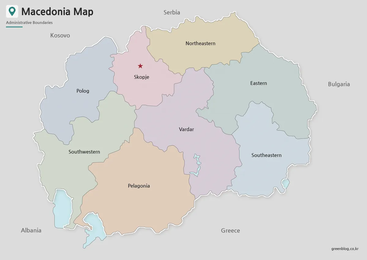
The color view is the fastest reference when an audience needs to distinguish adjacent regions at a glance. Polog is blue-gray, Skopje pink, Northeastern tan, Eastern pale green-blue, and Vardar lavender; the remaining fills continue the soft palette without overwhelming the boundary lines. A red star makes the capital stand apart from the region label that shares its name.
Use this version for an introductory slide, a regional comparison card, or a classroom answer key. The colored water bodies also help readers recognize the southwest and southeast edges. Because the palette is decorative rather than a data scale, the colors do not encode population, elevation, political control, or any ranked statistic.
When placing the image on a presentation, preserve enough width for “Northeastern,” “Southwestern,” and “Southeastern” to remain legible. Avoid adding a legend that assigns meaning to the existing colors. If the project needs quantitative shading, start from the outline and create a separate legend tied to a cited dataset.
Black and White Printable Version
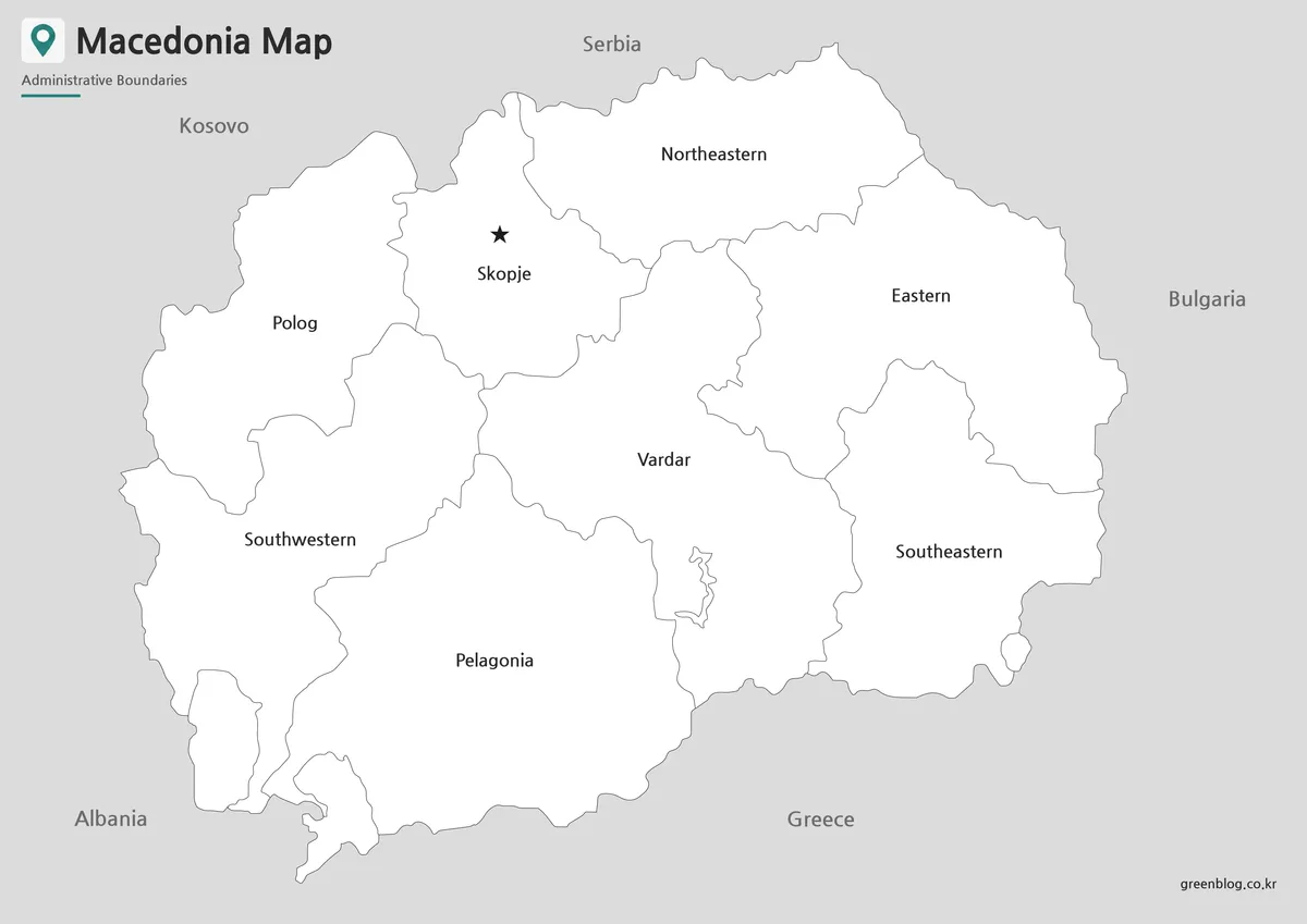
The labeled monochrome North Macedonia Map retains almost all of the reference content from the color version. Region names, neighboring countries, internal boundaries, lakes, and the Skopje star stay visible, but the regional fills become white. This makes the image suitable for grayscale documents and gives students room to add their own color key.
Choose it when names must remain available during an activity. Students can trace the Vardar region through the center, compare the two western regions, or group the eastern side without guessing which section is which. For a quiz that tests recall rather than recognition, the blank version is more appropriate because this one already supplies every regional answer.
For printing, run a single-page test before producing a class set. Printer margins and automatic scaling can shrink the light boundary lines, even when the source artwork uses an A3-oriented layout. “Fit to page” is convenient, but a reduced copy should still be checked for the smallest labels and the thin lake outlines.
Blank North Macedonia Outline Map for Editing
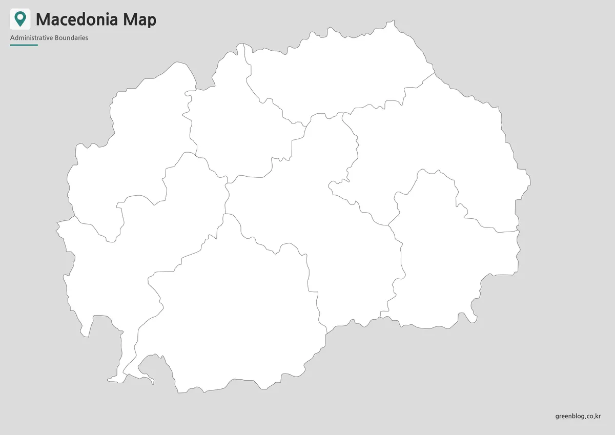
The outline strips the composition down to the national silhouette and eight internal areas. It does not show Skopje, region names, neighboring countries, or the lakes visible in the reference maps. That makes it a deliberate activity base rather than a simplified reference sheet.
Teachers can ask learners to label all eight regions, mark the capital, add the five neighboring countries, or identify the three southern lakes using an atlas. Designers can apply a new categorical palette, place icons, or build a regional comparison graphic. Since the supplied asset is a raster image rather than a confirmed vector file, large-format editing should begin with a resolution test.
Avoid using the blank boundaries for municipal-level statistics. If a dataset is organized by municipality, its values cannot be assigned accurately to these eight broad shapes without aggregation. For region-level data, verify that the source uses the same statistical division and state the reference year in the finished graphic.
Prepared for Printing and Presentation Use
Each supplied North Macedonia Map preview has a 1,200 × 849-pixel landscape canvas, close to the proportions of an A-series page. The original article identifies the set as prepared for A3 output, but final sharpness still depends on printer settings, scaling, and viewing distance. Use the available image at its natural proportions and avoid stretching it to fill a differently shaped frame.
For slides, place the map on a simple background and keep explanatory labels outside the national outline. For handouts, the monochrome version minimizes color use while retaining answers. For posters or data graphics, the outline gives the cleanest base, although any new markers and legends should be clearly distinguished from the original boundary artwork.
Practical Uses
Select the map by the amount of information the reader should receive. Use color for rapid visual separation, monochrome for a labeled print reference, and outline for recall, annotation, or a new thematic layer. Do not choose solely by appearance: the task determines whether names and the capital marker should already be visible.
- Create a Balkan geography sheet that pairs the country outline with its five neighbors.
- Compare the positions of Polog, Pelagonia, Vardar, and the other statistical regions.
- Build a capital-location exercise by transferring the Skopje star to the blank map.
- Use the labeled version as an answer key for an eight-region quiz.
- Add region-level categories only after checking the dataset’s geography and date.
- Supplement the set with a current road map when planning travel or routes.
A North Macedonia Map can also support a comparison with Albania, Kosovo, Serbia, Bulgaria, or Greece, provided each neighboring map uses a compatible level of detail. When exact distances, border crossings, municipal boundaries, or transport connections are required, use a specialized current source rather than inferring them from these regional illustrations.
Frequently Asked Questions
Can I print this North Macedonia Map in A3 size?
Yes. The maps were prepared for A3 high-resolution printing, making them suitable for classroom handouts, reports, and presentation materials.
Which version is best for printed documents?
The black and white map is usually the best option for printing because it keeps labels clear and reduces color use.
Does the map include English labels?
Yes. The map includes Korean and English labels, making it useful for bilingual reference materials.
Are lakes shown on the map?
Yes. Major lake areas are marked separately so they can be identified more easily.
Which North Macedonia Map is best for editing?
The blank outline map is the best choice for editing. It works well for adding colors, labels, statistics, icons, or route markers.
Map File Information
The package provides color, labeled black-and-white, and blank regional outline views for reference, teaching, presentations, and annotation.
- Included Versions: Color map · Black and white map · Outline map
- Printable Size: Prepared for A3 output
- File Type: Image files
- Intended Use: Lessons, worksheets, slides, and regional graphics
Related Maps
Additional Resources
- North Macedonia Timeless — The national tourism portal introduces the country’s cities, regions, landscapes, activities, and trip-planning information.
Green Map creates custom-edited map images using open geographic data sources such as geoBoundaries, Natural Earth, OpenStreetMap, and government open data.
These maps are edited visual materials, not raw data files, and are provided for education, documents, presentations, and graphic reference.