A Ghana Map in this collection shows the country’s former ten-region arrangement, not the 16-region system used today. The clue is Brong-Ahafo: it appears as one large region, while the old Northern, Volta, and Western regions have not yet been divided. This historical boundary context should be understood before the images are used in a lesson, report, or infographic.
Ghana moved from ten to 16 regions in 2019. In the present system, Brong-Ahafo is no longer a region; its territory is represented by Ahafo, Bono, and Bono East. North East and Savannah were separated from the former Northern Region, Oti from Volta, and Western North from Western. None of those newer boundaries or labels appears on these files.
The ten names visible here are Upper West, Upper East, Northern, Brong-Ahafo, Volta, Ashanti, Eastern, Western, Central, and Greater Accra. A Ghana Map with this configuration can still support historical comparison and boundary-change lessons, but it should not be presented as a current administrative reference without a clear date note.
Three matching versions are supplied: a pastel color map, a labeled black-and-white map, and an unlabeled outline. All three previews measure 1200 × 1697 pixels and share the same former regional boundaries. Lake Volta remains visible as a large branching interior water shape, and a star marks the capital location within Greater Accra near the coast.
Table of Contents
Printable Ghana Map Collection
The labeled versions include the ten former region names, Burkina Faso, Togo, Côte d’Ivoire, the southern ocean label, and the capital star. Lake Volta is drawn but not named. The outline removes all words, color, and the star while retaining the national silhouette, old regional lines, and the lake’s branching shoreline.
The artwork prints “Cote D’Ivoire” without the standard circumflex and uses “North Atlantic Ocean” below the coast. Modern English text normally preserves the official country name Côte d’Ivoire, while Ghana’s coast is commonly described as facing the Gulf of Guinea, part of the Atlantic Ocean. Those differences are worth noting when copying labels into new material.
No roads, railways, rivers, terrain, districts, travel routes, or city network is included. Although the capital star identifies the Accra area, the word Accra is not printed beside it. Users who need additional cities or accurate present-day regional boundaries should consult a current reference rather than estimating positions from the blank base.
Easy-to-Read Regional Layout
At the northern end, Upper West and Upper East sit above the very large former Northern Region. That older Northern shape extends far south around the upper branches of Lake Volta. On a current map, Savannah and North East would create additional divisions within this broad area, so the apparent size of Northern is one of the clearest signs that the artwork predates the 2019 structure.
Brong-Ahafo stretches across much of the middle-west and reaches toward Lake Volta. Its single label is another historical marker because the name disappeared from the first-level regional list when Ahafo, Bono, and Bono East were established. The file is therefore useful for comparing old and new arrangements, not for teaching those three current regions separately.
Along the east, the former Volta Region runs from the Togo border toward the coast. The current Oti Region is absent as a separate unit. In the southwest, Western remains undivided because Western North is not shown. Ashanti, Eastern, Central, and Greater Accra retain familiar positions across the southern half of the country.
Lake Volta is the strongest physical feature in the artwork. Its long, irregular shape cuts through the eastern and central interior and helps explain why several regional boundaries bend around water. The map does not label the lake or show tributary rivers, however, so readers should identify it in the caption or surrounding text rather than assume every white interior space is self-explanatory.
Color Ghana Map for Regional Reference
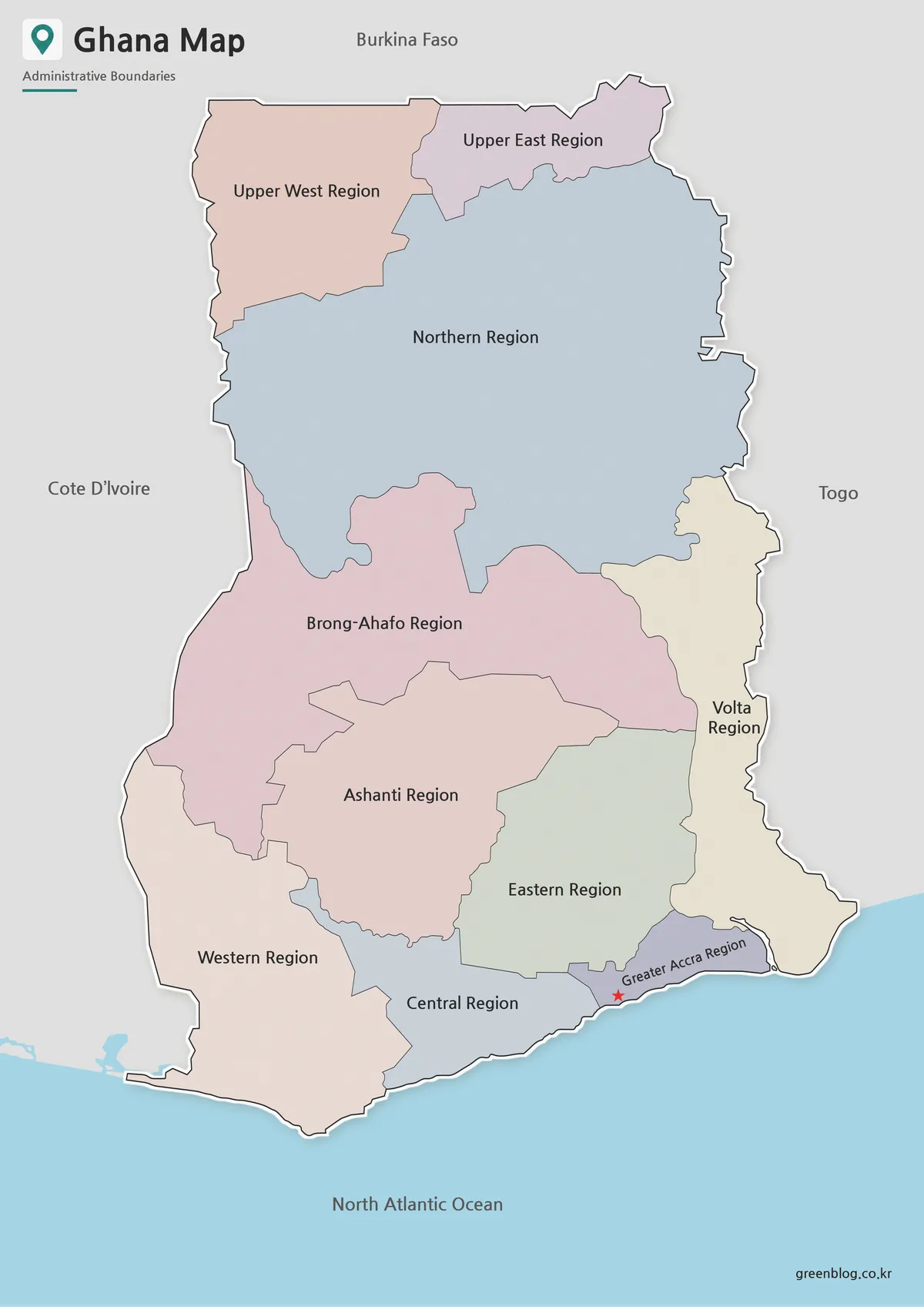
Pastel fills make adjoining former regions easy to separate. Northern occupies the largest blue area, Brong-Ahafo forms a wide pink band below it, and Ashanti sits in the south-central interior. Greater Accra is a narrow coastal shape beside Eastern and Volta, while Central and Western continue westward along the shoreline.
The red star lies within Greater Accra close to the coast and functions as the capital marker. Because no city name accompanies it, a first-time reader may need a caption explaining that the symbol represents Accra. The map contains no other city symbols, so it cannot support comparisons among Kumasi, Tamale, Sekondi-Takoradi, or other urban centers.
The colors do not encode population, language, cocoa production, elevation, election results, or dates. Their only purpose is categorical separation. A presentation using thematic data should add a new legend and cite a source rather than assigning meaning to the existing palette.
Black and White Ghana Map for Printing
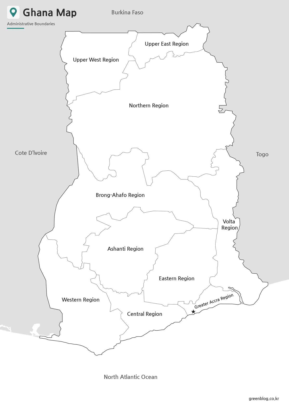
The monochrome version replaces colored regional fills with white while preserving the labels, capital symbol, internal boundaries, and surrounding geographic context. It is practical for low-ink handouts, report appendices, and answer sheets. Students can add their own shading without first covering a preset color scheme.
Boundary lines make the historical structure particularly clear. The large Brong-Ahafo, Northern, Volta, and Western shapes can be compared directly with a current 16-region source. This creates a useful change-over-time activity: learners can identify which old regions were divided and which names remained in use.
Lake Volta remains an unfilled branching form, and the capital star changes from red to black. The labels stay readable without color, but the page still supplies no scale, routes, or terrain. It should be used for regional reference rather than navigation or distance measurement.
Blank Ghana Outline Map for Editing
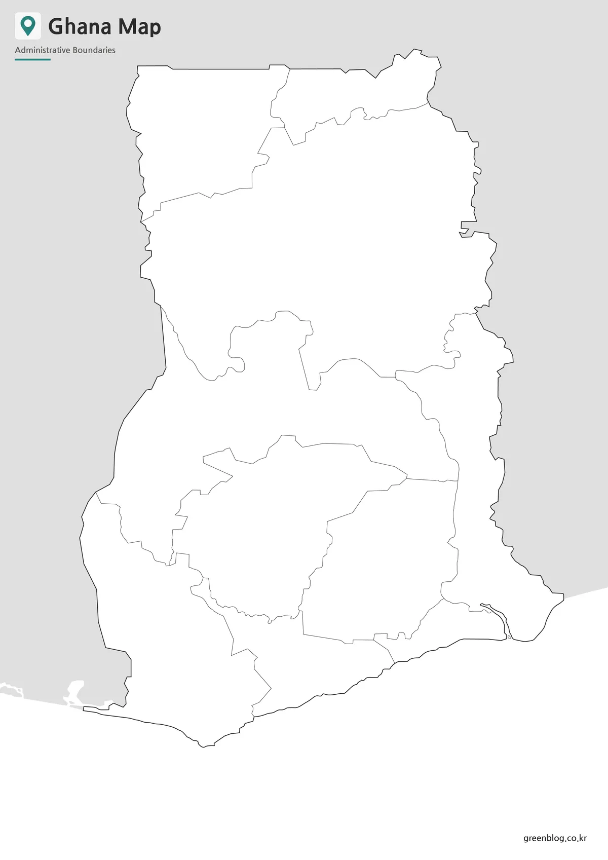
The outline version removes all labels, the capital star, neighboring-country names, and color while keeping the old regional geometry. Lake Volta’s outline remains visible. Because the map has no date or region names inside the image, anyone distributing it should state explicitly that the boundaries represent the former ten-region arrangement.
For a historical labeling exercise, begin with Upper West and Upper East at the top, then place Northern below them. Brong-Ahafo and Ashanti anchor the center, while Western, Central, Greater Accra, and Volta organize the coast. Eastern fills the southeast-central interior around the lower part of Lake Volta.
The blank base can also support a comparison overlay showing where the later regions were created. Such an overlay must be drawn from an authoritative current source because the new lines are not present here. The supplied image is a raster graphic, not a confirmed layered vector file, so additions are safest on a separate digital layer.
Built for Classroom, Blog, and Presentation Use
This collection is strongest when the historical boundary date is part of the subject. A teacher can pair the labeled ten-region map with a current 16-region reference, a blogger can explain Ghana’s 2019 administrative change, and a presenter can use the outline to reveal the later divisions step by step.
For ordinary present-day country profiles, add a visible note or choose a newer administrative map. Readers often assume that a clean labeled image is current, and the familiar names Greater Accra, Ashanti, and Central may hide the outdated divisions elsewhere. Clear dating prevents that misunderstanding.
Practical Uses for This Ghana Map
Choose the color version for immediate separation, the monochrome version when historical labels must remain in a printable document, and the outline for quizzes or sourced comparison overlays. All three share the same 1200 × 1697 proportions, so they can be used together without changing the page composition.
Before printing, preview the portrait layout to keep Burkina Faso, Togo, Côte d’Ivoire, and the ocean label within hardware margins. A fit-to-page setting protects the surrounding context. If the capital star or narrow Greater Accra label becomes too small, a test sheet will reveal the problem before a full classroom set is produced.
The most valuable activity is not simply memorizing ten names but explaining why the image differs from a current map. Identifying Brong-Ahafo and the undivided Northern, Volta, and Western regions turns an outdated boundary graphic into a focused historical resource while preventing accidental publication as present-day geography.
Frequently Asked Questions
Does this Ghana Map include Lake Volta?
Yes. Lake Volta is included because it is one of the most important geographic features in Ghana and helps explain the country’s internal layout.
Can I use the Ghana Map for classroom materials?
Yes. The black and white and outline versions are especially useful for worksheets, handouts, and student activities.
Which version should I use for presentations?
The color Ghana Map is usually best for presentation slides because the regional boundaries are easier to distinguish visually.
Is the outline map editable?
Yes. The blank outline map is intended for editing, coloring, labeling, infographic design, and custom annotations.
Is this Ghana Map suitable for printing?
Yes. The maps are prepared as high-resolution resources and are suitable for printable reference use.
Map File Information
Download three matching Ghana maps based on the former ten-region layout for historical reference and annotation.
- Included Versions: Color labeled, black-and-white labeled, and blank outline maps
- File Type: Image files / ZIP
- Intended Use: Historical comparisons, lessons, reports, and labeling activities
Related Maps
Additional Resources
- Encyclopaedia Britannica: Ghana — Review Ghana’s geography, history, government, and national context.
Green Map creates custom-edited map images using open geographic data sources such as geoBoundaries, Natural Earth, OpenStreetMap, and government open data.
These maps are edited visual materials, not raw data files, and are provided for education, documents, presentations, and graphic reference.