A Tennessee Map is useful for much more than locating Nashville or Memphis on a map of the United States. Tennessee stretches across the southeastern region of the country and connects several major transportation, economic, and cultural corridors. Because the state contains 95 counties and a wide range of geographic regions, maps are frequently used in classroom projects, regional comparison studies, travel planning materials, presentations, and infographic design work.
Located between Kentucky to the north and states such as Georgia, Alabama, Mississippi, Arkansas, Missouri, Virginia, and North Carolina along its borders, Tennessee covers a large area with distinct regional differences. Eastern Tennessee is dominated by the Appalachian Mountains, central Tennessee contains the Nashville metropolitan region, and western Tennessee is centered around Memphis and the Mississippi River corridor. Understanding these regional divisions is often much easier with a detailed county map than with text alone.
This printable Tennessee Map collection was created for users who need clear, high-resolution reference maps for printing or digital projects. The collection includes three versions: a color county map, a black and white labeled map, and a blank outline map. Files are prepared at A3 size and provided in JPG and ZIP formats. Whether you are creating educational handouts, presentation slides, blog graphics, travel materials, or editable geographic resources, each version serves a different purpose while maintaining a clean and readable layout.
During preparation, special attention was given to county boundaries and label placement. Tennessee contains many counties packed into a relatively narrow east-west shape, so readability was reviewed at larger print sizes to ensure county names remain clear when enlarged or printed.
Table of Contents
Map Collection Overview
Included in this Tennessee map set:
- Color county map
- Black and white labeled map
- Blank outline map
- High-resolution A3 format
- JPG image files
- ZIP download package
The collection was designed for both digital and print use. County boundaries remain visible when enlarged, making the maps suitable for presentations, educational worksheets, and regional reference materials.
Tennessee Map for Printing and Reference
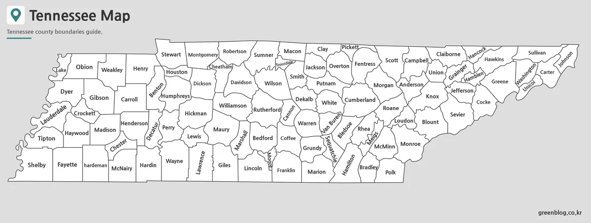
The labeled version focuses on county names and administrative boundaries without relying on heavy color fills. This format works particularly well in reports, research documents, educational materials, and classroom handouts.
Because Tennessee contains 95 counties, label placement required careful adjustment to maintain readability. Major cities such as Nashville, Memphis, Knoxville, and Chattanooga can be located easily while still preserving a clean overall layout.
Black and white printing was reviewed during the design process to ensure county boundaries remain visible even when color printing is unavailable.
Easy-to-Read County Color Map
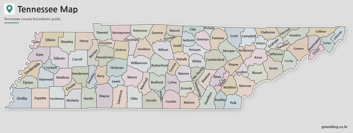
The color version highlights each county using contrasting colors, making regional divisions easier to identify at a glance. This format is often preferred for presentation slides, geography lessons, regional comparison graphics, and visual reference materials.
Tennessee’s long east-west layout creates distinct population centers and economic regions. A color-coded approach makes these differences easier to understand without requiring additional annotations. Neighboring counties were assigned contrasting colors to improve visual separation and readability.
The map also makes it easy to locate major counties such as Davidson County, Shelby County, and Knox County while maintaining a balanced visual appearance across the entire state.
Blank Outline Version for Editing
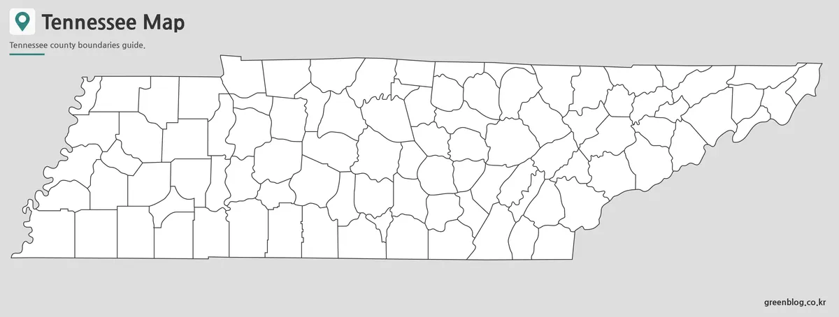
The outline version removes labels and colors while preserving county boundary lines. This creates a flexible base map for custom projects and graphic editing.
Many users prefer outline maps when adding demographic information, election results, transportation routes, tourism markers, or educational annotations. The simplified layout also works well for worksheets, classroom exercises, and infographic projects.
Boundary lines were reviewed at enlarged sizes to ensure they remain clear when used in editing software or printed as large-format educational materials.
Designed for Multiple Uses
Different users often need different map styles. The Tennessee Map collection was prepared with several practical applications in mind:
- Classroom geography lessons
- Educational worksheets
- Regional comparison projects
- Travel planning presentations
- Blog graphics and articles
- Infographic design
- Research documents
- Graphic editing projects
Having multiple versions available allows users to select the most appropriate map without creating custom layouts from scratch.
Frequently Asked Questions
Can I print the Tennessee Map in A3 size?
Yes. The files were prepared at high resolution and reviewed for A3 printing.
Which version is best for presentations?
The color county map is usually the easiest version to read on presentation slides.
Is the outline version editable?
Yes. The outline map works well for graphic editing, annotations, and custom regional projects.
Does the Tennessee Map include county boundaries?
Yes. All versions include Tennessee county boundaries.
Download Information
Tennessee Map Download
Choose the version that best fits your project. Printable and editable map files are included.
- File Format: JPG / ZIP
- Image Size: A3 High Resolution
- Color Mode: RGB
- Intended Usage: Printing · Presentations · Editing
Related Maps
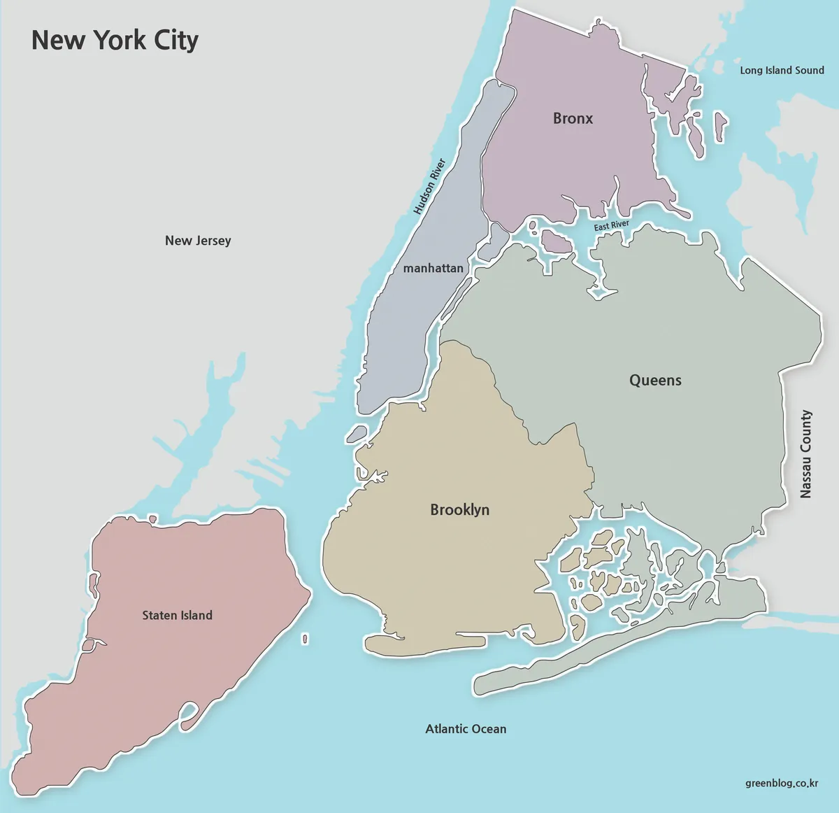
- Printable Utah Map Collection | Color, Black & White, Outline Maps
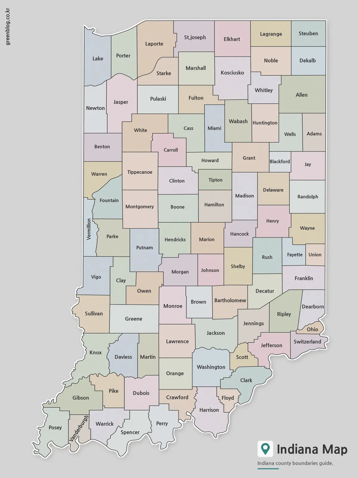
- Printable Indiana State Map Collection | County, Labeled & Outline Maps
- Printable Wisconsin Map Collection | County, Labeled & Outline Maps
- North Carolina State Map Collection (Printable County, Labeled & Outline Maps)
Additional Resources
- USGS National Map – Official mapping resource offering detailed geographic data, topographic maps, and boundary information across the United States.