Finding a reliable Senegal map is often about more than locating the country on a world map. Senegal has one of the most recognizable geographic layouts in West Africa because the territory of The Gambia extends deep into the country, creating a distinctive shape that stands out immediately when viewed on a map. For students, educators, bloggers, presentation creators, and graphic designers, this unusual regional structure makes a visual reference much more useful than a simple written description.
This printable Senegal map collection was created for users who need clear and practical map resources rather than lengthy background information. The set includes three different versions: a color administrative map, a black and white labeled map, and a blank outline map.
All maps were prepared in high resolution with large-format printing in mind and can be used for classroom handouts, regional comparison projects, travel presentations, infographic design, and educational worksheets.
Located on the Atlantic coast of West Africa, Senegal borders Mauritania, Mali, Guinea, and Guinea-Bissau while surrounding much of The Gambia. Dakar, the capital city, is positioned on the western coast and serves as the country’s primary urban center.
Because regional boundaries and the country’s unusual shape are important visual features, special attention was given to readability and regional identification during the map preparation process. Labels were reviewed for visibility at larger print sizes, and the overall layout was adjusted to remain clear when printed on A3 paper.
Table of Contents
Senegal Map Versions Included
The collection contains three map styles designed for different purposes.
Included files
- Color administrative map
- Black and white labeled map
- Blank outline map
- High-resolution printable format
- A3 print-friendly layout
Each version focuses on a different type of use, allowing users to select the most appropriate map for their project.
Regional Color Map
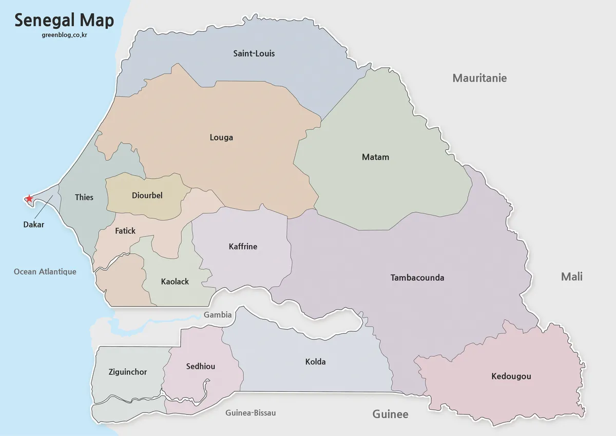
The color version of this Senegal map highlights administrative regions using separate colors for easier visual comparison. Dakar is clearly marked, and the distinctive position of The Gambia remains easy to identify.
Designed for educational presentations and regional overview materials, this version helps users quickly understand how the country’s regions are distributed across the national territory. The simplified neighboring country labels keep the map readable without adding unnecessary visual clutter.
One thing that became clear during the design process was how important the Gambia corridor is for understanding Senegal’s overall shape. Keeping that feature visually distinct improves geographic comprehension immediately.
Black and White Printable Version
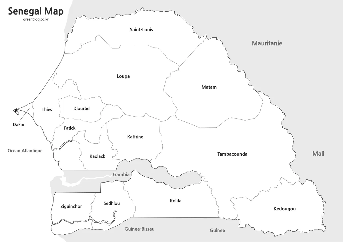
For printing projects, this black and white Senegal map offers a cleaner appearance while preserving regional labels and administrative boundaries.
Many classroom activities, reports, and printed reference sheets work better without heavy color usage. The simplified design keeps labels easy to read while maintaining all major regional information.
The layout was reviewed specifically for large-format printing to ensure that boundaries and place names remain visible when enlarged.
Blank Outline Map for Editing
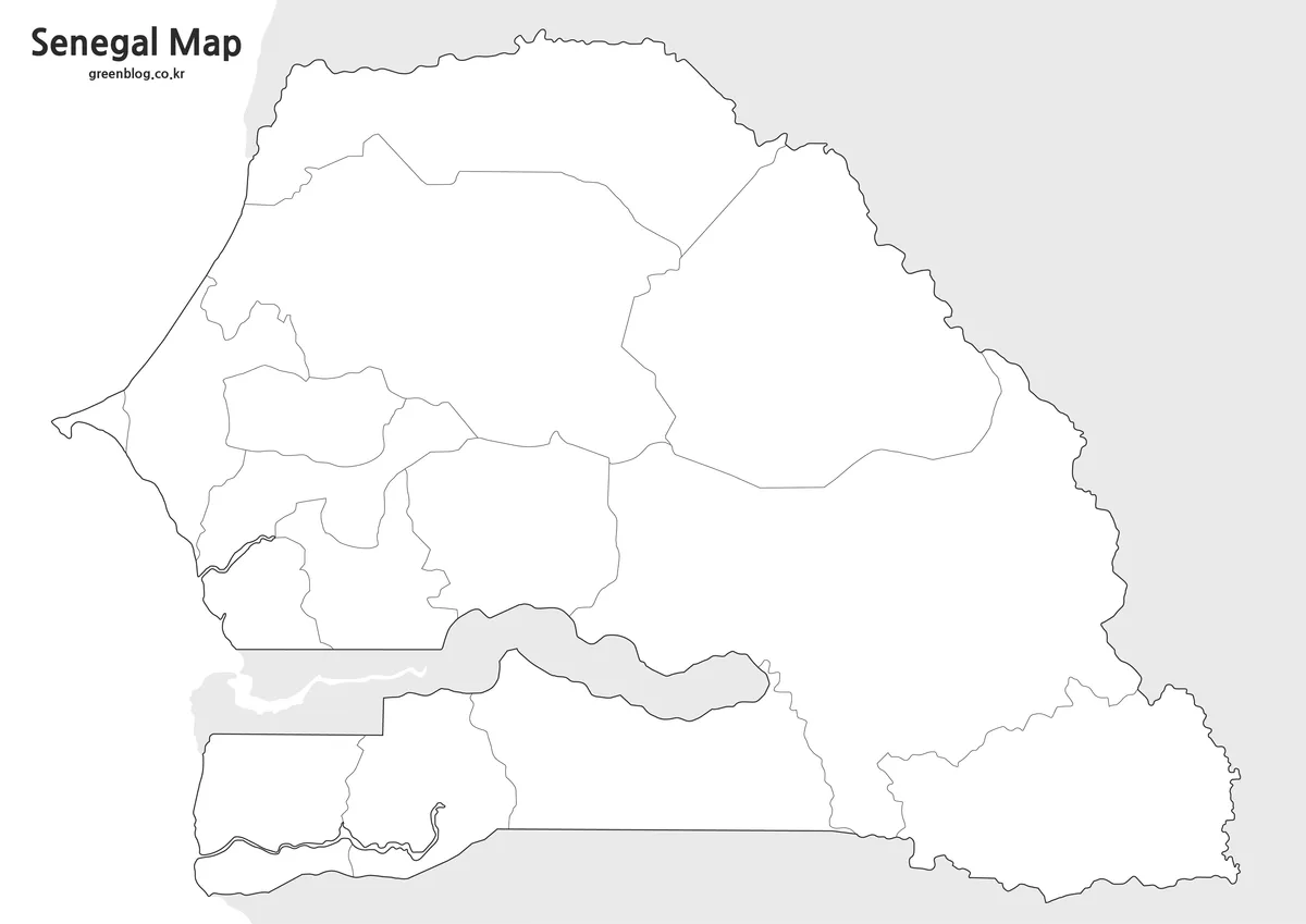
The outline version removes color and text, leaving only the boundary structure.
This format is particularly useful for:
- classroom exercises
- geography worksheets
- infographic projects
- graphic design work
- custom labeling projects
- regional comparison studies
Boundary lines were checked individually to ensure that editing and annotation work can begin immediately without additional cleanup.
Built for Printing and Presentation Use
Several practical situations may benefit from using these maps:
- West Africa geography lessons
- Regional comparison presentations
- Educational handouts
- Travel route planning
- Blog graphics
- YouTube presentation visuals
- Infographic projects
- Administrative region studies
Because Senegal’s shape is unusual compared with many neighboring countries, maps are often more effective than text descriptions when explaining the country’s geographic structure.
Frequently Asked Questions
Does the map show The Gambia?
Yes. The maps clearly display the geographic relationship between Senegal and The Gambia.
Are administrative regions included?
Yes. Regional boundaries are included in both the color and black and white versions.
Can the maps be printed in A3 size?
Yes. The collection was prepared with high-resolution printing in mind and works well at A3 size.
Is the outline version editable?
Yes. The outline map is intended for editing, annotation, coloring activities, and graphic projects.
Download Information
Choose the version that best fits your project. Color, black and white, and outline versions are included together for printing, educational use, and design work.
Senegal Map Download
The Senegal map files are available through the link below. Choose the version you need, including the color map, standard map, or outline map, and save it to your device.
- File Format: JPG / PNG / ZIP
- Use: Printing · Presentation · Editing
- Size: A3 High-Resolution
The files are provided in ZIP format. After downloading, extract the archive to access and use the map files.
Additional Resources
- Wikipedia – Useful for understanding the regional structure shown on the map.
Related Maps
- Liberia Map Collection: Color, Black and White, and Outline Maps
- Printable Paraguay Map Collection for Education and Design Projects
- Printable Iraq Map Download in A3 Size (Color, B&W, Outline)
- 5 United States Maps for Download (Color, Black & White, Outline)
Green Map creates custom-edited map images using open geographic data sources such as geoBoundaries, Natural Earth, OpenStreetMap, and government open data.
These maps are edited visual materials, not raw data files, and are provided for education, documents, presentations, and graphic reference.