This Netherlands map collection was created for people looking for a clean and easy-to-read Netherlands map rather than a highly detailed road map. The files include multiple versions designed for printing, presentations, classroom use, infographic layouts, and graphic editing projects.
The collection includes:
- color regional map
- labeled black and white map
- blank outline map
All versions were designed in high resolution A3 format so the borders and labels remain clear even when printed or enlarged on screen.
The layout focuses on readability instead of excessive detail. Roads, terrain textures, and unnecessary icons were intentionally removed to keep the provincial structure easy to understand at a glance.
Table of Contents
Map Overview
The Netherlands is located in Western Europe between Belgium and Germany. Much of the country consists of low-lying coastal terrain, and its regional structure includes both mainland provinces and coastal island regions connected by bridges and dams.
This map set focuses on the European part of the Netherlands and does not include overseas territories.
The simplified layout works well for:
- classroom handouts
- travel presentations
- infographic projects
- regional comparison graphics
- blog illustrations
- printable worksheets
- editable design projects
Travelers and students who want more detailed regional information can also visit the Official Netherlands Tourism Website.
Included Map Versions
Three different map styles are included in this collection.
Included Files
- Regional color map
- Black and white printable map
- Blank outline map
File Information
- Resolution: 4960 × 3500
- Format: JPG
- Color Mode: CMYK
- Designed for A3 printing
The maps were created using Adobe Illustrator and Photoshop to keep lines clean even at larger print sizes.
Regional Color Map
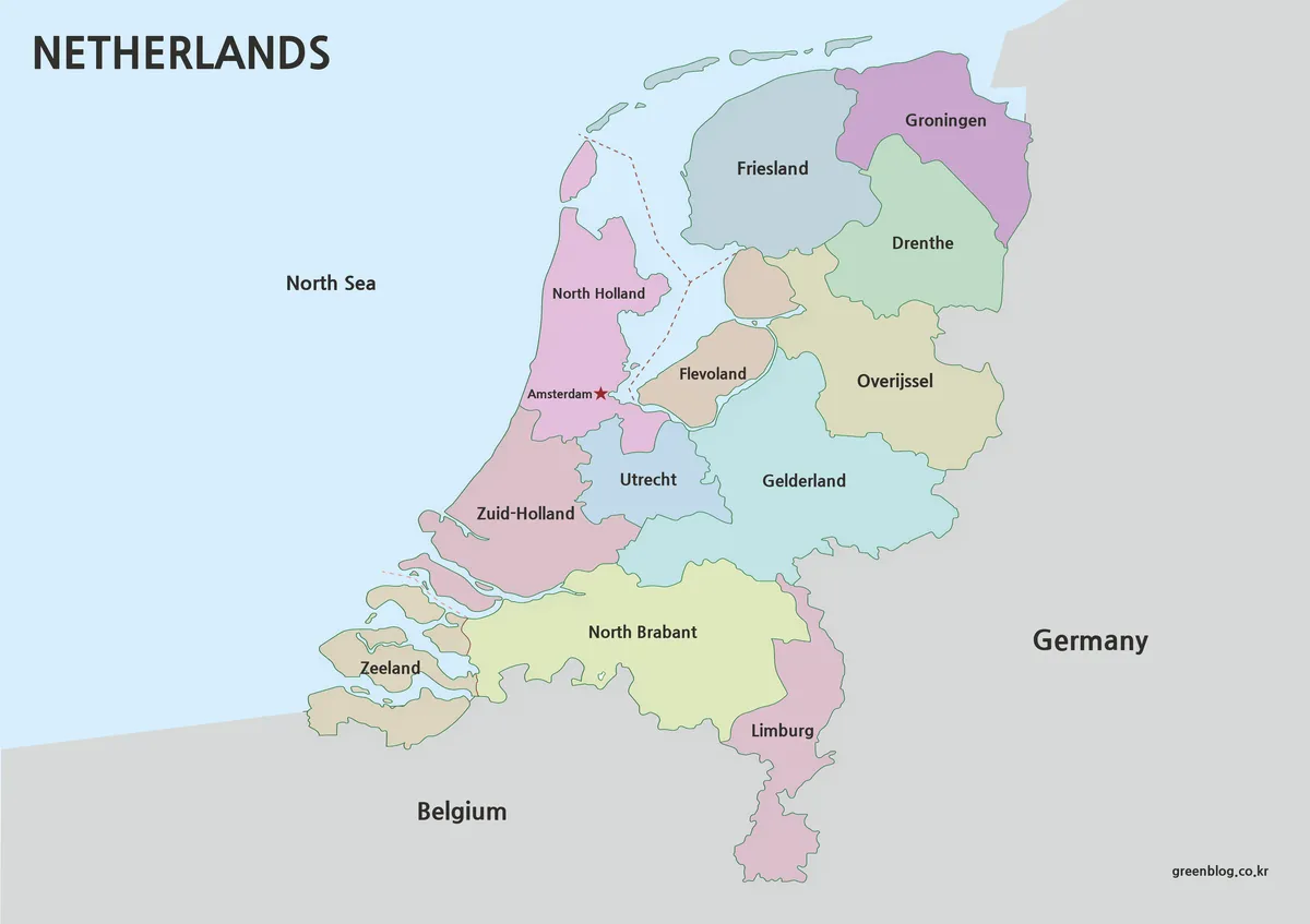
The color version was designed for quick regional recognition and visual presentations.
Each province uses a different soft color tone so the overall layout can be understood at a glance without overwhelming the viewer. Neighboring countries such as Belgium and Germany were intentionally shown in muted gray tones to keep the focus on the Netherlands itself.
Province labels are written in English, and Amsterdam is highlighted separately for easier reference.
This version works especially well for:
- presentation slides
- educational reference
- regional comparison
- blog graphics
- visual learning materials
The coastline and internal boundaries were simplified to create a cleaner visual flow while still preserving the recognizable shape of the country.
This Netherlands map style is useful for understanding the provincial layout quickly and clearly.
Black and White Printable Version
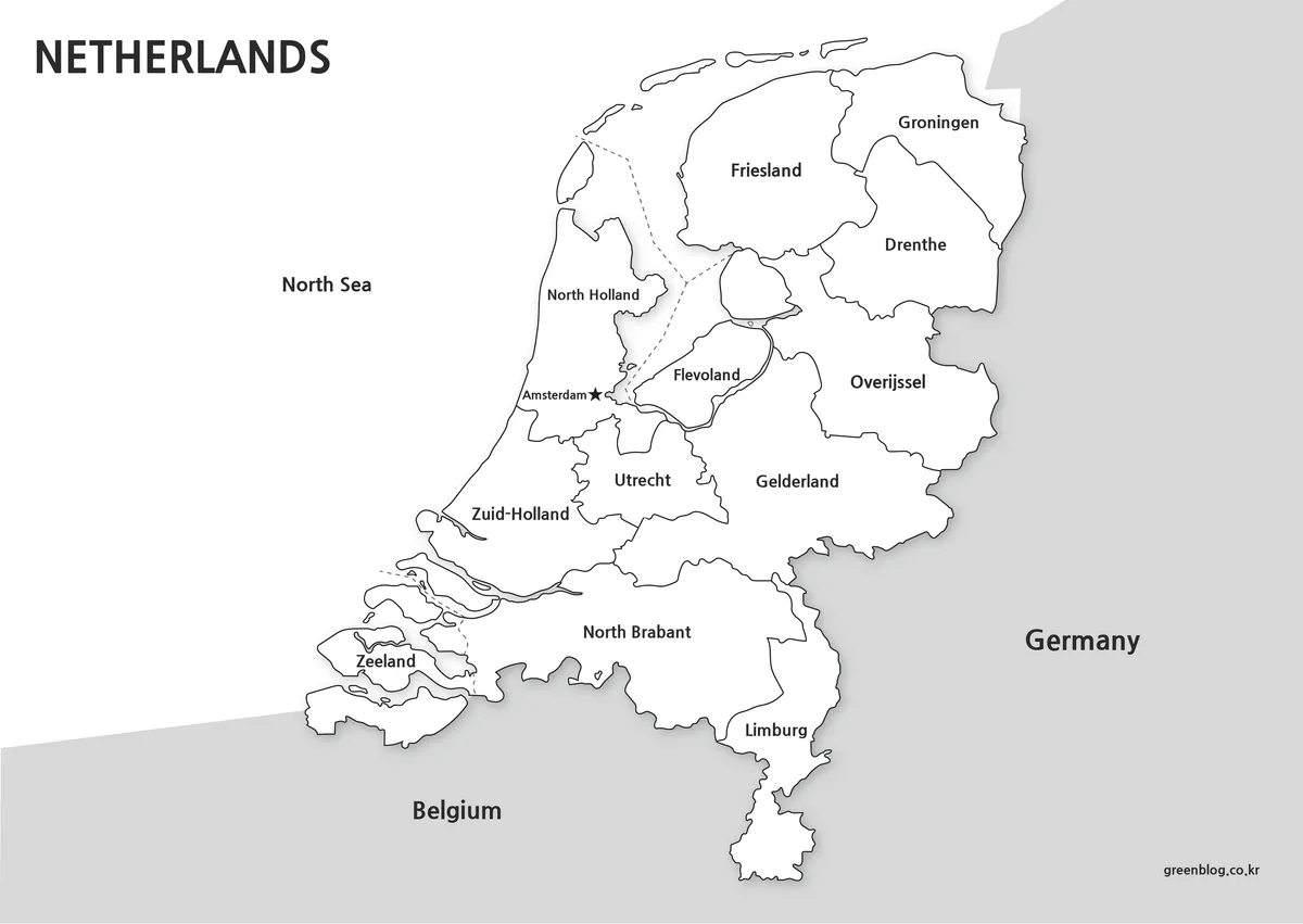
The black and white version removes color distractions and focuses entirely on borders and labels.
This layout is often easier to print because the province names appear more clearly on paper. It also uses less ink than the color version.
The simplified monochrome structure works well for:
- printed worksheets
- classroom reference
- note-taking
- document inserts
- map markup and study materials
Although the labels may look small in preview images, the full A3-resolution files remain sharp when printed.
This version is also useful for highlighting regions manually with markers or editing tools.
Many users prefer this Netherlands map style for printable educational and reference materials.
Blank Outline Map for Editing
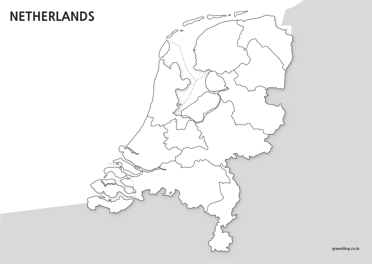
The outline version removes all labels and colors, leaving only the provincial boundaries.
This makes the file useful for graphic editing, educational materials, and custom design work.
The clean structure allows users to:
- add custom labels
- compare regions visually
- color areas manually
- create infographic layouts
- build travel route graphics
- prepare classroom activities
Because the boundaries remain connected and uncluttered, the map can be edited right away without additional cleanup.
This version works well with Photoshop, Illustrator, presentation software, and video editing tools.
The blank Netherlands map can also serve as a flexible base for infographic and visual design projects.
Designed for Printing and Presentation Use
Many downloadable maps online look acceptable on small screens but become blurry or difficult to read once printed.
This collection was designed specifically with printing and enlarged viewing in mind.
The A3 layout allows:
- larger labels
- cleaner province borders
- clearer coastline visibility
- easier classroom projection
- high-resolution infographic usage
Even the simpler outline version remains visually clean when enlarged.
Frequently Asked Questions
Can I print the Netherlands map in A3 size?
Yes. All files were created in high resolution specifically for A3 printing.
Does the map include roads and city-level detail?
No. The focus is on provincial structure and regional readability rather than transportation details.
Is the outline version editable?
Yes. The blank version was designed for editing, annotations, and custom graphic projects.
Are neighboring countries included?
Yes. Belgium and Germany appear as simplified background references to help show the geographic position of the Netherlands.
Netherlands Map Download
The Netherlands map files are provided as a downloadable collection including color, printable black and white, and blank outline versions.
Included formats are intended for:
- Printing
- Classroom reference
- Presentation graphics
- Infographic work
- Editing projects
Choose the version that best fits your project or presentation style.
The files are provided in ZIP format and can be extracted after download.
Related Map Suggestions
Green Map creates custom-edited map images using open geographic data sources such as geoBoundaries, Natural Earth, OpenStreetMap, and government open data.
These maps are edited visual materials, not raw data files, and are provided for education, documents, presentations, and graphic reference.