
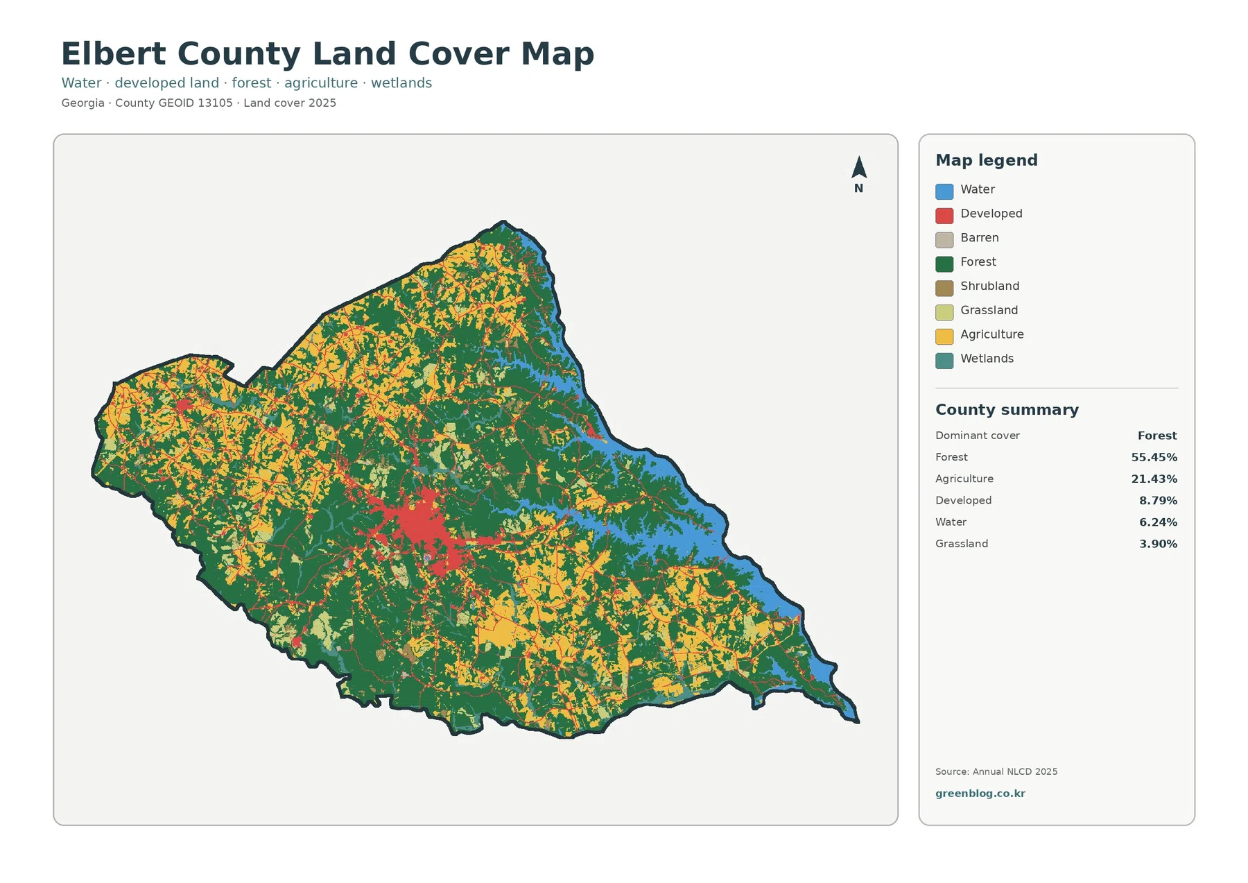
Elbert County Georgia Land Cover Map – Forest Covers 55.45% as Elberton Forms the Main Built Core
The Elbert County Georgia Land Cover Map set focuses on a county where forest remains the dominant surface while farmland, […]
The Elbert County Georgia Land Cover Map set focuses on a county where forest remains the dominant surface while farmland, […]
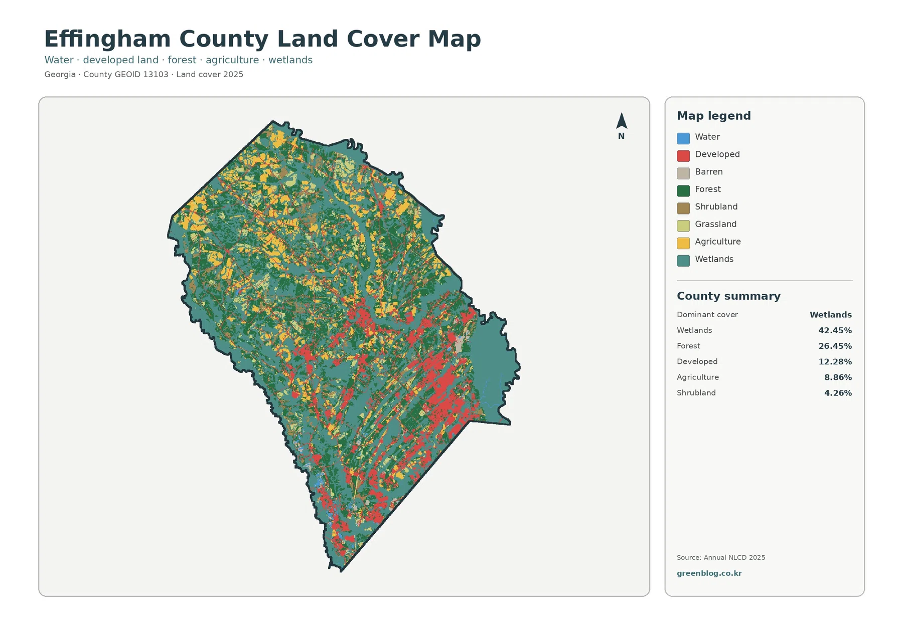
Effingham County’s 2025 land-cover picture is defined first by water-influenced landscapes: wetlands account for 42.45% of the county, while forest
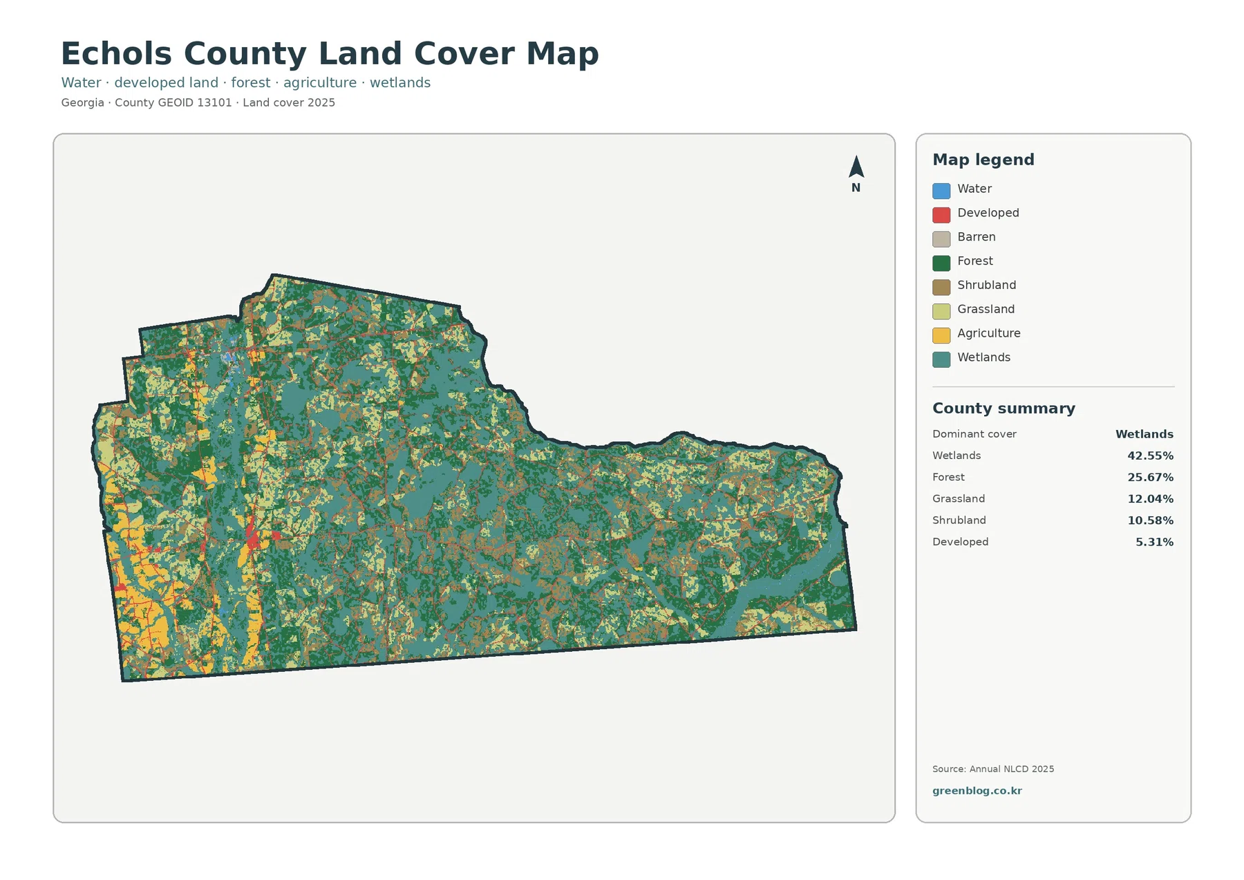
Wetlands dominate the supplied 2025 Echols County Georgia Land Cover Map, covering 42.55% of the county. Forest accounts for 25.67%,
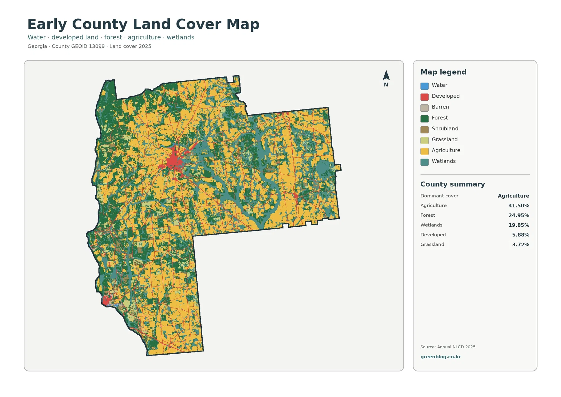
The Early County Georgia Land Cover Map shows a rural county where agriculture is the largest mapped class without covering
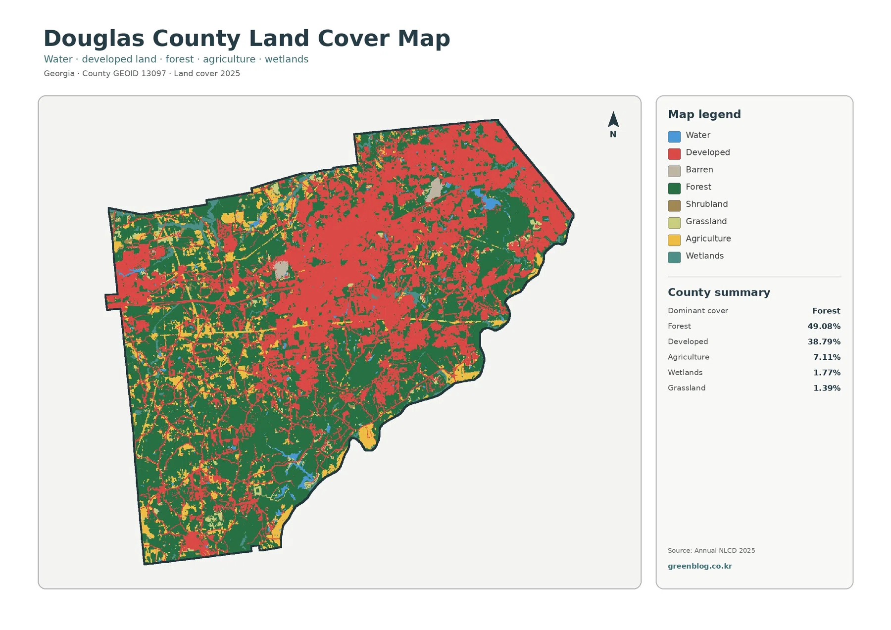
Forest and developed land account for most of Douglas County in the supplied 2025 classification. Forest is the largest class
Douglas County Georgia Land Cover Map – Nearly Half Forest in Atlanta’s Western Suburbs Read More »
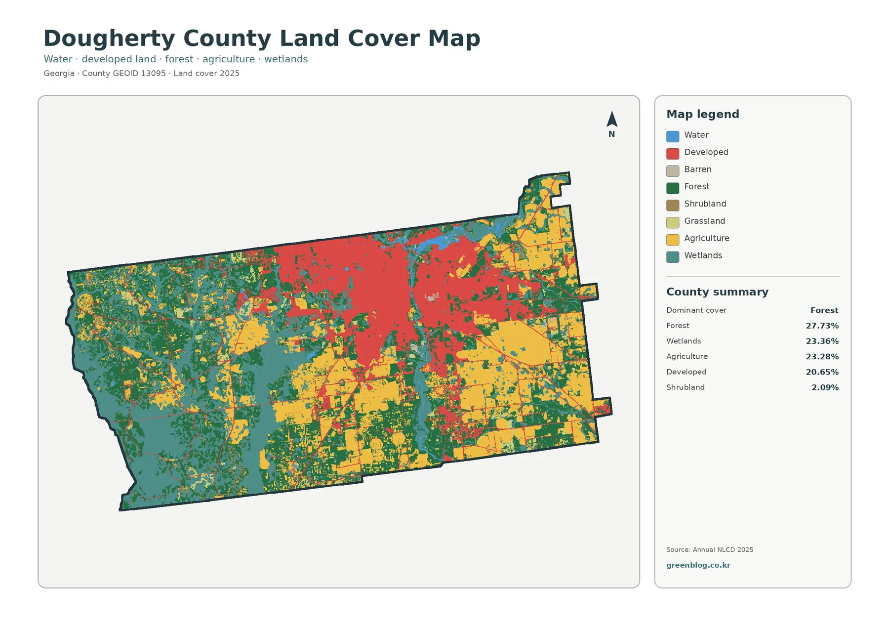
Dougherty County has an unusually balanced land-cover mix for a county anchored by a sizable city. Forest is the largest
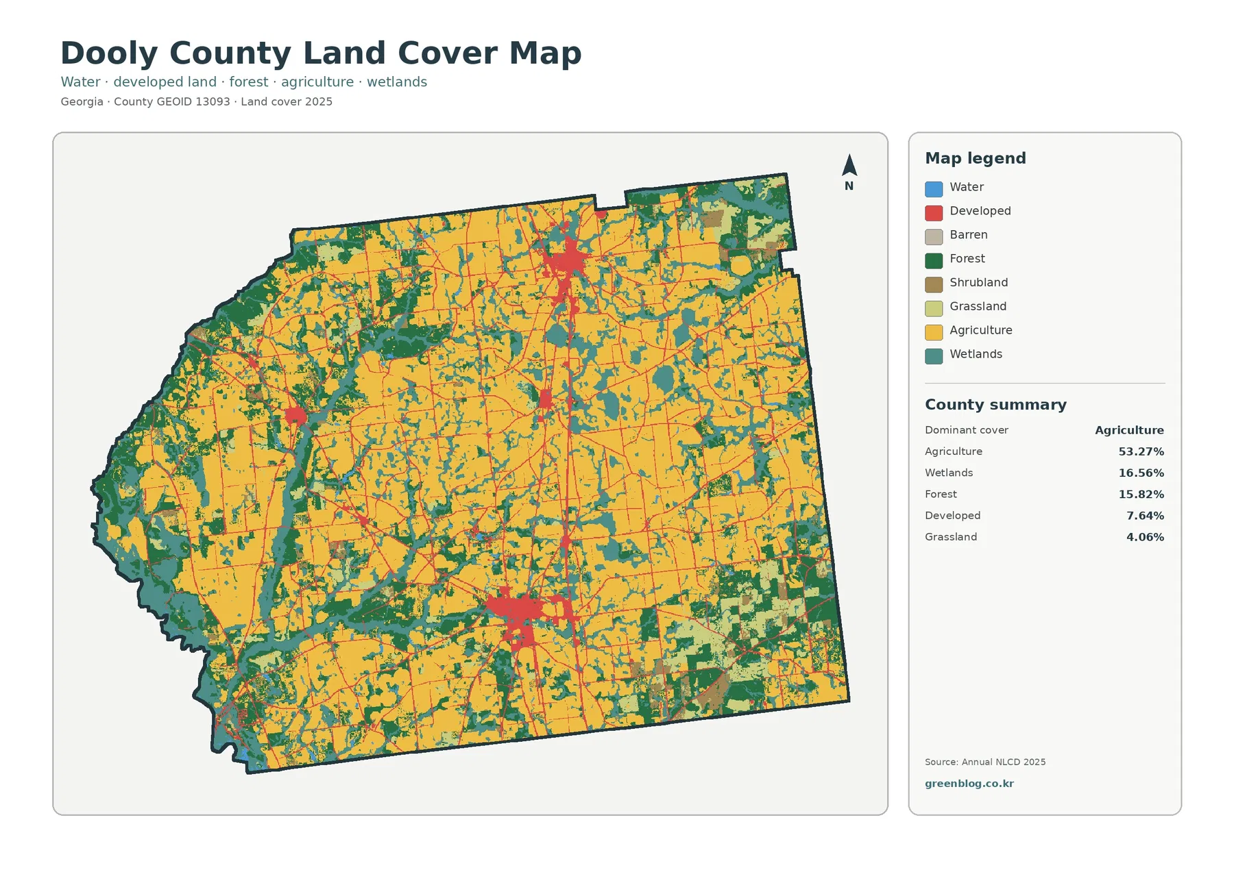
Agriculture is the defining surface in Dooly County in 2025, covering 53.27% of the mapped area. Wetlands account for 16.56%,
Dooly County Georgia Land Cover Map – Broad Farmland, Wet Corridors, and I-75 Towns Read More »
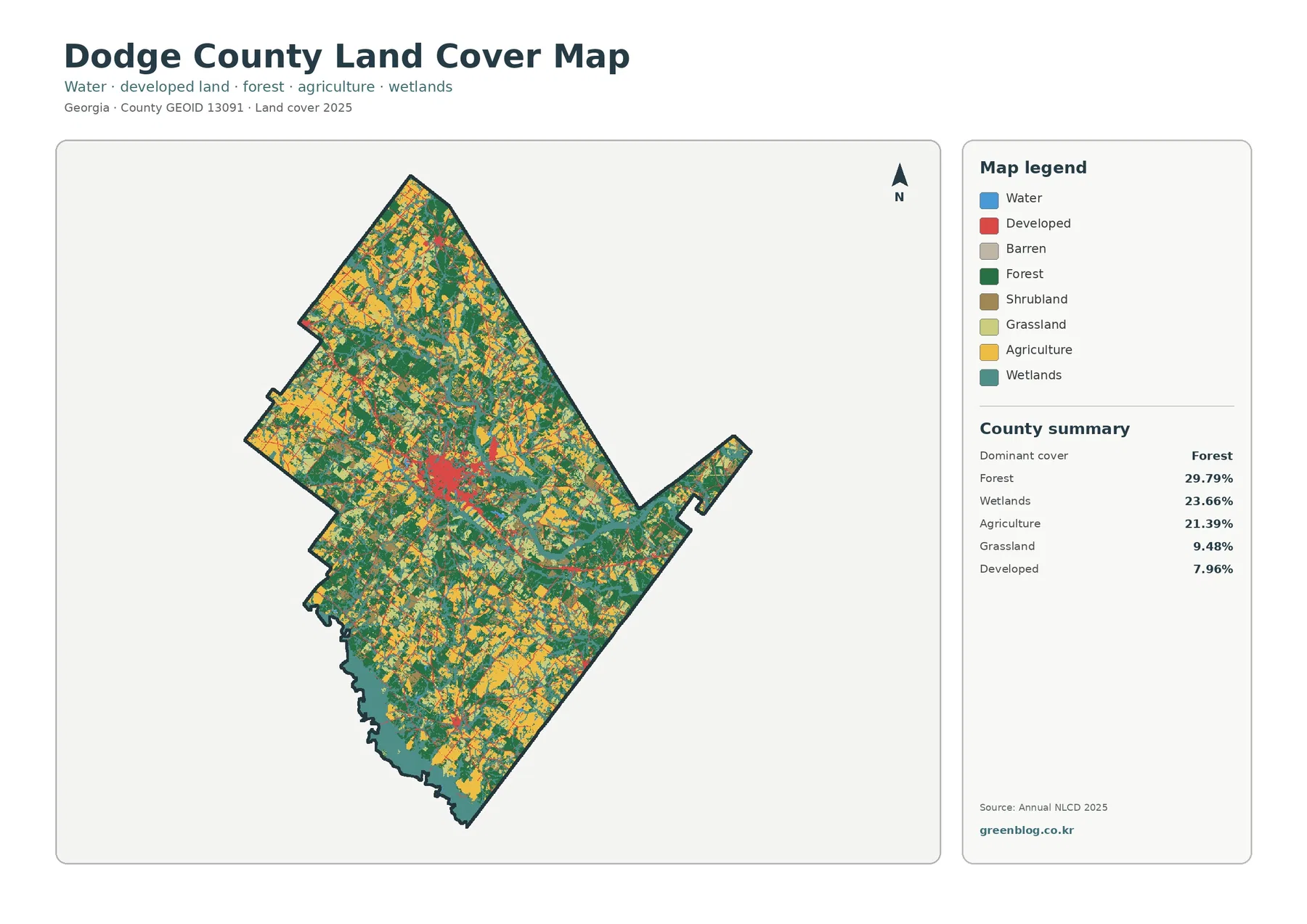
Dodge County does not read as one simple block of forest or farmland on the 2025 data. Forest is the
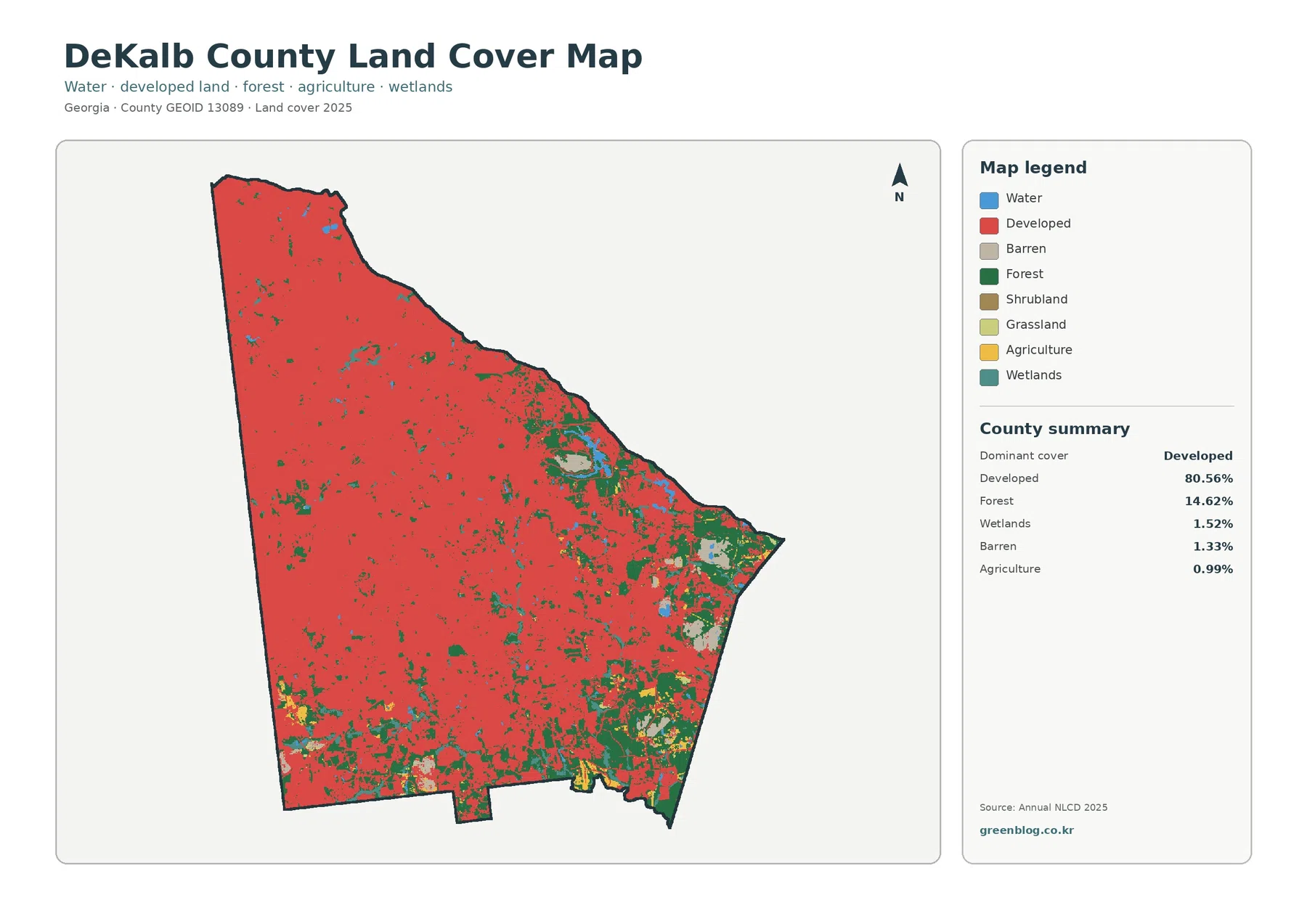
Developed land covers most of DeKalb County in the supplied 2025 classification, yet the map is not uniformly urban from
DeKalb County Georgia Land Cover Map | 80.56% Developed, Forest Pockets, and Four JPGs Read More »