
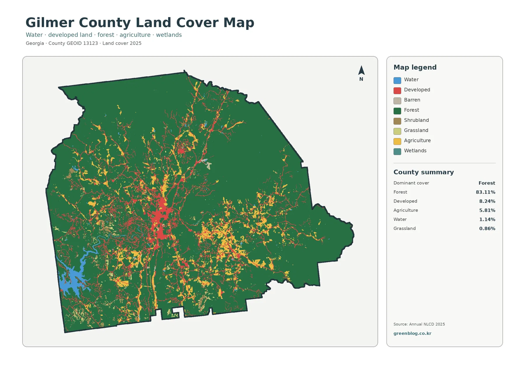
Gilmer County Georgia Land Cover Map – 83.11% Forest with Development Centered on Ellijay
Forest is the defining land-cover pattern in Gilmer County, Georgia, but the county is not visually uniform. The 2025 summary […]
Forest is the defining land-cover pattern in Gilmer County, Georgia, but the county is not visually uniform. The 2025 summary […]
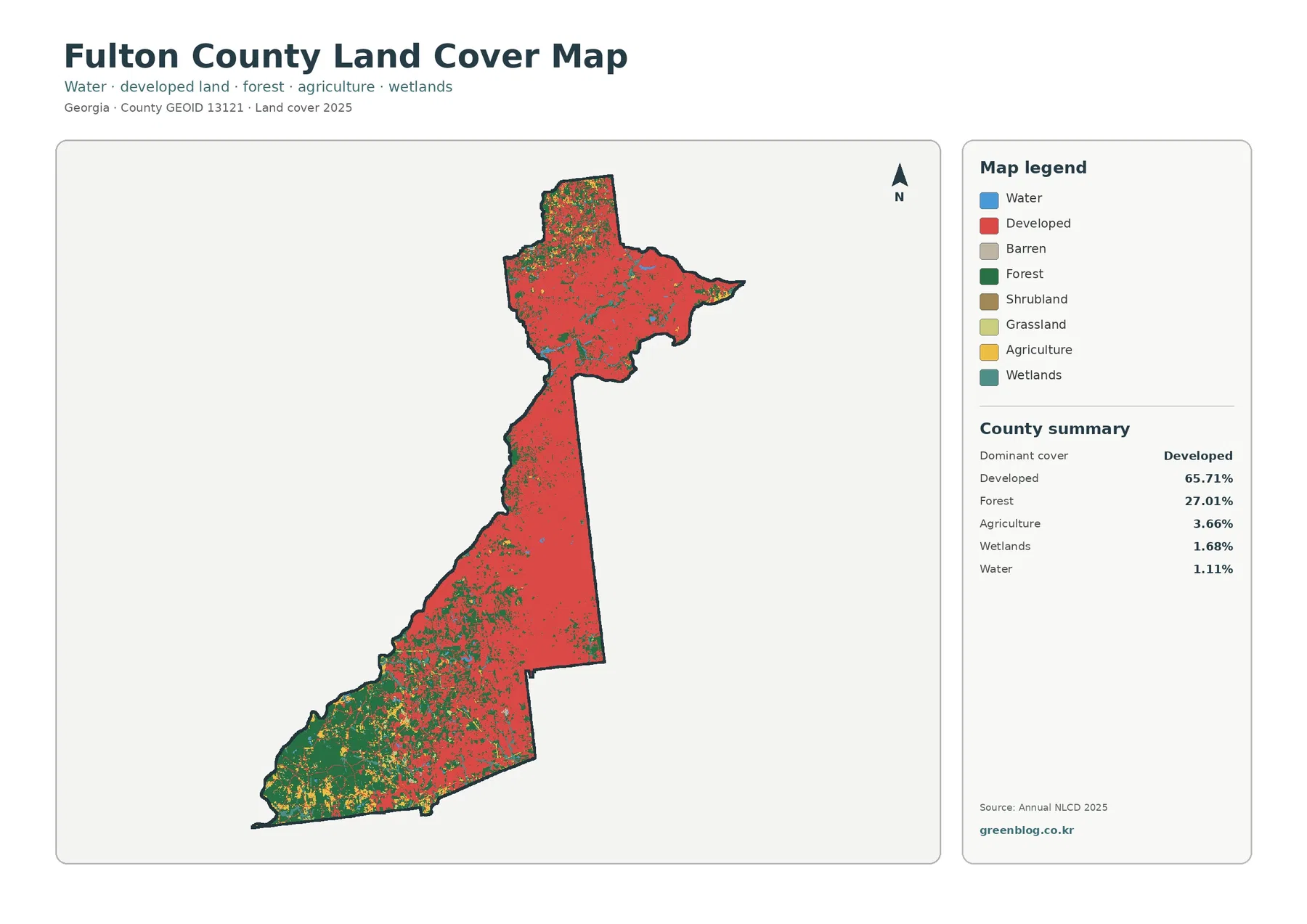
Fulton County is one of the clearest Georgia examples of why a countywide percentage needs a map beside it. Developed
Fulton County Georgia Land Cover Map | Atlanta-Area Development and a Forested Southwest Read More »
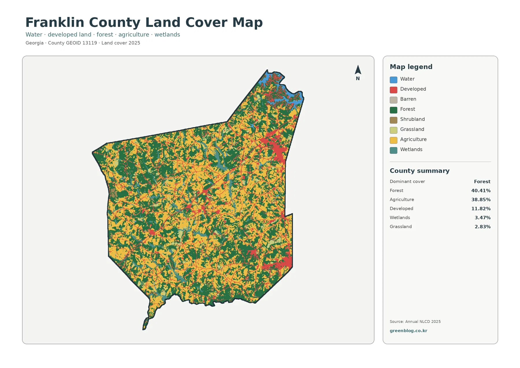
Franklin County in northeast Georgia has an unusually balanced countywide land-cover mix. The 2025 summary places forest at 40.41% and
Franklin County Georgia Land Cover Map – Forest and Farmland Share Most of the Landscape Read More »
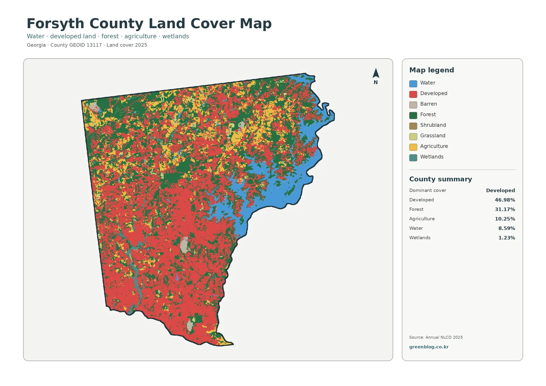
Forsyth County, Georgia, has a land-cover pattern shaped by two strong contrasts. Developed cover accounts for 46.98% of the county
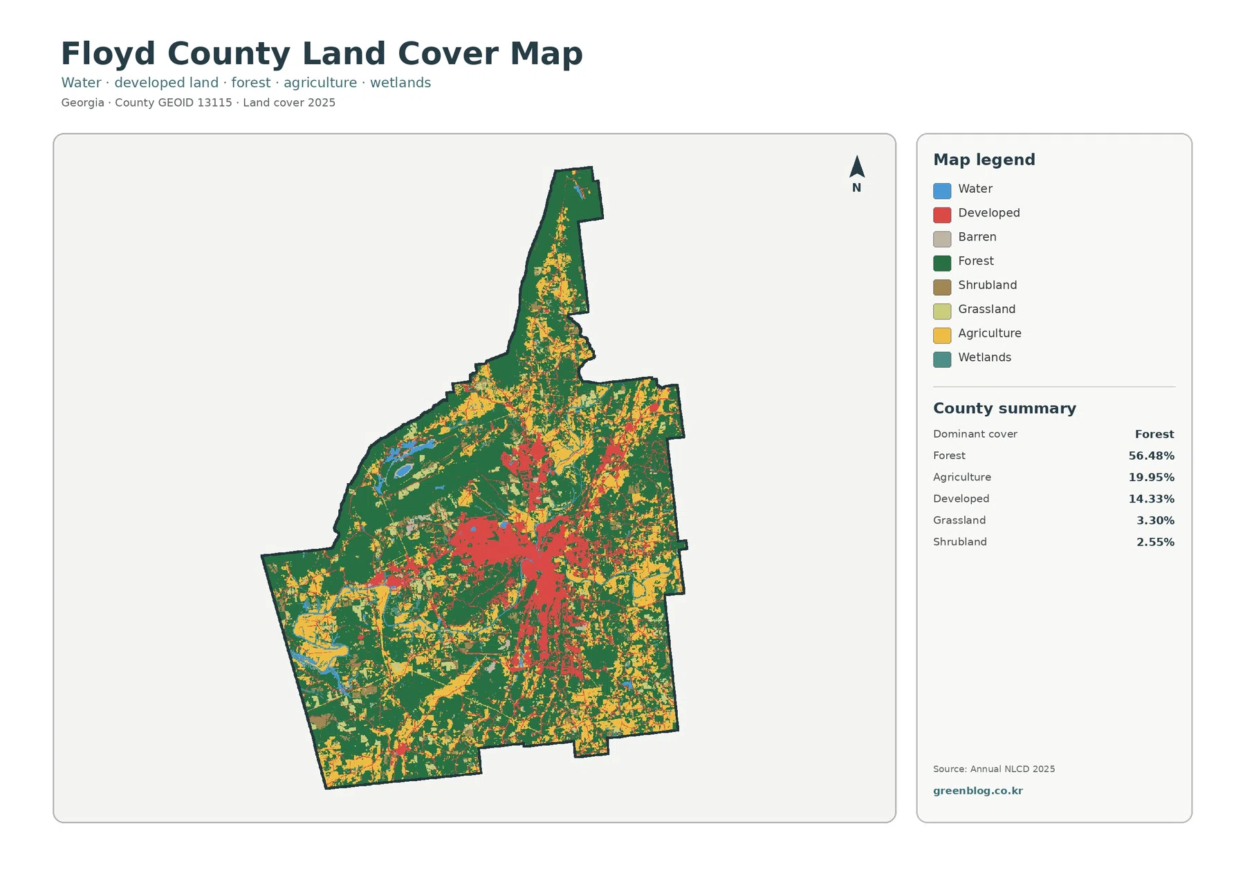
Floyd County’s 2025 land-cover pattern is defined by a strong contrast between Rome and the large wooded and agricultural areas
Floyd County Georgia Land Cover Map – Rome’s Built Center Within 56.48% Forest Cover Read More »
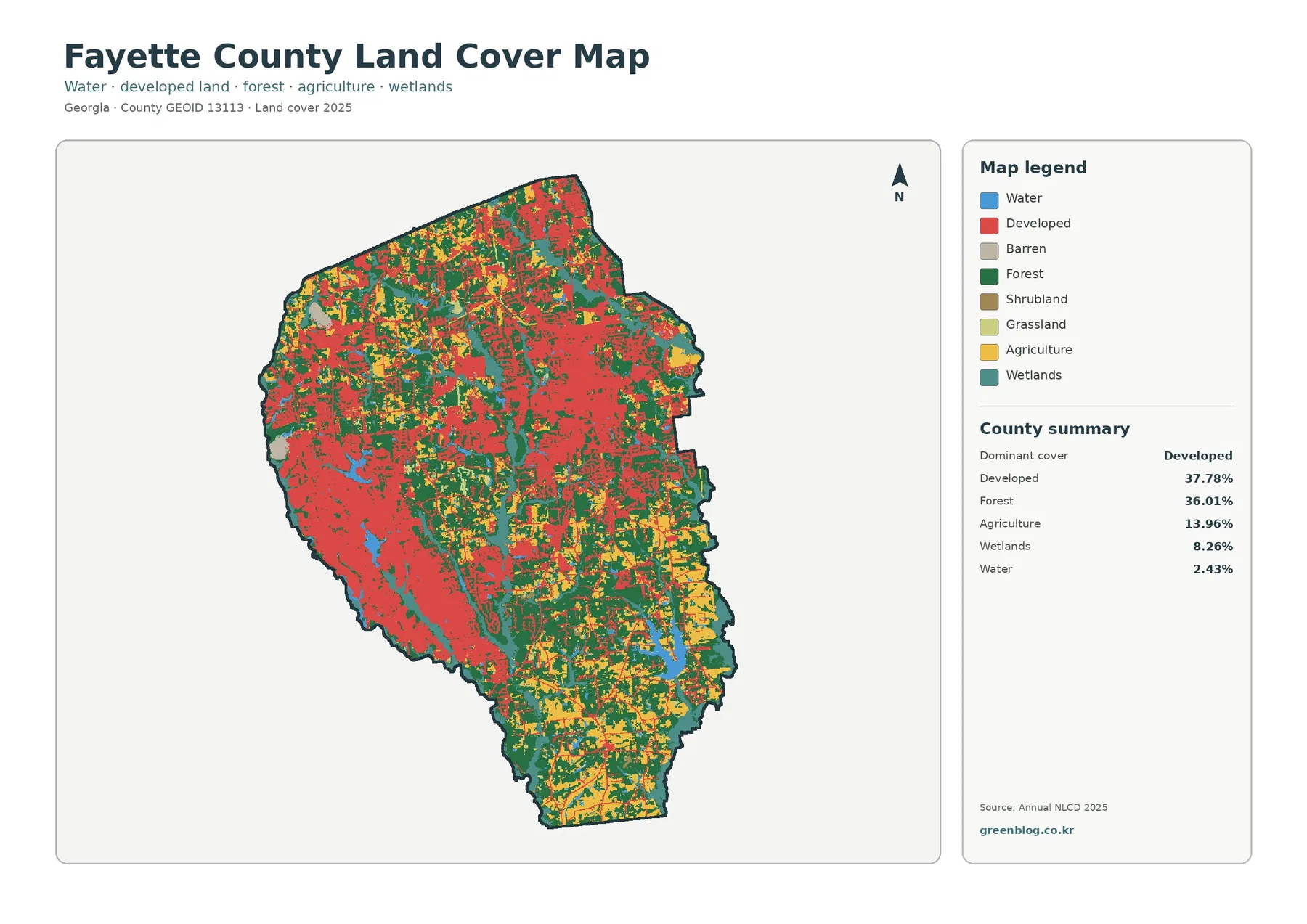
Fayette County does not fit a simple urban-or-rural label when viewed through land cover. The 2025 summary lists developed cover
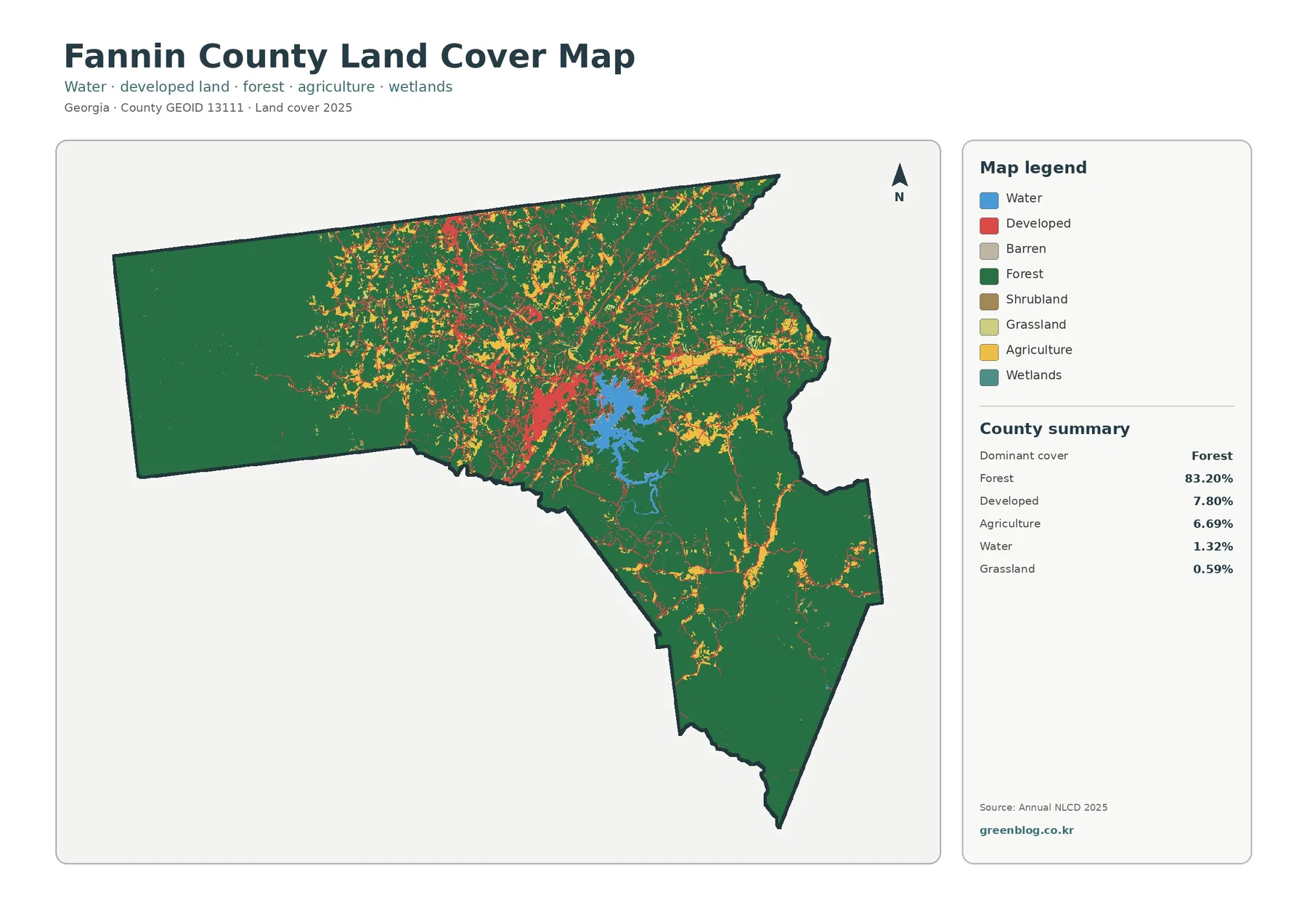
Fannin County in north Georgia is overwhelmingly forested, but the four supplied maps reveal strong local contrasts. The 2025 county
Fannin County Georgia Land Cover Map – Forested Mountains Around Blue Ridge Reservoir Read More »
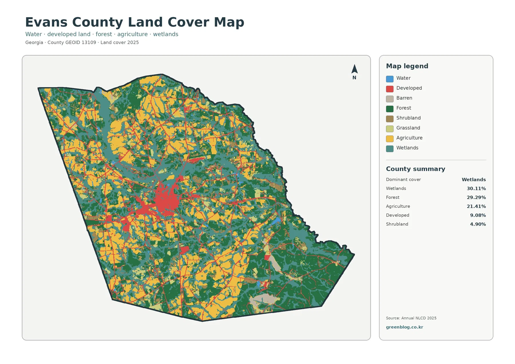
Evans County, Georgia has a land-cover pattern that is easy to miss on a conventional road map. Wetlands and forest
Evans County Georgia Land Cover Map – A Wetland-Rich Mosaic Around Claxton Read More »
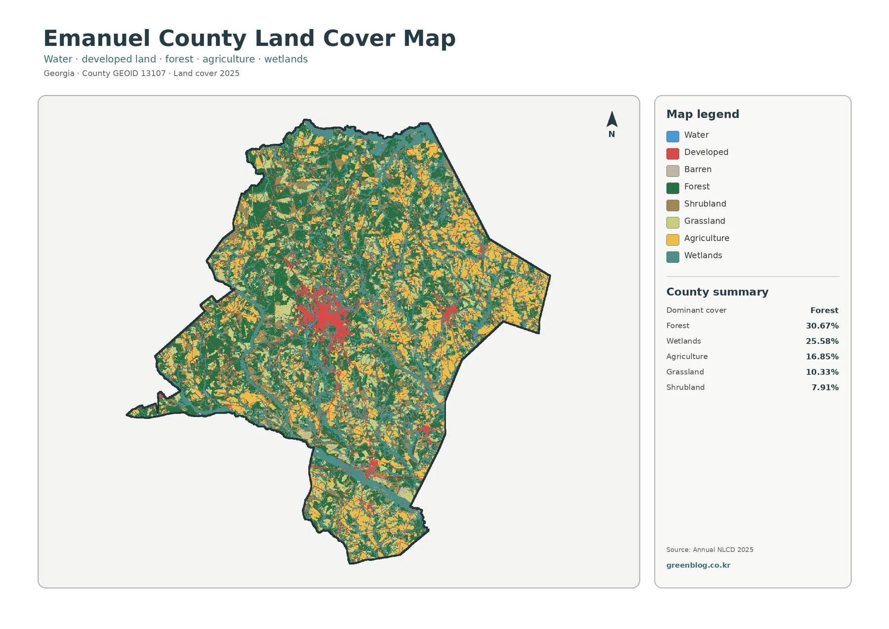
Emanuel County’s 2025 land-cover pattern is not dominated by one continuous block. Forest accounts for 30.67% of the county and