
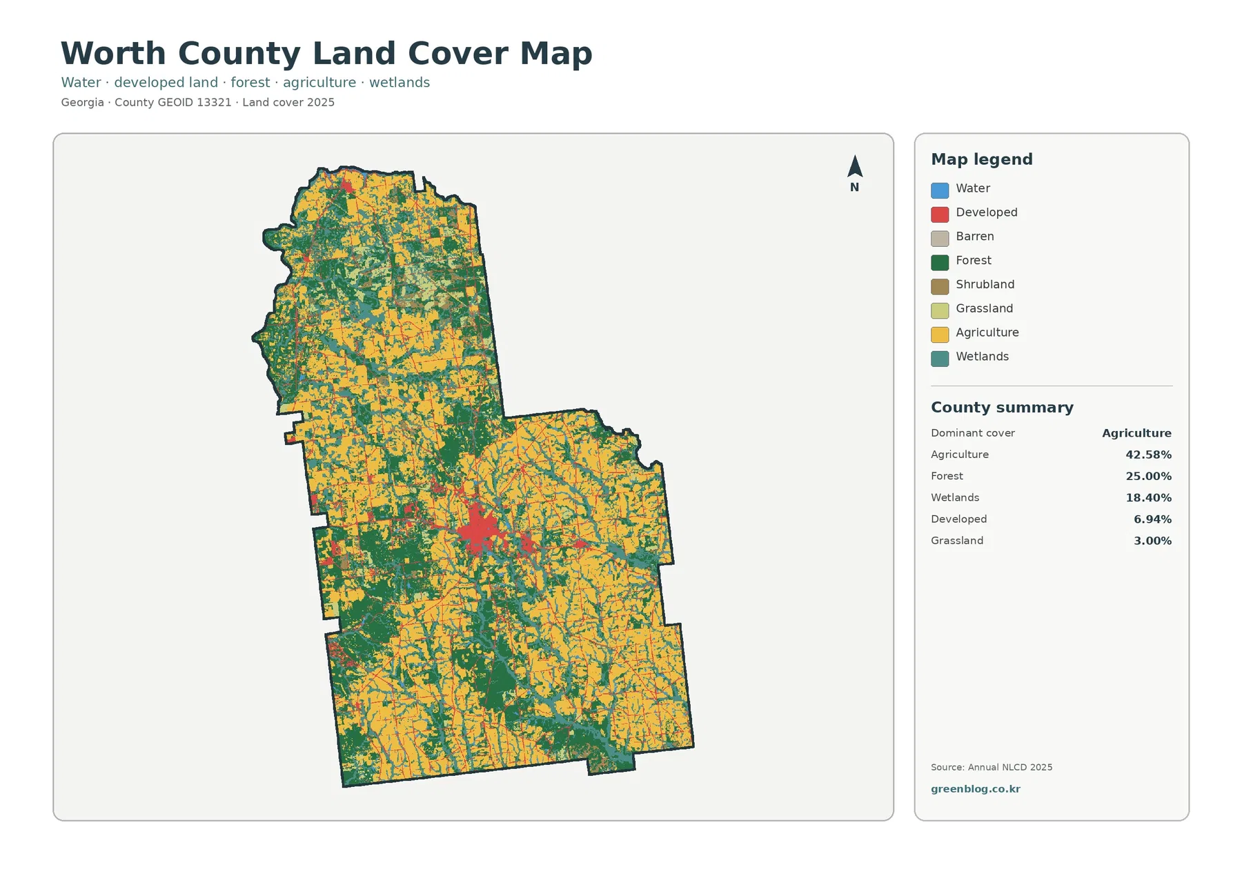
Worth County Georgia Land Cover Map | Farm-Dominant Ground Around a Compact Central Built Area
Agriculture is the defining cover in the supplied 2025 Worth County map. It accounts for 42.58% of the county, well […]
Agriculture is the defining cover in the supplied 2025 Worth County map. It accounts for 42.58% of the county, well […]
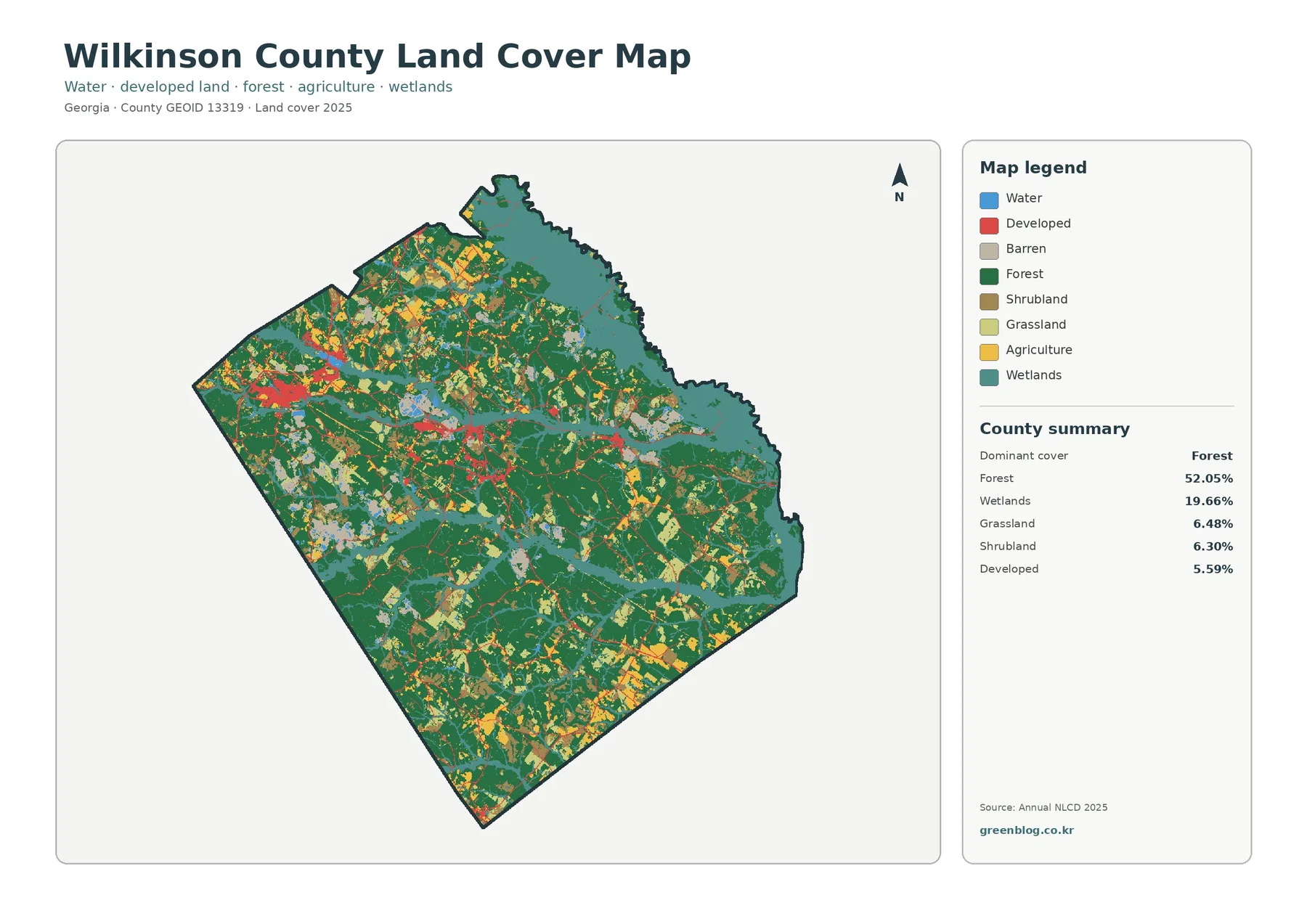
Forest is the largest surface on the supplied 2025 Wilkinson County maps, but the county is not a single uninterrupted
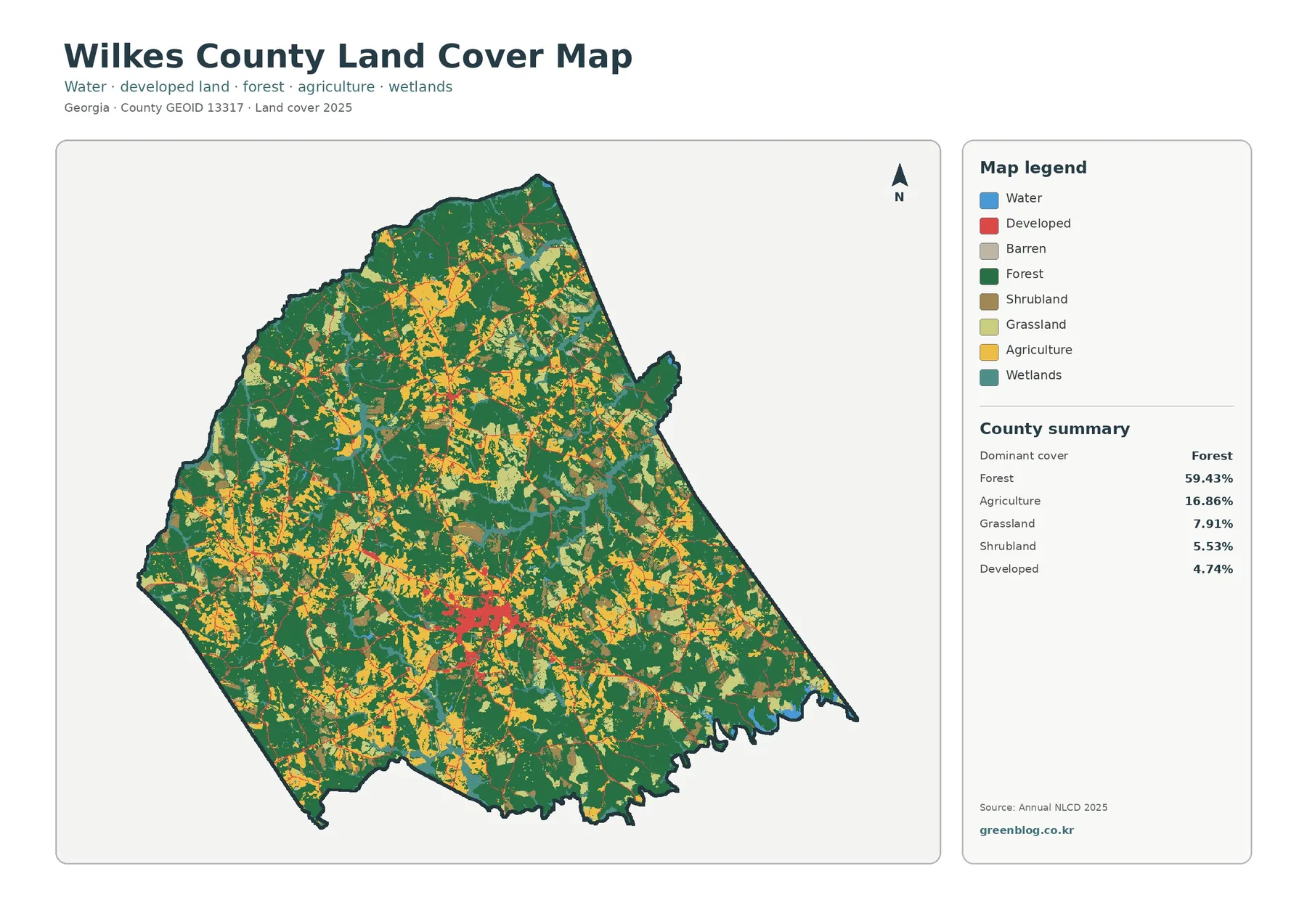
Forest is the defining surface on the supplied 2025 map of Wilkes County, Georgia. It accounts for 59.43% of the
Wilkes County Georgia Land Cover Map: 59.43% Forest Around a Compact Washington Core Read More »
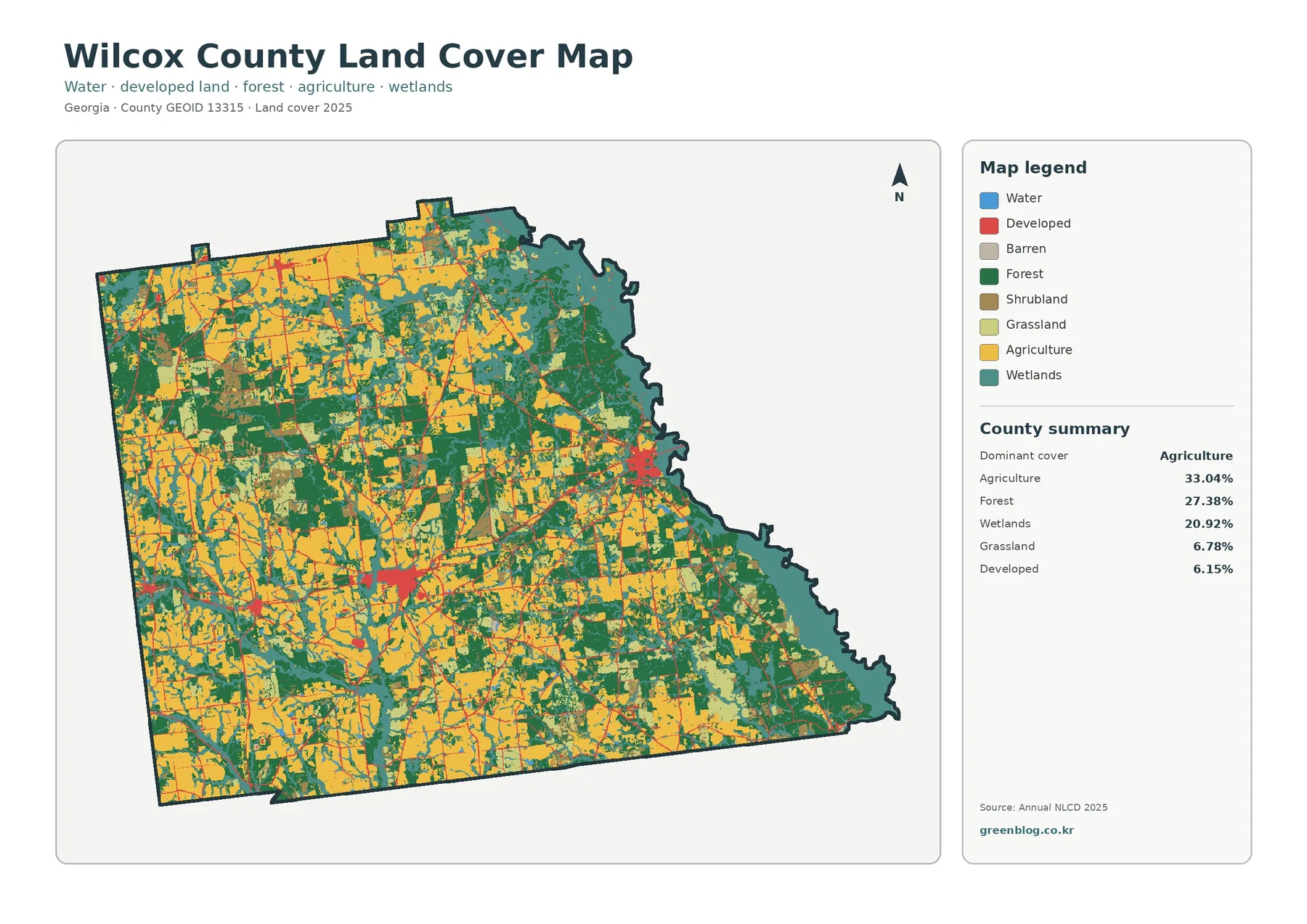
Wilcox County in south-central Georgia does not read as a single-cover landscape. Agriculture is the largest 2025 class at 33.04%,
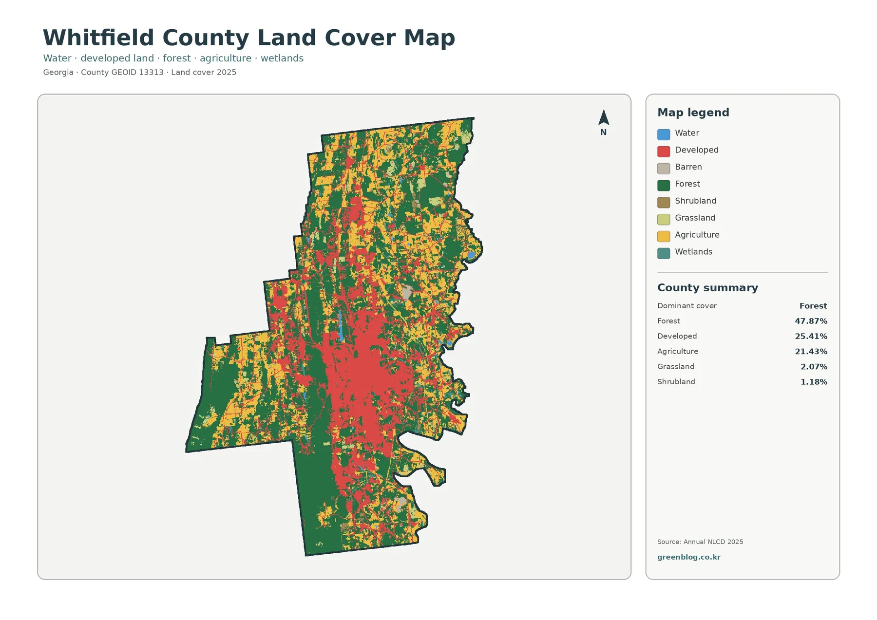
The Whitfield County Georgia Land Cover Map shows a county where forest remains the largest surface class while the Dalton-area
Whitfield County Georgia Land Cover Map – Forest Blocks Around Dalton’s Developed Center Read More »
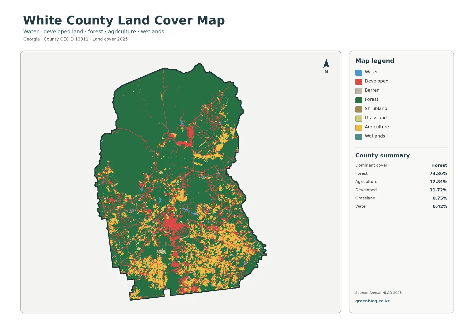
Forest is the defining surface on the supplied 2025 White County map. It covers 73.86% of the county, while agriculture
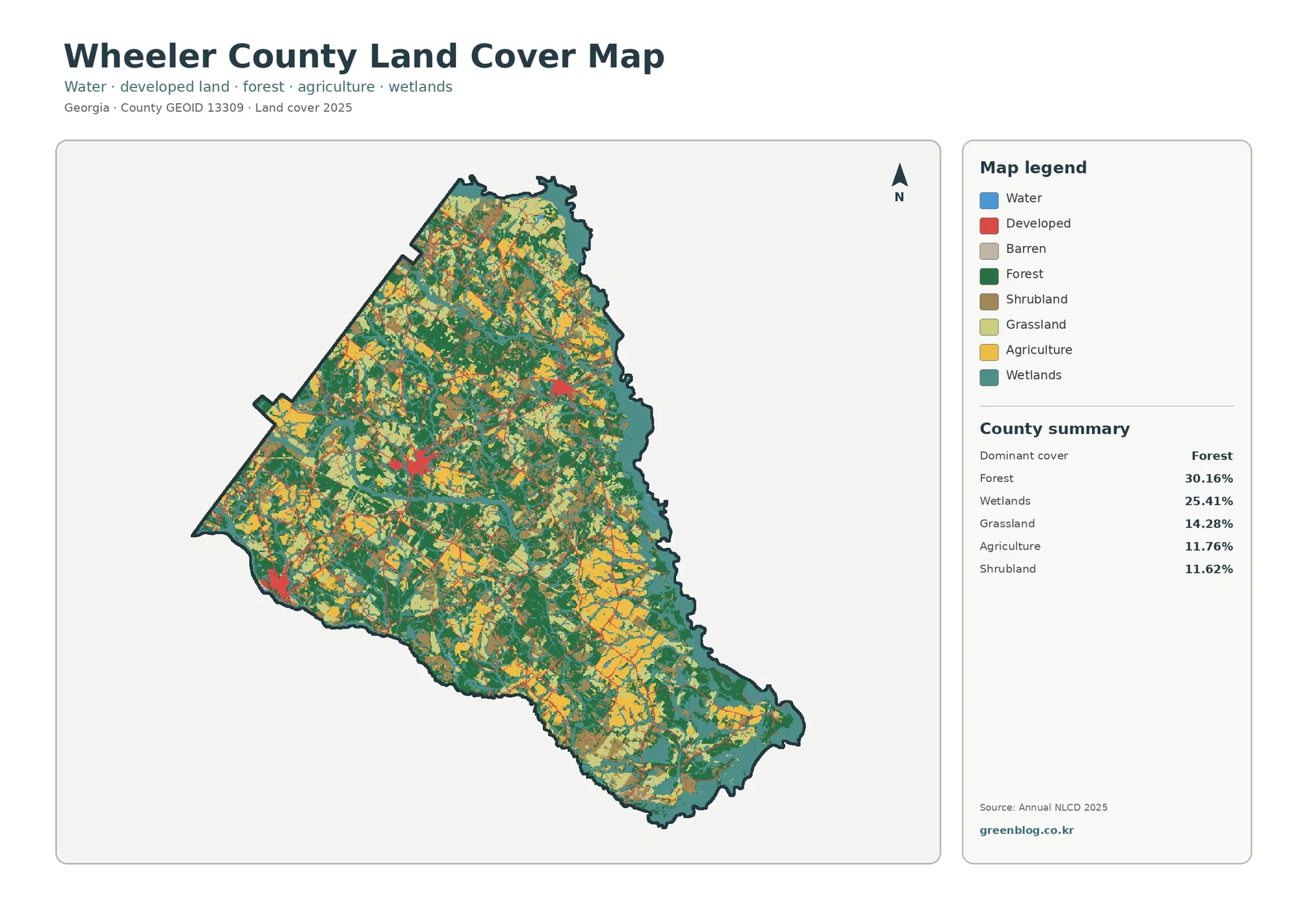
Wheeler County is not dominated by one simple surface type. The supplied 2025 summary places forest first at 30.16%, wetlands
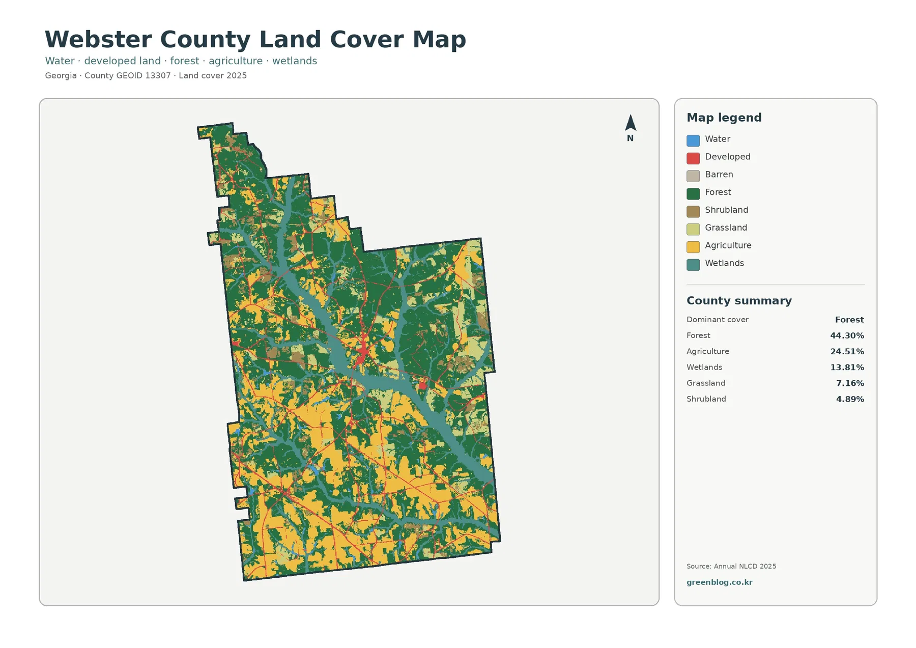
Webster County in southwest Georgia is a rural county where the 2025 surface is divided mainly among forest, agriculture, and
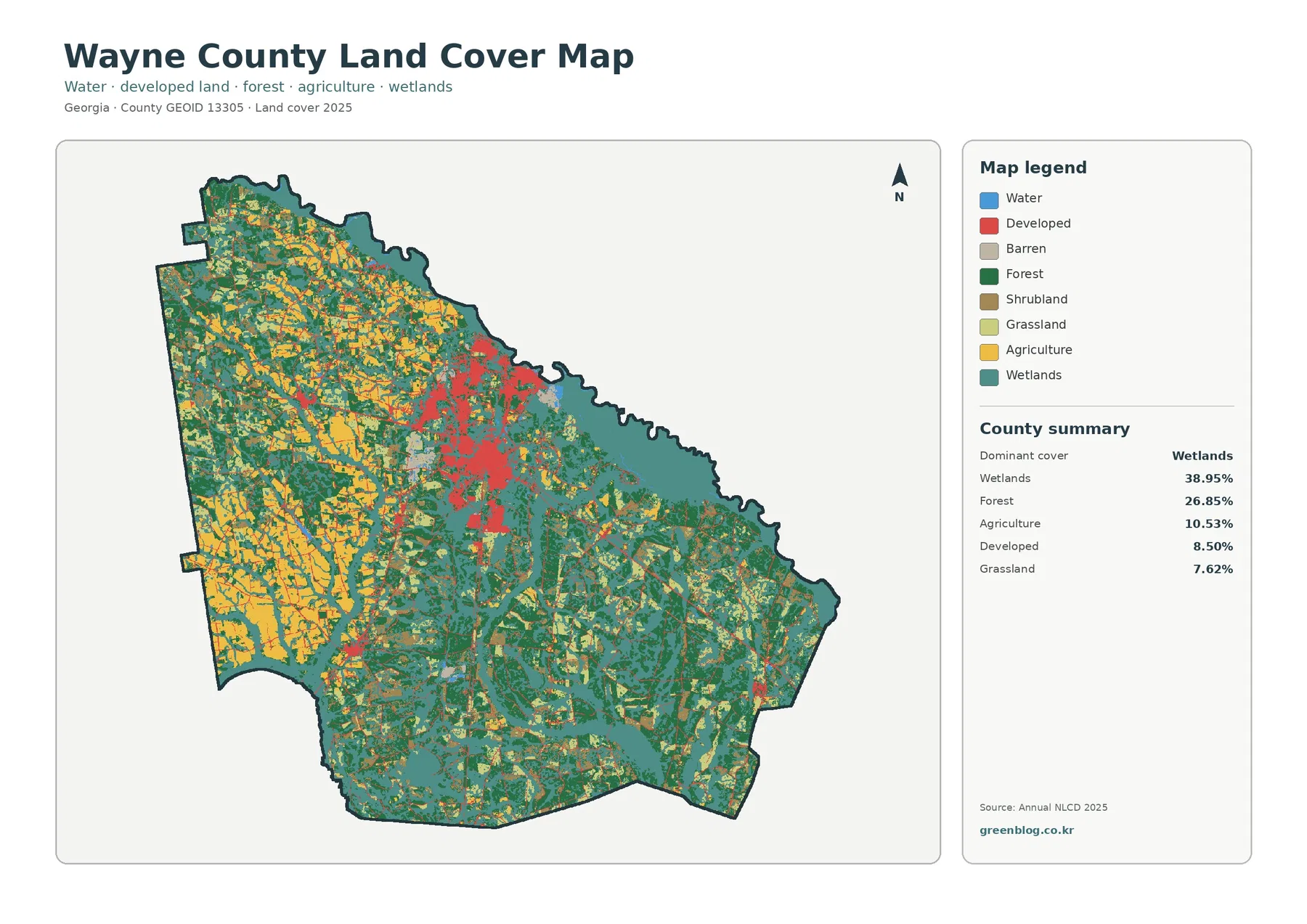
Wetlands are the largest mapped surface in Wayne County in the supplied 2025 summary, covering 38.95% of the county. Forest
Wayne County Georgia Land Cover Map — Wetlands Around a Strong Jesup Development Cluster Read More »