A South Sudan Map has to explain more than the outline of Africa’s newest internationally recognized country. South Sudan is a landlocked state in East-Central Africa with six international neighbors, a broad east–west span, and an administrative layout that includes ten states and three administrative areas. The supplied collection presents that structure in three distinct images: a color administrative map, a blank outline map, and a labeled black-and-white map.
The maps are intended as regional references rather than road or tourist guides. Teachers can introduce the states, students can add labels or thematic data, and presentation designers can compare South Sudan with its six neighbors. Their emphasis on boundaries and names also supports reports about the Nile basin or the country’s internal organization.
The South Sudan Map collection requires one important qualification. Abyei appears as a separately labeled area near the northern border, but its final status remains unresolved between Sudan and South Sudan. A callout distinguishes it from an ordinary state while keeping Ruweng and Greater Pibor visible alongside the ten states.
Table of Contents
Reading the South Sudan Map in Regional Context
South Sudan became independent from Sudan on July 9, 2011, and its capital is Juba in Central Equatoria. The country has no coastline. Sudan lies to the north, Ethiopia to the east, Kenya to the southeast, Uganda to the south, the Democratic Republic of the Congo to the southwest, and the Central African Republic to the west. Those six neighbors are labeled around the mapped territory, so the page can support both national and wider East African orientation.
The country’s shape is especially recognizable at its edges. Western Bahr el Ghazal forms a broad western projection, Upper Nile extends northward in the northeast, and Eastern Equatoria creates an angular southeastern end near Kenya and Uganda. A South Sudan Map also supports physical context: the White Nile runs generally northward and the vast Sudd wetland occupies part of the central lowlands, although neither feature is drawn here.
These images show administrative geography, not elevation, transport routes, population density, or detailed hydrography. The blank outline can serve as a base for adding the White Nile or Sudd from a separate reference, but it does not replace a terrain or river map.
States and Administrative Areas Shown
The ten states form recognizable geographic groups. Western Bahr el Ghazal and Northern Bahr el Ghazal occupy the west and northwest; Warrap, Lakes, and Unity lie closer to the center. Western, Central, and Eastern Equatoria extend across the south, while Jonglei covers a large east-central area and Upper Nile fills much of the northeast.
Three additional areas appear. Ruweng lies north of Unity and west of Upper Nile. Greater Pibor occupies the southeast of Jonglei near Ethiopia. Abyei is shown through a callout near the Sudan border because its small size and exceptional status make it difficult to present like the larger states.
The South Sudan Map uses the English names Upper Nile, Jonglei, Unity, Lakes, Warrap, Northern Bahr el Ghazal, Western Bahr el Ghazal, Western Equatoria, Central Equatoria, and Eastern Equatoria. Juba and other cities are not labeled, so the files are state-level references rather than city-location maps.
What Color Adds to the South Sudan Map
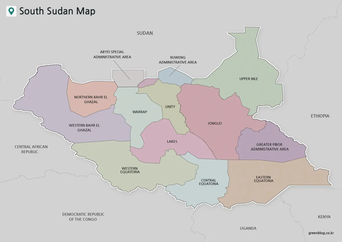
The color version gives each state or administrative area a different muted shade. It makes the contrast between large eastern divisions and smaller north-central areas immediately visible. Upper Nile, Jonglei, Greater Pibor, and Eastern Equatoria occupy substantial spaces, while Ruweng and Abyei require closer attention.
Surrounding countries remain gray, preserving cross-border context without competing with the subject. On a classroom screen or presentation slide, viewers can follow the three Equatoria states across the south without relying only on thin internal lines.
A Blank Outline for Labels and Thematic Data
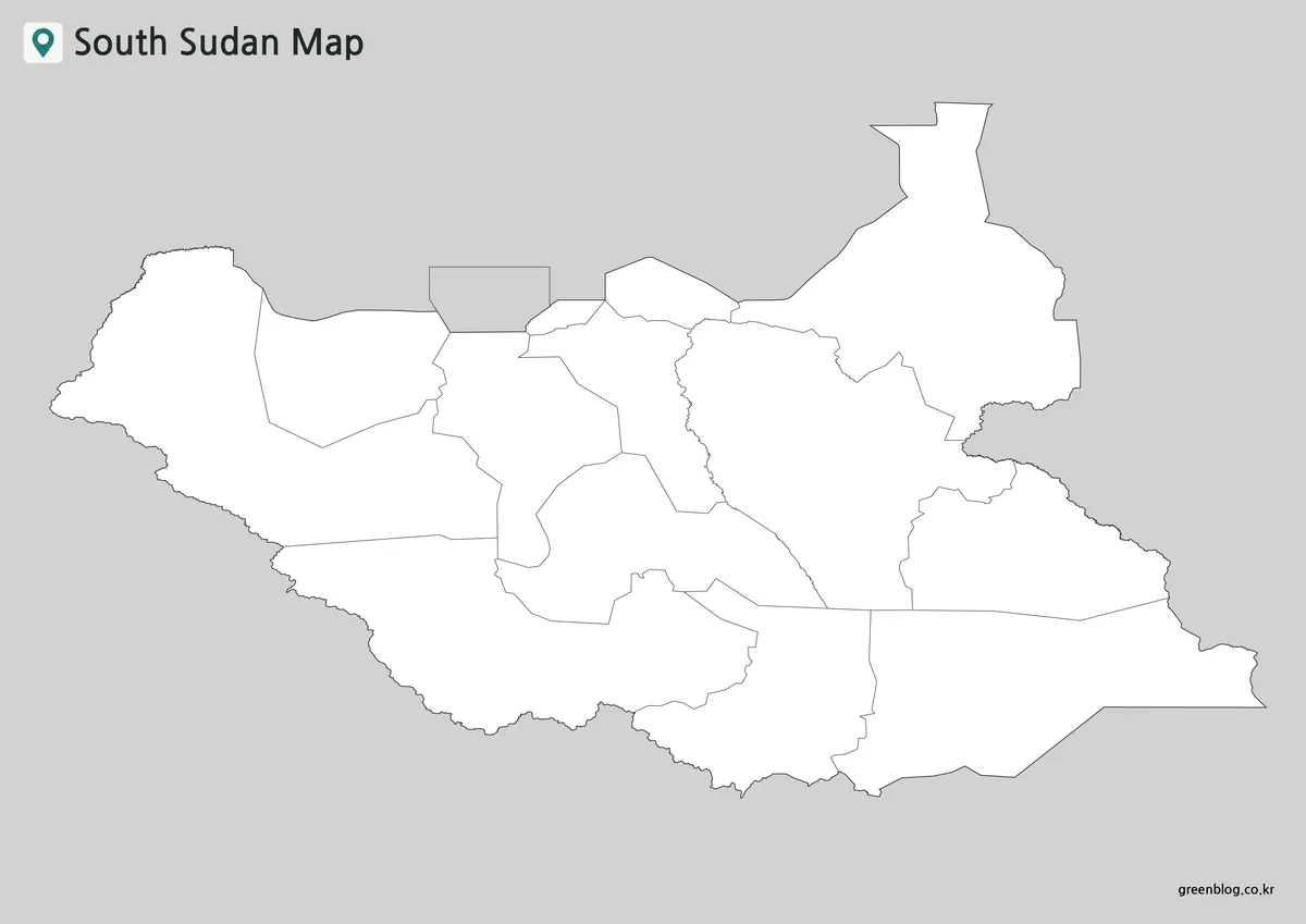
The outline South Sudan Map removes names and color fills while preserving national and internal boundaries. Its open areas can hold state names, capital markers, statistics, or color categories. A student might group the three Equatoria states, distinguish the Bahr el Ghazal states, or add the White Nile from a physical reference.
For infographic work, a designer can color selected states, place symbols over study areas, or create a worksheet about neighboring countries. The Abyei callout remains visible and leaves room for a note about its special, disputed status.
A Labeled Version for Monochrome Documents
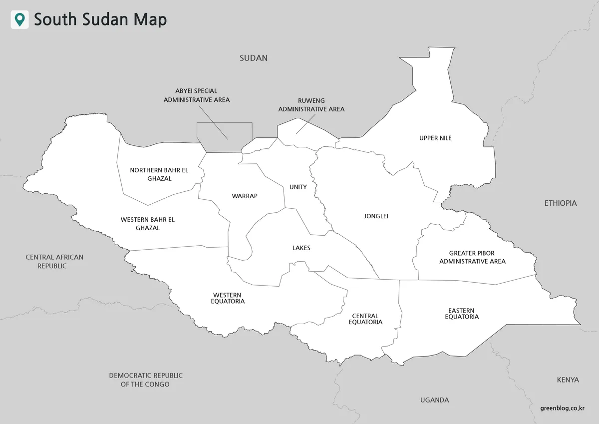
The black-and-white image keeps English state names, administrative-area labels, neighboring countries, and boundary lines. Long names such as Northern Bahr el Ghazal and Greater Pibor Administrative Area are broken across lines to remain readable.
This labeled South Sudan Map suits reports and worksheets in which color would compete with charts or text. It can also serve as the answer reference beside the blank version. Ruweng and Abyei use leader lines because their names cannot fit comfortably inside the narrow mapped areas.
Why Abyei Needs a Separate Explanation
Abyei is not simply another state at the top of the map. Peace agreements gave the area a special administrative arrangement, but its final status was not settled when South Sudan became independent. The boundary question remains sensitive.
A rectangular callout near the northern border distinguishes Abyei from the ten states and prevents the small area from disappearing among nearby lines. In a class or report, a note should explain that its inclusion reflects the mapped administrative framework and does not settle the dispute.
Ruweng and Greater Pibor are administrative areas within South Sudan’s domestic arrangement. Their positions can be read directly beside Unity, Upper Nile, Jonglei, and Ethiopia, while Abyei still receives the necessary qualification.
Selecting a Version for a Specific Task
Choose the color map for quick comparison, especially when an audience is unfamiliar with names such as Bahr el Ghazal or Equatoria. Its visual grouping helps viewers trace the southern band from Western Equatoria to Eastern Equatoria.
Use the black-and-white map when names matter more than color. Select the outline for participation or customization: labeling states, adding Juba, drawing the White Nile, marking the Sudd, or applying colors to a dataset.
Practical Uses Beyond Basic Identification
A South Sudan Map can support a lesson about the division of Sudan and the creation of a new international border in 2011. Learners can mark Sudan to the north, trace the other five borders, and discuss why Abyei is presented differently.
For environmental studies, students may add the White Nile, indicate the approximate Sudd wetland area, or compare flood-affected regions with state boundaries. A development presentation can shade selected states according to a cited dataset without rebuilding the national outline.
Together, the files create a simple sequence: introduce regions in color, review English names on the labeled sheet, and test recall or add thematic information on the blank outline.
Frequently Asked Questions
What administrative divisions does the South Sudan Map show?
The collection shows ten states—Upper Nile, Jonglei, Unity, Lakes, Warrap, Northern Bahr el Ghazal, Western Bahr el Ghazal, Western Equatoria, Central Equatoria, and Eastern Equatoria—plus Ruweng, Greater Pibor, and Abyei administrative areas. Abyei requires a separate note because its final status between Sudan and South Sudan remains unresolved.
Which version should I use for a classroom labeling activity?
The blank outline is the most practical choice because it retains the national and internal boundaries without filling the regions with names or colors. Students can label states, identify neighboring countries, mark Juba, or add features such as the White Nile after checking an appropriate reference source.
Are cities, roads, and rivers included?
No. The supplied images concentrate on state and administrative-area boundaries. Neighboring countries are named on the color and black-and-white versions, but cities, road networks, elevation, and detailed waterways are not shown. Use a separate city, transport, or physical map when those features are required.
Why is Abyei placed in a callout?
Abyei is small at this map scale and has a special, disputed status. The callout makes the area visible without suggesting that it functions exactly like one of the ten states. It also creates room for a label and a short explanatory note in lessons or presentations.
Can the outline be used for data visualization?
Yes, as a visual base. Individual regions can be colored or annotated with statistics from a cited source. Because the supplied outline contains no built-in dataset, the user should add a legend, reference year, units, and source information whenever population, climate, displacement, or economic data are applied.
Map File Information
This set contains three image maps for studying South Sudan’s states, administrative areas, and international-border context.
- Included Versions: Color map, outline map, black-and-white map
- File Type: Image files
- Intended Use: Classroom activities, presentations, document graphics, regional comparison, labeling, and thematic annotation
Related Maps
Additional Resources
- Republic of South Sudan Country Brief: The Ministry of Foreign Affairs and International Cooperation provides an overview of the country and its administrative organization.
Green Map creates custom-edited map images using open geographic data sources such as geoBoundaries, Natural Earth, OpenStreetMap, and government open data. These maps are edited visual materials, not raw data files, and are provided for education, documents, presentations, and graphic reference.