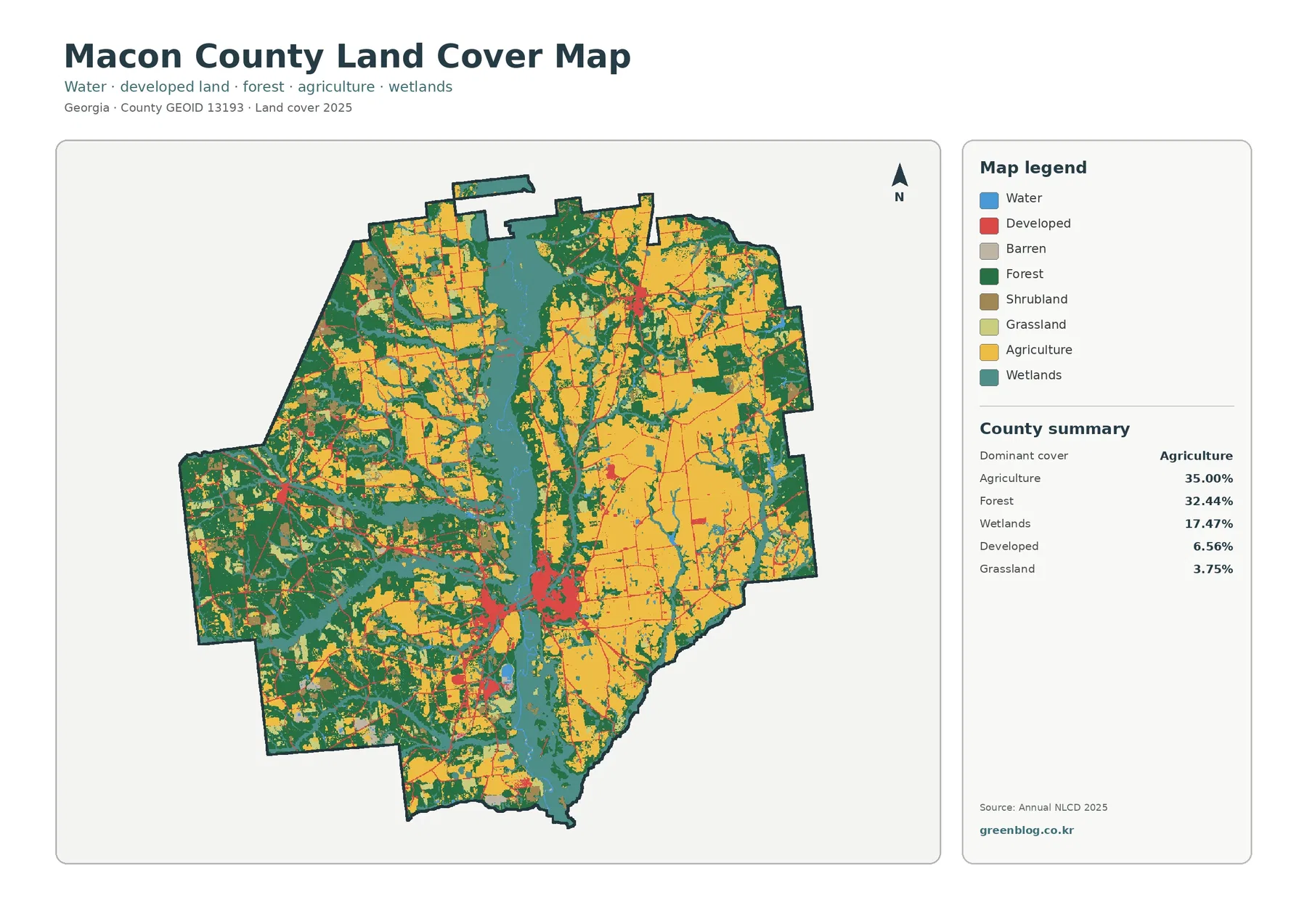
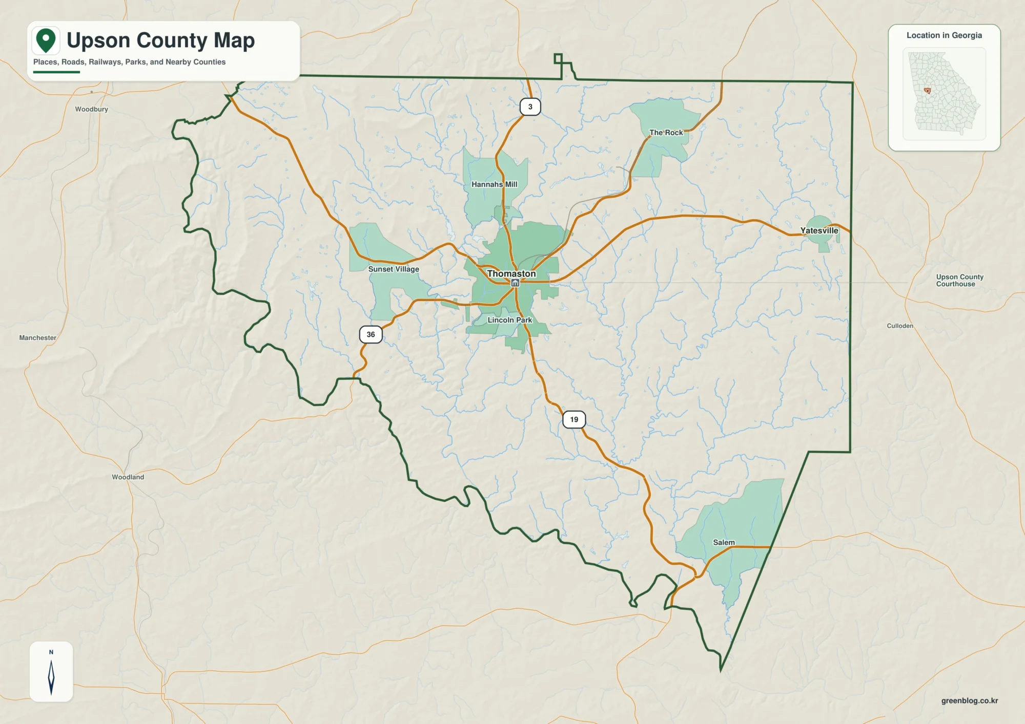
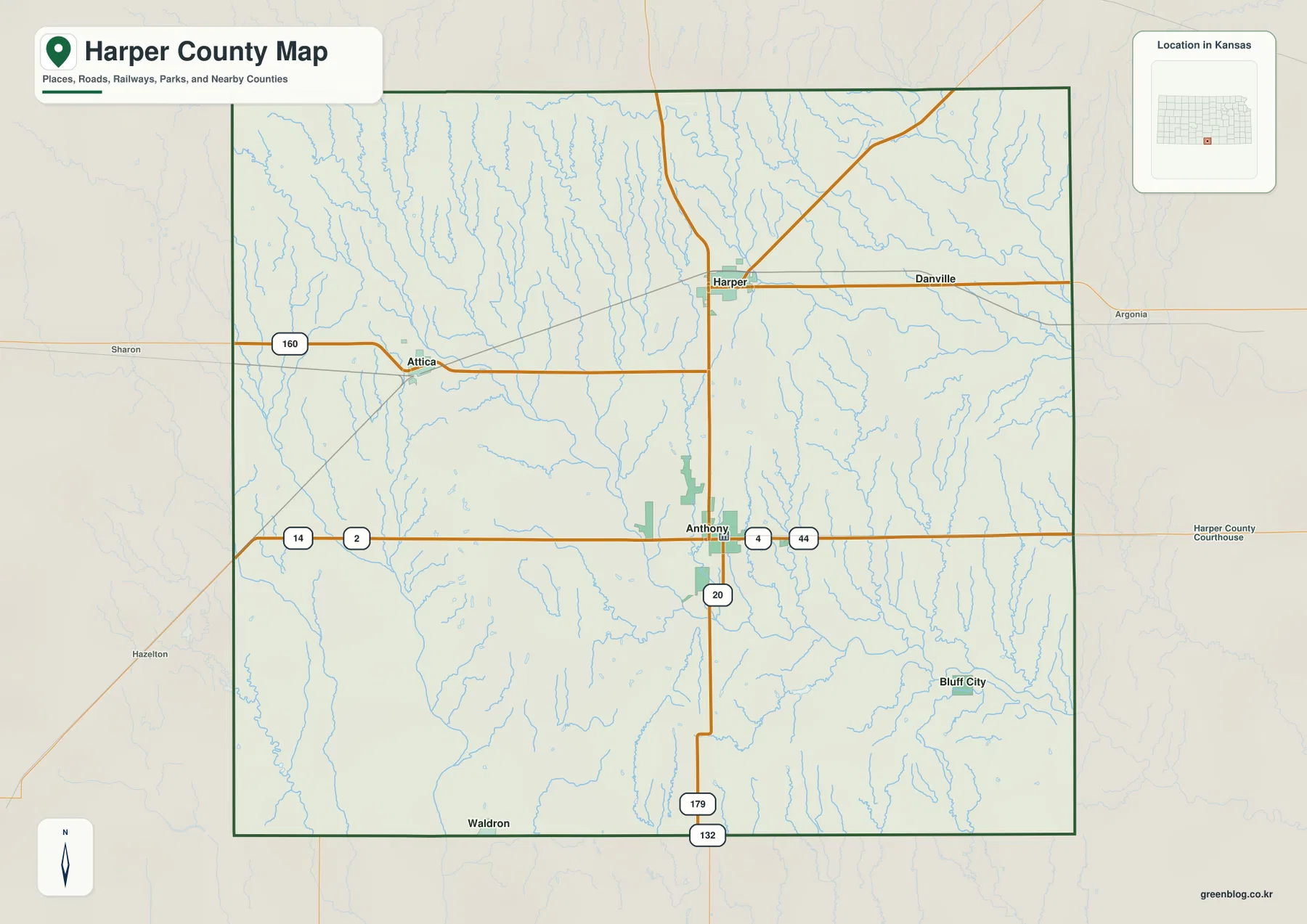
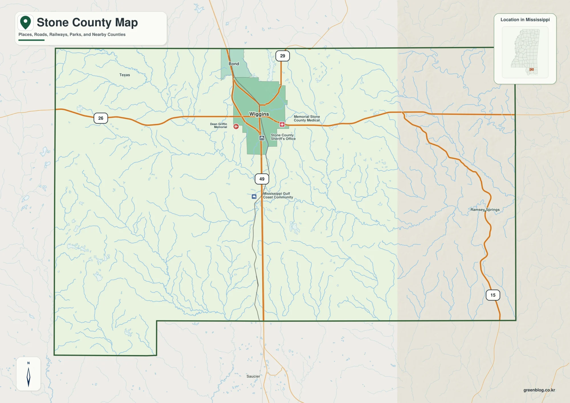
Madison County sits in central Mississippi with a map pattern that changes sharply from south to north and from west to east. Canton is the county seat, but the southern end is where Madison, Ridgeland, and Gluckstadt cluster along the I-55 corridor just north of Jackson. Flora stands apart in the west, while the northeastern part of the county reaches into a much more rural and hilly landscape. The maps on this page are designed to make those contrasts easy to follow: county boundaries and roads, the distribution of the five labeled cities, rivers and lakes, and elevation. You can download all four high-resolution A3 JPG maps in one ZIP, which is useful when you want a larger view, a printable copy, or an offline reference.
Looking at all four maps together is more useful than treating Madison County as a single suburban area. The Big Black River side in the west is comparatively low and open, the east and northeast contain the strongest bands of higher relief, and the Pearl River system forms an important reference along the southeastern side. Canton occupies a useful middle position between these settings. South of it, development becomes more concentrated around the I-55 communities; north and west of it, labeled settlements thin out quickly. That mix of city growth, rural land, two major river systems, and rolling terrain is the organizing idea for the article.
Table of Contents
Start with Canton and the county’s long north-south road pattern
The county map places Canton slightly south of the geographic middle, where several important routes meet. I-55 and US 51 run generally north-south and provide the clearest way to trace the relationship between Canton and the southern communities. MS 16 crosses eastward from the Canton area, MS 17 appears in the northeastern side, and MS 43 serves the southeastern part of the county. To the west, MS 22 and MS 49 are visible around Flora, while MS 463 links the western side back toward the central corridor. Reading these roads first makes the irregular county outline much easier to understand.
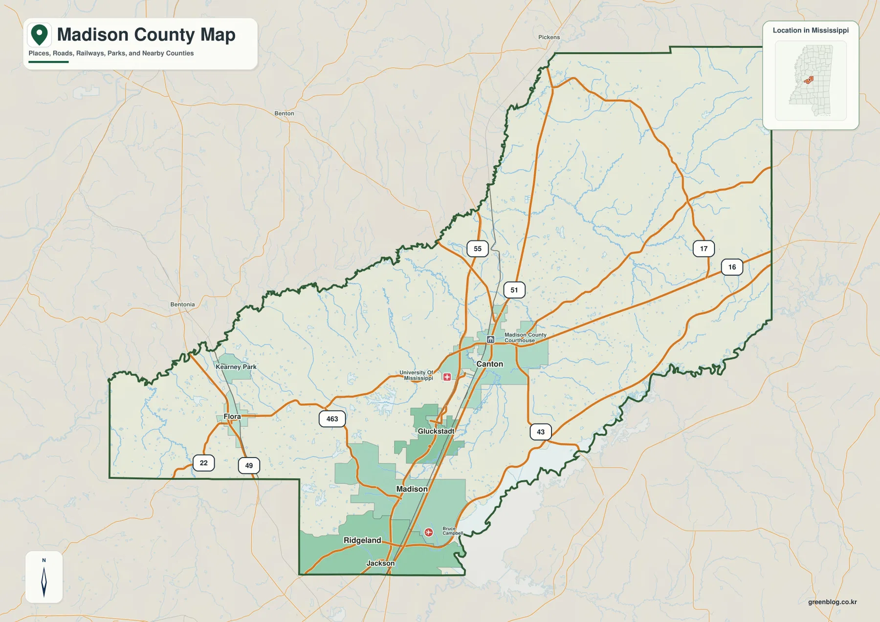
The boundary itself explains why a single center point can be misleading. A narrow southern section reaches toward Jackson, a broad western arm includes Flora, and the county expands north and northeast toward Holmes and Attala counties. The eastern side faces Leake County, while the southeastern edge lies near Rankin and Scott counties. On the city map, Yazoo County is labeled to the west and Hinds County to the southwest. These neighboring names are useful orientation markers because they show how Madison County bridges the Jackson-area south with a much larger rural interior.
| Reference | Value or map detail |
|---|---|
| County seat | Canton |
| FIPS code | 28089 |
| 2020 Census population | 109,145 |
| July 2025 population estimate | 116,298 |
| 2025 Gazetteer land area | 714.212 sq mi |
| 2025 Gazetteer water area | 27.828 sq mi |
| Simple density reference | About 152.8 residents per sq mi using 2020 population and 2025 land area |
| Elevation map actual range | About 40–150 m; mean about 85 m |
The 2020 census count and the July 2025 estimate refer to different dates, so they should not be treated as measurements from the same moment. The density figure is also a countywide calculation rather than a description of how people are spread on the ground. The maps make that limitation obvious: the built-up southern communities occupy a relatively compact part of the county, while large northern and western areas have far fewer labeled settlements. For geographic orientation, the contrast shown on the maps is more informative than assuming the countywide density applies evenly everywhere.
The five labeled cities reveal a strong southern cluster
The city map ranks five places and makes their distribution easy to compare without turning the page into a road-distance chart. Madison is shown as number 1, Ridgeland as number 2, Canton as number 3, Gluckstadt as number 4, and Flora as number 5. The first two sit close together near the southern end of the county, Gluckstadt lies just to their north, and Canton is farther up the central corridor. Flora is the outlier, positioned well to the west of the other four. The map therefore shows two different settlement patterns at once: a compact southern group and a much more separated western place.
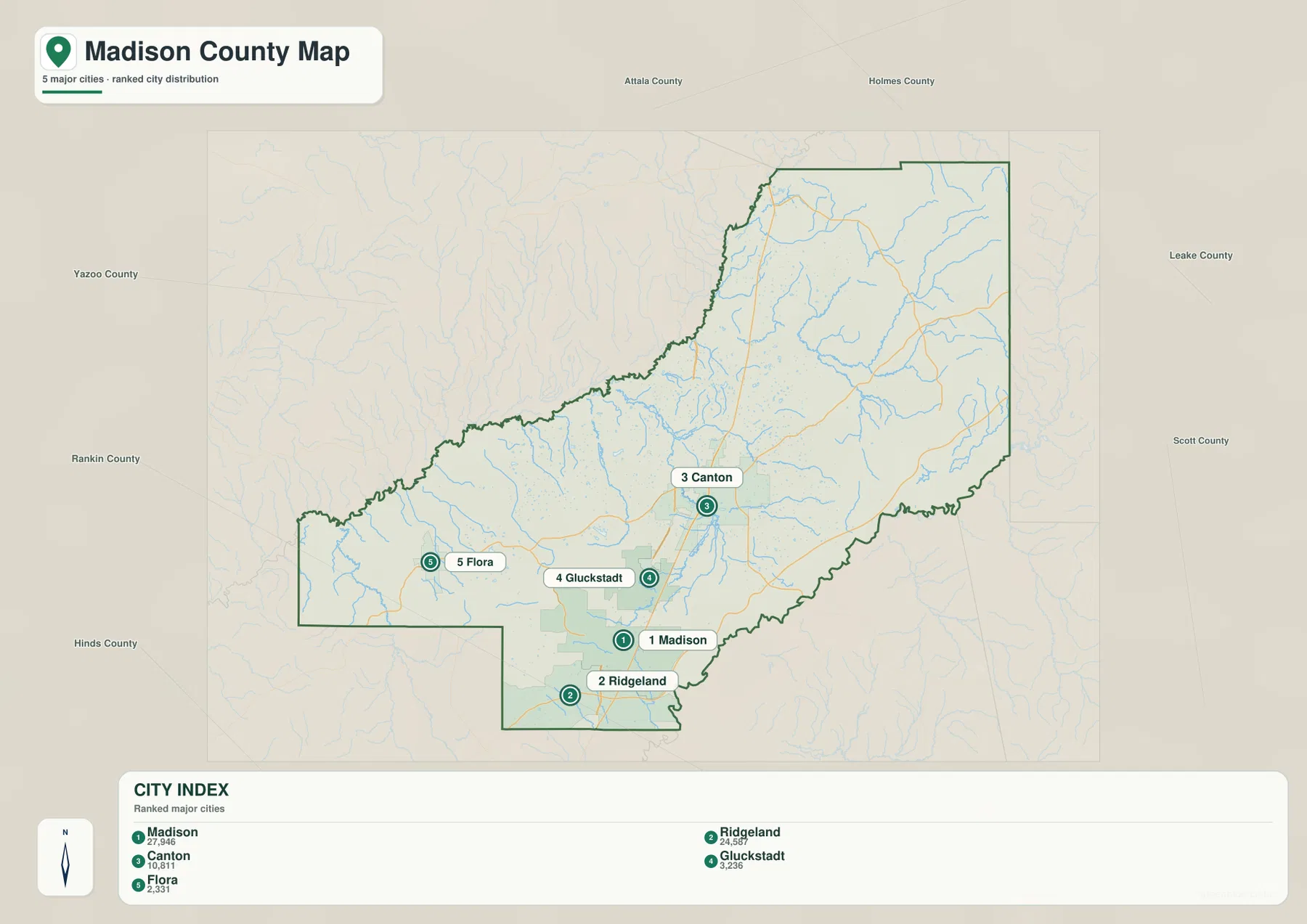
This distribution helps explain why the southern part of Madison County can feel closely tied to Jackson even though Canton remains the county seat. Ridgeland and Madison lie immediately north of the Jackson label on the map, and Gluckstadt continues the pattern northward along the same general corridor. Canton is separated enough to read as its own center, especially where the road network spreads east and west. Flora, by contrast, is removed from that corridor and provides a useful marker for the county’s western rural side.
The surrounding county labels add regional context. Holmes County is north of Madison County and Attala County appears toward the northeast. Leake County lies to the east, Scott and Rankin counties are southeast, Hinds County is southwest, and Yazoo County is west. When these names are read together with the five cities, the map shows why northbound, westbound, and southeast-bound travel from Canton leads into quite different landscapes. The city map is meant for relative position and distribution; it does not give driving times or replace a street-level navigation map.
Two major river systems frame the county from west and southeast
The terrain and water map gives Madison County a second organizing structure. The Big Black River runs along the western side, while the Pearl River is the principal large-water reference on the east and southeast. Between them is a dense network of smaller creeks, branches, and lakes. Bear Creek and Panther Creek are labeled in the central area, and the northeastern hills contain many short tributaries that divide the terrain. This is important because the county is not drained as one simple basin: western watercourses relate to the Big Black system, while the eastern and southeastern side trends toward the Pearl River.
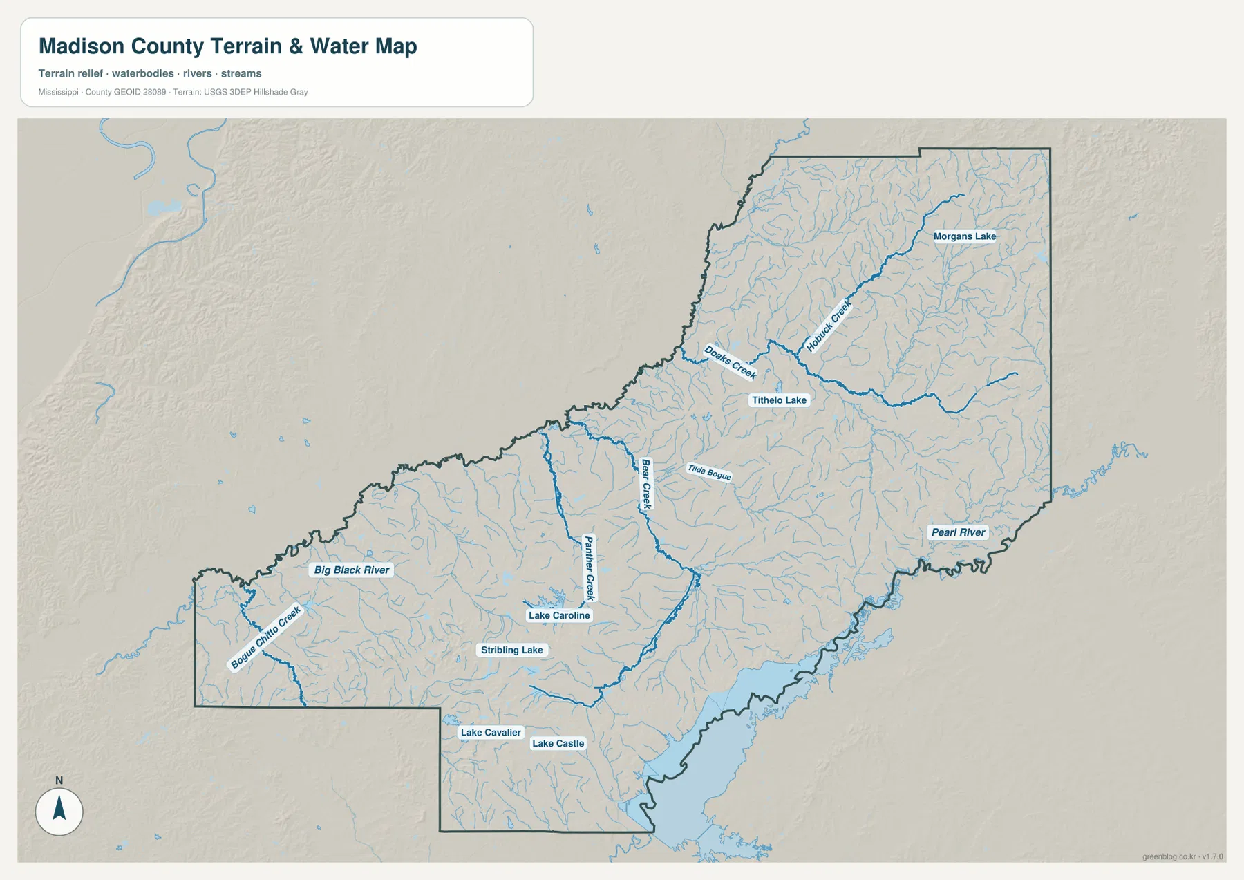
Several named lakes help locate the southern and central parts of the county. Lake Caroline and Stribling Lake appear in the central-southern area, while Lake Cavalier and Lake Castle are farther south. Morgans Lake is labeled in the northeast. These are especially useful when the water map is compared with the city map, because the southern urban corridor is not a continuous block of dry land; small lakes and creek corridors remain woven through it. North and northeast of Canton, the tributary network becomes visually finer as streams cut across the hillier terrain.
The broad southeastern water area is associated in the supplied article with the Pearl River and Ross Barnett Reservoir area near Rankin County. It is a strong regional landmark, but this page should not be used as a flood map, boating chart, or legal-water-boundary source. The water map shows relative location and drainage context only. Current flood stages, reservoir operations, navigation conditions, and regulatory boundaries require the appropriate agency’s specialized data.
Elevation separates the lower western side from the hillier east
The elevation map reports an actual county range of roughly 40 to 150 meters, with a mean near 85 meters. The colors are locally scaled to emphasize differences inside Madison County, so the important feature is the pattern rather than any single shade. Higher terrain is most continuous in the east and northeast, where orange and brown ridges form long, closely spaced bands. The western side and much of the central county are greener and lower. This is a substantial visual contrast even though Madison County is not a mountainous county.
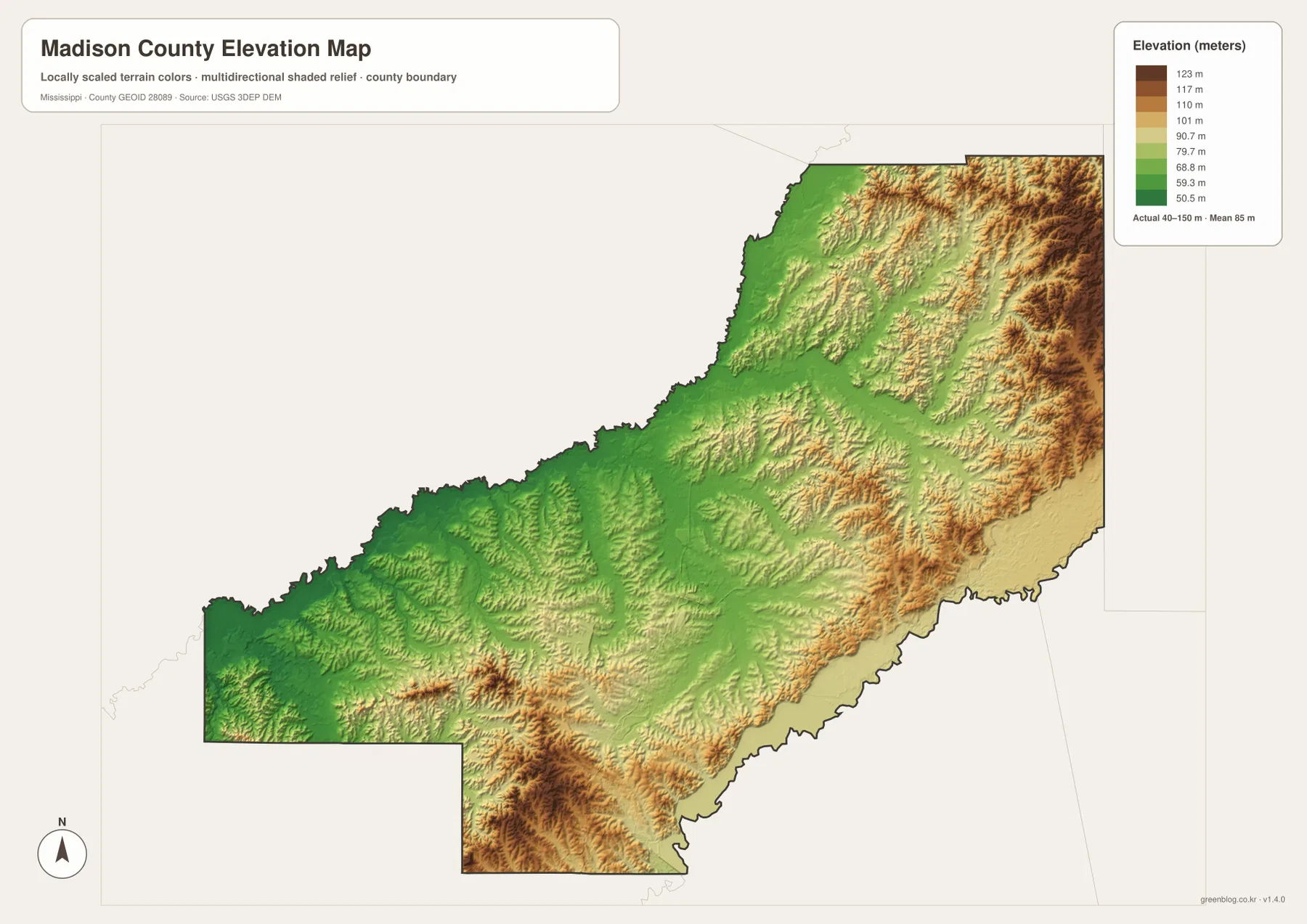
The relationship with the water map is clear. Lower terrain is prominent toward the Big Black River side, while creek valleys cut through the higher eastern and northeastern areas. A separate pocket of stronger relief also appears in the southern interior. The Pearl River side has its own low corridor along the southeastern edge, creating a county that is not simply high in the east and low in the west at every point. Still, the broad west-to-east change is strong enough to be one of the most useful features of the elevation map.
This surface is generalized for county-scale viewing. The stated 40–150 meter range is appropriate for understanding the overall difference between low valleys and higher ridges, but it is not survey-grade information for a house lot, road project, drainage design, or engineering calculation. Anyone needing a precise elevation at a specific point should use the underlying USGS elevation data or a professional survey rather than reading a value directly from the shaded map.
Putting roads, settlement, water, and relief on the same mental map
The four maps become most informative when the same locations are compared across them. Canton is a road center, but it is also close to the transition between the southern urban corridor and the larger rural interior. South of Canton, I-55 connects Gluckstadt, Madison, and Ridgeland; west of the central corridor, Flora sits closer to the Big Black River side. Eastward routes such as MS 16 and MS 43 move into terrain that becomes more strongly dissected by hills and creeks. Those relationships are difficult to see from a list of place names alone.
The southern end provides another useful comparison. Ridgeland and Madison are close to Jackson and occupy the most concentrated part of the city map. At the same time, the water map shows numerous lakes and creek corridors in and around this developed area, while the elevation map shows that the south is not uniformly flat. The southeastern Pearl River and reservoir area adds a large water feature beside the metropolitan edge. This combination helps explain why a road map, a settlement map, and a terrain map each contribute different information without duplicating one another.
The western side tells a different story. Flora is separated from the I-55 city cluster, and the Big Black River provides the strongest large-water reference. The elevation colors are generally lower than in the northeastern hills, although local ridges still appear. North of Canton, labeled cities become scarce while the road and stream networks continue through a broader rural area. Reading these differences prevents the common mistake of treating all of Madison County as an extension of the Jackson suburbs.
Choose the map by the question you need to answer
Each file has a different practical strength. If you need roads, county boundaries, and place names on one page, start with the county map. If the main question is where the five labeled cities sit relative to one another, the city map removes much of the extra detail. The water map is best for river, creek, and lake names, while the elevation map is the clearest way to compare the lower west with the hillier east and northeast. The WebP images on the page are quick previews; the downloadable A3 JPG files are better when you need to zoom in or print.
- Use the county map for Canton, the I-55 and US 51 corridor, state routes, and the overall county outline.
- Use the city map to compare Madison, Ridgeland, Canton, Gluckstadt, and Flora without assuming the ranking represents travel distance.
- Use the water map for the Big Black River, Pearl River, named creeks, and lakes such as Lake Caroline and Lake Castle.
- Use the elevation map to compare the approximately 40–150 m county range and the concentration of higher ridges in the east and northeast.
The download contains four high-resolution A3 JPG files corresponding to the county, city, water, and elevation maps shown in the article. They are suitable for larger displays, classroom handouts, reference sheets, or printed map collections. They are not legal boundary plats, parcel maps, real-time navigation products, flood-risk maps, or engineering elevation documents.
Frequently Asked Questions
Is the City of Madison the county seat of Madison County?
No. Canton is the county seat. The City of Madison is one of the principal communities in the southern part of the county and is ranked first on the supplied city map, but the administrative center is Canton. The county map marks the Madison County Courthouse at Canton, which is the clearest reference when the shared city and county name causes confusion.
Where does the elevation map show the highest concentration of hills?
The most continuous higher relief appears in the eastern and northeastern parts of the county. The western Big Black River side and much of the central area are lower, while the southeast includes a lower Pearl River corridor. The map gives an actual county range of about 40 to 150 meters with a mean near 85 meters, but it should not be used to read survey-grade elevations for individual sites.
Can the water map be used to judge flooding or reservoir conditions?
No. It is a reference map for the relative positions of the Big Black River, Pearl River, creeks, lakes, and the southeastern reservoir area. It does not provide flood depth, current stage, release operations, navigational information, or legal water boundaries. Those questions require current data from the responsible water or emergency-management agencies.
Sources and reference data
Population and area figures come from the supplied Census references, while the road, water, and elevation descriptions are based on the provided maps and the official data sources listed below. These links are the better place to check updated or more precise information when a county-scale reference map is not sufficient.
- U.S. Census Bureau Madison County QuickFacts
- U.S. Census Bureau Gazetteer Files
- Mississippi Department of Transportation official highway map
- USGS National Hydrography
- USGS 3D Elevation Program
- Ross Barnett Reservoir regional reference
Map File Information
The ZIP contains A3 high-resolution JPG versions of the Madison County county, city, water, and elevation maps shown on this page.
- Included Files: 4 map JPGs
- File Type: ZIP containing JPG images
Related Maps
Green Map creates custom-edited map images using open geographic data sources such as geoBoundaries, Natural Earth, OpenStreetMap, and government open data. These maps are edited visual materials, not raw data files, and are provided for education, documents, presentations, and graphic reference.