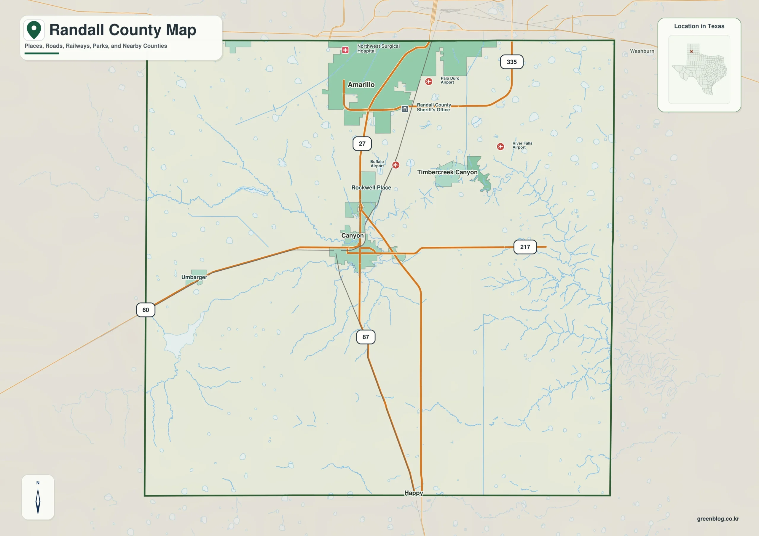
Canyon and southern Amarillo form one of the fastest-changing urban corridors in the Texas Panhandle. The Randall County Texas map identifies that north-central growth area while preserving the county’s eastern canyon country and broad rural sections. The county had an estimated 150,547 residents in 2024 and contains 912.71 square miles of land.
Randall County is not simply the southern half of metropolitan Amarillo. Canyon provides county government, higher education, and museum services; Palo Duro Canyon creates a major recreation landscape to the east; and farms, ranches, wildlife habitat, and small communities fill the remaining territory. The map set is arranged for local reference, monochrome printing, and custom labeling.
Continent: North America
Country: United States
State: Texas
County: Randall County
Location in State: South-central Texas Panhandle
Adjacent Counties: Potter County, Carson County, Armstrong County, Swisher County, Castro County, Deaf Smith County, Oldham County
Major Places: Canyon, southern Amarillo, Palisades, Timbercreek Canyon
Geographic Features: Palo Duro Canyon, Prairie Dog Town Fork Red River, Buffalo Lake National Wildlife Refuge
Table of Contents
A university town anchors county government
Canyon is the county seat and the home of West Texas A&M University. The university gives the city a regional role that reaches beyond courthouse business, supporting education, employment, athletics, and cultural events. Nearby, the Panhandle-Plains Historical Museum interprets the human and environmental history of the broader High Plains.
The city’s identity differs from suburban Amarillo even though Interstate 27 connects the two. Canyon retains a distinct downtown and civic center, while the corridor north of town increasingly carries commuter housing, retail development, and regional traffic.
Population growth follows the I-27 spine
The county’s population rose from 141,334 in 2020 to 150,547 in 2024, an increase of 9,213 residents. Much of that growth is associated with southern Amarillo and the developed route between Amarillo and Canyon rather than with the sparsely settled eastern and western edges.
I-27 and U.S. 87 provide the principal north-south connection, and U.S. 60 branches near Canyon toward the southwest and northeast. TxDOT has treated the segment between southern Amarillo and the U.S. 60/U.S. 87 interchange as a specific improvement corridor, reflecting the route’s importance to commuting and freight.
The county line runs through Amarillo
Amarillo extends across both Potter and Randall counties. Older central and northern districts lie largely in Potter County, while many southern neighborhoods and commercial areas are in Randall County. Municipal boundaries therefore do not reveal which courthouse, election office, or county jurisdiction applies to a particular address.
This split is one reason a county map remains useful in an urban setting. It can distinguish the Randall County side of Amarillo from Canyon and from the unincorporated spaces that surround the metropolitan edge.
Palo Duro changes the visual scale of the High Plains
East of Canyon, the Prairie Dog Town Fork of the Red River has cut a deep, branching canyon system into the otherwise level plains. Palo Duro Canyon State Park spans Randall and Armstrong counties and covers more than 27,000 acres. Trails, campgrounds, scenic drives, and the Lighthouse formation make it a major Panhandle destination.
Palisades and Timbercreek Canyon identify small residential areas near the canyon environment. Their terrain and access differ sharply from the gridded streets of Amarillo or the open agricultural land west of Canyon. Buffalo Lake National Wildlife Refuge adds seasonal wetland and grassland habitat in the southwestern part of the county.
A county formed during Panhandle settlement
Randall County was officially organized in 1889, with Canyon selected as the county seat. Railroad development and agricultural settlement helped establish the local economy, while later highway construction tied the county more closely to Amarillo.
Today the county combines metropolitan expansion with long-standing farming, ranching, education, and outdoor recreation. The Randall County Texas map is most informative when those land uses are viewed as separate zones rather than as one continuous urban area.
Color Map
The color edition separates Randall County from Potter County at the Amarillo side and from Armstrong County along the Palo Duro corridor. Canyon appears south of the metropolitan area, while Palisades and Timbercreek Canyon mark the more rugged eastern landscape. Swisher and Castro counties establish the southern and southwestern regional context. The contrast between the developed north, the central county seat, and the canyon edge remains clear through the area colors.

Black-and-White Map
The monochrome version removes the area fills but retains selected community names and boundary lines. Canyon can be compared with the Randall County portion of Amarillo, and the eastern places remain available as reference points for Palo Duro travel. The open background suits printed planning notes, classroom worksheets, and highway annotations.

Outline Map
The outline file removes printed labels and colors, leaving the county perimeter and included internal linework. Users can add I-27, Canyon, southern Amarillo, and the Prairie Dog Town Fork corridor. Palo Duro Canyon, Buffalo Lake, Potter County, and Armstrong County can also be labeled for a custom regional exercise.

Download the printable map set
The three A3 JPG editions support different uses: quick geographic reference, clean monochrome printing, and custom route or landscape labeling. Major place names appear on the first two versions, while the outline file provides an uncluttered base.
County Map File Information
The download includes color, black-and-white, and outline versions of the Randall County map. Selected place names appear on the labeled editions, while the outline edition retains boundary linework without area colors or printed names.
- Included Versions: Color, Black and White, Outline
- File Type: JPG
- Printable Size: A3
- Map Coverage: County perimeter, included internal boundaries, and neighboring county context
- Suggested Uses: Printing, lessons, reports, presentations, route marking, and custom labels
Frequently Asked Questions
What is the largest population center in Randall County?
The Randall County portion of Amarillo contains the largest concentration of residents, while Canyon is the county seat and a separate incorporated city.
Which institutions are located in Canyon?
Canyon is home to West Texas A&M University, the Randall County courthouse, and the Panhandle-Plains Historical Museum.
Can the outline map be used for Palo Duro routes?
Yes. The blank edition leaves room to mark the canyon, park access, nearby communities, highways, and the Armstrong County boundary.
Official data and local references
- Randall County: About Us — Official county information on Canyon, Amarillo, West Texas A&M University, Palo Duro Canyon, and local institutions.
- U.S. Census Bureau QuickFacts — Federal population estimates and demographic statistics for Randall County.
- Texas Parks and Wildlife: Palo Duro Canyon State Park — Official park information for the canyon landscape shared by Randall and Armstrong counties.
- TxDOT I-27 Randall County Project — Transportation context for the Amarillo-to-Canyon corridor.
Related Maps
- Terrell County Texas map|Sanderson, Dryden, Border Canyons, and Desert Rail History
- San Patricio County Texas map|Rail Towns, Ship Channel Industry, and Coastal Bend Growth
- Taylor County Texas map|Abilene, Dyess AFB, Railroad Towns, and the Callahan Divide
- Zavala County Texas map|Crystal City, La Pryor, Batesville, and the Nueces River
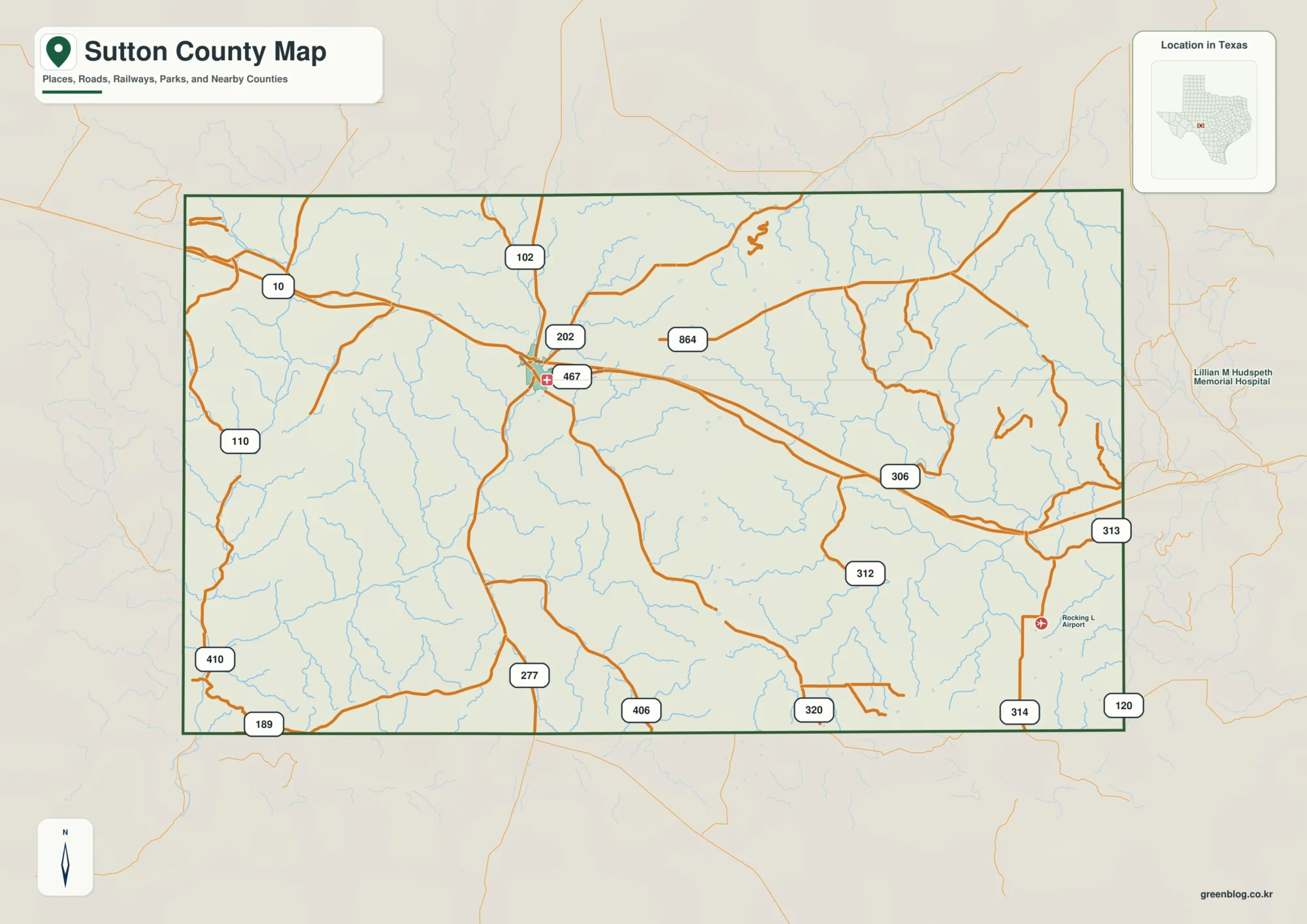
- Sutton County Texas map|Sonora, Caverns, Ranch Country, and Two Watersheds
Green Map creates custom-edited map images using open geographic data sources such as geoBoundaries, Natural Earth, OpenStreetMap, and government open data.
These maps are edited visual materials, not raw data files, and are provided for education, documents, presentations, and graphic reference.