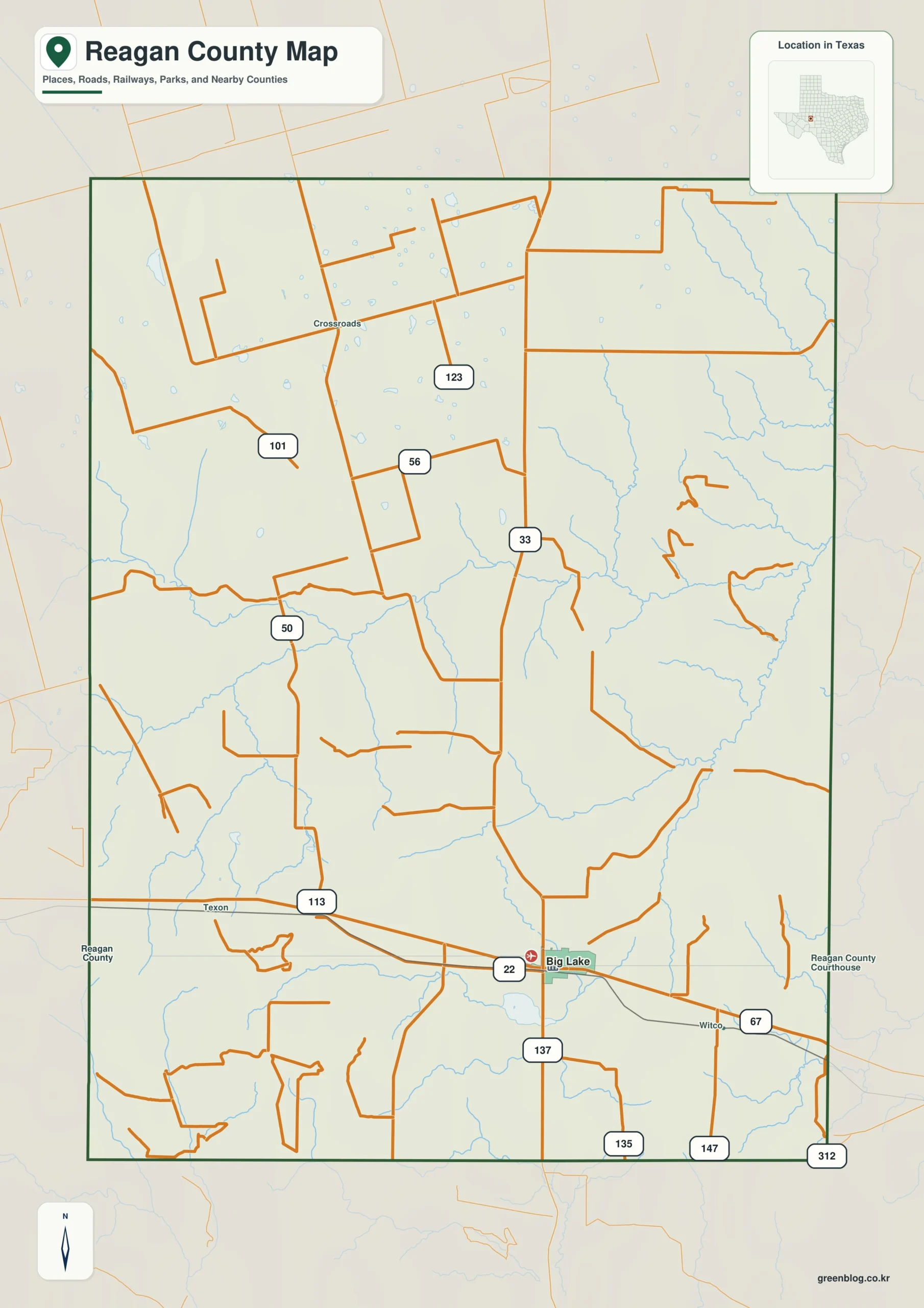
Reagan County Texas map — Reagan County is centered on Big Lake, with Best and Texon marking the historic Santa Rita oil landscape.
Download the Reagan County map
- Map file: County reference map
- File format: ZIP
Table of Contents
Quick Facts
- State: Texas
- County: Reagan County
- County seat: Big Lake
- Mapped places: Big Lake, Best, Texon
- Natural features: Permian Basin oil fields, Santa Rita oil field, arid ranch plains
- Main routes: U.S. 67, State Highway 137
What the Map Shows
Big Lake sits centrally, Best west, and Texon southwest. Few settlement labels appear across the broad energy and ranch grid.
County Layout and Location
U.S. 67 crosses Big Lake east-west, and State Highway 137 runs north-south. Oil-field roads spread across otherwise open plains.
Local Context
Oil and gas production dominates the economy. Development of the Santa Rita field was decisive in the growth of Big Lake and nearby settlements.
Ways to Use This Map
- Compare Big Lake with the western sites
- Locate the highway junction
- Read settlement density against oil roads
Frequently Asked Questions
Where is Texon relative to Big Lake?
It lies southwest in the Santa Rita oil district.
Why are there few towns?
Most land consists of sparsely settled ranches and energy fields.
Related Maps
Green Map creates custom-edited map images using open geographic data sources such as geoBoundaries, Natural Earth, OpenStreetMap, and government open data.
These maps are edited visual materials, not raw data files, and are provided for education, documents, presentations, and graphic reference.