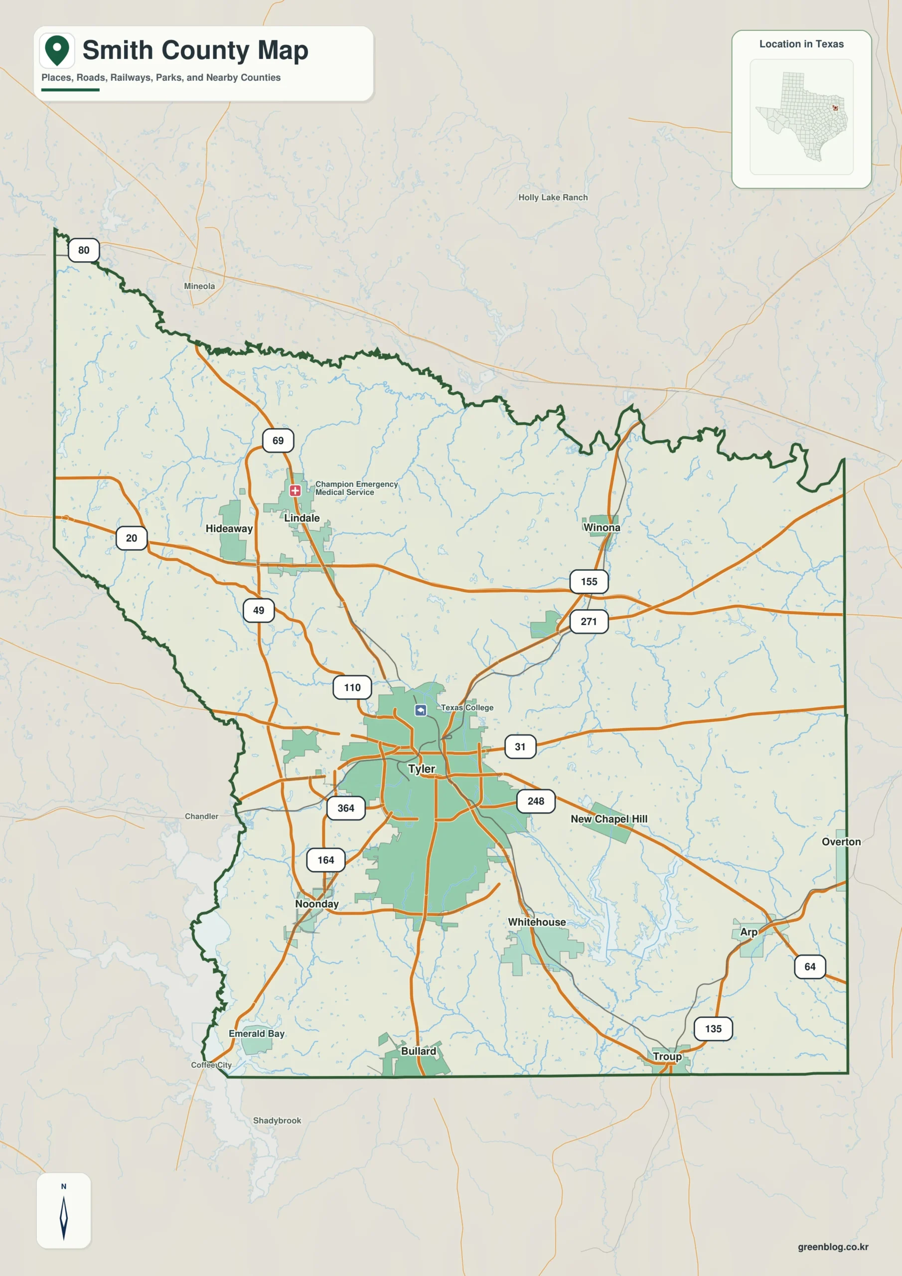
Smith County Texas map — Smith County is a Tyler-centered metropolitan county with a northbound I-20 connection and separate lake-oriented suburbs to the south and southeast.
Download the Smith County map
- Map file: County reference map
- File format: ZIP
Table of Contents
Quick Facts
- State: Texas
- County: Smith County
- County seat: Tyler
- Mapped places: Tyler, Lindale, Whitehouse, Troup, Bullard
- Natural features: Lake Tyler, northern Lake Palestine, East Texas pine woods
- Main routes: Interstate 20, U.S. 69
What the Map Shows
Tyler is central, Lindale northwest, Whitehouse and Troup southeast, and Bullard south. Lake Tyler anchors the southeastern water side.
County Layout and Location
U.S. 69 links Lindale, Tyler, and Bullard. Interstate 20 crosses the north, while Lake Tyler and northern Lake Palestine organize the southern drainage.
Local Context
Tyler concentrates healthcare, education, commerce, and manufacturing. Lindale faces the Interstate 20 growth corridor, while southern communities are more lake and commuter oriented.
Ways to Use This Map
- Follow U.S. 69 through the county
- Compare the two southeastern towns
- Use Lake Tyler to orient the water side
Frequently Asked Questions
Which community provides the I-20 reference?
Lindale lies closest to the northern interstate corridor.
How do Whitehouse and Troup differ?
Both lie southeast of Tyler, but Whitehouse sits closer to Lake Tyler.
Green Map creates custom-edited map images using open geographic data sources such as geoBoundaries, Natural Earth, OpenStreetMap, and government open data.
These maps are edited visual materials, not raw data files, and are provided for education, documents, presentations, and graphic reference.