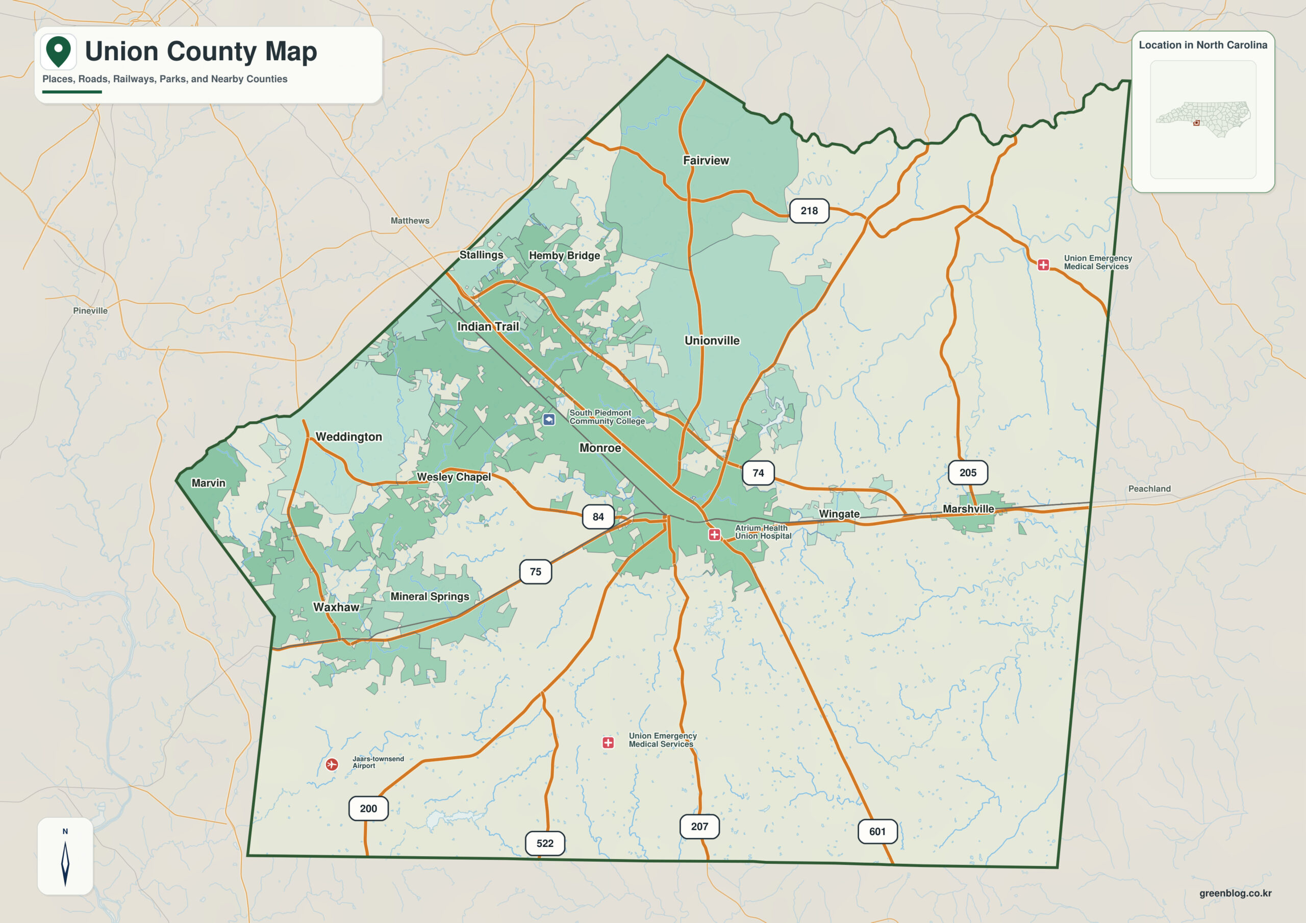
Union County North Carolina map is defined by a sharp growth contrast. Monroe remains the traditional seat and employment center, Indian Trail anchors the northwestern Charlotte suburbs, Waxhaw the southwest, and broad rural land persists farther east.
The relationship among Monroe, Indian Trail, and Waxhaw is more useful than municipal rank alone. Keeping Twelve Mile Creek basin and Charlotte growth corridor as independent physical anchors prevents the county from looking geographically uniform.
Union County quick facts
- County seat: Monroe
- North Carolina setting: southern Piedmont / Charlotte metro fringe
- Place references: Monroe, Indian Trail, Waxhaw
- Physical references: Twelve Mile Creek basin, Charlotte growth corridor, South Carolina state line
- Neighboring counties: Anson, Cabarrus, Mecklenburg, Stanly
Monroe versus the western suburbs
Monroe is the traditional county seat and employment center, Indian Trail is a large northwestern suburb near Mecklenburg, and Waxhaw anchors the southwestern growth corridor near South Carolina.
Indian Trail and Waxhaw face different corridors
Union 2050 responds to rapid growth by distinguishing designated higher-density areas from rural/agricultural land without full urban infrastructure. A Rural Land Use Plan adopted in March 2026 further emphasizes farmland preservation and lower-impact development.
2026 rural preservation sharpens the contrast
Union was formed from Mecklenburg and Anson Counties in 1842 and borders South Carolina. Its modern geography is defined by Charlotte-facing suburban growth on one side and efforts to preserve rural character on the other.
A practical reading sequence starts at Monroe, expands to Indian Trail and Waxhaw, and then checks Twelve Mile Creek basin and Charlotte growth corridor. That order keeps local function, county administration, and physical geography from collapsing into one description.
Comparing growth areas with rural land
Union County is easiest to use when Monroe, Indian Trail, Waxhaw, and the rural east remain separate zones. Development activity and the 2026 rural land-use preservation policies can then be compared without flattening the county into one suburban growth belt.
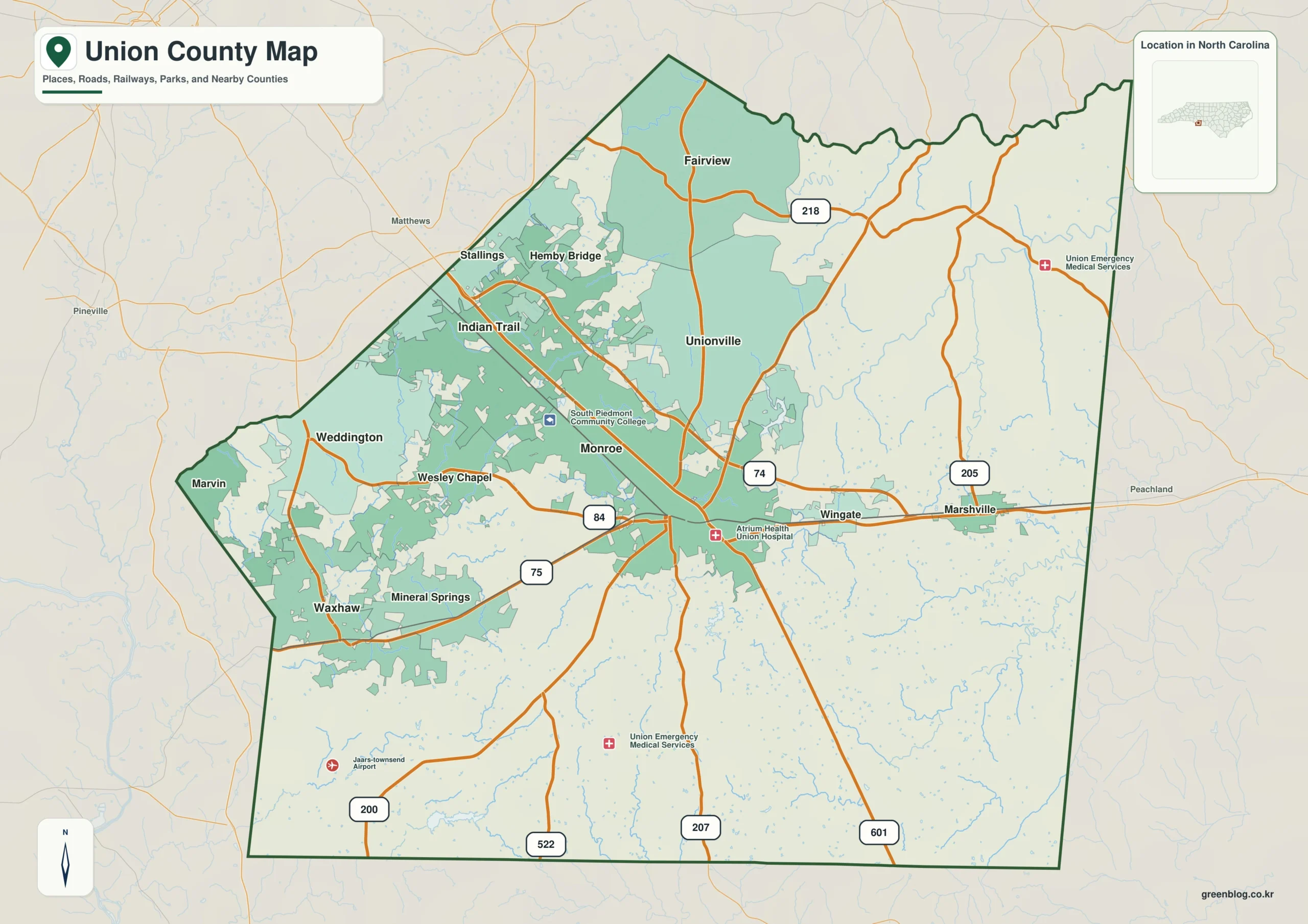
Union County single map file
The image above is a web preview; the button is reserved for the separate original map asset.
Download the Union County map fileFrequently Asked Questions
What does Twelve Mile Creek basin add when the map is read at county scale?
Starting with Twelve Mile Creek basin gives Monroe and the outer communities a common geographic frame. Adding Charlotte growth corridor then clarifies how the county’s natural setting differs across its mapped area.
Why is the Indian Trail area worth distinguishing from Monroe?
The two names represent different map roles rather than competing centers. Monroe establishes administration, while Indian Trail adds another functional or geographic zone.
Sources
Related County Maps
Green Map creates custom-edited map images using open geographic data sources such as geoBoundaries, Natural Earth, OpenStreetMap, and government open data.
These maps are edited visual materials, not raw data files, and are provided for education, documents, presentations, and graphic reference.