At the northern edge of the Texas Panhandle, Perryton serves a farm, ranch, and energy region that looks toward both Texas and Oklahoma. The Ochiltree County Texas map places the county seat near the U.S. 83 corridor, shows the small Ochiltree County portion of Booker on the east, and follows Wolf Creek south of town toward Lake Fryer. The county had an estimated 9,717 residents in 2024.
The county contains 917.685 square miles of land but only 0.514 square mile of water. Most of the landscape is open High Plains cropland and grazing country, with communities concentrated around highway or railroad locations. A state-line frame is essential because Texas County, Oklahoma, forms the entire northern neighbor.
Continent: North America
Country: United States
State: Texas
County: Ochiltree County
Location in State: Northern Texas Panhandle along the Oklahoma state line
Adjacent Regions: Texas County, Oklahoma, Lipscomb County, Roberts County, Hansford County
Major Places: Perryton, Booker, Waka, Farnsworth
Geographic Features: Wolf Creek, Lake Fryer, High Plains
Table of Contents
Rail access moved the county seat to Perryton
Ochiltree County was created in 1876 and organized in 1889. The first courthouse town, Ochiltree, developed away from the later railroad corridor. When rail service reached a new townsite in 1919, businesses and residents shifted to Perryton, and the county seat moved there.
That change explains the modern settlement pattern better than the geographic center of the county does. Perryton became the location for government, grain handling, schools, retail, and regional services because it combined rail access with roads leading across the northern Panhandle.
The county economy faces the High Plains rather than a river valley
Broad level ground supports wheat, grain sorghum, corn, cattle, and related agricultural businesses. Elevators, farm suppliers, trucking firms, and equipment services cluster in Perryton, while cultivated fields and pasture dominate most of the rural area.
Natural-gas development added another major industry during the twentieth century. Production and processing in the wider Panhandle field brought investment and industrial traffic, creating an economy in which agriculture and energy share the same road network.
Booker demonstrates why city and county lines must be separated
Booker is incorporated primarily in Lipscomb County, but a small western portion extends into Ochiltree County. A community label alone can therefore give the impression that the entire town belongs to one county. Showing the county line beside the place name prevents that error.
Waka and Farnsworth provide different rural references. Waka lies southeast of Perryton and reflects the railroad-and-grain settlement pattern, while Farnsworth identifies the eastern farm country closer to the Lipscomb County side.
Wolf Creek creates the county’s main recreational corridor
Wolf Creek begins in central Ochiltree County and flows east across the Panhandle toward Oklahoma. South of Perryton, the creek is impounded at Lake Fryer within Wolf Creek Park. Texas Parks and Wildlife lists the reservoir at about 86 acres and notes that it is roughly twelve miles south of the county seat.
The park provides fishing, camping, picnicking, swimming, and boating opportunities in a county with very little permanent surface water. That makes the creek corridor locally important even though water represents only a tiny fraction of the county’s total area.
Roads connect Perryton with two states
U.S. 83 runs north from Perryton toward the Oklahoma line and south toward the central Panhandle. State Highway 15 crosses Perryton from the Hansford County side and continues east through the Booker area toward Lipscomb County. The intersection concentrates through traffic and local services in the county seat.
Farm-to-market roads provide access to elevators, fields, ranches, and smaller communities. The resulting pattern is a road-centered rural network rather than a dense grid of towns.
A nearly stable population remains strongly concentrated
The estimated population changed from 9,953 in 2020 to 9,717 in 2024, a decline of about 2.4 percent. With approximately 10.6 residents per square mile, the county is rural, but Perryton contains most homes, institutions, and commercial activity.
Outside the city, long sections of the map represent working land rather than missing information. An Ochiltree County Texas map is most useful when the spaces between labels are read as crop fields, pasture, oil and gas sites, and transportation corridors.
Color Map
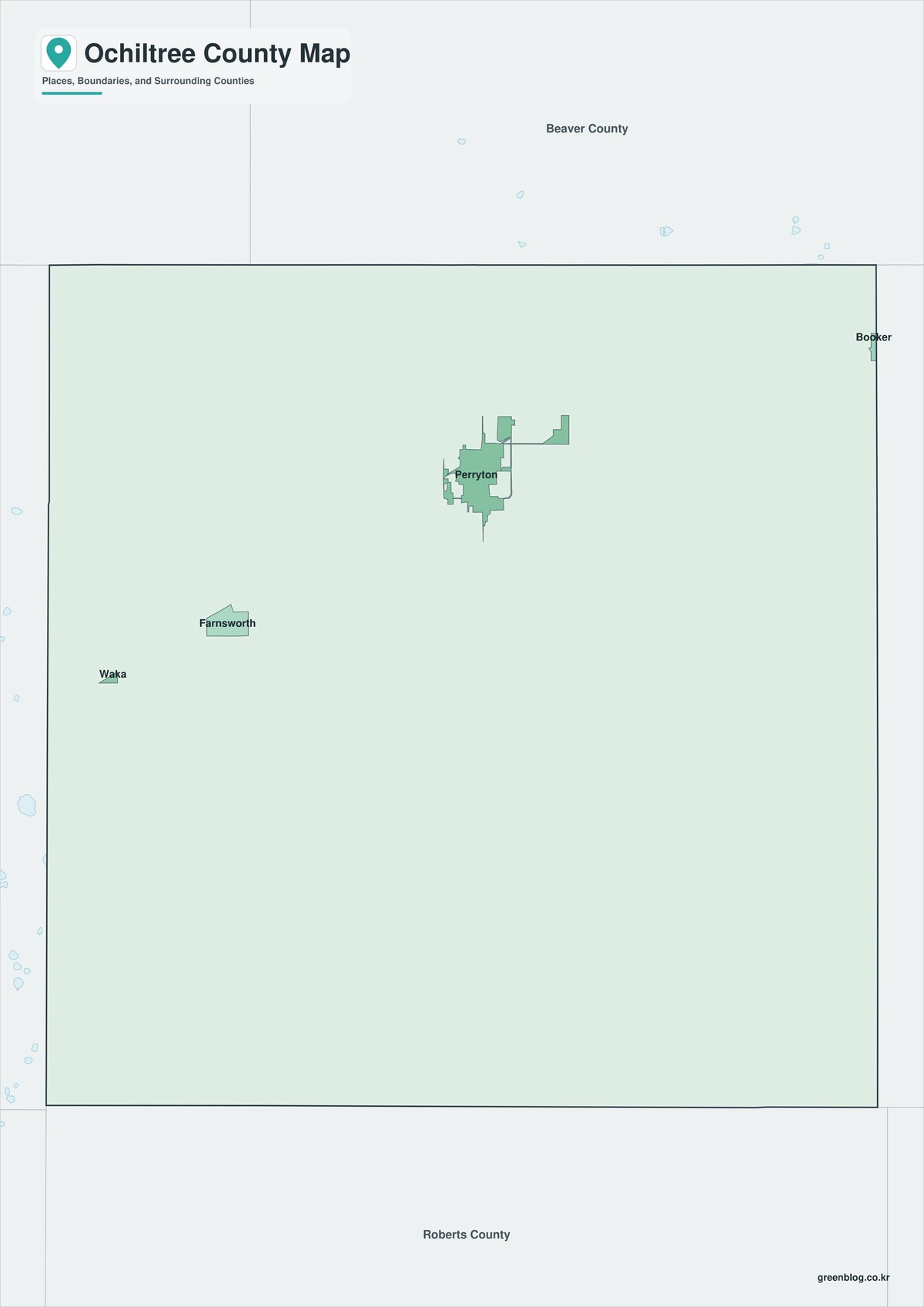
The color edition separates Ochiltree County from Texas County, Oklahoma, along the north and from Hansford, Roberts, and Lipscomb counties on the Texas sides. Perryton anchors the central-northern portion, while Booker appears at the eastern county line and Waka lies to the southeast. Wolf Creek and the Lake Fryer area add a southward reference from the county seat. The broad colored farm areas show how strongly settlement is concentrated around a small number of named places.
Black-and-White Map
The monochrome edition retains selected place names and boundary lines without area fills. U.S. 83 can be traced north toward Oklahoma, and State Highway 15 can be added across Perryton toward Booker. The open design is suitable for crop-route notes, printed county reports, and lessons about city limits crossing a county boundary.
Outline Map
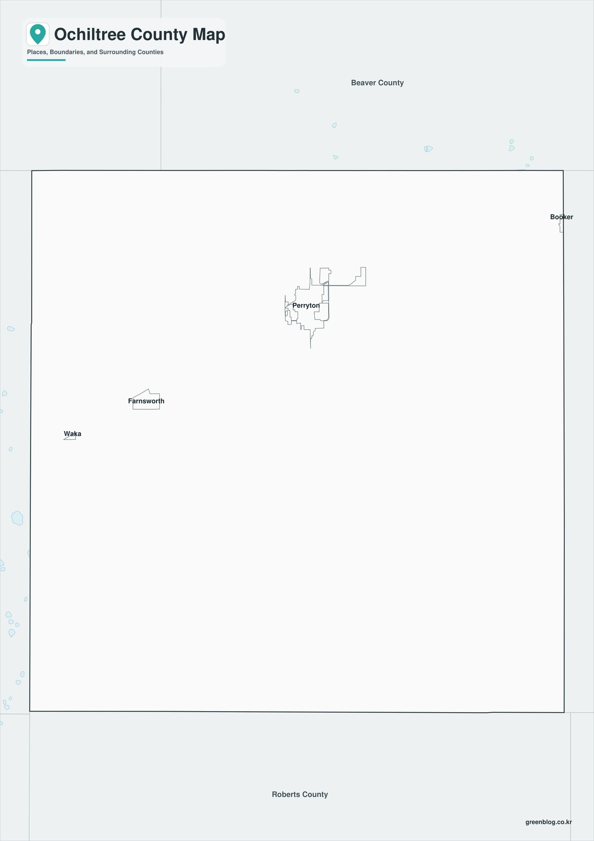
The outline file removes labels and colors, leaving the county perimeter and included internal linework. Users can mark Perryton, Waka, and the Ochiltree County section of Booker, then draw Wolf Creek or the main highways. The surrounding counties and Oklahoma state line can also be labeled to create a custom northern Panhandle reference.

Download the printable county maps
The A3 JPG set includes color, black-and-white, and outline editions. The labeled maps support quick geographic reference, while the blank version is suited to highway marking, agricultural planning notes, classroom activities, and custom labels.
County Map File Information
The download includes three Ochiltree County map styles. Selected place names appear on the color and monochrome editions, while the outline edition retains boundary linework without labels or area fills.
- Included Versions: Color, Black and White, Outline
- File Type: JPG
- Printable Size: A3
- Map Coverage: County perimeter, included internal boundaries, neighboring state and county context
- Suggested Uses: Printing, lessons, reports, route marking, and custom agricultural notes
Frequently Asked Questions
Does Ochiltree County border Oklahoma?
Yes. Texas County, Oklahoma, forms the county’s entire northern boundary, and U.S. 83 provides the principal road connection across the state line.
Is all of Booker located in Ochiltree County?
No. Most of Booker is in Lipscomb County, while a small western section extends into Ochiltree County.
What is the main public recreation site near Perryton?
Wolf Creek Park and Lake Fryer, about twelve miles south of Perryton, provide fishing, camping, picnicking, swimming, and boating facilities.
Official and regional references
- Ochiltree County, Texas — Official courthouse and county-government information in Perryton.
- Texas State Library: Counties and County Seats — State reference identifying Perryton as the Ochiltree County seat.
- Handbook of Texas: Ochiltree County — Historical context for county organization, ranching, farming, rail development, and Perryton.
- Texas Parks and Wildlife: Lake Fryer — Official location, size, access, and fishing information for the reservoir in Wolf Creek Park.
- U.S. Census Bureau QuickFacts — Federal population and geographic statistics used for the county profile.
Related Maps
- Webb County Texas map|Laredo, Rio Bravo, and the Rio Grande
- Taylor County Texas map|Abilene, Dyess AFB, Railroad Towns, and the Callahan Divide
- Throckmorton County Texas map|Cow Country, Throckmorton, and the Brazos Forks
- Upshur County Texas map|Gilmer, Big Sandy, and Lake O’ the Pines
- Trinity County Texas map|Groveton, Lake Livingston, and Davy Crockett National Forest
Green Map creates custom-edited map images using open geographic data sources such as geoBoundaries, Natural Earth, OpenStreetMap, and government open data.
These maps are edited visual materials, not raw data files, and are provided for education, documents, presentations, and graphic reference.