Reservoir access is the defining geographic feature of this small northeast Texas county. The Rains County Texas map places Emory near the center, Point toward the northwest, and East Tawakoni beside the eastern shore of Lake Tawakoni. Lake Fork lies along the opposite side of the county, giving residents and visitors two major fishing and recreation destinations within a short regional drive.
Rains County contains 229.49 square miles of land and 29.34 square miles of water. Its 2024 estimated population was 13,306, an increase of 1,127 residents since 2020. Despite its limited size, the county connects four neighbors and several road corridors used for travel between the Dallas area, Greenville, Sulphur Springs, and the upper Sabine River basin.
- Continent: North America
- Country: United States
- State: Texas
- County: Rains County
- Location in State: Northeast Texas, upper Sabine River region east of Dallas
- Adjacent Counties: Hunt County, Hopkins County, Wood County, Van Zandt County
- Major Places: Emory, Point, East Tawakoni
- Geographic Features: Lake Tawakoni, Lake Fork Reservoir, Sabine River basin
Table of Contents
A county reshaped by reservoir shorelines
More than eleven percent of the county’s total area is water. Lake Tawakoni occupies a broad western setting shared with Hunt and Van Zandt counties, while Lake Fork Reservoir reaches into the eastern side from Wood and Hopkins counties. These reservoirs changed the county from a primarily agricultural landscape into a place where marinas, boat ramps, fishing businesses, and lakeside housing also influence local travel.
Texas Parks and Wildlife lists Lake Tawakoni as a 37,879-acre reservoir impounded in 1960. Lake Fork covers 27,264 acres and was impounded in 1980. Rains County operates a public ramp on the Lake Fork Creek arm, demonstrating the county’s direct connection to recreation on both lakes.
Emory Rains gave his name to both county and seat
The county was organized in 1870 from territory that had largely belonged to Wood County. It was named for Emory Rains, a pioneer and lawmaker who served in the Congress of the Republic of Texas and later in the state legislature. The settlement first called Springville was renamed Emory and became the county seat.
Emory remains the largest local center and houses county government. Point and East Tawakoni provide smaller municipal centers with different orientations: Point faces the northwestern road network, while East Tawakoni is closely associated with the Lake Tawakoni shoreline.
Roads meet at the county’s central service town
U.S. 69 passes through the Emory area on a northwest-to-southeast line, and State Highway 19 provides the principal north-south connection. State Highway 276 serves the western reservoir corridor and links communities near Lake Tawakoni. These routes make Emory the most practical location for county services, shopping, and transfers between local roads.
The compact county shape means a traveler can move from the county seat to a lake community without crossing the long distances common in West Texas. At the same time, reservoir arms and county lines can make direct-looking routes less simple than they appear on a small regional map.
Recent growth in a rural-lake setting
The population rose from 12,179 in 2020 to 13,306 in 2024, a gain of about 9.3 percent. Growth does not create a continuous suburban landscape; instead, homes and services tend to cluster around Emory, highway approaches, and lake-access areas.
The local economy still includes agriculture and rural services, but reservoir recreation adds a strong seasonal and visitor component. This mix helps explain why a county with only three incorporated cities can support numerous ramps, marinas, lodging properties, and fishing-related businesses.
Color Map
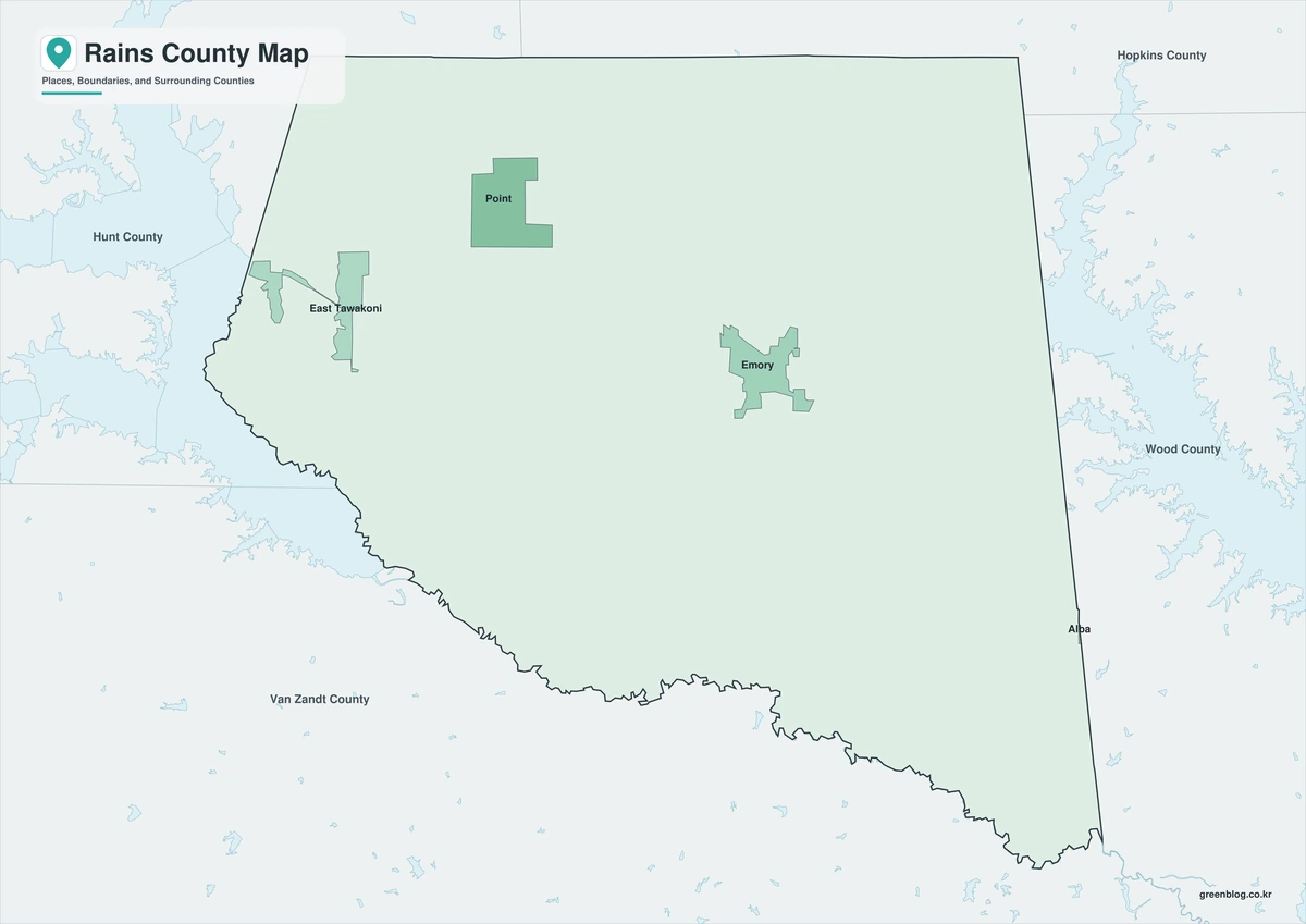
The Rains County Texas map color edition separates the county from Hopkins County to the north and Wood County to the east, while Hunt and Van Zandt counties frame the western side. Emory forms the inland reference point, and East Tawakoni identifies the Lake Tawakoni shore. Point sits between those two settings toward the northwest. Lake Fork on the eastern side completes the county’s distinctive position between two large reservoirs.
Black-and-White Map
The monochrome version removes area fills but retains selected place names and boundary lines. Emory can still be compared with Point and the Lake Tawakoni side of the county, while the eastern edge remains clear for Lake Fork orientation. The simplified background is suitable for route notes, printed reports, and fishing-trip planning.
Outline Map
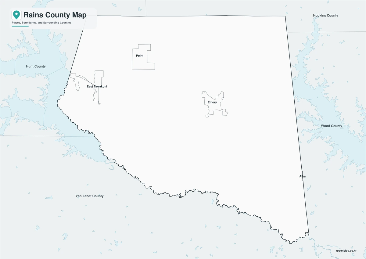
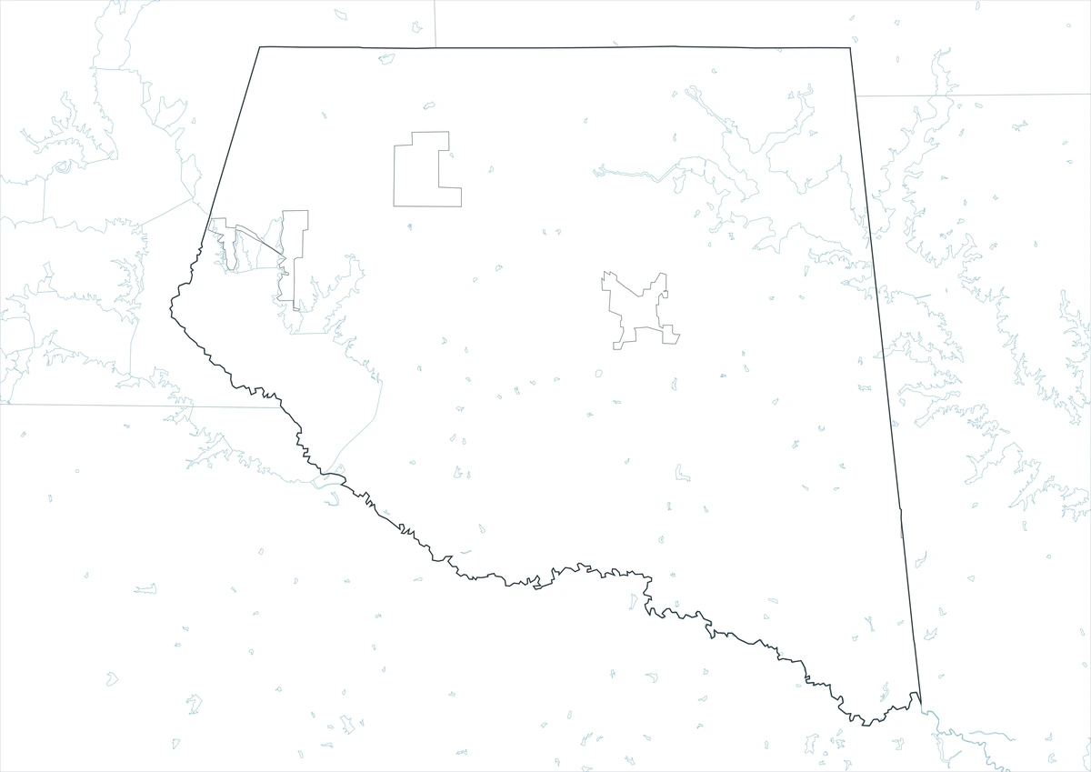
The outline file removes printed names and colors, leaving the county perimeter and included internal linework. Users can add Emory and East Tawakoni, trace U.S. 69 and State Highway 19, or label Lake Fork and Lake Tawakoni. Hunt, Hopkins, Wood, and Van Zandt counties may also be written around the boundary for a regional exercise.
Download the printable county maps
The A3 JPG set includes color, black-and-white, and outline editions. The labeled files work as quick county references, while the blank version supports custom road, reservoir, or community annotations.
County Map File Information
The download includes three Rains County map styles. Selected place names appear on the color and monochrome editions, while the outline edition retains boundary linework without labels or area fills.
- Included Versions: Color, Black and White, Outline
- File Type: JPG
- Printable Size: A3
- Map Coverage: County perimeter, included internal boundaries, neighboring county context
- Suggested Uses: Printing, lessons, reports, presentations, fishing-trip notes, and custom labels
Frequently Asked Questions
Which incorporated cities are in Rains County?
The county’s incorporated cities are Emory, Point, and East Tawakoni. Emory is the county seat and largest local service center.
Why is so much of the county shown as water?
Parts of both Lake Tawakoni and Lake Fork Reservoir lie within the county. Together, mapped water covers more than eleven percent of its total area.
Is Rains County part of the Dallas metropolitan area?
It is east of the core Dallas–Fort Worth counties and is usually described as northeast or East Texas, although road access and relocation patterns connect it economically with the broader Dallas region.
Sources and regional references
- Rains County Tourism — Official county information identifying Emory, Point, East Tawakoni, and the two-reservoir setting.
- Handbook of Texas: Rains County — Historical and geographic background on the county, Emory Rains, agriculture, and reservoir development.
- Texas Parks and Wildlife: Lake Tawakoni — Official reservoir location, size, depth, and impoundment information.
- Texas Parks and Wildlife: Lake Fork — Official information on the reservoir shared by Rains, Wood, and Hopkins counties.
- U.S. Census Bureau QuickFacts — Federal population and geographic statistics used for the county profile.
Related Maps
- Tarrant County Texas map|Fort Worth, Arlington, Airport Cities, and Trinity Lakes
- Roberts County Texas map|Miami, Canadian River Breaks, and Ranch Country
- Shelby County Texas map|Center, Sabine River, and the East Texas Borderlands
- Throckmorton County Texas map|Cow Country, Throckmorton, and the Brazos Forks
- Wise County Texas map|Decatur, Bridgeport, and Lake Bridgeport
Green Map creates custom-edited map images using open geographic data sources such as geoBoundaries, Natural Earth, OpenStreetMap, and government open data.
These maps are edited visual materials, not raw data files, and are provided for education, documents, presentations, and graphic reference.