Long before modern county lines were drawn, ranches and settlements followed Spanish and Mexican land grants along the Rio Grande. That older pattern still shapes the county: communities crowd the river and U.S. 83, while large tracts of thornscrub and ranchland extend north toward Jim Hogg and Brooks counties. A Starr County Texas map makes the contrast visible between a populated international border corridor and a much more sparsely settled interior.
The Census Bureau estimated that Starr County had a population of 66,319 on July 1, 2025, which was 0.6 percent higher than the 2020 estimate base of 65,916. Rio Grande City is the county seat, but Roma, Escobares, La Grulla, and numerous census-designated communities form a nearly continuous chain of settlements along the southern highway corridor.
Table of Contents
Land Grants Created a River-Facing Settlement Pattern
Spanish colonial authorities issued large grants along the lower Rio Grande during the eighteenth century. Access to water mattered so much that many properties were arranged in long strips extending north from the river. Ranch headquarters, small plazas, and family communities developed within that framework, creating a cultural landscape older than Starr County itself.
The county was created in 1848 from part of Nueces County and named for James Harper Starr, a public official of the Republic and State of Texas. Rio Grande City became the county seat near a river crossing and trading point. Roma, farther west, grew into another important commercial center and later preserved a nationally recognized historic district of border architecture.
U.S. 83 Links the County’s Population Centers
Most incorporated cities and larger communities lie close to U.S. Highway 83. La Grulla occupies the eastern end near Hidalgo County, while Rio Grande City anchors government and services. Escobares sit between the county seat and Roma, with Roma serving the western river corridor. The route continues toward Zapata County, following a broad east–west line not far from the international boundary.
North of that corridor, settlement becomes much thinner. Farm-to-market roads lead toward San Isidro, El Sauz, Santa Anna, and isolated ranches, but there is no comparable chain of towns. The uneven distribution is crucial for understanding the map as geographic distances within the county do not match an even population or service spread.
The Rio Grande Is Boundary, Water Source, and Trade Route
The river forms Starr County’s entire southern international boundary with Tamaulipas, Mexico. Its bends create an irregular county edge, and the western part approaches Falcon International Reservoir. Historically, the river supported ferries, ranch crossings, irrigation, and commerce; today bridges and ports of entry concentrate formal cross-border movement at selected locations.
Floodplain soils near the river differ from the drier uplands farther north. Irrigated fields and denser settlement occupy parts of the southern belt, while thorny brush, mesquite, cactus, and grassland dominate much of the interior. The county lies within the South Texas Plains, where hot conditions and variable rainfall strongly influence farming, ranching, and wildlife habitat.
Ranching, Agriculture, and Border Services
Cattle ranching shaped the county for generations and remains visible in large private tracts away from the river. Irrigation-supported crops predominated in the southern part of the county, with changes in acreage and crop selections due to shifts in water costs, market dynamics, and drought conditions. Hunting leases and wildlife management also add value to brush-country ranches.
Modern employment is more varied than the landscape suggests. Government, education, health care, retail, transportation, construction, and border-related services are concentrated around Rio Grande City and the U.S. 83 communities. Roma’s historic district and riverfront heritage add a cultural tourism element that differs from the county seat’s administrative role.
County Orientation List
- County seat: Rio Grande City
- Western center: Roma
- Main populated corridor: U.S. Highway 83 near the Rio Grande
- Northern references: El Sauz, San Isidro, and Santa Anna
- International boundary: Rio Grande opposite Tamaulipas, Mexico
- Adjacent Texas counties: Hidalgo, Brooks, Jim Hogg, and Zapata
Color Map
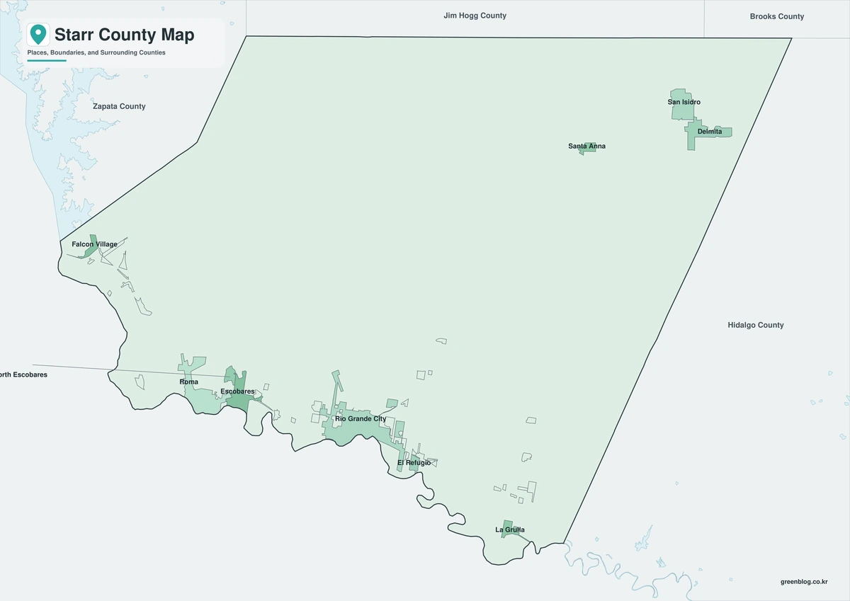
The color map separates Starr County from Zapata, Jim Hogg, Brooks, and Hidalgo counties while emphasizing its long southern edge. Roma and Escobares can be followed eastward toward Rio Grande City and La Grulla along the settled border corridor. The Rio Grande and Falcon Reservoir direction provide a natural frame for comparing river communities with El Sauz and other inland locations.
Black-and-White Map
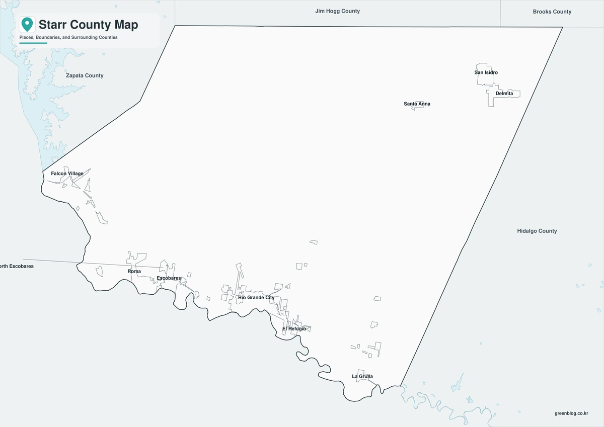
Color fills are removed, but the county outline, surrounding boundaries, and selected place labels remain. The monochrome layout preserves the contrast between Roma in the west and La Grulla in the east while keeping Rio Grande City easy to locate. It is suitable for reports or printed handouts that need clear labels without color ink.
Outline Map
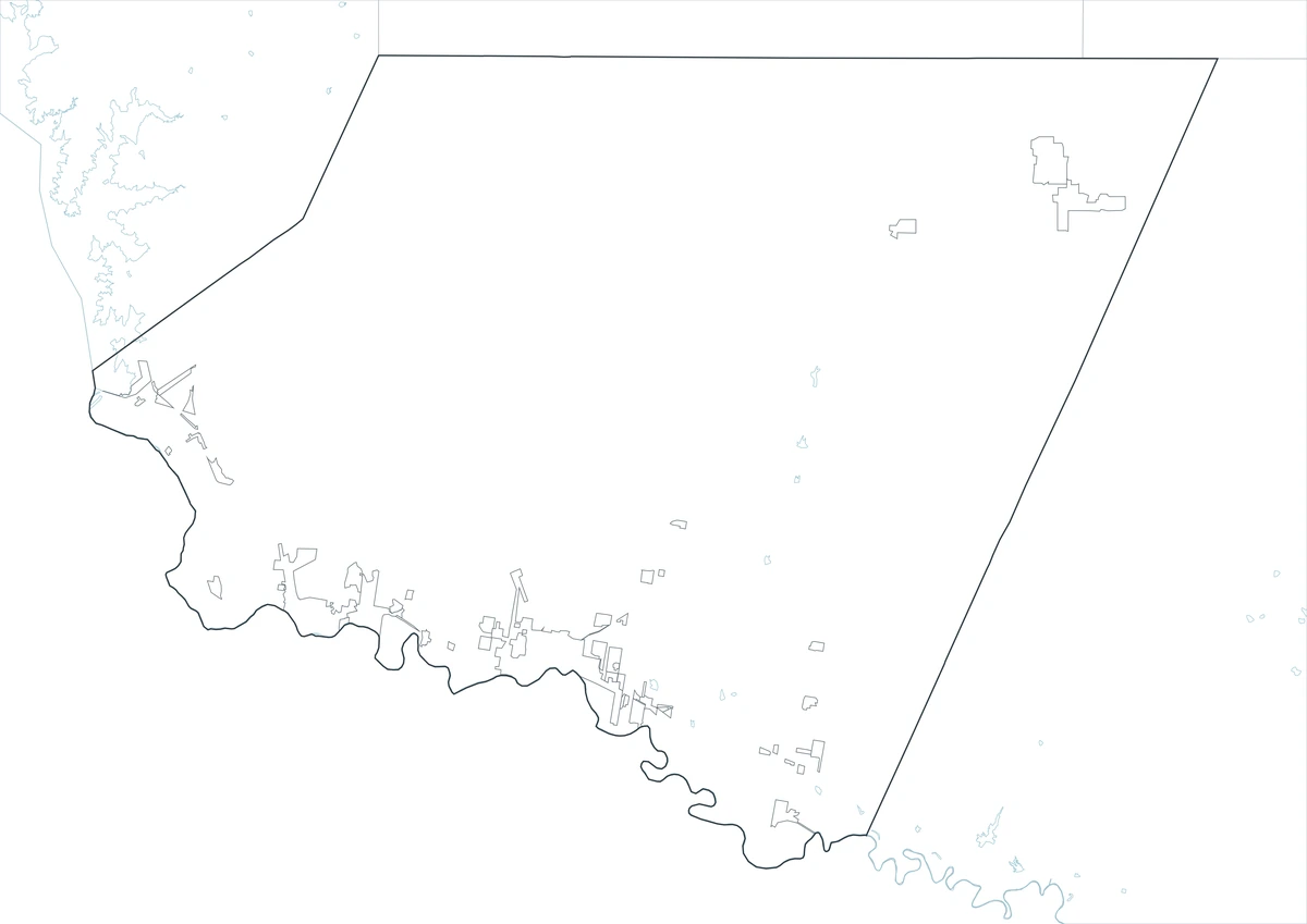
The outline version removes labels and fills, leaving the Starr County border and neighboring county framework. Users can plot Roma and Rio Grande City, draw the Rio Grande, or add U.S. 83 and routes toward San Isidro. It also provides room for custom notes about ports of entry, ranch areas, or population distribution.
Download the Starr County Map Set
The download includes labeled color and black-and-white maps plus an unlabeled outline file. All three JPG versions use an A3 layout for printing, classroom work, presentations, and digital reference.
County Map File Information
This download includes three A3 JPG versions of the Starr County map. The labeled maps use selected place names for readability, while the outline version contains boundary lines without labels or color fills.
- Included Versions: Color, Black and White, Outline
- File Type: JPG
- Printable Size: A3 high-resolution layout
- Map Detail: County boundary, selected place boundaries, and surrounding county reference
- Intended Use: Printing, classroom materials, presentations, documents, blog graphics, and custom annotations
Frequently Asked Questions
Why are so many communities close to the southern county line?
The Rio Grande supplied water, transportation, and access to irrigable land, and U.S. 83 later reinforced the same east–west corridor. Northern Starr County has much larger ranch tracts and fewer population centers.
Are Rio Grande City and Roma the same type of regional center?
No. Rio Grande City is the county seat and primary government-service center. Roma is a western border city known for its historic district, river commerce, and connections toward Falcon Reservoir and Zapata County.
Does the map show Mexican municipalities south of the river?
The county map is designed primarily around Starr County and nearby reference areas. The Rio Grande marks the international boundary, but detailed municipal divisions in Tamaulipas require a separate Mexico administrative map.
Sources and Further Reading
The Handbook of Texas entry for Starr County documents county formation, border settlement, soils, vegetation, agriculture, and political history.
U.S. Census Bureau QuickFacts supplies the 2020 population count, 2025 estimate, and recent percentage change.
The Handbook of Texas entry for Roma and local historic resources provide background on the western border city, river commerce, and preserved architecture.
Regional Information
Continent: North America
Country: United States
State: Texas
County: Starr County
Location in State: South Texas along the Rio Grande and Mexican border
Adjacent Counties: Hidalgo County, Brooks County, Jim Hogg County, Zapata County
Major Places: Rio Grande City, Roma, Escobares, La Grulla, El Sauz
Geographic Features: Rio Grande, Falcon International Reservoir, South Texas Plains
Related Maps
- Schleicher County Texas map|Eldorado, Three Watersheds, Ranching, and Wind Energy
- Val Verde County Texas map|Del Rio, Lake Amistad, and Devils River
- Sherman County Texas map|Stratford, Texhoma, and the High Plains Border
- Scurry County Texas map|Snyder, Oil Fields, Railroad Settlements, and Two River Basins
- Uvalde County Texas map|Uvalde, Sabinal, the Nueces River, and Frio River
Green Map creates custom-edited map images using open geographic data sources such as geoBoundaries, Natural Earth, OpenStreetMap, and government open data.
These maps are edited visual materials, not raw data files, and are provided for education, documents, presentations, and graphic reference.