A Zimbabwe Map places an inland southern African country within a distinctive four-neighbor setting, but the supplied artwork is selective about what it shows. Zambia is labeled above the country, Botswana to the west, and Mozambique to the east. Zimbabwe also meets South Africa along its southern border, although that country’s name does not appear on these sheets.
The collection contains three 1200-by-846-pixel landscape images arranged for A3 use: a pastel map with names, a black-and-white labeled version, and an unlabeled outline. The first two identify eight broad provinces and use circle markers for Harare and Bulawayo. The third retains the national silhouette and internal lines but removes every geographic label and both city markers.
This visual distinction matters because Zimbabwe officially has eight provinces and two cities with provincial status. Harare and Bulawayo belong in a ten-unit administrative explanation, yet the Zimbabwe Map represents them as points rather than drawing their metropolitan boundaries as separate polygons. The page therefore treats the images as educational provincial references, not as complete boundary files for all ten first-level units.
Table of Contents
Zimbabwe Map Download Overview
Zimbabwe is landlocked between Zambia, Mozambique, South Africa, and Botswana. Its outline broadens across the west and narrows around parts of the northeast and southeast. On the page, that shape occupies most of the landscape frame, leaving enough outer space for three neighboring-country labels without reducing the interior province names to tiny type.
The eight labeled province shapes are Matabeleland North, Matabeleland South, Midlands, Masvingo, Manicaland, Mashonaland East, Mashonaland Central, and Mashonaland West. Harare appears as a red circle in the northeast-central area, while Bulawayo is marked near the meeting area of Matabeleland North, Matabeleland South, and Midlands. Neither dot should be read as the full extent of its metropolitan province.
A helpful way to read the Zimbabwe Map is to begin with the two western Matabeleland provinces, then follow Midlands through the center. Masvingo anchors the southeast, Manicaland forms much of the eastern side, and the three Mashonaland provinces occupy the north and northeast. The sequence makes the national pattern easier to remember than studying ten names without spatial context.
The neighboring labels also require care. Zambia, Botswana, and Mozambique are visible, but their territories are not outlined as complete countries. South Africa is absent as text even though Zimbabwe shares a border with it. No rivers, lakes, roads, terrain shading, scale bar, compass, or additional cities are included.
Included Map Versions
All three images use the same national outline and eight large internal province shapes, allowing readers to switch between reference and practice without learning a new layout. Their visible content differs as follows:
- Pastel color map with eight province names, two city markers, and three neighboring-country labels
- Black-and-white map retaining the same names, city circles, and boundary network
- Blank outline with the national and internal boundaries but no text or markers
The colored sheet supports quick separation, the monochrome sheet emphasizes names and lines, and the outline provides an answer-free base. The pastel fills are decorative identifiers only; they do not indicate population, elevation, climate, land use, politics, or another measured category. Any such interpretation must be added separately with a clear legend and a verified data source.
Color Zimbabwe Province Map
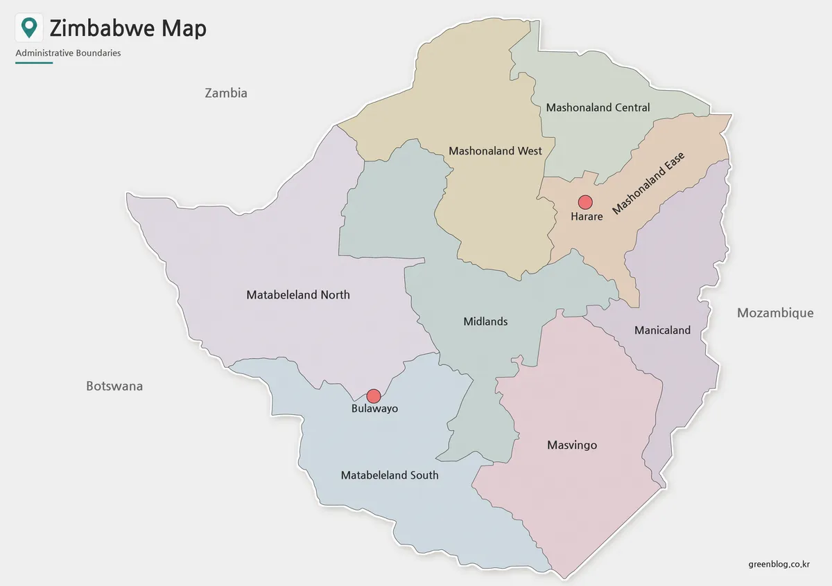
The color treatment is most valuable where several provinces converge around Midlands. Pale blue-green separates the central province from Matabeleland North, Mashonaland West, Mashonaland East, Manicaland, Masvingo, and Matabeleland South. The contrast also helps readers distinguish the three similarly named Mashonaland provinces before comparing their positions.
On this Zimbabwe Map, the Harare and Bulawayo circles use a stronger coral tone than the province fills. That hierarchy lets the two urban references stand out without suggesting that the circles show metropolitan area size. Harare is labeled inside the Mashonaland East-colored shape, and Bulawayo sits near provincial boundaries in the southwest; these are point symbols, not boundary depictions.
Select the color version for an introductory slide, a labeled regional reference, or an answer key beside the blank map. It is especially effective when the task is to group the three Mashonaland names, compare the two Matabeleland shapes, or locate the central Midlands province. The fills should remain visually subordinate if additional annotations are added.
Black and White Zimbabwe Map for Printing
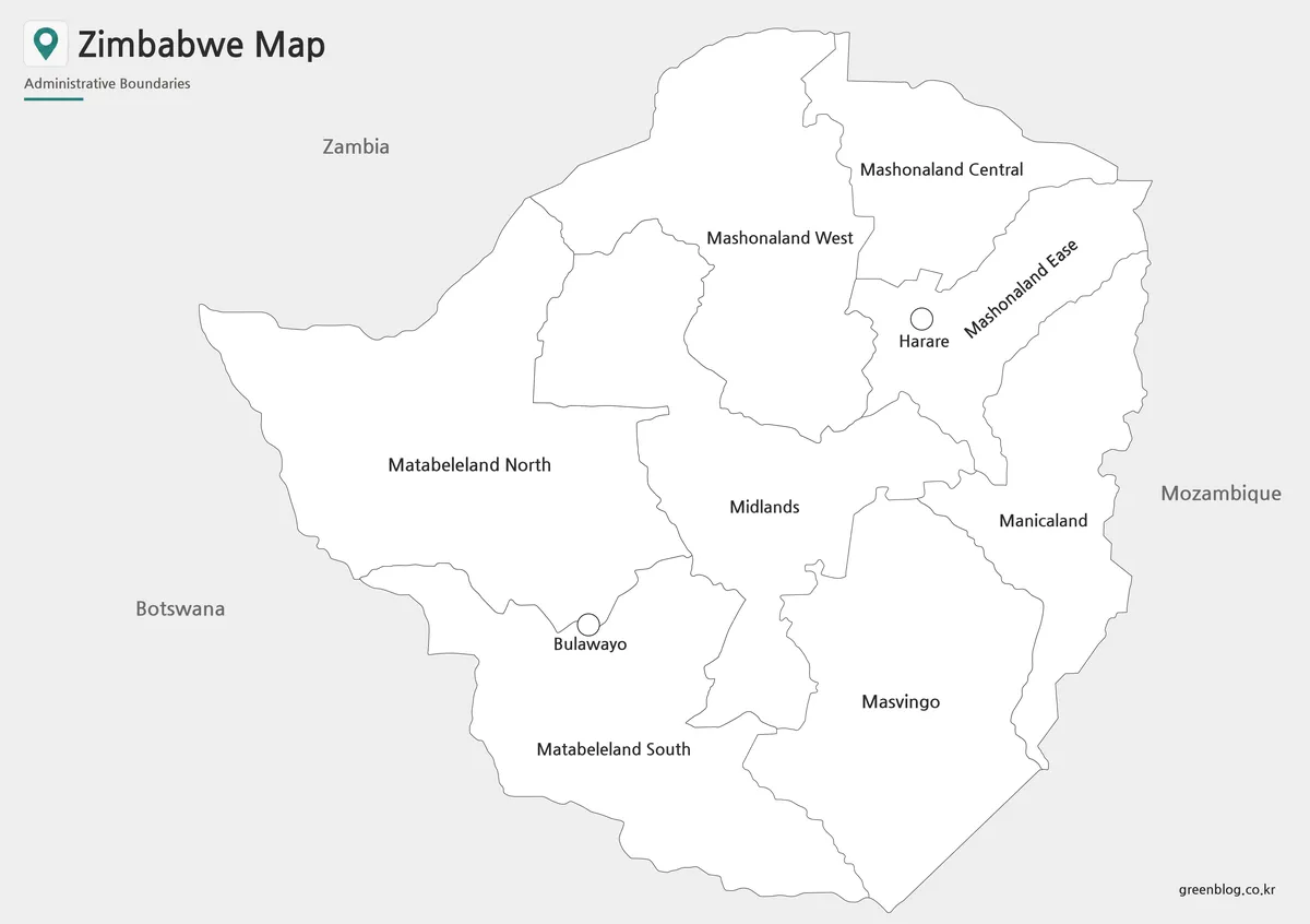
Removing color directs attention to the internal linework and text. The eight provinces remain white, while the surrounding area is pale gray, so the national silhouette stays distinct from the page. Harare and Bulawayo use unfilled circles rather than the coral markers found on the color sheet, but their positions and labels remain unchanged.
This version suits reports, restrained presentation themes, labeled worksheets, and grayscale handouts. Mashonaland East is angled to fit its narrow diagonal form, while other names sit horizontally in broader shapes. Before producing multiple copies, make a test print and confirm that the thin borders and smaller city labels remain clear at the chosen scale.
The monochrome page is still a completed reference rather than a test sheet. Students can consult it while checking the blank outline, or a writer can place it beside a paragraph about provincial organization. If a task requires learners to supply every name themselves, the outline version avoids the need to mask printed labels.
Blank Zimbabwe Outline Map for Editing
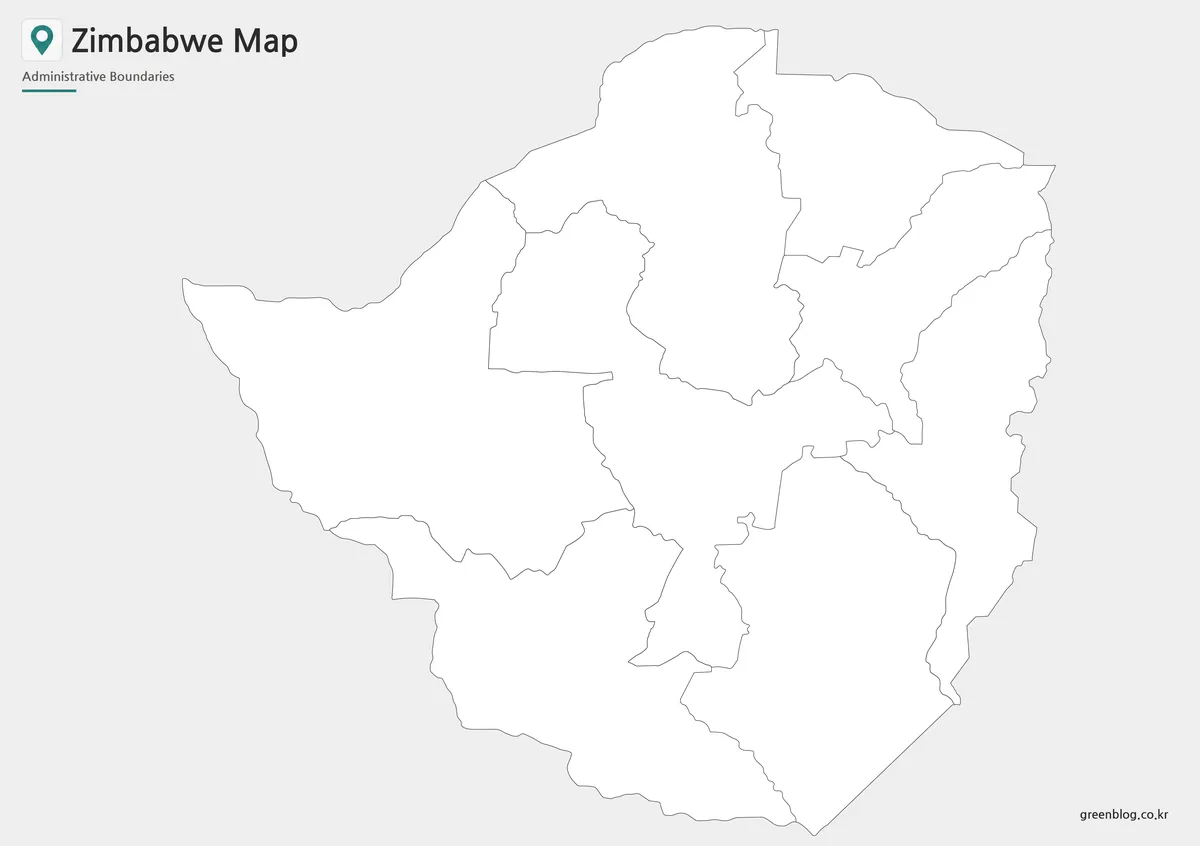
The blank sheet removes province names, neighboring-country labels, and the Harare and Bulawayo circles. It keeps the outer national border and the same eight broad internal areas seen on the labeled sheets. Consequently, users must add the two metropolitan references themselves if an activity is intended to cover Zimbabwe’s full ten-unit first-level structure.
A blank Zimbabwe Map can support a recall exercise in which learners label the three Mashonaland provinces, the two Matabeleland provinces, Midlands, Masvingo, and Manicaland. Another activity can ask them to place Harare and Bulawayo using the color map as a reference. The sheet also accepts project-specific routes, symbols, or data fills when those additions come from suitable sources.
Keep an untouched copy before editing digitally. Add a legend whenever colors represent information, preserve the original aspect ratio during export, and avoid positioning a symbol directly over a province line. Because this is a raster image rather than a confirmed vector source, enlarging it far beyond its supplied dimensions may soften the linework.
Why a Zimbabwe Map Is Useful
Zimbabwe’s provincial names form three memorable groups on the page: Mashonaland across the north, Matabeleland across much of the west and southwest, and four other references through the center, east, and southeast. Seeing that arrangement reduces the chance of confusing Mashonaland Central, East, and West or reversing Matabeleland North and South.
The map also supports careful country-orientation work. Zambia is placed beyond the upper border, Botswana beside the broad western side, and Mozambique along the east. A complete neighboring-country lesson should add South Africa from another verified reference because the southern label is absent. This limitation is more informative than pretending that every border country is already shown.
Practical Uses for the Zimbabwe Map Collection
For a structured lesson, begin with the color sheet to establish the provincial pattern, switch to the monochrome map for name reading, and finish with the outline for recall. A presentation creator can use the same progression across three slides. Shared geometry makes comparison straightforward because province positions do not shift between versions.
When printing the Zimbabwe Map at A3, select landscape orientation and preserve the image’s proportions. “Fit to page” is safer than stretching width and height independently. Smaller paper can still be practical, but the Harare and Bulawayo labels and the angled Mashonaland East name should be checked on a sample before a full handout run.
For a custom infographic, start with the outline and add only information relevant to the project. A province comparison needs a legend; a city exercise needs sourced point positions; and a transport or physical-geography topic requires a different reference layer. These maps contain no roads, rivers, relief, statistics, or distance scale and should not be presented as though they do.
Basic Zimbabwe Information for Map Users
Harare is Zimbabwe’s capital and one of the country’s two cities with provincial status; Bulawayo is the other. The official ten-unit list also includes the eight provinces named on the artwork. The red or open circles communicate city location only, so they should never be traced as the administrative outlines of Harare Metropolitan or Bulawayo Metropolitan.
Map users should also distinguish a provincial overview from a legal or survey product. The supplied images are appropriate for broad orientation, teaching, labeling, and design. Work that depends on exact metropolitan extents, lower-level districts, coordinates, or current legal boundaries should be checked against an authoritative government or statistical source.
Frequently Asked Questions
One limitation should be clear before reading the protected answers below: the Zimbabwe Map names eight provinces and marks Harare and Bulawayo with circles, but it does not draw the two metropolitan boundaries as separate polygons. The blank version also omits both city points, so a ten-unit boundary exercise needs another verified reference.
What is included in this Zimbabwe map download?
The Zimbabwe map download includes color, black and white, and outline versions. Each version is designed for a different use, such as visual reference, printing, or editing.
Can I use the Zimbabwe map for classroom materials?
Yes. The map works well for geography worksheets, classroom handouts, student reports, and presentation slides.
Which version is best for printing?
The black and white version is usually the best choice for printing because it keeps province labels and boundary lines clean without relying on color.
Is the outline map useful for editing?
Yes. The blank outline map can be used to add city markers, province names, route lines, industry notes, or infographic labels.
Are major cities included?
Yes. Harare and Bulawayo are marked as key city reference points in the labeled map versions.
Map File Information
The download contains the three Zimbabwe administrative map views displayed on this page, all using the same national outline and eight broad province shapes.
- Included Versions: Color labeled map, black-and-white labeled map, and blank outline map
- Printable Size: Maps arranged for A3 landscape use
- File Type: Image files
- Intended Use: Provincial study, worksheets, presentations, reports, and sourced annotation projects
Related Maps
Additional Resources
- Zimbabwe Ministry of Foreign Affairs: Facts and Figures: Review the government’s list of eight provinces and the two cities with provincial status.
Green Map creates custom-edited map images using open geographic data sources such as geoBoundaries, Natural Earth, OpenStreetMap, and government open data.
These maps are edited visual materials, not raw data files, and are provided for education, documents, presentations, and graphic reference.