A Slovakia Map is especially revealing when read from Bratislava at the narrow western end to the broader regions around Prešov and Košice in the east. The country is landlocked between the Czech Republic, Austria, Hungary, Ukraine, and Poland, and its elongated outline makes those border relationships easy to compare on one landscape page. The supplied maps add eight internal regional boundaries and a capital star without introducing roads, terrain, or other layers that would compete with the administrative pattern.
The set provides three 1,200 × 848-pixel WebP views: a pastel color map, a labeled black-and-white map, and an unlabeled outline divided by the same regional lines. Both labeled versions name Slovakia’s eight regions and place the five neighboring countries around the national border. The outline retains the region geometry but removes the place names and capital marker, leaving a cleaner base for recall exercises and custom annotations.
Teachers can use the versions as an answer key and worksheet pair, while writers and designers can choose between immediate label reference and a neutral background. The maps are prepared for an A3 layout, although their wide proportions should be preserved when they are placed on another page size. Because the artwork does not show roads, rivers, relief, distances, or border crossings, it should be treated as an administrative reference rather than a navigation map.
Table of Contents
Slovakia Map Overview
Slovakia stretches mainly west to east across Central Europe. The Czech Republic lies to the northwest, Austria touches the short western and southwestern edge, Hungary runs along much of the south, Ukraine meets the far east, and Poland follows the northern side. That arrangement means nearly every edge of the silhouette has a different international context, even though the country itself is compact enough to fit comfortably in a single frame.
Bratislava is marked with a star in the small western region that shares its name. Its position is unusual for a national capital because it sits close to both Austria and Hungary rather than near the geographic center of the country. On this Slovakia Map, the marker provides a strong starting point for tracing the administrative sequence eastward, but it does not identify a street-level location or measure travel distance.
The western cluster begins with Bratislava, Trnava, Trenčín, and Nitra. Žilina occupies a broad northern area, Banská Bystrica spans much of the center-south, and Prešov and Košice divide the east. The eight areas are regions, not districts or municipalities, so the internal lines should not be interpreted as a complete local-government map.
The artwork simplifies several Slovak names by omitting diacritics: Žilina appears as “Zilina,” Trenčín as “Trencin,” Banská Bystrica as “Banska Bystrica,” Prešov as “Presov,” and Košice as “kosice.” Those visible forms are practical for recognizing the supplied image, but an answer key or formal caption can retain the standard spellings. The black-and-white preview also clips the Czech Republic label at the left, so the color map is the clearer reference when all neighboring-country names must remain readable.
Printable Map Collection
All three versions use the same national silhouette and eight-region division, which makes them easy to combine in one activity. A reader can study the labeled color map, review the monochrome version, and then complete the outline without having to adjust to a new projection or crop. The landscape composition also leaves room around Slovakia for border-country labels instead of squeezing them inside the national shape.
The consistent geometry is more important than decorative variety. It allows a presentation to move from explanation to practice, or a worksheet packet to pair reference and assessment pages. None of the colors represents population, language, elevation, political affiliation, or tourism zones; the fills simply separate adjacent administrative regions.
Color Slovakia Map for Regional Comparison
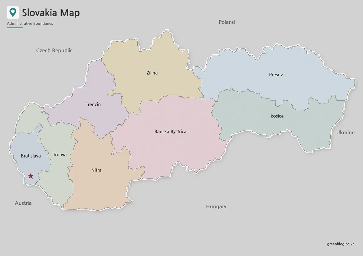
Muted pastel fills make each region visible without hiding its boundary. The long contrast between Žilina along the north and Banská Bystrica across the center-south is easy to see, while the smaller Bratislava and Trnava regions remain distinct at the western tip. A red star separates the capital location from the regional text label.
Choose the color view for an introductory slide, a regional comparison, or an answer key that students should scan quickly. The surrounding gray background gives the country names enough contrast, and the alternating fills clarify which boundaries are internal. Since no legend assigns values to the colors, they should never be described as a statistical scale.
The horizontal spread also helps readers notice that Bratislava and Košice occupy opposite ends of the national layout. That relationship is useful in a country overview, but the map supplies no route connecting them. Any lesson about travel time, highways, railways, rivers, or mountains needs a separate source made for that subject.
Black and White Printable Slovakia Map
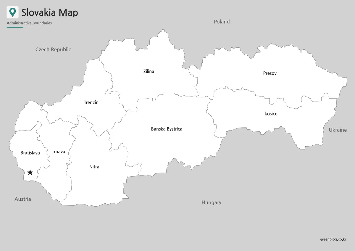
The black-and-white Slovakia Map replaces the pastel fills with white interiors while retaining region names, country labels, boundary lines, and the capital star. This creates a restrained page for reports, classroom packets, and handwritten notes. The region outlines remain separable without requiring a color printer, although the label clipping near the Czech border should be considered when the western context matters.
Use this labeled version when learners need names available during an exercise. They might identify the four western regions, compare the two eastern regions, or trace which areas meet the Hungarian border. If the goal is unaided recall, select the outline instead, because the monochrome artwork already reveals the answers.
Before producing a full set of handouts, print one test sheet and check the smaller western boundaries and Bratislava star. Automatic cropping can also remove parts of the neighboring-country labels. Keeping the original 1,200 × 848 aspect ratio avoids stretching Slovakia’s east–west shape.
Blank Slovakia Outline Map for Editing
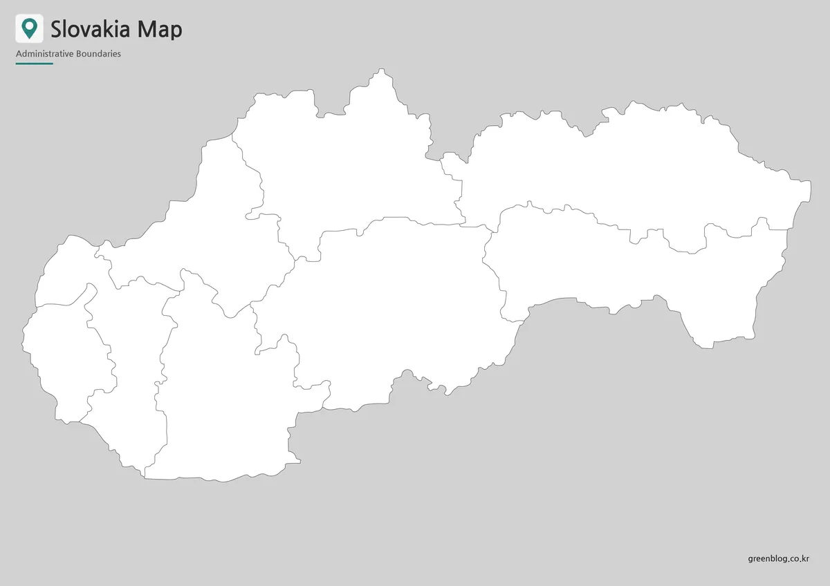
The outline removes region names, neighboring-country labels, and the star while preserving every first-level boundary. Students can label Bratislava through Košice, number the eight regions, color the four western areas as a group, or write the five bordering countries outside the silhouette. Because the source is a raster image rather than a vector file, editing should be understood as drawing or placing content over the image.
A blank Slovakia Map can also support comparisons that the original color palette does not encode. A presenter might apply a custom categorical scheme, a teacher might turn the western-to-eastern sequence into a memory exercise, or a designer might place one carefully sourced statistic in each region. Any new colors, symbols, or labels need their own legend so viewers do not confuse the added information with the base artwork.
The generous gray margin can hold annotations, but it should not be mistaken for mapped territory. Add neighboring names in positions matching the labeled reference: Poland above, Ukraine at the far right, Hungary below, Austria at the lower left, and the Czech Republic at the upper left. The outline itself does not provide these prompts.
Practical Uses for the Slovakia Map
For a classroom sequence, begin with the color reference, switch to the labeled monochrome page for guided practice, and finish with the outline for recall. Students can sort regions into west, center, and east; identify the capital region; or match each side of the national border to a neighboring country. These tasks rely only on information actually shown in the supplied set.
In presentations, the color version communicates the administrative pattern fastest, while the outline leaves visual space for one topic chosen by the presenter. In documents, the monochrome version is less likely to compete with surrounding charts or text. The Slovakia Map should be supplemented whenever a project requires district boundaries, municipal names, physical geography, or current transport information.
Choosing the Best Version
Select color when the eight regions must be distinguished at a glance. Select monochrome when the labels must remain visible in a restrained print layout. Select outline when the reader will supply the names, build a custom legend, or add an original data layer.
Scale is the second decision. The full landscape page preserves the small western regions and the context around all five international borders, whereas a tight crop emphasizes only Slovakia’s internal pattern. Avoid enlarging beyond the source dimensions if crisp label edges are essential, and confirm legibility on the actual screen or paper size before reuse.
Frequently Asked Questions
What is included in this Slovakia Map collection?
The collection includes a color map, a black and white map, and an outline map. Each version is prepared for a different use, such as printing, presentations, classroom materials, or editing.
Is this Slovakia Map useful for classroom projects?
Yes. The black and white and outline versions are especially useful for worksheets, geography activities, country reports, and Central Europe comparison assignments.
Can I edit the outline map?
Yes. The outline version is a blank base map, so users can add labels, colors, city markers, route lines, or regional data.
Why are neighboring countries important on a Slovakia Map?
Slovakia is a landlocked Central European country bordered by several countries. Showing nearby countries helps readers understand its regional position much faster than text alone.
Map File Information
The protected package contains three consistent administrative views for regional reference, printing, classroom activities, and annotation.
- Included Versions: Color map · Black and white map · Outline map
- Printable Size: Maps prepared for A3 layout
- File Type: Image files
Related Maps
Additional Resources
- Slovakia Travel: Tourist Regions — The national tourism portal introduces Slovakia’s named travel regions and their geographic settings for readers who want context beyond the eight administrative areas shown here.
Green Map creates custom-edited map images using open geographic data sources such as geoBoundaries, Natural Earth, OpenStreetMap, and government open data.
These maps are edited visual materials, not raw data files, and are provided for education, documents, presentations, and graphic reference.