A Montenegro Map has to fit a narrow Adriatic coast, the deeply indented Bay of Kotor, a broad central interior, and a northern reach toward Bosnia and Herzegovina and Serbia onto one tall page. The supplied portrait composition follows that north–south form, placing Pljevlja near the top and Ulcinj at the southern coastal end. Albania, Kosovo, Serbia, Bosnia and Herzegovina, and the Adriatic Sea provide surrounding context.
The Montenegro Map set contains three 1,200 × 1,697-pixel WebP administrative views and one separate 900 × 450-pixel flag image. The color and black-and-white maps label 21 municipal areas, while the blank version retains the same internal boundaries without names. These files support historical boundary reference, classroom exercises, presentation layouts, country profiles, and custom annotation.
A date warning is essential: the artwork shows an older 21-unit municipal framework, not Montenegro’s current 25 municipalities. Gusinje, Petnjica, Tuzi, and Zeta do not appear as separate labeled units. Use the set to read the supplied legacy arrangement, but obtain a current official boundary source before assigning modern municipal statistics, preparing official documents, or creating a present-day administrative comparison.
Table of Contents
Montenegro Map Overview
The country occupies a compact part of the western Balkans and meets the Adriatic along its southwest side. Bosnia and Herzegovina lies to the northwest, Serbia to the northeast, Kosovo to the east, and Albania to the southeast; Montenegro also has a short border with Croatia that is not labeled on these previews. The surrounding gray land helps locate the country without adding roads, towns, elevation, or other atlas layers.
The coast is the most intricate part of the outline. Herceg Novi, Kotor, and Tivat cluster around the Bay of Kotor, where water channels, peninsulas, and small municipal shapes leave little room for centered labels. Budva sits farther down the coast, followed by Bar and Ulcinj toward Albania. A leader line places Tivat outside its narrow area so the name does not cover the shoreline.
Inland, Podgorica occupies a large south-central shape in this older division, with Danilovgrad to the northwest and Cetinje between the capital area and the coast. Nikšić dominates much of the west-central interior. Kolašin, Mojkovac, and Šavnik form smaller transitional areas leading toward the northern and eastern municipalities.
The northern half spreads into larger shapes such as Pljevlja, Plužine, and Bijelo Polje. Berane, Rožaje, Andrijevica, and Plav form the eastern sequence beside Serbia, Kosovo, and Albania. This Montenegro Map makes the contrast between compact coastal units and broader inland areas visible, but the absence of four newer municipalities means those shapes should not be interpreted as the current legal arrangement.
Included Map Versions
The three maps share the same portrait canvas, coastline, outer border, and 21-area geometry. That consistency lets a reader move from a labeled reference to an unlabeled activity without changing orientation. The flag is an independent fourth resource rather than another geographic view.
- Color administrative map: pastel fills distinguish the older municipal areas and blue marks the Adriatic water.
- Black-and-white map: names, borders, neighboring labels, and coastal context remain without regional fills.
- Blank outline map: internal divisions remain while municipal names and neighboring labels are removed.
- National flag: a separate red-and-gold 2:1 image supports country-profile designs.
The artwork uses simplified Latin spellings without every Montenegrin diacritic. For example, labels appear as Zabljak, Savnik, Niksic, Pluzine, Kolasin, and Rozaje rather than Žabljak, Šavnik, Nikšić, Plužine, Kolašin, and Rožaje. Keep the visible spellings when creating a direct answer key, or add a note explaining the standard forms.
Color Montenegro Administrative Map
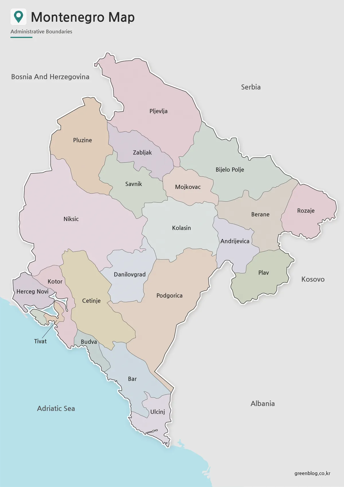
The color Montenegro Map gives each supplied municipal shape a muted fill, making narrow boundaries easier to follow through the center and around Boka Bay. The Adriatic is blue, while neighboring countries remain gray. Because the palette is categorical, the colors do not encode population, altitude, development, political control, or any other statistic.
This version is the clearest first reference for comparing Pljevlja with smaller central units or finding the coastal sequence from Herceg Novi to Ulcinj. It also helps separate Podgorica from Danilovgrad and Cetinje at a glance. Use it as an answer key, introductory slide, or legacy-boundary illustration rather than as proof of current municipal limits.
Keep the image large enough for the labels in the Bay of Kotor area. Herceg Novi, Kotor, and Tivat sit close together, and the Tivat leader line can disappear when a thumbnail is reduced too aggressively. A wider inset would be necessary for street, settlement, or bay-level detail, none of which is included here.
Black and White Printable Version
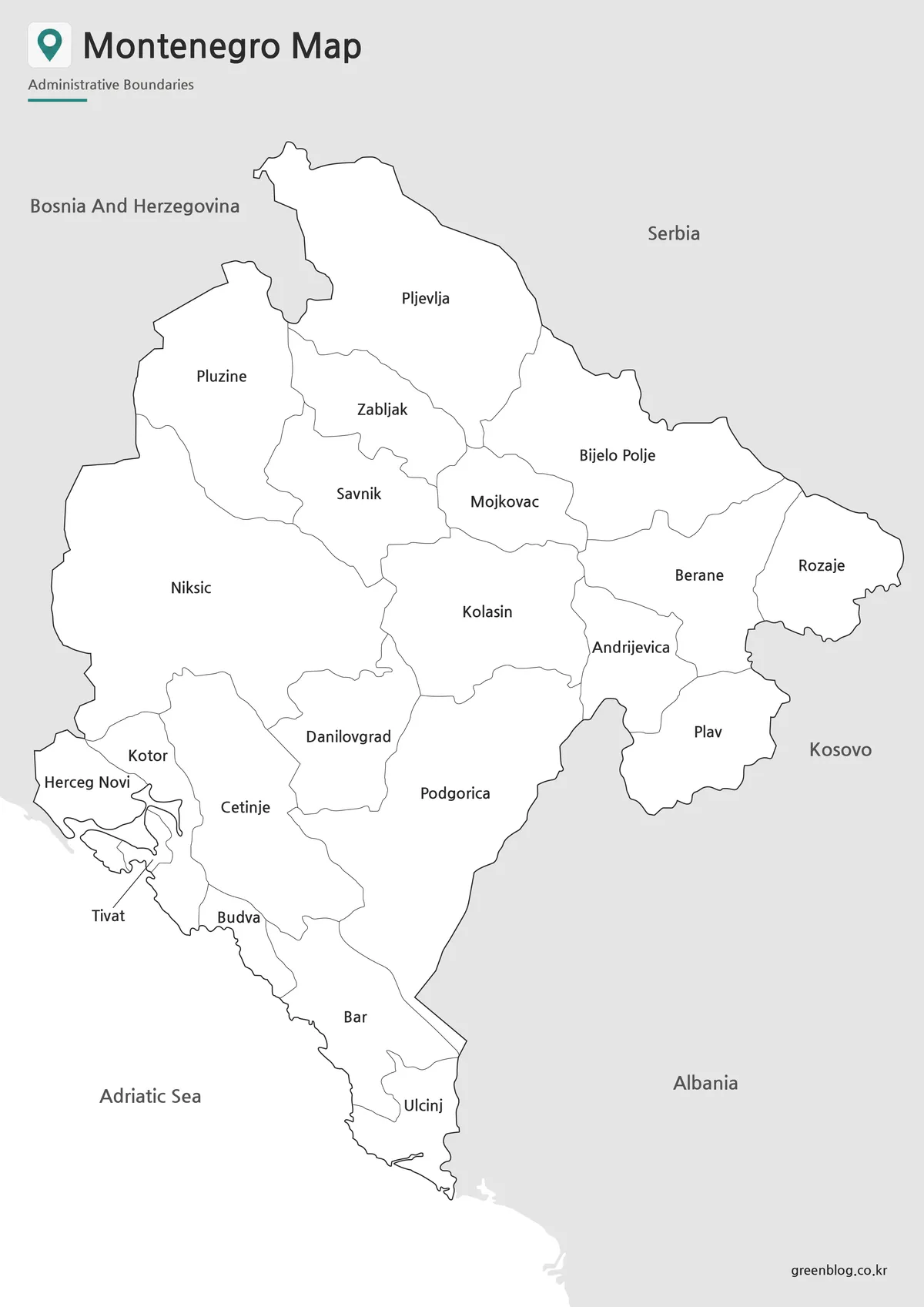
The monochrome Montenegro Map preserves all 21 names, boundary lines, neighboring labels, and the Adriatic label while removing pastel fills and blue water. Its neutral appearance fits worksheets, reports, and print layouts where color is unnecessary. Readers can still compare the coast, central corridor, and northern interior without relying on a legend.
Choose this version when the names should remain visible during an exercise. Students can trace the outer border, group coastal units, or compare larger northern areas with the smaller municipalities around the bay. It is less suitable for a recall quiz because the answers are already printed on the page.
Run a test copy before printing at a smaller size. The original 1,200 × 1,697-pixel portrait design is compatible with an A-series page ratio, but printer margins and automatic scaling can weaken fine internal lines. Preserve the full canvas and check that Tivat, Kotor, Herceg Novi, and the narrow coastal divisions remain legible.
Blank Montenegro Outline Map for Editing
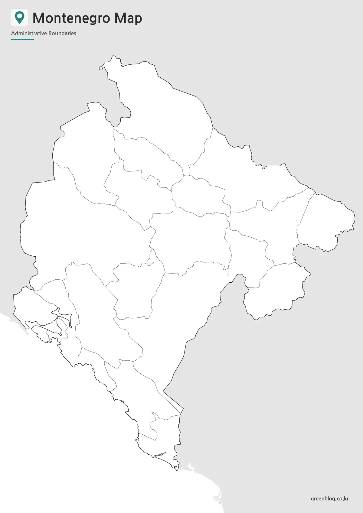
The blank Montenegro Map removes municipal and neighboring-country names but keeps the national edge, coast, and the same 21 internal shapes. It offers open space for handwritten labels, category colors, symbols, or numbered questions. The surrounding land remains gray, helping readers distinguish the country even without text.
A teacher can ask learners to restore the 21 names shown on the labeled reference, identify the Adriatic coast, or add the five neighboring areas with the help of a current atlas. A separate advanced exercise can compare this legacy framework with today’s 25 municipalities by locating Gusinje, Petnjica, Tuzi, and Zeta. The older geometry should not be recolored with current municipal data unless those four areas are correctly separated first.
The supplied WebP is a raster image, not a confirmed SVG, AI, or layered source file. It can accept annotations in common image-editing or presentation software, but large enlargement may soften small boundary details. Test the intended output size before building a poster or detailed infographic.
Montenegro Flag
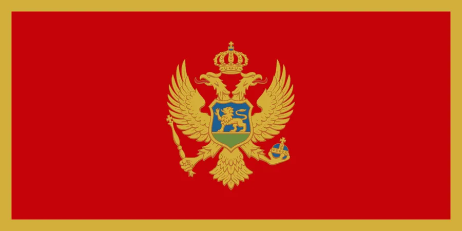
The fourth image is Montenegro’s national flag rather than a fourth map type. It has a red field, gold border, and the national coat of arms centered on the field. At 900 × 450 pixels, its 2:1 horizontal canvas contrasts with the tall map previews.
Place the flag beside a Montenegro Map for a country-profile cover, classroom identification card, or introductory presentation slide. Keep it separate from map legends so the gold, red, and blue elements are not mistaken for administrative categories. The flag identifies the country; the maps explain its shape and internal divisions.
Practical Uses for This Montenegro Map
Select the image according to both the task and the required boundary date. Color is best for quick separation, monochrome retains labels in a restrained print style, and the blank outline supports recall or annotation. The flag adds national identity but carries no geographic information.
- Build a legacy 21-area labeling sheet with the monochrome map as its answer key.
- Compare the compact Boka Bay municipalities with the larger northern interior.
- Mark Podgorica, Cetinje, the Adriatic coast, and neighboring Balkan areas.
- Create a before-and-after exercise introducing the four newer municipalities.
- Use the flag with a country card or regional presentation cover.
- Add current official sources for roads, travel routes, terrain, or modern statistics.
Do not use these images as a current navigation, cadastral, electoral, or municipal-statistics base. Their strength is a clean visual explanation of Montenegro’s tall national form and an older administrative arrangement. Stating the boundary limitation in a caption or worksheet note keeps the resource useful without presenting legacy geometry as current.
Frequently Asked Questions
Is this Montenegro Map suitable for A3 printing?
Yes. This Montenegro Map was prepared with A3 printing in mind, so it works well for classroom materials, presentation boards, and printed reference sheets.
Does the Montenegro Map include roads or tourist attractions?
No. The map focuses on the country shape and administrative boundaries. Leaving out roads and detailed tourism markers keeps the design cleaner and easier to use for general reference.
Which version is best for classroom use?
The black and white version is usually best for printed handouts, while the outline version works well for coloring activities, labeling exercises, and geography worksheets.
Can I use the outline map for editing?
Yes. The blank outline version is designed for adding custom labels, colors, routes, city markers, or infographic data.
Why is the map arranged vertically?
Montenegro has a long north–south shape, so a vertical layout helps show the full country more naturally and improves readability on an A3 page.
Download Information
The page presents color, labeled monochrome, and blank 21-area administrative views plus a separate national flag preview. The protected download package is confirmed for the three map styles; consult an updated official source when a project requires the current 25-municipality system.
Map File Information
The package provides three consistent legacy-boundary map views for reference, lessons, print, and presentation work.
- Included Versions: Color map · Black and white map · Outline map
- Printable Size: Maps prepared for A3 output
- File Type: Image files
Related Maps
Additional Resources
- Official Tourism Map of Montenegro — The National Tourism Organisation provides a current visitor map for destinations, trip context, and further geographic reference.
Green Map creates custom-edited map images using open geographic data sources such as geoBoundaries, Natural Earth, OpenStreetMap, and government open data.
These maps are edited visual materials, not raw data files, and are provided for education, documents, presentations, and graphic reference.