A Cameroon Map has to fit ten regions into a country that stretches from a narrow northern projection to a broad southern and coastal base. The supplied artwork uses French regional labels, even though the surrounding countries and ocean are named in English. Recognizing that mixed language system is essential before the map is used in an English-language lesson or report.
Cameroon borders Nigeria, Chad, the Central African Republic, Equatorial Guinea, Gabon, and the Republic of the Congo. All six neighbors are represented, although the southeastern label reads simply “Congo.” The western coast is accompanied by the label “Atlantic Ocean,” while the water body at the far north and several interior blue shapes are left unnamed.
The three Cameroon Map previews share a 1200 × 1697 portrait canvas and identical regional geometry. One uses pastel fills and blue water, one retains the labels on white interiors, and one removes all geographic text. The long page gives the Far North enough height while preserving the smaller western cluster and the wide East and South regions.
These are first-level administrative references rather than city, road, or physical maps. Yaoundé, Douala, Bamenda, Garoua, Maroua, and other cities are not marked. There are no capital stars, settlement dots, roads, relief, scale bar, north arrow, or statistical legend. A gray island silhouette also appears offshore without a name, so it should not be treated as an identified destination.
Table of Contents
Cameroon Map Collection Overview
All three versions preserve the same national outline and ten-region boundary network. The amount of guidance changes from a completed color reference to a labeled monochrome sheet and then to an unlabeled exercise or design base.
- Color administrative view: French region names, pastel fills, blue water, six neighboring-country labels, and the Atlantic Ocean label.
- Black-and-white printable view: all regional and surrounding labels with white region interiors and no blue water.
- Blank outline: the ten internal boundaries and national perimeter without region, country, or ocean names.
The map labels are Extreme Nord, Nord, Adamaoua, Nord-Ouest, Ouest, Sud-Ouest, Littoral, Centre, Est, and Sud. In standard English, these correspond to Far North, North, Adamawa, North West, West, South West, Littoral, Centre, East, and South. “Littoral” and “Centre” are retained in both the map and common official English usage.
The regional names are French while Nigeria, Chad, Central African Republic, Equatorial Guinea, Gabon, Congo, and Atlantic Ocean are written in English. The sheet is therefore not fully bilingual; it is a mixed-language design. An editor preparing an English-only version should translate all ten region labels consistently rather than changing only the most obvious directional terms.
The geographic sequence is easy to follow from north to south. Extreme Nord occupies the narrow upper projection, Nord fills the broad section below it, and Adamaoua crosses the center as a wide belt. Nord-Ouest, Ouest, Sud-Ouest, and Littoral form the compact western group, while Centre, Est, and Sud dominate the lower half.
Color Administrative Map
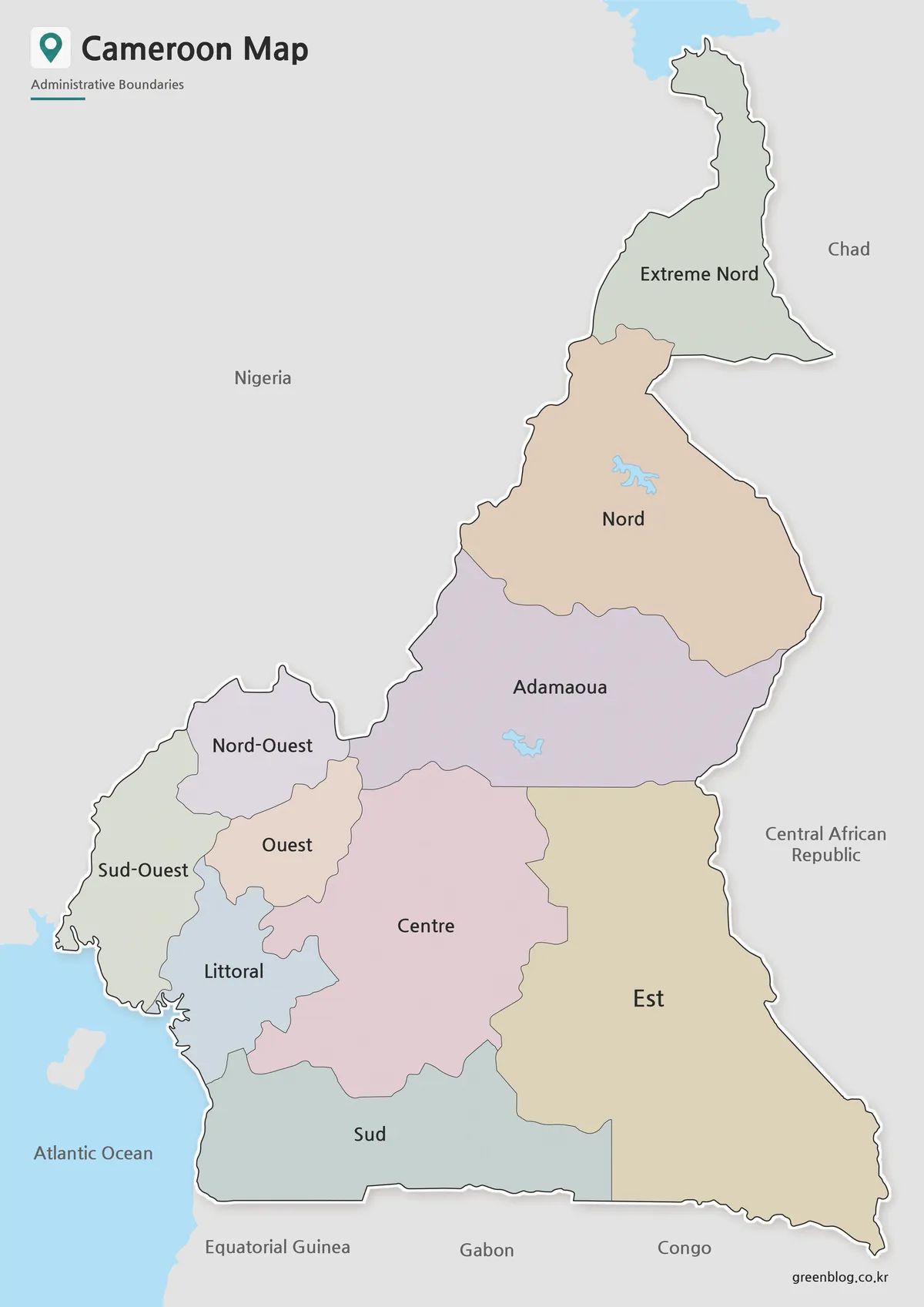
The color Cameroon Map uses muted green, tan, purple, pink, blue-gray, and yellow fills to separate adjacent regions. The colors are decorative categories only. They do not encode population, language, elevation, land cover, politics, climate, or economic data, and they do not distinguish francophone from anglophone areas.
Blue water distinguishes the coast and several lake or reservoir shapes, but none of the inland water features is named. The northern blue area is only partly visible at the top edge. On the coast, the map says Atlantic Ocean rather than Gulf of Guinea. A user adding physical geography should verify and label each feature independently instead of inferring names from shape alone.
Color is particularly useful in the west, where Nord-Ouest, Ouest, Sud-Ouest, and Littoral meet in a confined area. It also separates the broad Centre from Est and Sud across the lower part of the country. The narrow boundary between Sud and Est remains visible near the southern border even though both regions occupy large polygons.
This version works best as a completed overview for a slide or reference sheet. A presenter can translate each French label aloud, trace the north–south sequence, identify all six international neighbors, and explain the coast without adding unsupported city locations. Any later data overlay needs its own source, year, units, and legend.
Black and White Printable Version
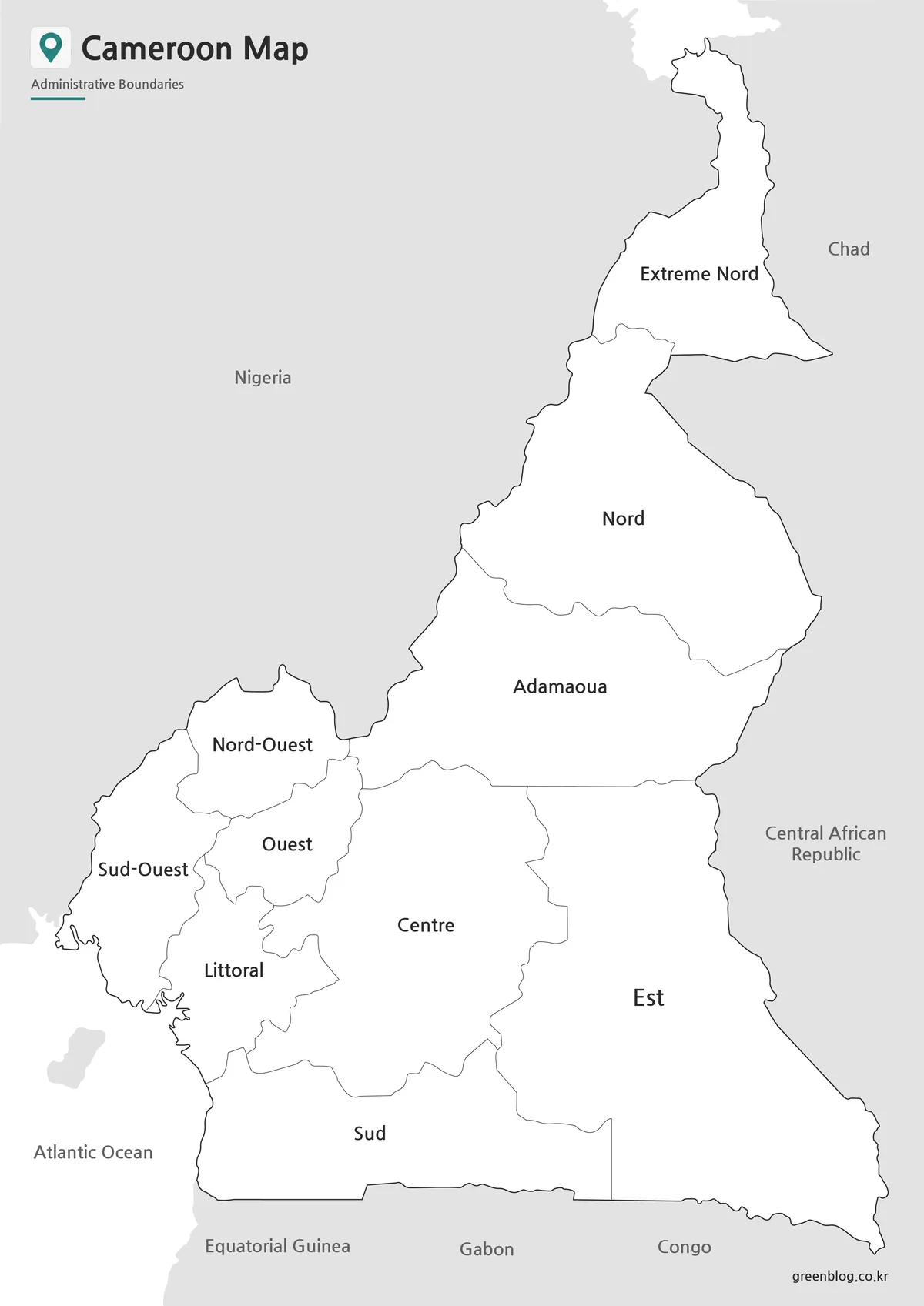
The black-and-white Cameroon Map keeps every region name, all six country labels, and the Atlantic Ocean text. It removes pastel fills and the blue water layer, leaving Cameroon white against gray neighboring land. The offshore island silhouette remains gray but is still unnamed.
This version is the practical choice for a low-ink report, a regional-name answer key, or a classroom reference. The large northern labels remain easy to read, while the western group requires more attention. Check Nord-Ouest, Ouest, Sud-Ouest, and Littoral after scaling because their shapes and text occupy the tightest part of the composition.
White interiors also leave room for notes or hand-applied shading. If students are expected to use English region names, provide a translation key rather than treating the French labels as spelling errors. Cameroon has English and French as official languages, and the important issue here is that this particular artwork selects one regional naming convention.
Blank Outline Map for Editing
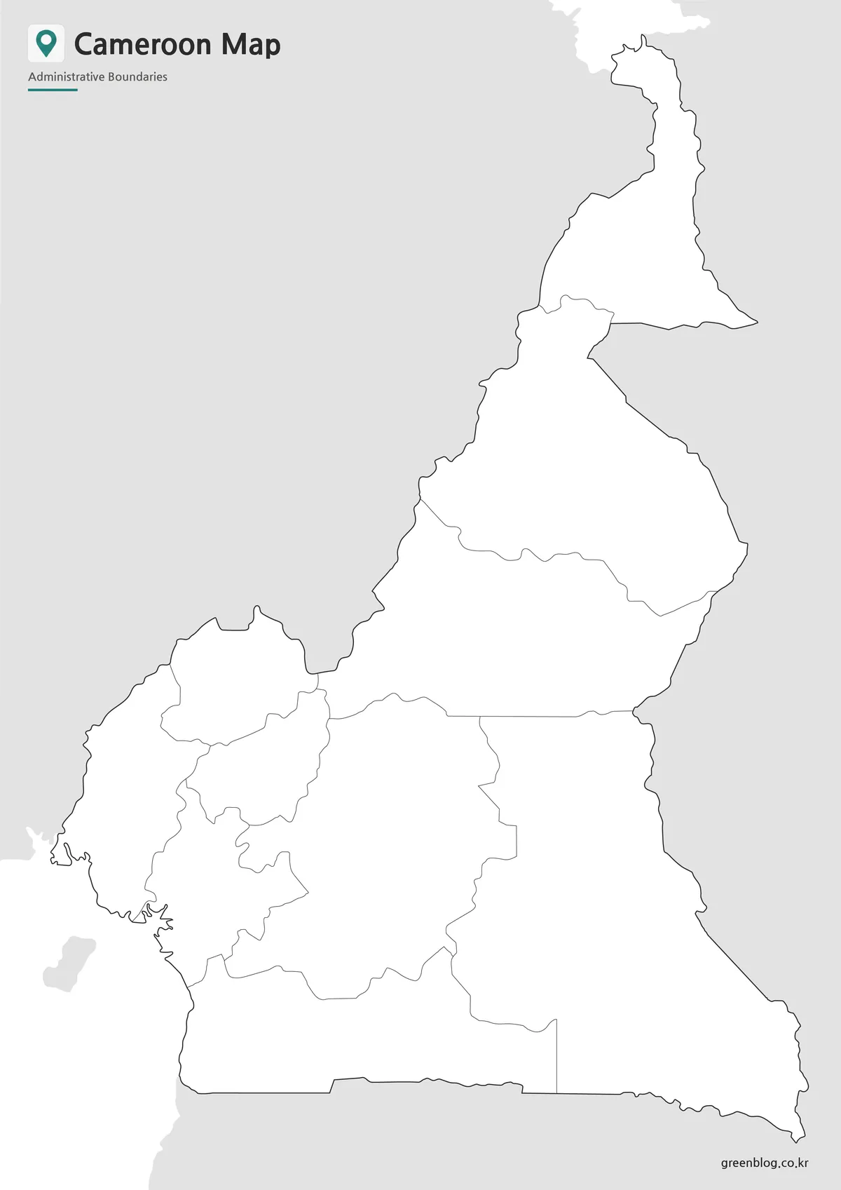
The outline Cameroon Map removes the ten region labels, every neighboring-country name, the Atlantic Ocean text, and all blue water. It retains the title, subtitle, national outline, ten-region boundary network, gray surrounding land, the offshore island silhouette, and the site mark.
For a labeling exercise, begin with the narrow Far North and broad North, add Adamawa across the middle, then complete the four compact western regions before identifying Centre, East, and South. A second version can use the French terms printed on the reference sheets, while another can use the official English equivalents for comparison.
The supplied preview is a WebP raster image rather than an SVG, GIS layer, or editable vector file. It can accept text, arrows, icons, and color overlays in an image editor, but the regional polygons are not promised as independently selectable objects. Preserve the 1200 × 1697 proportions when resizing so the long northern projection is not compressed.
Practical Uses for a Cameroon Map
For geography instruction, the color sheet can introduce the ten-region pattern, the monochrome sheet can serve as an answer key, and the outline can become a labeling assessment. The mixed naming system also supports a focused language exercise matching Extreme Nord to Far North, Est to East, and Sud-Ouest to South West.
For regional comparison, retain enough margin to show Nigeria, Chad, the Central African Republic, Equatorial Guinea, Gabon, and Congo. Explain that “Congo” is the shortened map label for the neighboring Republic of the Congo. Do not infer cities or transport links from the blank spaces because none are represented.
The package description identifies the downloadable image as suitable for high-resolution A3 output, while the three web previews examined here are WebP. Their 1200 × 1697 ratio closely follows A-series portrait proportions. Test the western labels and coastline at the intended print size before producing a full set.
Frequently Asked Questions
What map versions are included?
The collection includes a color administrative map, a black and white printable map, and a blank outline map.
Is the Cameroon Map suitable for A3 printing?
Yes. The maps were prepared in high resolution for large-format printing while maintaining label readability.
Which version is best for editing?
The outline version is the most flexible because it contains only administrative boundary lines.
Can I use these maps in presentations?
Yes. All three versions are designed for presentations, educational materials, and visual reference projects.
Does the map mark Yaoundé or any regional capitals?
No. The completed versions label administrative regions, neighboring countries, and the Atlantic Ocean, but they contain no city names or point symbols. Add Yaoundé, Douala, Bamenda, and other cities only from a verified source, and use a separate legend so the new points are not confused with regional labels.
Map File Information
The archive groups the color, labeled monochrome, and blank regional views displayed above.
- Included Versions: Color, black and white, and outline
- File Type: Image files in a ZIP archive
- Intended Use: Lessons, reports, presentations, translation exercises, and annotations
Related Maps
Additional Resources
The official Cameroon Presidency regional presentation lists the ten regions with their English names and regional capitals.
Green Map creates custom-edited map images using open geographic data sources such as geoBoundaries, Natural Earth, OpenStreetMap, and government open data.
These maps are edited visual materials, not raw data files, and are provided for education, documents, presentations, and graphic reference.