An Austria Map has to explain more than a long east–west country shape. It also needs to show Vienna as a small federal state inside Lower Austria and Tyrol as two separated areas, with East Tyrol detached from the state’s larger western section. The supplied landscape layout keeps those features visible in color, black and white, and blank outline versions.
The maps focus on Austria’s nine federal states rather than roads, railway lines, terrain, districts, or municipalities. State and neighboring-country names appear on the first two images, while the third removes all labels and color. That division gives readers one quick reference, one monochrome print option, and one base for custom labeling or data work.
Austria borders Germany, the Czech Republic, Slovakia, Hungary, Slovenia, Italy, Switzerland, and Liechtenstein. Six of those names are printed around the Austria Map; Switzerland and Liechtenstein are not labeled beside the narrow western end. The artwork therefore supports broad Central European orientation but should not be treated as a complete neighboring-country map.
Table of Contents
Austria Map Versions Included
All three published previews measure 1200 × 848 pixels and share the same landscape proportions. The labeled versions identify Vorarlberg, Tyrol, Salzburg, Upper Austria, Lower Austria, Vienna, Burgenland, Styria, and Carinthia. Tyrol’s name appears twice because the state includes the geographically separate East Tyrol area, not because Austria has ten federal states.
The downloadable material is identified as JPG files prepared for A3 output and packaged in a ZIP archive. The website previews are WEBP images, a delivery detail separate from the confirmed download type. The supplied files do not establish PNG, PDF, SVG, transparent-background, layered, or editable vector versions, so those formats are not promised here.
How the Nine Federal States Fit Together
Vorarlberg forms the compact western end, followed by the main part of Tyrol. Salzburg occupies a central position between western and eastern Austria, while Upper Austria extends north and east of it. Carinthia runs along much of the southern center, with Styria covering a broad southeastern area and Burgenland forming a narrow eastern strip beside Hungary.
Lower Austria is the largest shape in the northeastern part of the artwork. Vienna appears as a separate enclosed unit inside it, which is one of the most important map-reading details on the page. A learner who sees the small central-eastern outline should understand it as a federal state with the national capital, not as an ordinary city symbol or an unlabeled hole in Lower Austria.
Tyrol requires a second explanation. The small southern piece labeled Tirol represents East Tyrol, which is separated from the main state by Italian territory. On a blank exercise, both pieces must receive the same state name. Treating the detached section as a tenth state would produce an incorrect count even though ten colored land areas are visible.
Color Separation for States and Enclaves
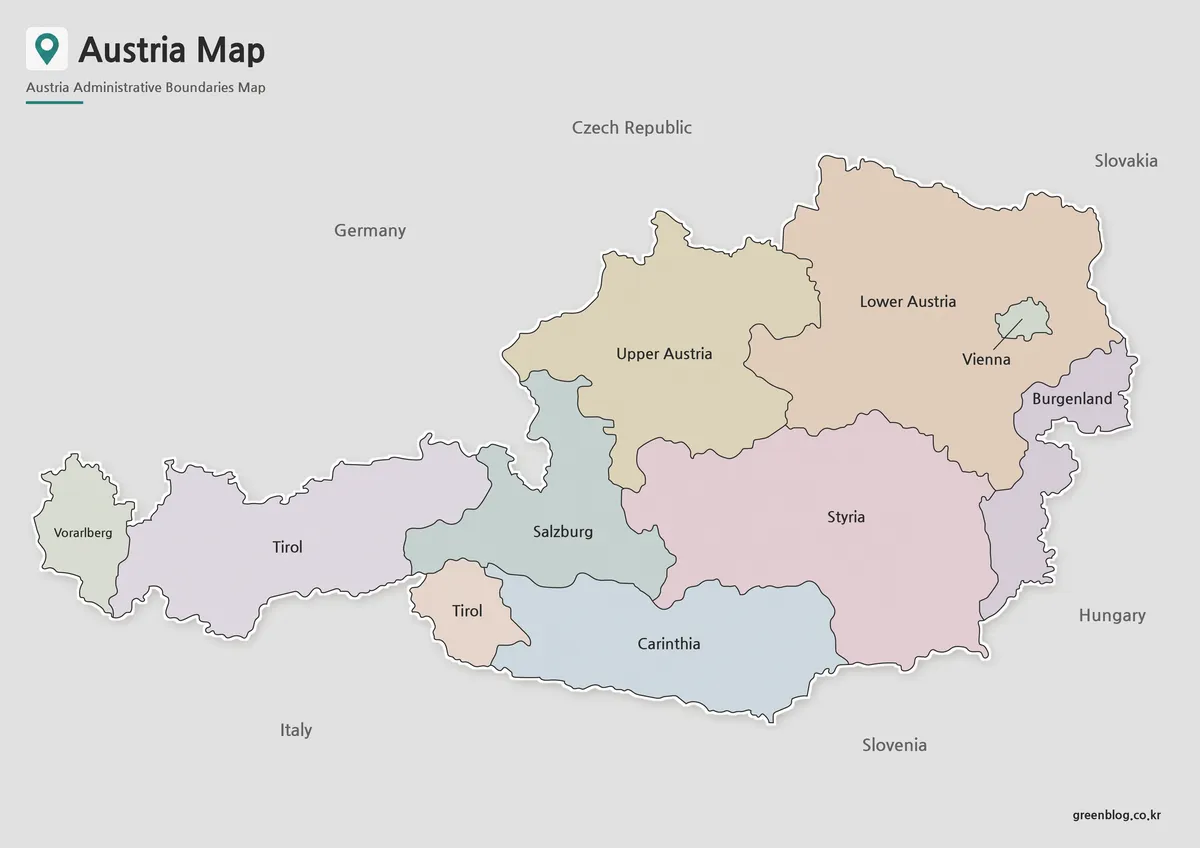
The color Austria Map assigns a different pastel fill to adjoining states and gives Vienna its own color inside Lower Austria. These colors do not represent population, politics, elevation, language, or economic data. Their purpose is to separate administrative areas clearly, especially where Salzburg, Upper Austria, Styria, and Carinthia meet near the center.
This is the easiest version to use on presentation slides or in a first geography lesson. Viewers can compare the long western states with the broader eastern shapes and immediately locate the Vienna enclosure. The two matching Tyrol labels also allow a presenter to explain noncontiguous territory without adding a separate inset.
Labeled Boundaries Without Color
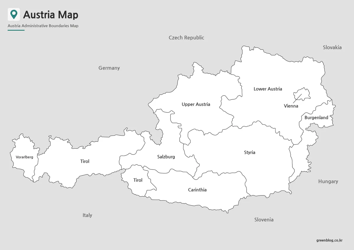
The black-and-white version retains the federal-state names, Vienna label, two Tyrol labels, internal boundaries, and six visible neighboring-country names. White interiors reduce competition with text and allow the map to sit comfortably in reports or classroom packets. This is the strongest choice when labels must remain available but a color printer is unnecessary.
Because Vorarlberg, Vienna, Burgenland, and East Tyrol occupy relatively small spaces, reducing the image too far can make their labels or outlines difficult to read. An A3 or full-page layout gives these features more room. Users adding pencil notes should place them in the larger state interiors or margins rather than over the compact eastern and western areas.
A Blank Base for State-Level Activities
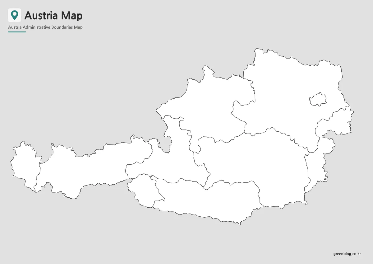
The outline keeps the national silhouette, all state boundaries, Vienna’s enclosed shape, and both pieces of Tyrol while removing text and color. Students can label the nine states, identify Austria’s eastern and western ends, or color the areas that share a border with a selected neighboring country. Designers can add routes, city markers, statistics, or custom regional groupings.
A useful exercise begins by locating Vienna inside Lower Austria, then assigning Tyrol to both western pieces. From there, Vorarlberg, Salzburg, Carinthia, Styria, Burgenland, and Upper Austria can be placed by relative position. Because the downloaded image is a raster JPG, digital annotations should be added on a separate layer or overlaid in a slide or document program.
Choosing and Printing an Austria Map
Choose the color view for immediate state comparison, the monochrome view for a labeled reference sheet, and the outline when readers must supply information. The maps can support administrative study and broad travel orientation, but route planning requires a separate road or transport source because no roads, railways, distances, or city network is included.
For A3 printing, preserve the landscape aspect ratio and use print preview to keep the full western and eastern edges inside hardware margins. “Fit to page” helps protect the outer labels, while actual-size printing is preferable when several regional maps must use a consistent scale. A test sheet can confirm that Vienna and East Tyrol remain clear at the selected size.
Frequently Asked Questions
Can I print the Austria Map in A3 size?
Yes. The files were prepared in high resolution and are suitable for A3 printing.
Which Austria Map version works best for presentations?
The color administrative version is usually the easiest to read on presentation slides.
Is the Austria Map outline version editable?
Yes. The outline version was created specifically for annotation, customization, and graphic editing.
Is Vienna marked on the map?
Yes. Vienna is highlighted to make the capital city easy to locate.
Map File Information
Download the three Austria federal-state map versions together for printing, reference, or annotation.
- Included Versions: Color labeled, black-and-white labeled, and blank outline maps
- Printable Size: A3
- File Type: JPG / ZIP
- Intended Use: Lessons, handouts, presentations, and state-level projects
Related Maps
Additional Resources
- Statistics Austria Regional Divisions — Explore official tables and maps for federal provinces, districts, municipalities, and other regional units.
Green Map creates custom-edited map images using open geographic data sources such as geoBoundaries, Natural Earth, OpenStreetMap, and government open data.
These maps are edited visual materials, not raw data files, and are provided for education, documents, presentations, and graphic reference.