A Georgia State Map becomes especially valuable when the goal is to understand all 159 counties rather than simply recognize the state’s outline. Georgia combines a dense county pattern around metropolitan Atlanta, broad rural counties in the south, mountain counties along its northern edge, and an irregular Atlantic coast. Seeing those shapes together makes county relationships much clearer than a list of names can.
This collection provides three views of the same county framework: a softly color-coded map with county names, a labeled black-and-white map, and a blank outline with county boundaries. The maps are prepared as high-resolution A3 resources, with JPG images grouped in a ZIP download. Teachers, students, writers, presenters, and designers can therefore choose a reference view or an annotation base without changing the underlying geography.
Georgia lies in the southeastern United States. Tennessee and North Carolina meet its northern border, South Carolina lies to the east and northeast, Florida is directly south, and Alabama borders the west. The Atlantic Ocean reaches the southeastern side of the state. On the supplied maps, the neighboring-state labels and coastline help orient the county grid, while the long north-to-south layout shows why counties near Dade, Rabun, Camden, and Seminole occupy very different corners.
The county pattern also provides a useful way to read Georgia’s major regions. Northern counties extend into the Blue Ridge, Ridge and Valley, and Appalachian areas; Atlanta and many surrounding counties sit in the Piedmont; and much of central and southern Georgia spreads across the plains toward the coast. The Georgia State Map does not depict terrain, roads, or cities, but its boundary arrangement supplies a practical framework for discussing those regional contrasts with separate notes or data.
Table of Contents
What Is Included in This Georgia State Map Collection?
All three images use the same portrait composition and show Georgia divided into its 159 counties. The color and monochrome versions label every county, while the outline version retains the county lines but removes the names. Alabama, Florida, South Carolina, and the Atlantic Ocean are shown around the state as orientation references; the neighboring areas are not presented as detailed county maps.
- Color-coded county map with county names
- Black-and-white county map with county names
- Blank county outline without labels
- High-resolution A3 layout in JPG format
- One ZIP archive containing the map files
The labeled maps are county references rather than city or transportation maps. Atlanta, Savannah, Augusta, Columbus, Macon, highways, rivers, and elevation are not marked in this set. That distinction matters when choosing a version: use the labels to identify counties, then add separate city markers, routes, statistics, or physical features only when a project calls for them.
Color County Map for Regional Comparison
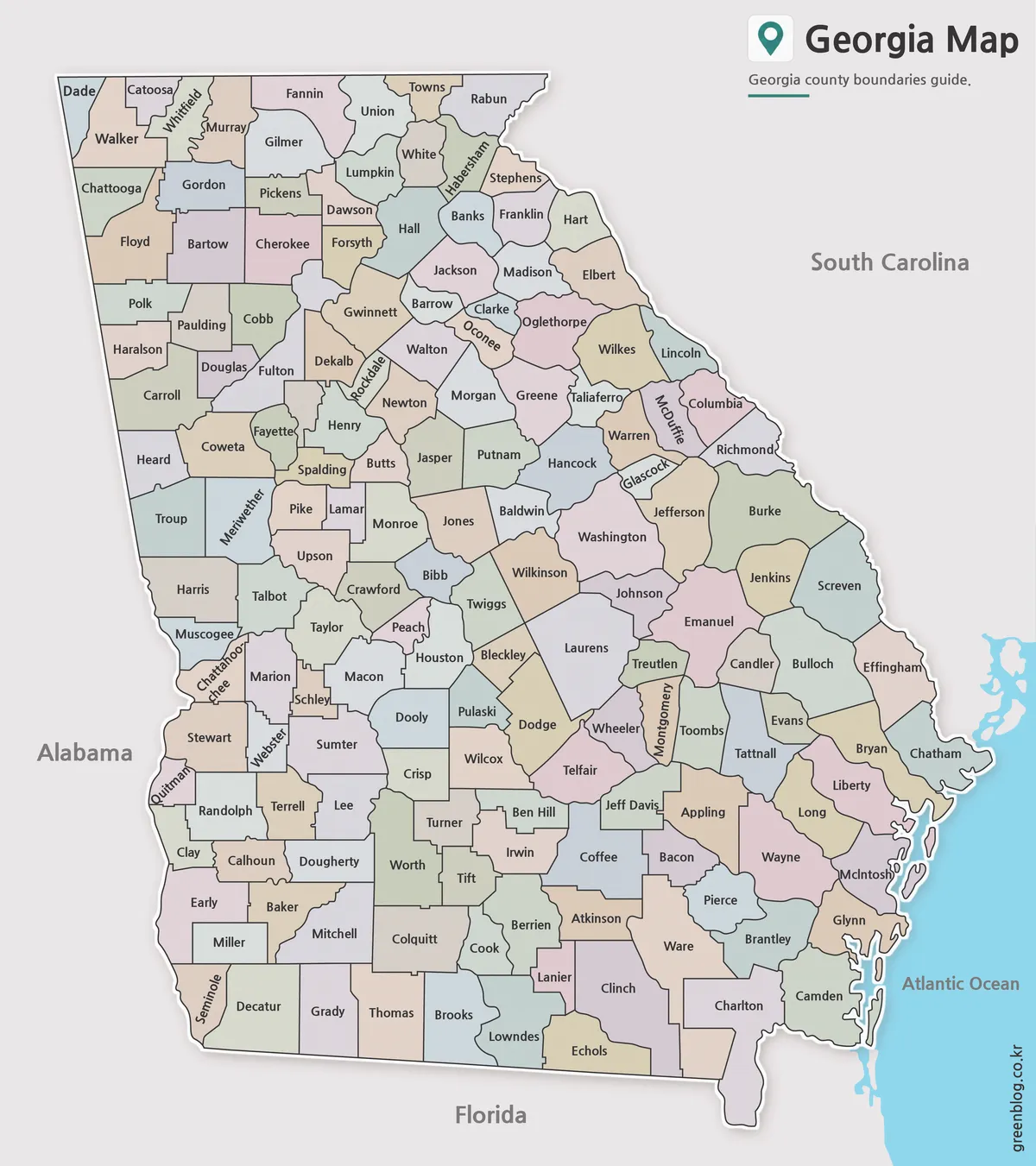
Pastel fills separate adjacent counties without turning the page into a thematic map. The colors do not represent political results, population groups, or official regions; they serve only as visual separators. This treatment is helpful in the Atlanta area, where Fulton, Cobb, DeKalb, Gwinnett, Clayton, Douglas, Fayette, Henry, Rockdale, and nearby counties form a compact cluster that can be difficult to follow when every area has the same fill.
The same color separation makes the Georgia State Map easier to scan across the full length of the state. A reader can trace the Tennessee border from Dade toward Rabun, compare western counties beside Alabama, or follow the sequence of coastal counties around Chatham, Liberty, McIntosh, Glynn, and Camden. Because names remain on the map, this version suits slides, reference sheets, and regional comparisons where quick identification matters more than writing space.
Black and White Georgia State Map for Printing
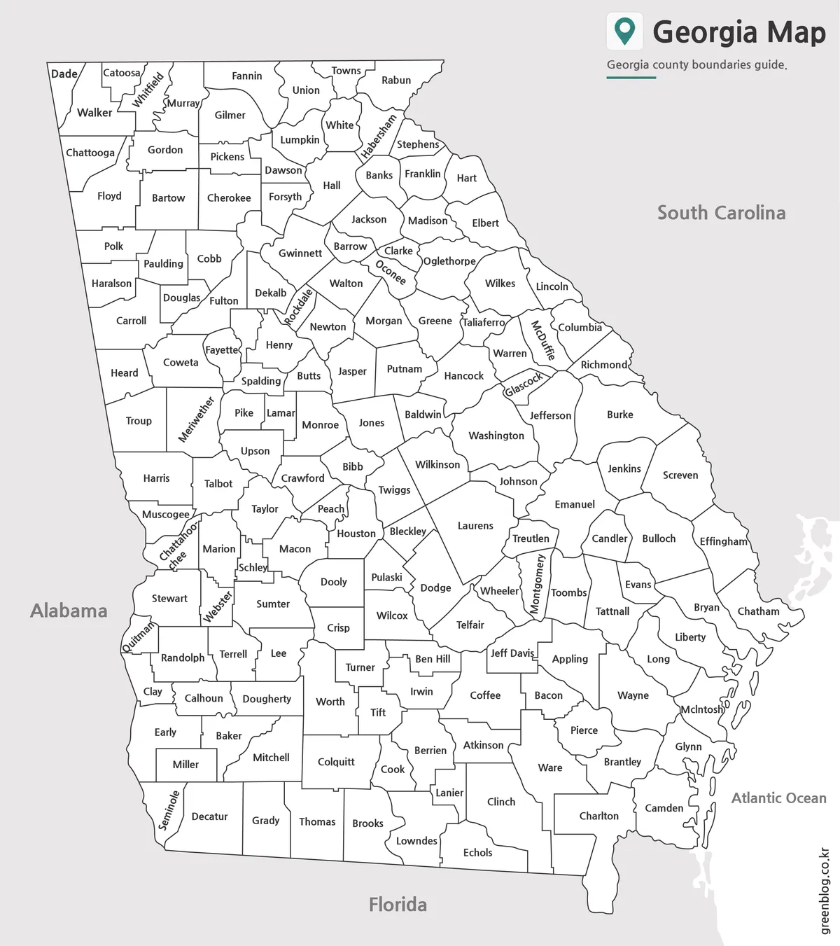
The monochrome view removes the pastel county fills while preserving names and boundary lines. Its plain white county interiors reduce competition with surrounding text when the map is placed in a report, lesson packet, or reference page. Readers still receive the same county coverage, including narrow and compact shapes that require rotated labels, such as Chattahoochee, McDuffie, Glascock, and Montgomery.
This is the more practical labeled option when a printer or document uses grayscale. It can support county-location quizzes in which names remain visible, comparisons between northern and southern county patterns, or a written exercise asking students to find counties along a state border. If learners must supply the county names themselves, however, the blank outline below provides a cleaner starting point.
Blank Outline Map for Editing
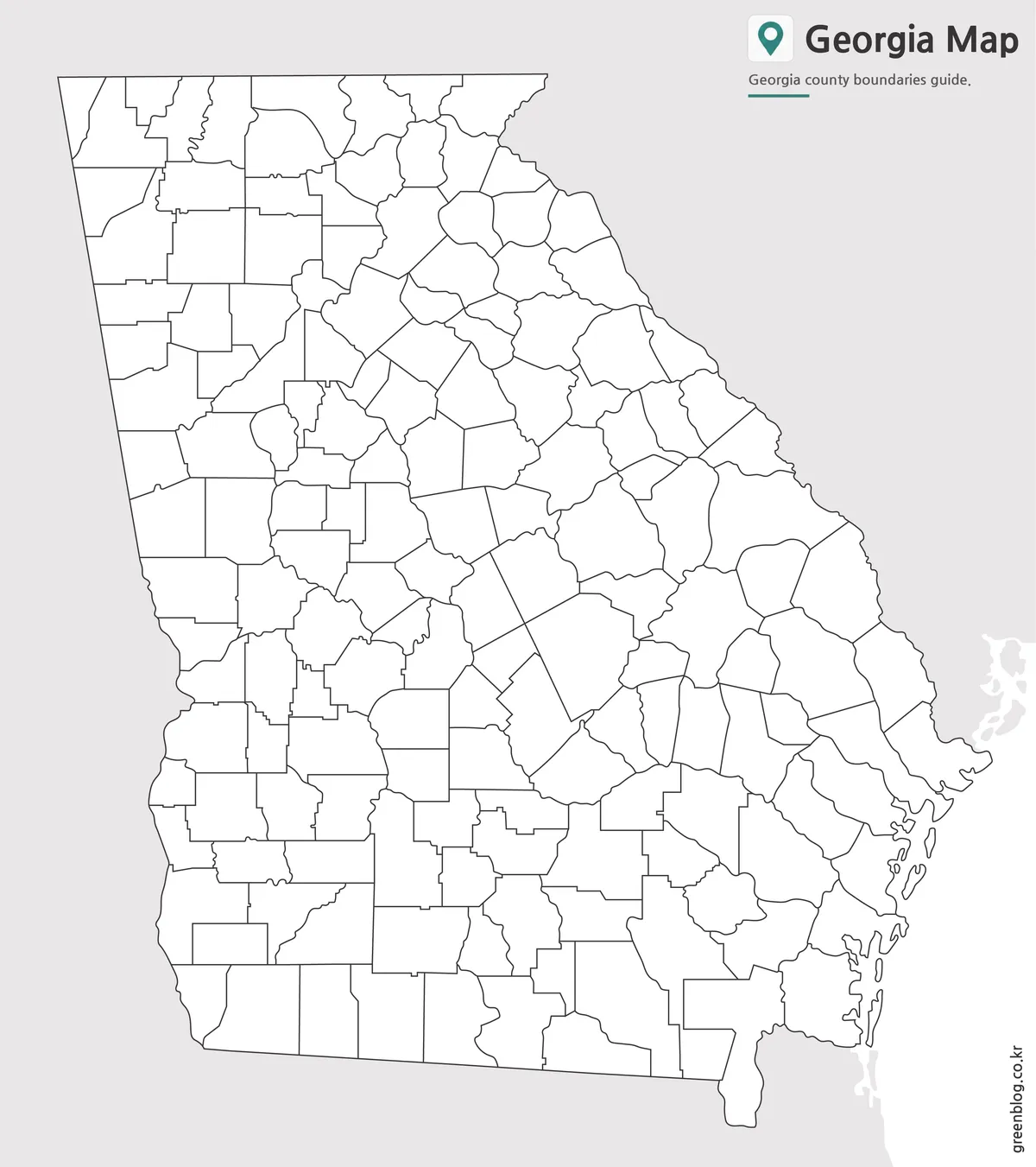
The blank view retains the outer state shape, coastline, and internal county divisions while removing both names and color. It is a raster image rather than a vector source file, but the open county areas provide room for printed or digital annotations. Students can label selected counties, color counties by a teacher-defined region, or use a numbered key when the smaller areas around Atlanta leave too little space for longer notes.
For a data project, the outline can serve as the base for categories such as population ranges, agricultural regions, service areas, or trip coverage, provided the user supplies and cites the data separately. A route-planning graphic can add city points and connecting lines above the county framework. The Georgia State Map outline is also suited to exercises that ask learners to identify border counties, locate the Atlantic coast, or reconstruct county names from a reference list.
Choosing and Using the Georgia State Map
Choose the color version when the audience needs to distinguish neighboring counties quickly on a screen or presentation. Select the black-and-white labeled version for a clean county reference in printed documents. Use the blank outline when the activity depends on student labeling, custom categories, highlighting, or hand-drawn notes. Each version answers a different need, so placing all three on one worksheet is rarely necessary.
When printing the Georgia State Map at A3 size, keep the portrait orientation and preserve the image’s proportions rather than stretching it to fill a page. A smaller print can still show the overall county pattern, but Georgia’s numerous county names—especially in the central-northern cluster—will become harder to read. When placing the map in a slide, crop only unused page margin; cropping the coastline or border labels removes useful orientation cues.
The layout was organized so the long state shape occupies most of the page while leaving space for neighboring labels and the Atlantic edge. Label direction varies where county shapes are narrow, which is visible around Chattahoochee on the west and McIntosh on the coast. For accessibility in a presentation, pair the map with a short text explanation and avoid relying on pastel colors alone to communicate any added categories.
These files are best treated as general visual resources, not substitutes for a current surveying, legal-boundary, navigation, or emergency-management map. If a project depends on authoritative boundary data or a specific date, compare the relevant county information with an official government source. For ordinary teaching, presentations, and visual planning, the consistent geometry across the three versions makes it easy to move from reference to annotation.
Frequently Asked Questions
Can I print the Georgia State Map in A3 size?
Yes. The map files were prepared as high-resolution A3 resources for printing.
Does the map include county boundaries?
Yes. All three versions include Georgia county boundary lines.
Which version is best for editing?
The blank outline map is the best choice for editing, custom coloring, and adding data.
Is the black and white version good for documents?
Yes. The labeled black and white map is designed for reports, worksheets, and classroom printing.
Map File Information
The archive contains three Georgia county-map views for labeled reference, monochrome printing, and custom annotation.
- Included Versions: Color labeled · Black-and-white labeled · Blank outline
- Printable Size: A3 High Resolution
- File Type: JPG / ZIP
- Intended Use: Printing · Lessons · Presentations · Annotation
Additional Resources
- U.S. Census Bureau Georgia Geography Guide – Review the Census Bureau’s explanation of Georgia counties and other geographic units.
Related Maps
Green Map creates custom-edited map images using open geographic data sources such as geoBoundaries, Natural Earth, OpenStreetMap, and government open data.
These maps are edited visual materials, not raw data files, and are provided for education, documents, presentations, and graphic reference.