A Michigan Map is often needed for much more than locating the state on a map of the United States. Teachers use it to explain the Great Lakes region, students include it in geography projects, and presentation creators frequently rely on state maps when discussing transportation, industry, demographics, or regional development. Michigan is particularly interesting because it is divided into two separate landmasses—the Upper Peninsula and the Lower Peninsula—creating one of the most recognizable state shapes in the country.
Located in the north-central United States, Michigan is surrounded by four of the five Great Lakes and shares borders with Wisconsin as well as neighboring Canadian regions across the water. More than ten million people live in the state, with major population centers including Detroit, Grand Rapids, Lansing, and Ann Arbor. Because communities are distributed across two peninsulas and dozens of counties, a well-designed map often provides a much clearer understanding of the state than text alone.
This printable Michigan Map collection was created for users who need a practical visual resource rather than a simple location reference. The collection includes three versions: a color county map, a labeled black and white map, and a blank outline map. Files are provided in JPG, PNG, and ZIP formats and were prepared at A3 size for high-resolution printing. These maps work well for classroom handouts, regional comparison projects, infographic design, travel presentations, blog graphics, and editable mapping projects.
During preparation, extra attention was given to county boundaries and label placement. Michigan contains a large number of counties, particularly in the southeastern portion of the Lower Peninsula where administrative divisions are closely grouped together. Labels were adjusted repeatedly to improve readability, and the final versions were reviewed at larger print sizes to ensure that boundaries and names remain clear when enlarged.
Table of Contents
Map Versions Included
The Michigan map package contains:
- Color county map
- Labeled black and white map
- Blank outline map
- High-resolution A3 format
- JPG, PNG, and ZIP files
Each version serves a different purpose depending on whether the project focuses on printing, presentation design, education, or graphic editing.
Color-Coded County Map
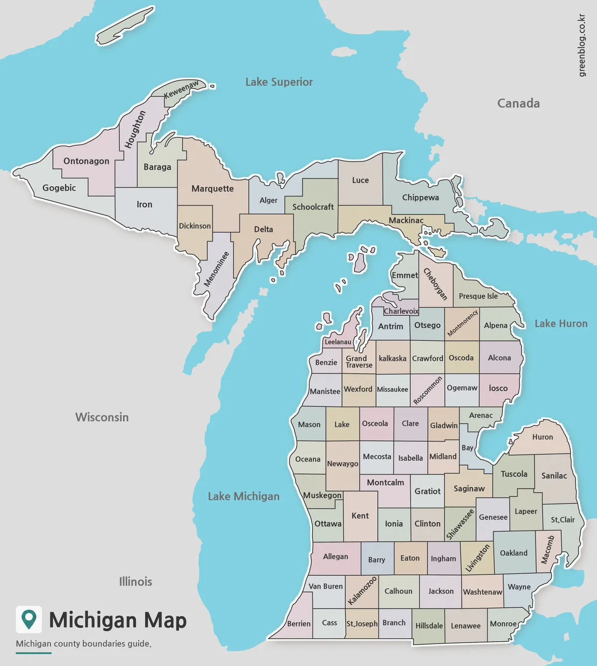
The color version separates counties using contrasting colors, making administrative divisions easy to distinguish at a glance. This style works particularly well for classroom presentations, regional comparisons, and demographic visualizations.
Michigan’s split geography can sometimes make county relationships difficult to understand. The color-coded layout helps users quickly identify county locations across both peninsulas while maintaining clear visual separation between neighboring regions.
Labeled Version for Printing
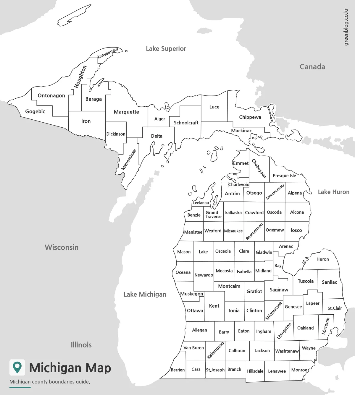
The black and white version focuses on county names and boundary lines rather than color distinctions. Many users prefer this style when preparing reports, educational materials, or presentation slides where a cleaner appearance is needed.
Readability was tested at reduced sizes and in black and white printing environments. Special attention was given to crowded counties around southeastern Michigan so that labels remain legible even when the map is printed smaller than its original size.
Blank Outline Map for Editing Projects
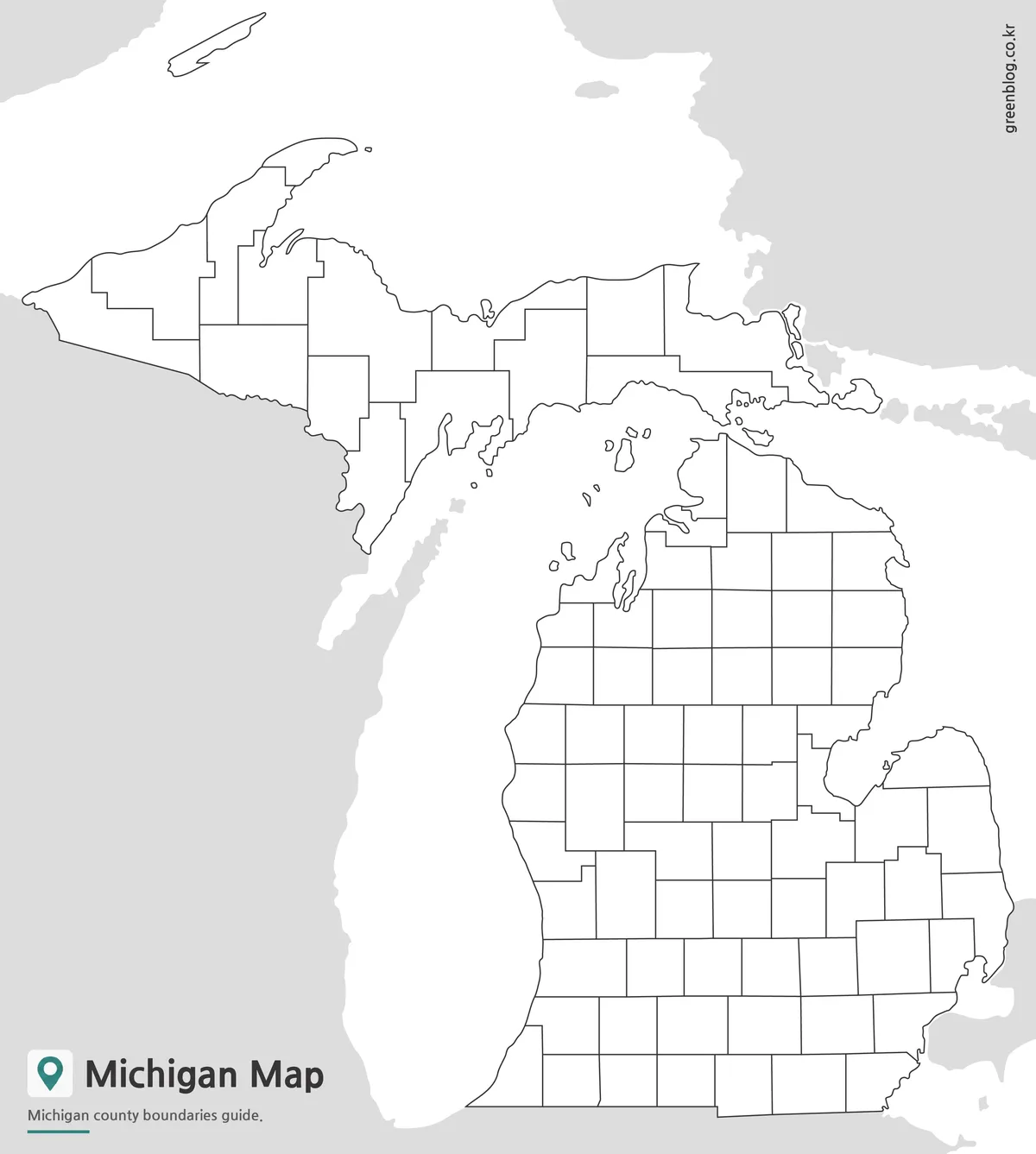
The outline version removes labels and color while preserving county boundary lines. Designers, educators, and researchers often prefer this format because it provides a clean foundation for customized projects.
County-level statistics, election results, tourism zones, transportation networks, and regional planning information can be added without competing visual elements. The simplified layout also works well for educational worksheets where students need to identify counties or create their own thematic maps.
Boundary line thickness was adjusted to remain visible after enlargement, and the map was reviewed for compatibility with common editing workflows in graphic design software.
Why a Michigan Map Can Be Helpful
Michigan’s geography is unlike that of most U.S. states. Because the state consists of two major peninsulas separated by water, understanding regional relationships can be difficult without a visual reference.
Common uses include:
- Classroom geography lessons
- State comparison projects
- Great Lakes region presentations
- Travel planning resources
- Blog and website graphics
- Regional economic studies
- Infographic design projects
- Educational worksheets
A well-designed Michigan Map often communicates regional structure far more effectively than written descriptions.
Frequently Asked Questions
Can I print the Michigan Map in A3 size?
Yes. All versions were prepared for high-resolution A3 printing.
Which file formats are included?
The collection includes JPG, PNG, and ZIP files.
Is the outline version editable
Yes. The outline map is suitable for graphic editing, annotations, educational activities, and infographic creation.
Does the map include county boundaries?
Yes. All versions include county boundary information, although the amount of labeling varies by version.
Michigan Map Download
Choose the Michigan map version that best fits your project. Printable and editable formats are included for educational, presentation, and design use.
- File Format: JPG / PNG / ZIP
- Image Size: A3 High Resolution
- Color Mode: RGB
- Intended Use: Printing · Education · Presentation · Editing
Additional Resources
- USGS National Map Viewer — Official map and geographic reference service for U.S. mapping data.
Related Maps
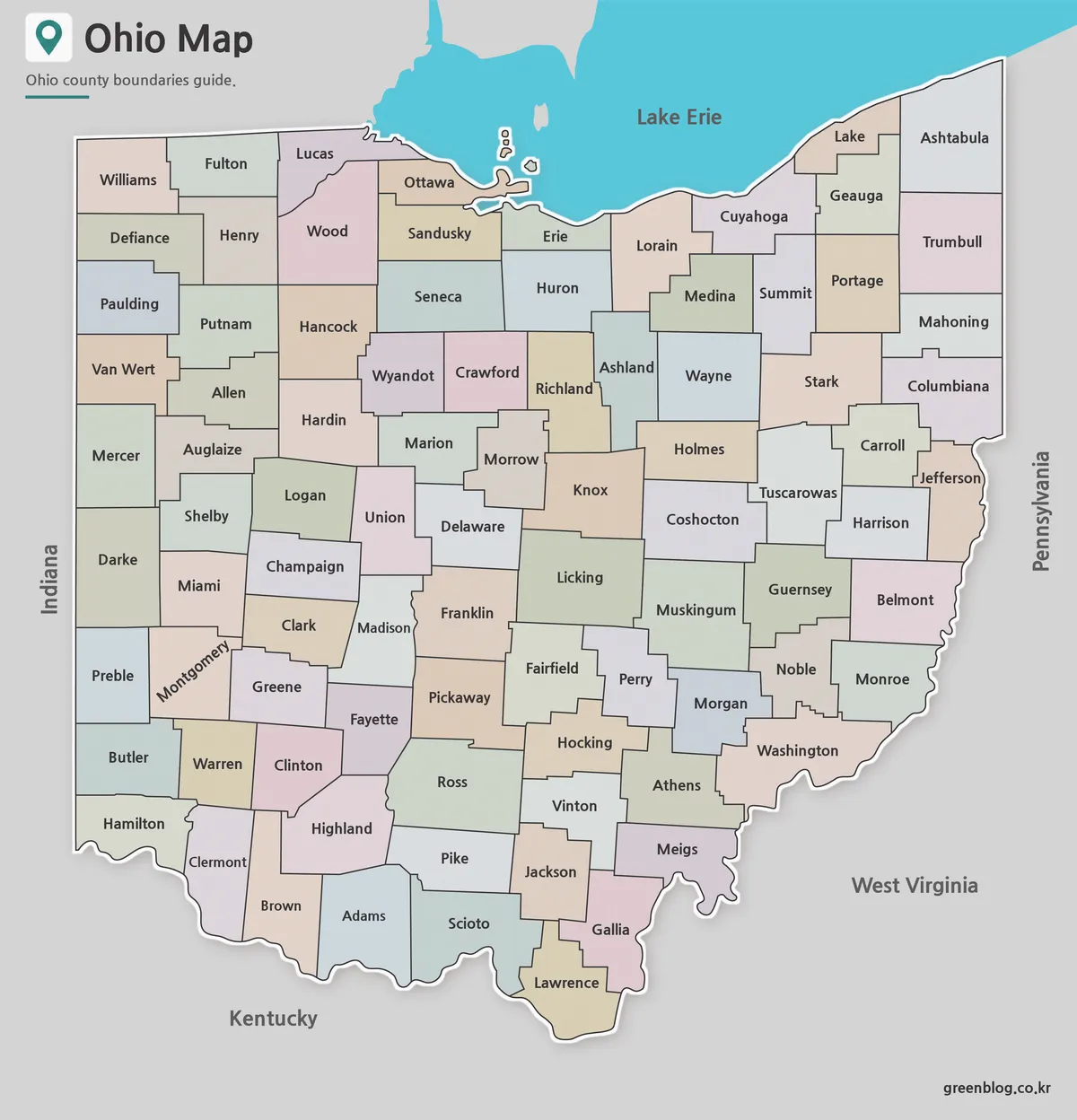
- Ohio Map Collection Free Download | Printable County Maps
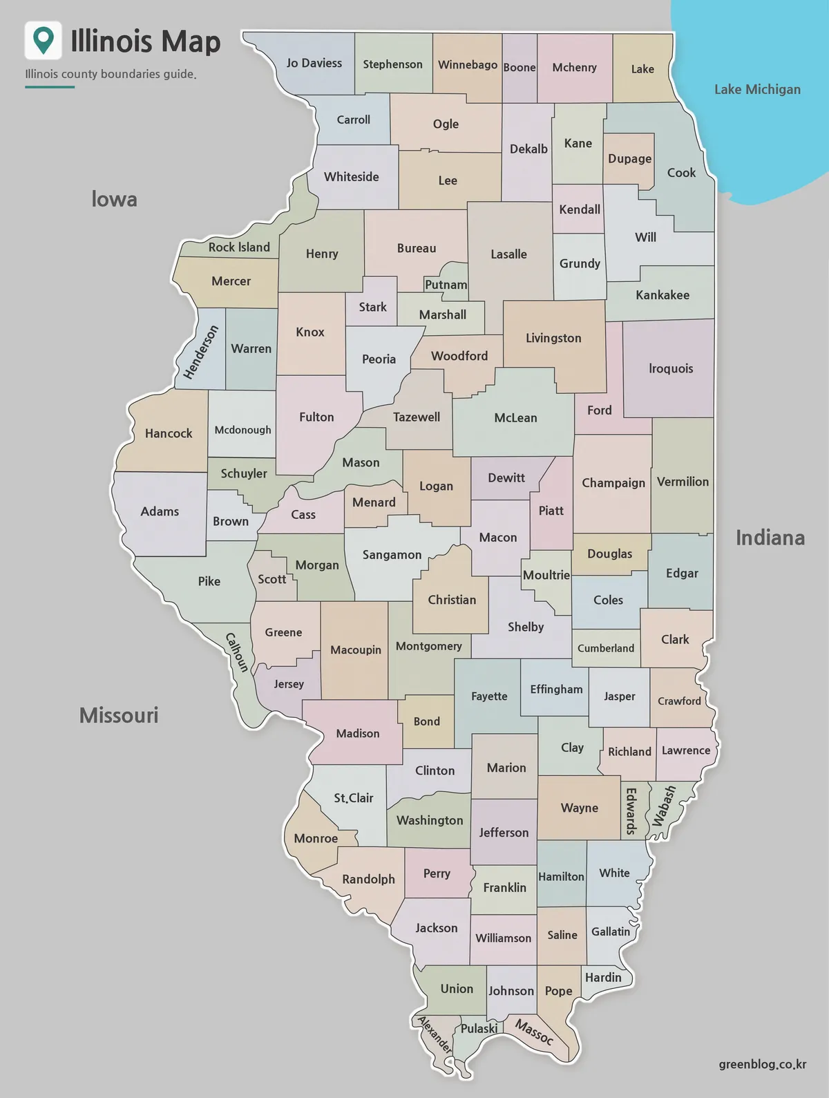
- Illinois County Map Download – Color, Black and White, Outline Versions
- Idaho County Map Collection (Printable Color, Labeled & Outline Maps)
- New York County Map Collection (Printable Color, Labeled & Outline Maps)