
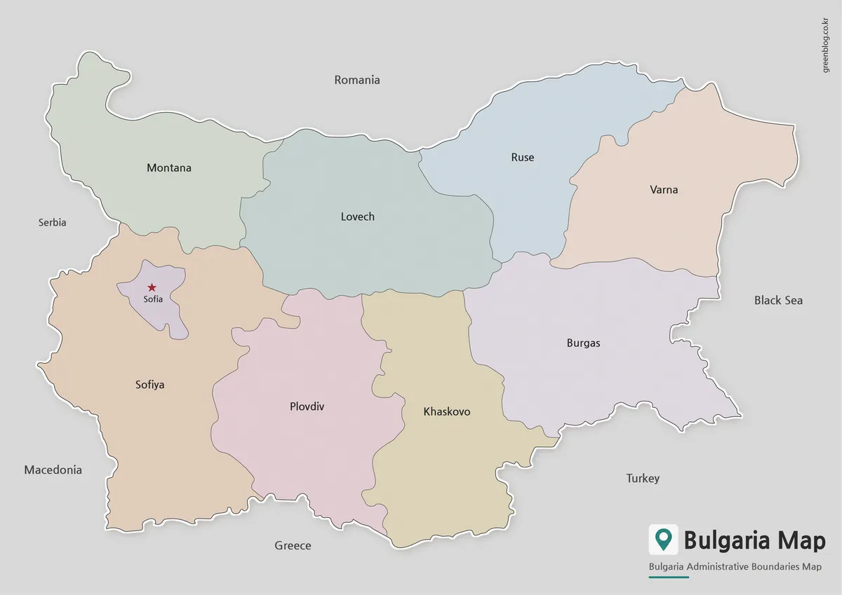
Nine Broad Divisions and Sofia in a Bulgaria Map
A Bulgaria Map in this collection divides the country into nine broad labeled areas rather than displaying all 28 present-day
Nine Broad Divisions and Sofia in a Bulgaria Map Read More »
A Bulgaria Map in this collection divides the country into nine broad labeled areas rather than displaying all 28 present-day
Nine Broad Divisions and Sofia in a Bulgaria Map Read More »
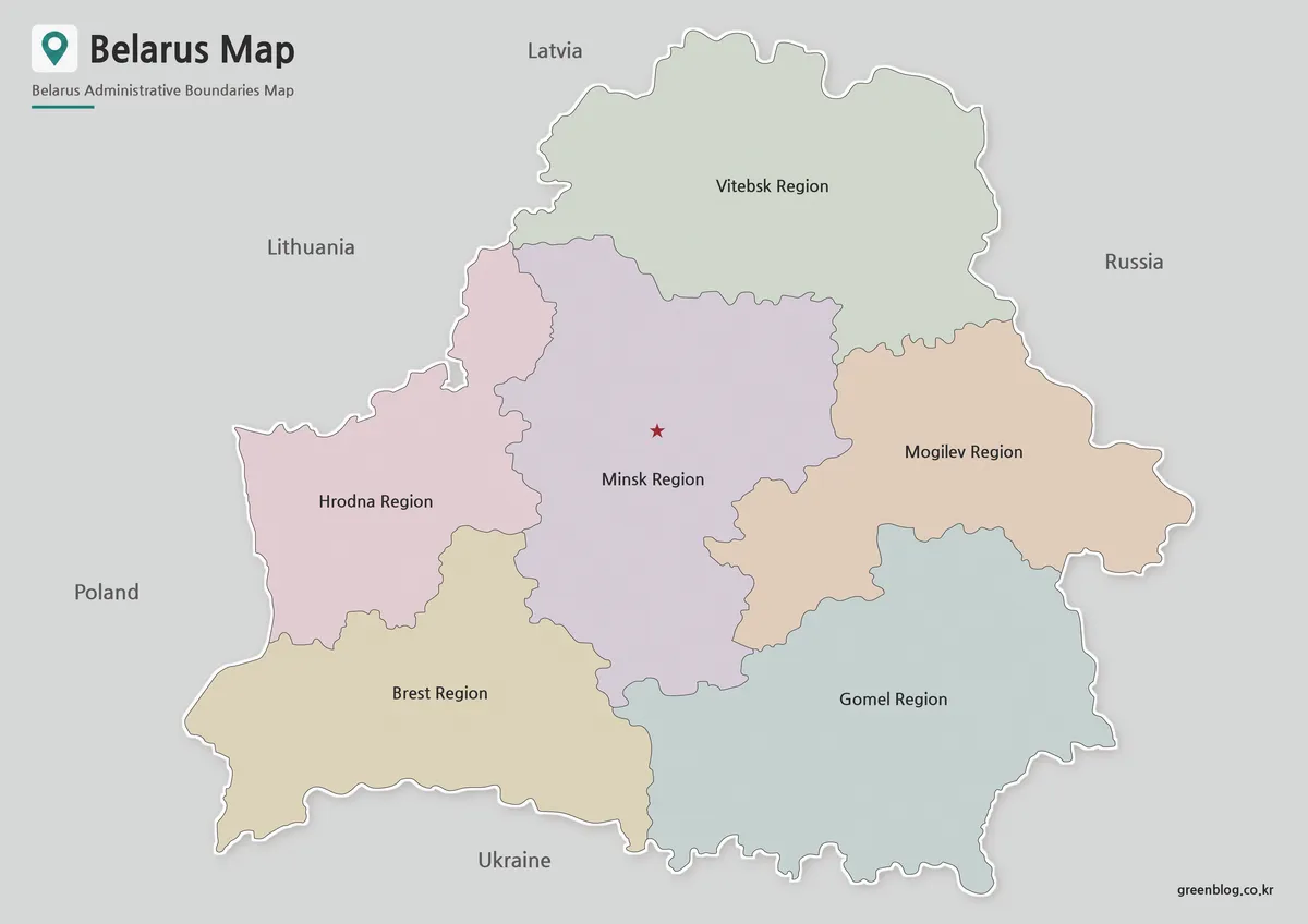
A Belarus Map makes the country’s position between the Baltic region, Central Europe, Russia, and Ukraine much easier to read
Belarus Map Files for Reading Six Regions and Minsk Read More »
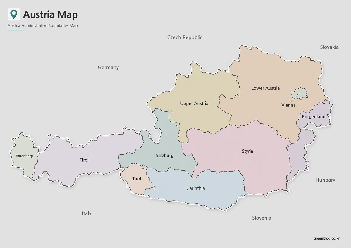
An Austria Map has to explain more than a long east–west country shape. It also needs to show Vienna as
Nine Federal States and a Vienna Enclave on an Austria Map Read More »
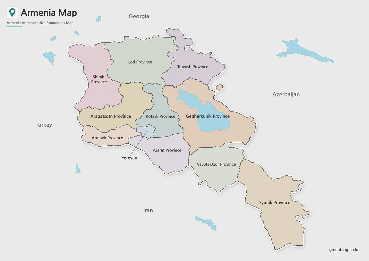
An Armenia Map needs to distinguish ten marzes from Yerevan, which is governed separately from those regions. The supplied artwork
Ten Marzes, Yerevan, and Lake Sevan on an Armenia Map Read More »
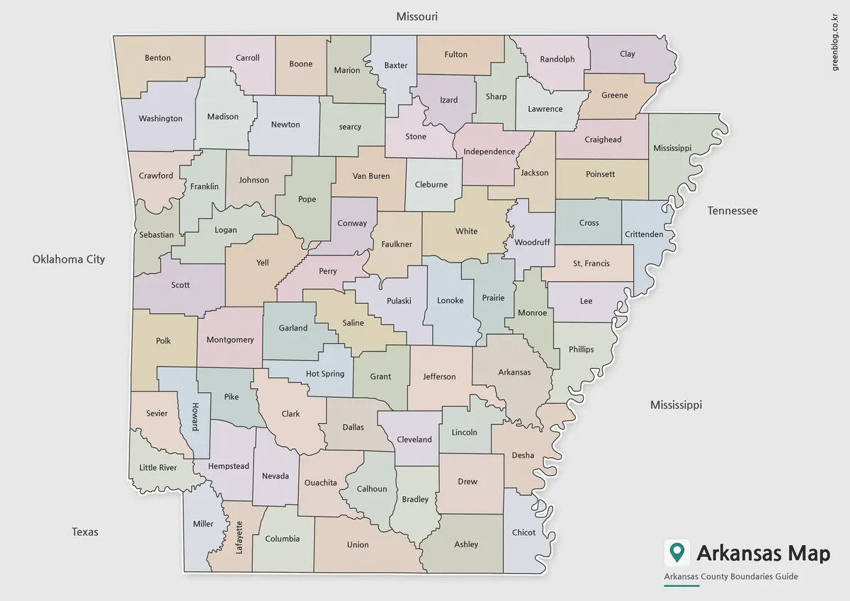
An Arkansas Map has to make 75 county names readable inside a state whose straight northern and southern edges contrast
Following 75 County Shapes Across an Arkansas Map Read More »
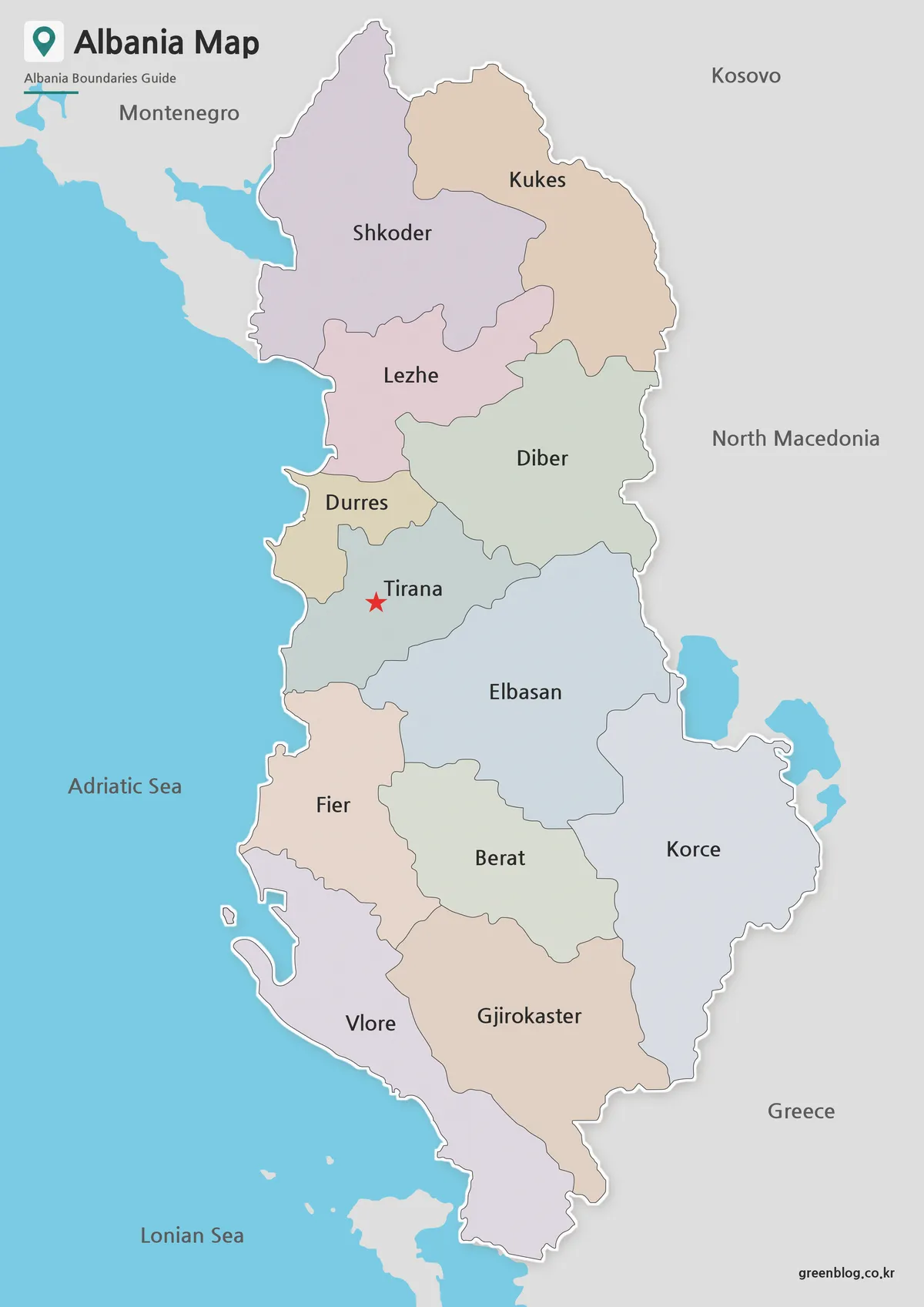
An Albania Map is most useful when it distinguishes the country’s 12 counties from the smaller municipalities below them. The
Twelve Counties from Shkodër to Vlorë on an Albania Map Read More »
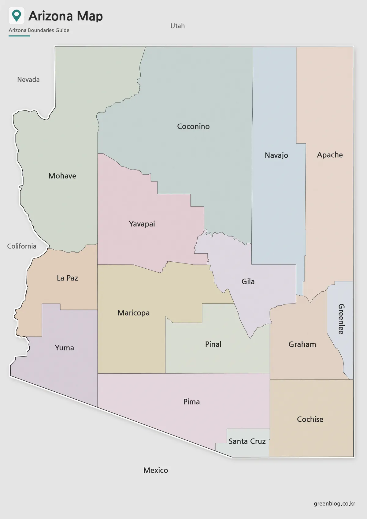
This Arizona State Map turns a familiar southwestern silhouette into a county-by-county reference. Arizona appears nearly rectangular along its northern
From Mohave to Cochise: Reading an Arizona State Map Read More »
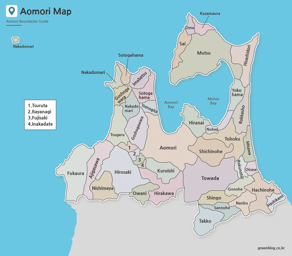
An Aomori Prefecture Map is unusually easy to recognize because two peninsulas reach north on opposite sides of Mutsu Bay.
Aomori Prefecture Map Guide to Mutsu Bay and Local Boundaries Read More »
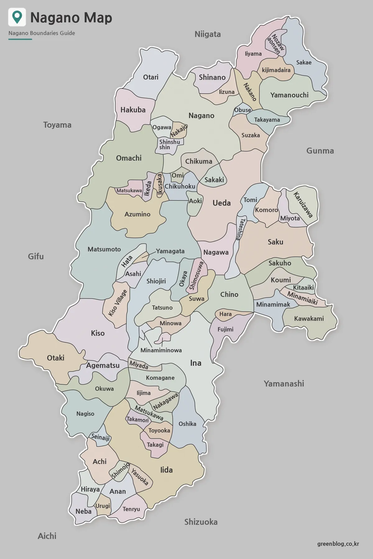
A Nagano Prefecture Map must fit a long inland prefecture and many differently sized municipalities into one readable page. Nagano
Nagano Prefecture Map: Why Mountain Corridors Shape the Layout Read More »