
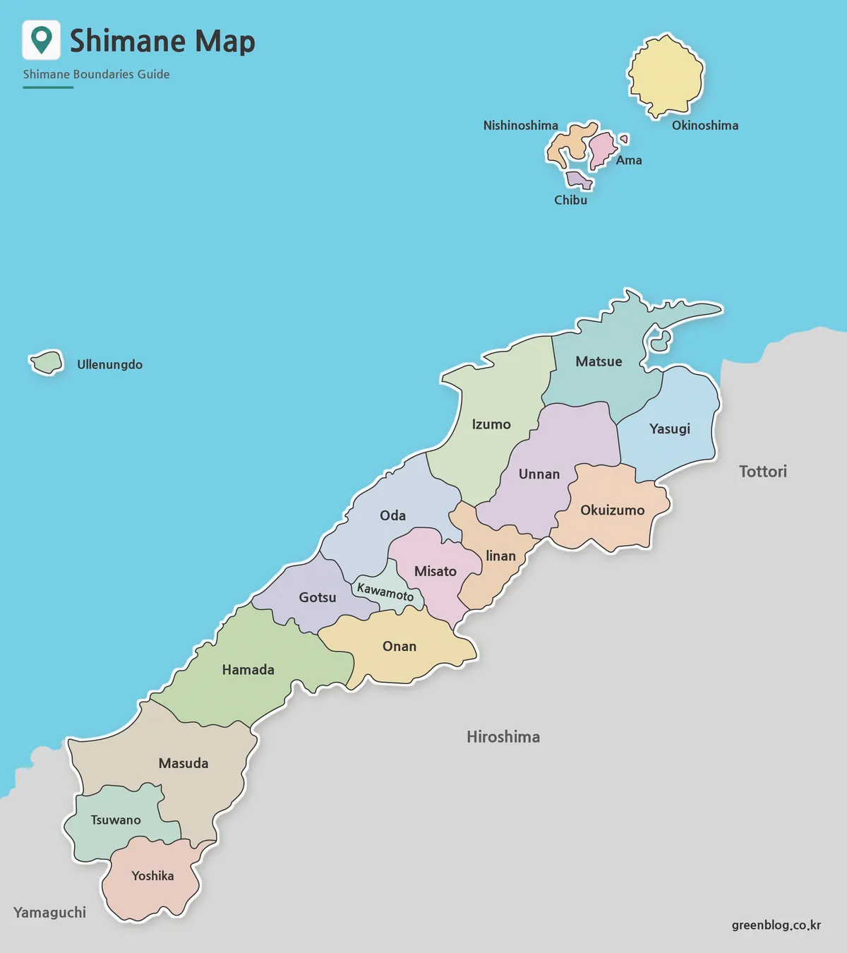
Mainland and Oki: Reading a Shimane Prefecture map
A Shimane Prefecture map has to balance a long mainland corridor with four municipalities in the Oki Islands. The current
Mainland and Oki: Reading a Shimane Prefecture map Read More »
A Shimane Prefecture map has to balance a long mainland corridor with four municipalities in the Oki Islands. The current
Mainland and Oki: Reading a Shimane Prefecture map Read More »
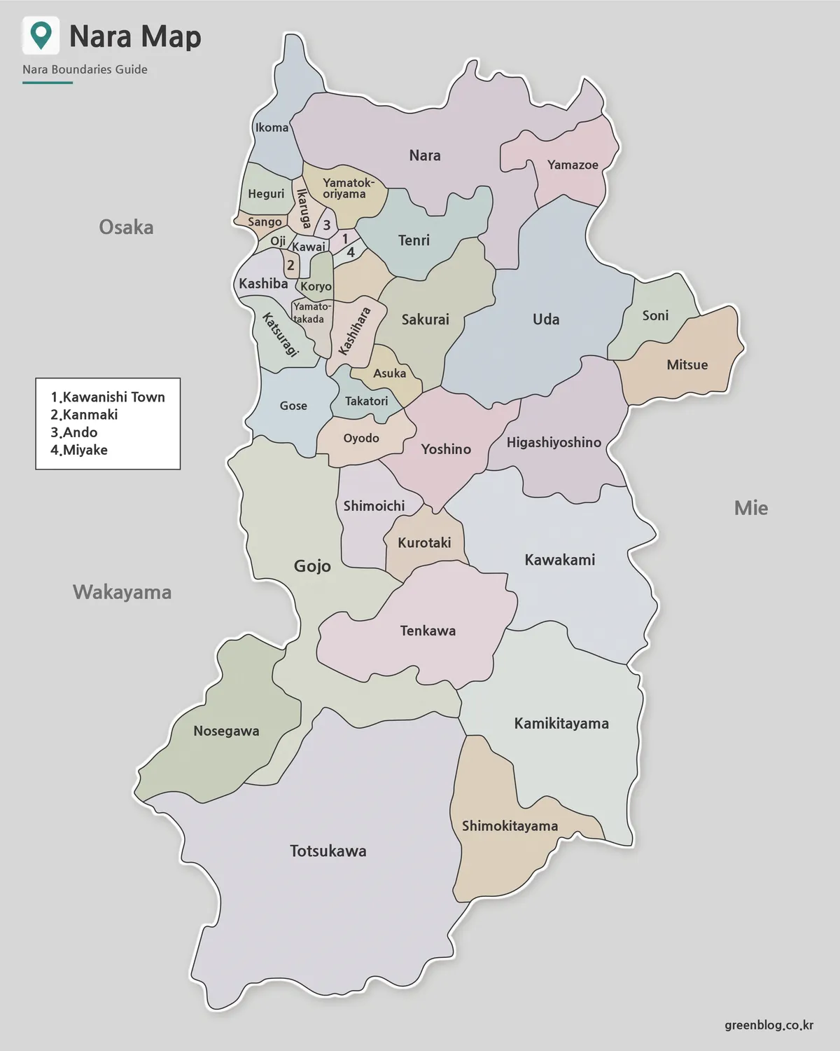
A Nara Prefecture map has to present two very different administrative patterns on one page. Small municipalities cluster tightly across
Why a Nara Prefecture map needs an inset for four towns Read More »
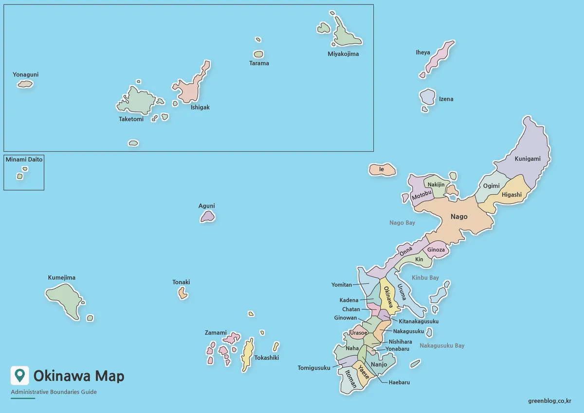
An Okinawa Prefecture Map has to explain a prefecture that cannot be understood as one continuous landmass. Okinawa’s municipalities extend
An Okinawa Prefecture Map Across Main Island, Miyako, and Yaeyama Read More »
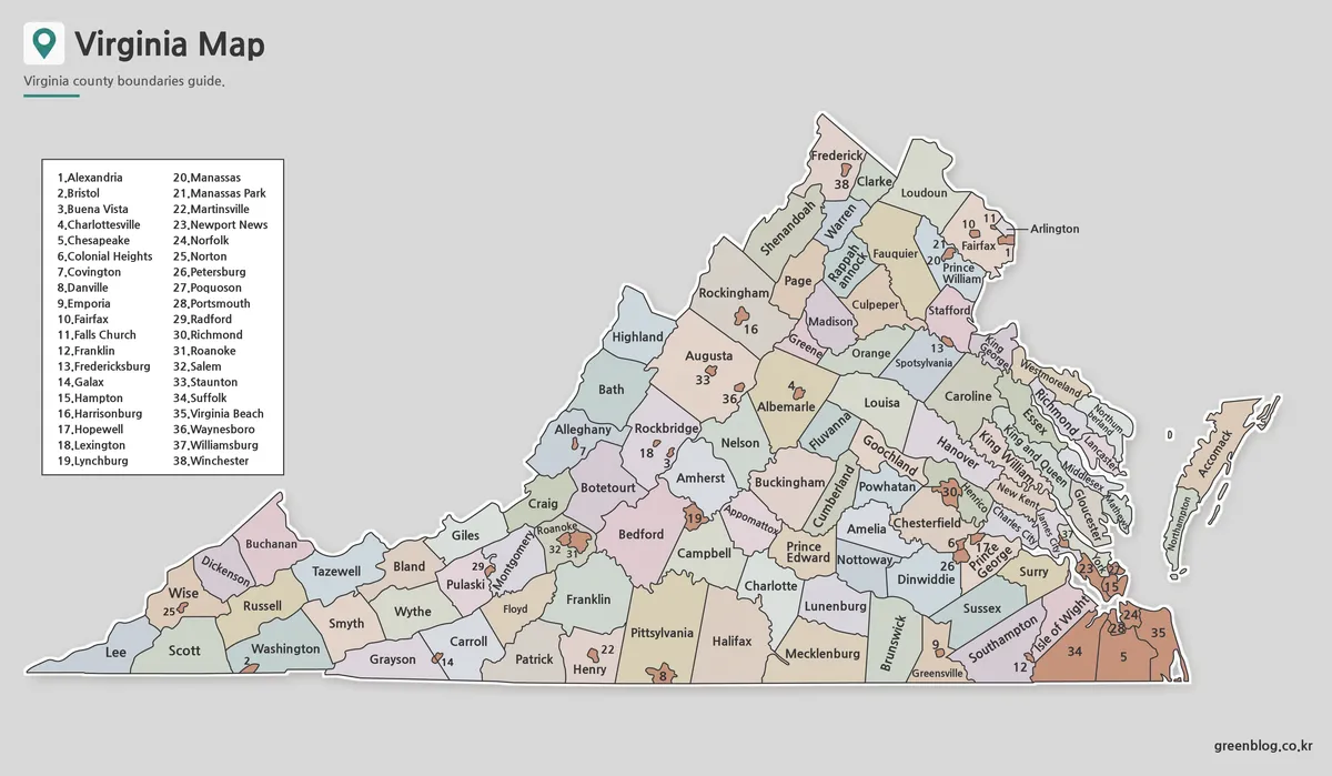
A Virginia Map must explain two kinds of first-level local government on the same page: 95 counties and 38 independent
Why a Virginia Map Needs 38 Numbered City Markers Read More »
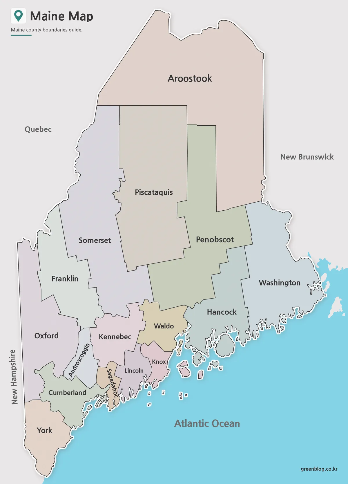
A Maine Map must balance two very different shapes: an expansive northern interior and a deeply indented Atlantic coast. Maine
Which Maine Map Fits Your Project? Three 16-County Views Read More »
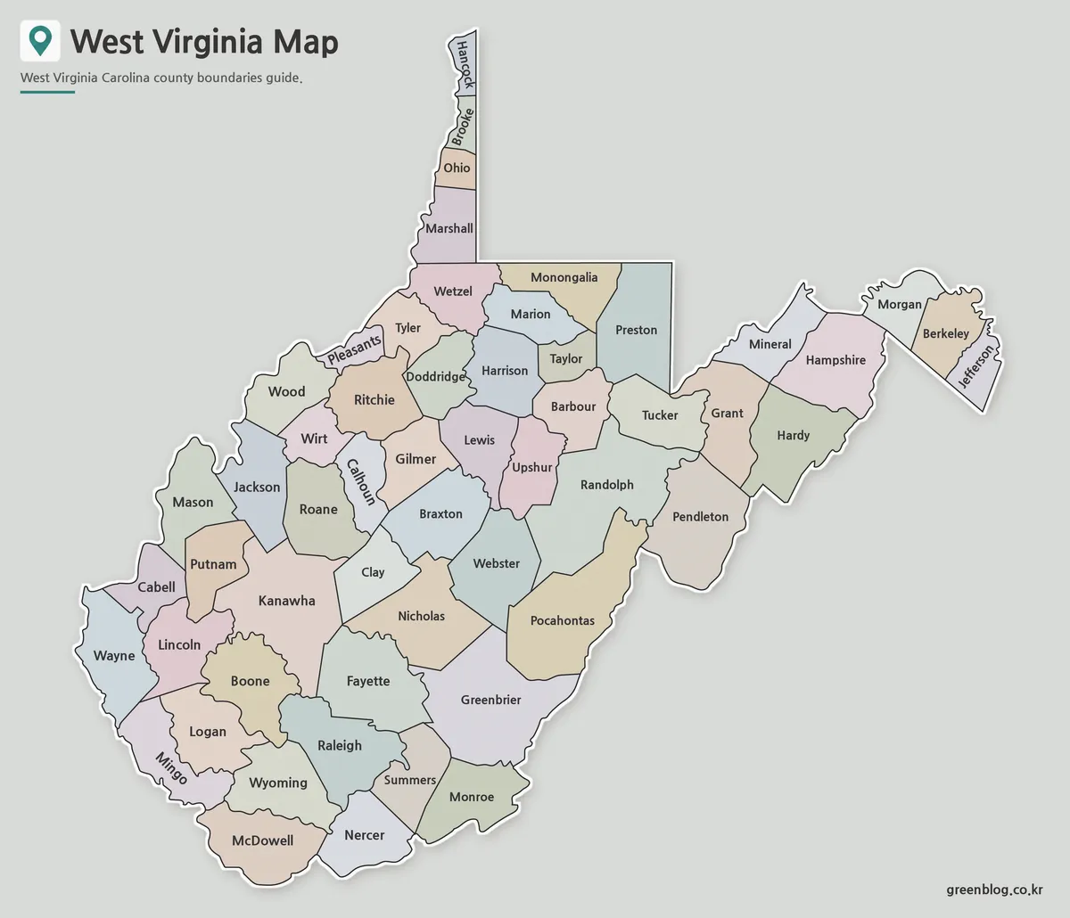
A West Virginia Map must accommodate one of the most irregular state silhouettes in the eastern United States. The Northern
Why a West Virginia Map Needs Room for 55 County Labels Read More »
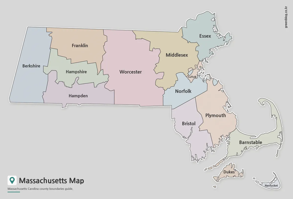
A Massachusetts Map is useful for much more than locating the state within the northeastern United States. Teachers often use
Massachusetts Map Collection | Printable County Maps in High Resolution Read More »
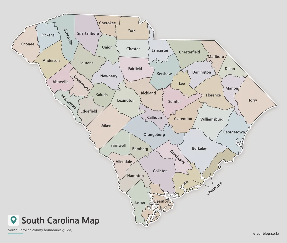
A South Carolina Map becomes most useful when it makes all 46 counties readable across a state that narrows toward
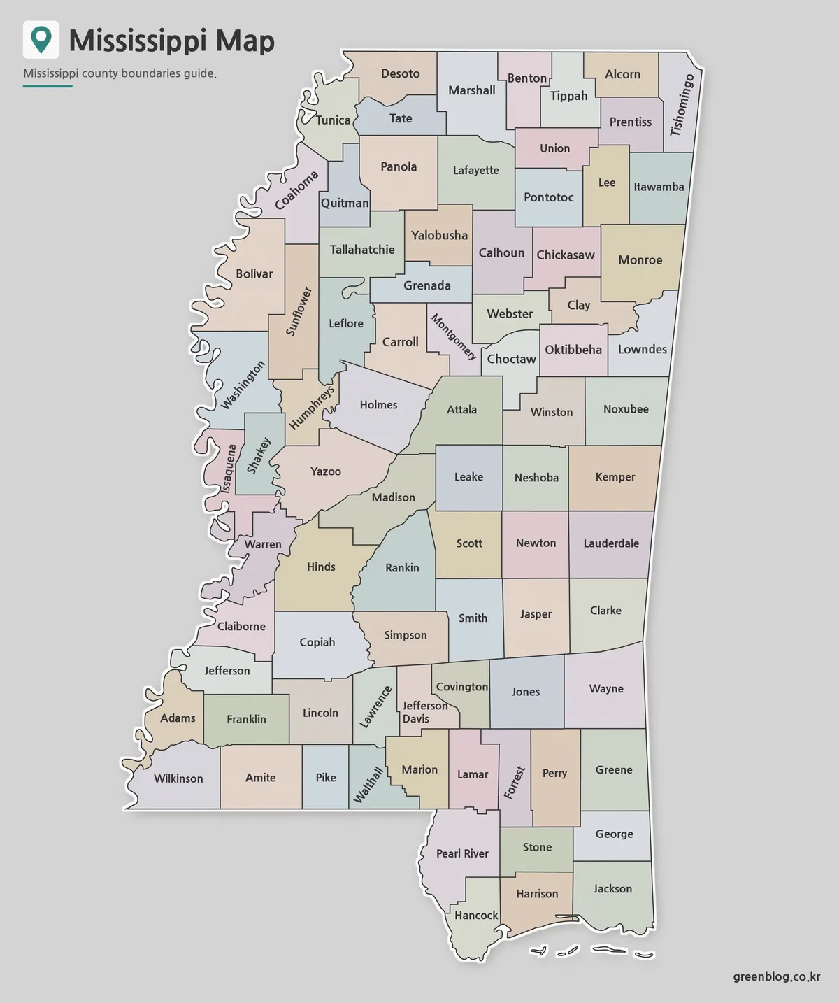
A Mississippi Map has two immediately recognizable edges: the winding western boundary associated with the Mississippi River and the short
Following 82 Counties Down a Mississippi Map to the Gulf Coast Read More »