
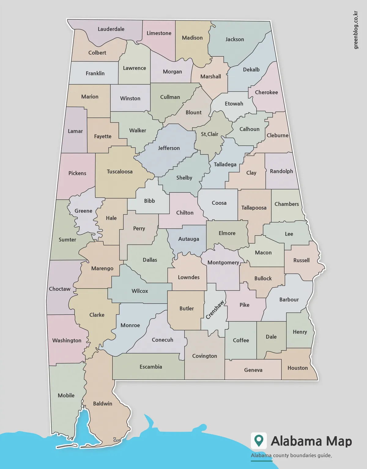
Why Mobile and Baldwin Shape the Bottom of an Alabama map
An Alabama map must keep 67 county shapes readable inside a state that is much taller than it is wide.
Why Mobile and Baldwin Shape the Bottom of an Alabama map Read More »
An Alabama map must keep 67 county shapes readable inside a state that is much taller than it is wide.
Why Mobile and Baldwin Shape the Bottom of an Alabama map Read More »
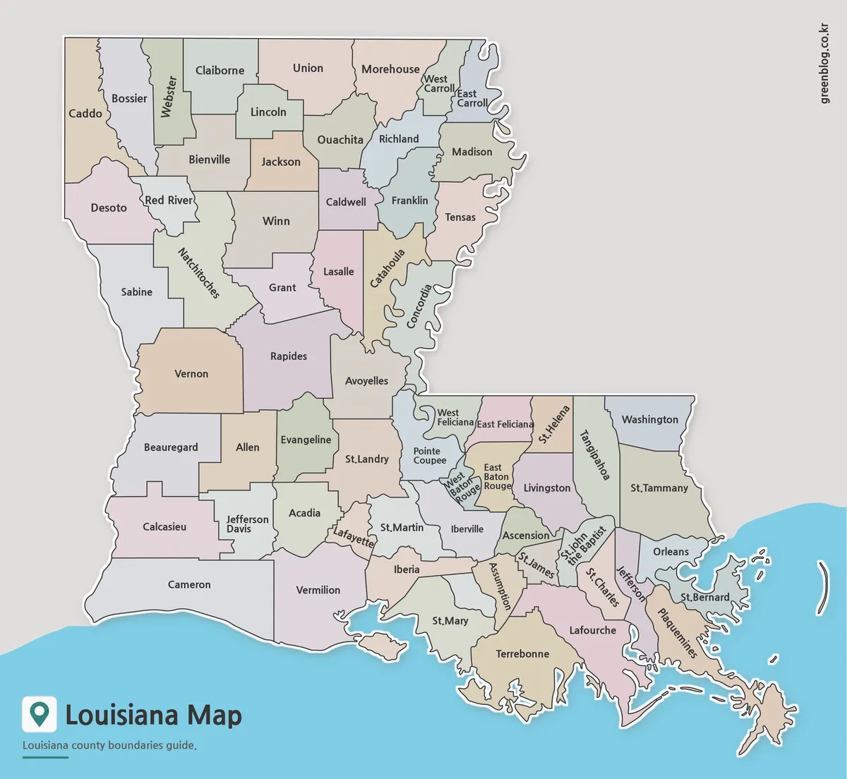
A Louisiana Parish Map has to fit 64 county-equivalent areas into a state outline that changes dramatically from the straight
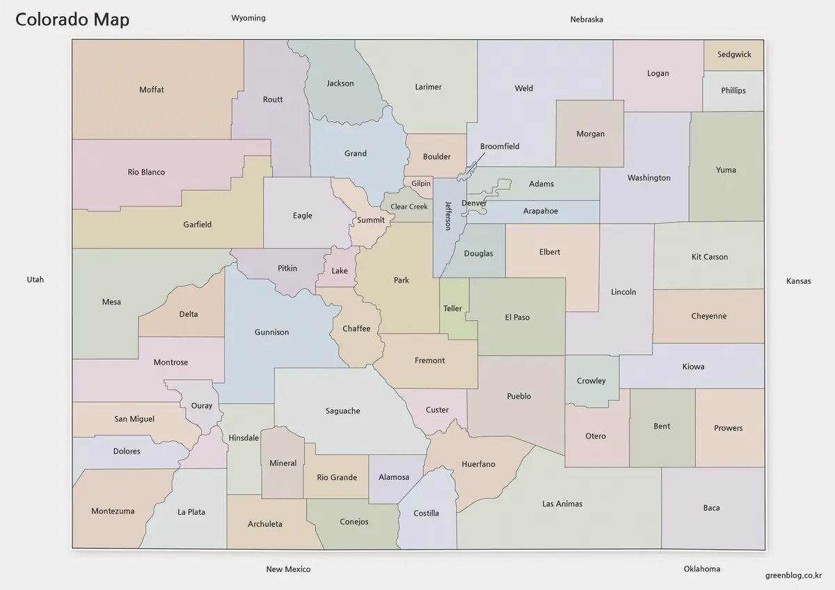
A Colorado Map becomes much more informative when it shows the state’s 64 counties rather than only its familiar rectangular
Colorado Map Guide to 64 Counties and the Denver-Area Cluster Read More »
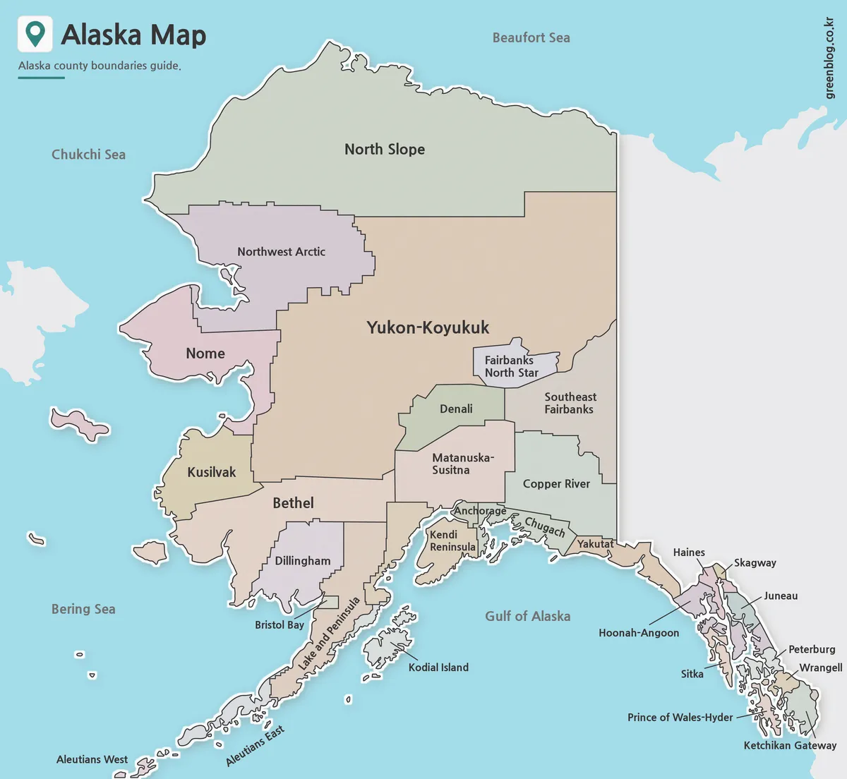
This Alaska Map has to fit three very different geographic forms into one frame: the enormous mainland, the Aleutian chain
Boroughs, Census Areas, and Islands on an Alaska Map Read More »
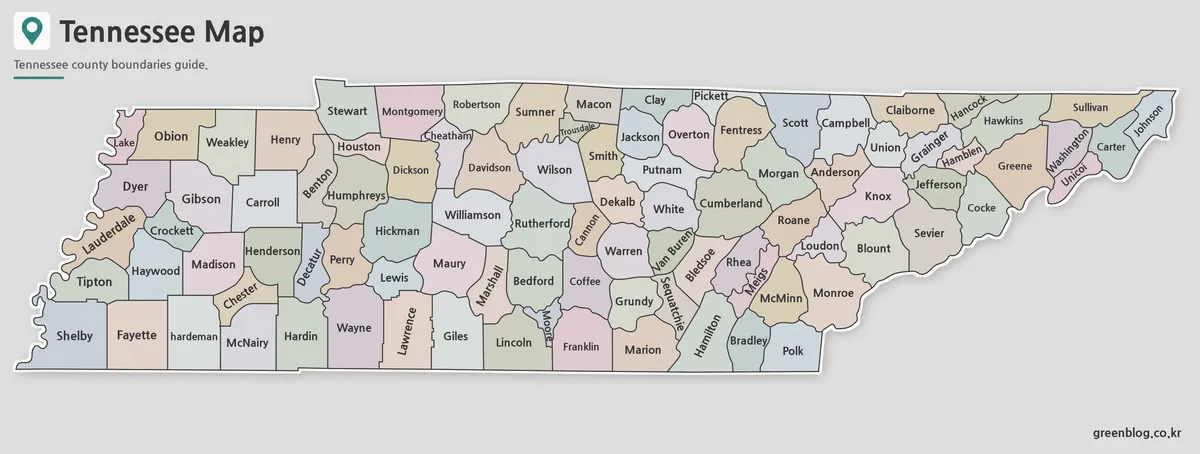
A Tennessee Map has to place 95 county shapes inside a state that is much wider than it is tall.
County Names Across a Ribbon-Shaped Tennessee Map Read More »
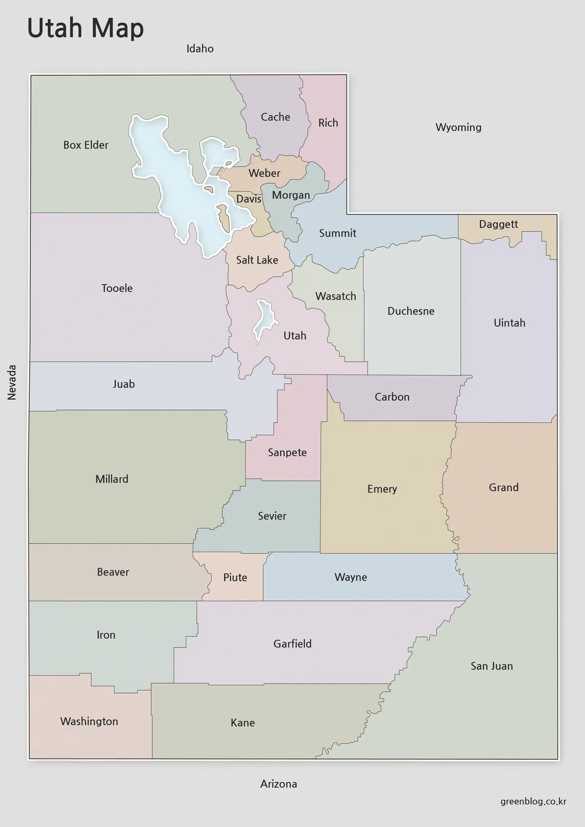
A Utah Map becomes easier to orient when the Great Salt Lake, Utah Lake, and all 29 county boundaries appear
Great Salt Lake to Four Corners: A Utah Map of 29 Counties Read More »
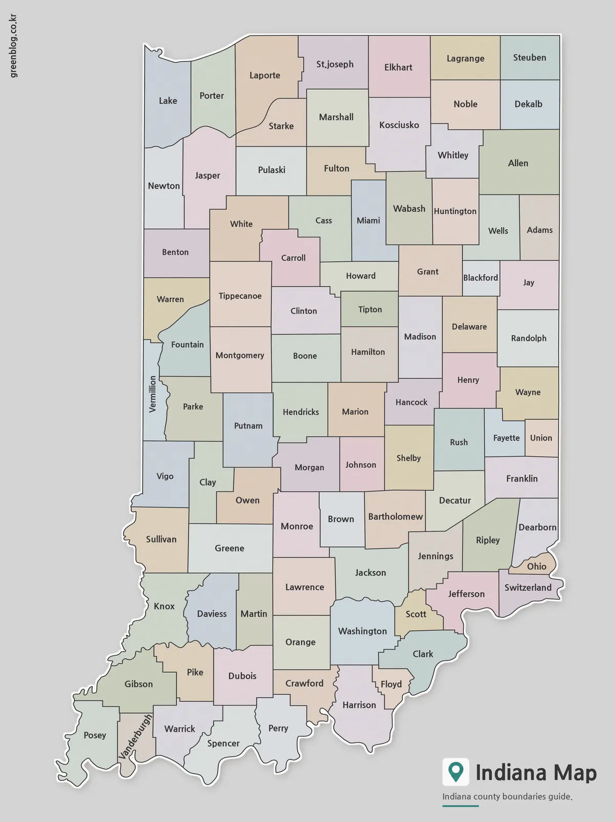
An Indiana State Map has a naturally tall layout: Lake Michigan touches the northwest corner, the state extends south through
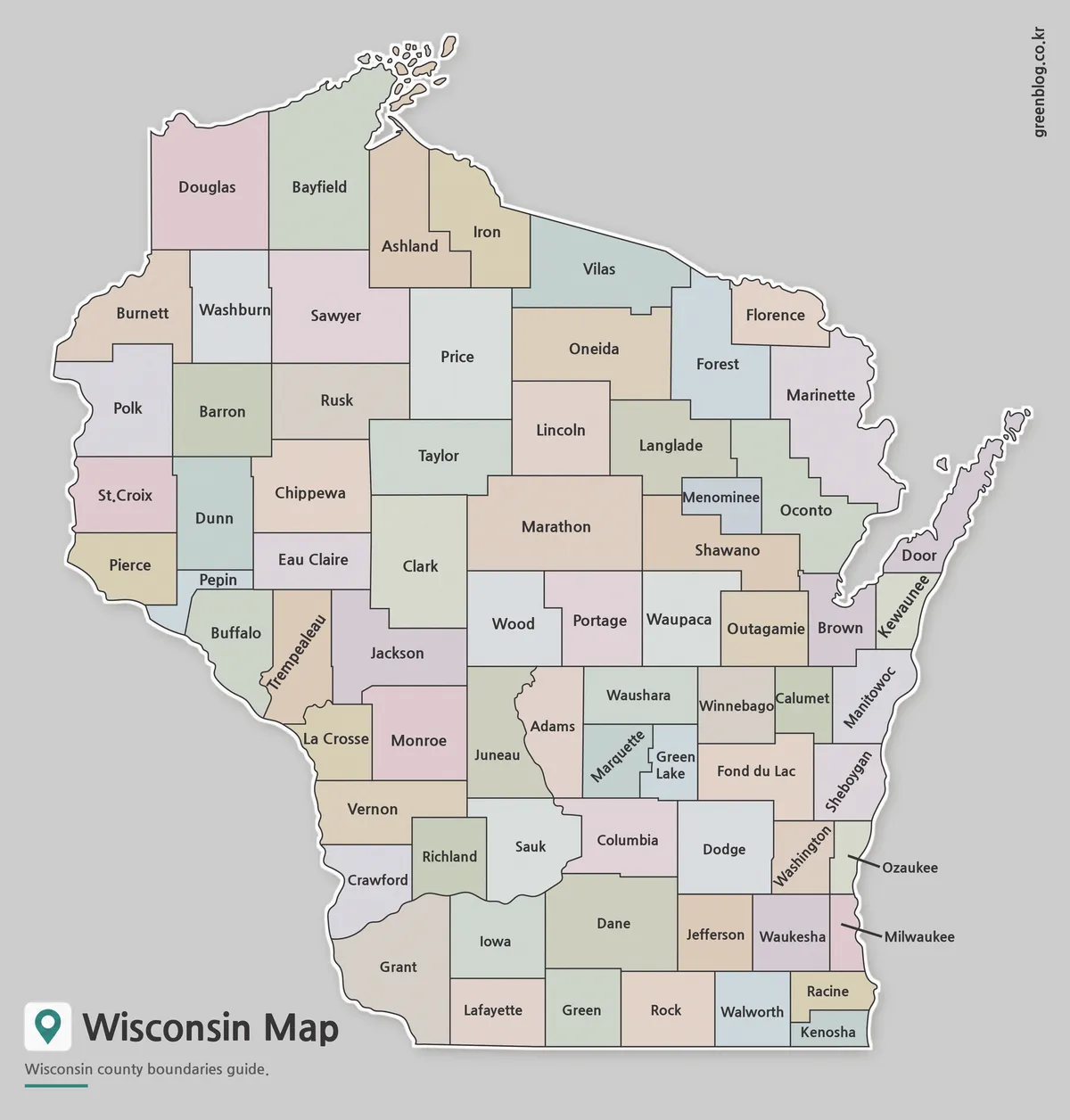
A Wisconsin Map has to make room for 72 counties within a state outline shaped by two Great Lakes, a
Wisconsin Map: 72 Counties Between the Great Lakes and Mississippi Read More »
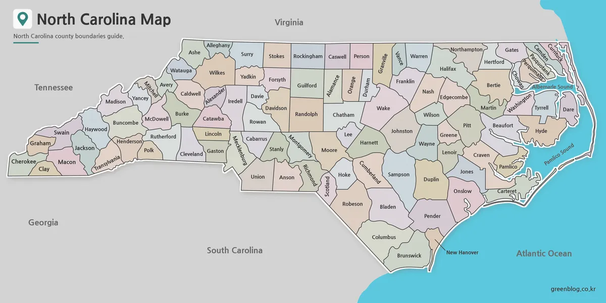
A North Carolina State Map has to fit 100 counties into a long east-west shape that changes sharply from the
From Mountain Counties to the Sounds: A North Carolina State Map Read More »