
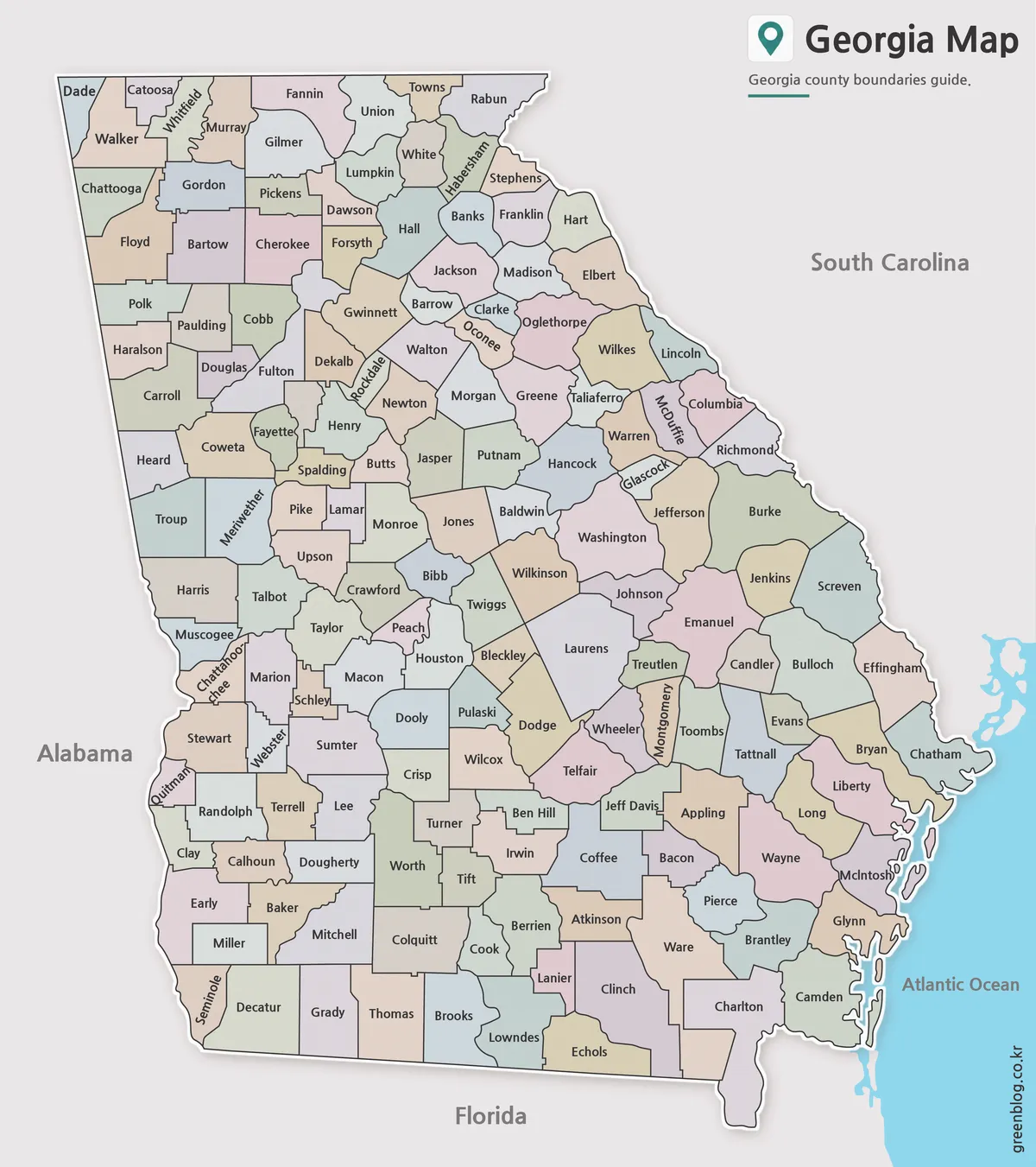
A Georgia State Map for Reading 159 County Boundaries
A Georgia State Map becomes especially valuable when the goal is to understand all 159 counties rather than simply recognize
A Georgia State Map for Reading 159 County Boundaries Read More »
A Georgia State Map becomes especially valuable when the goal is to understand all 159 counties rather than simply recognize
A Georgia State Map for Reading 159 County Boundaries Read More »
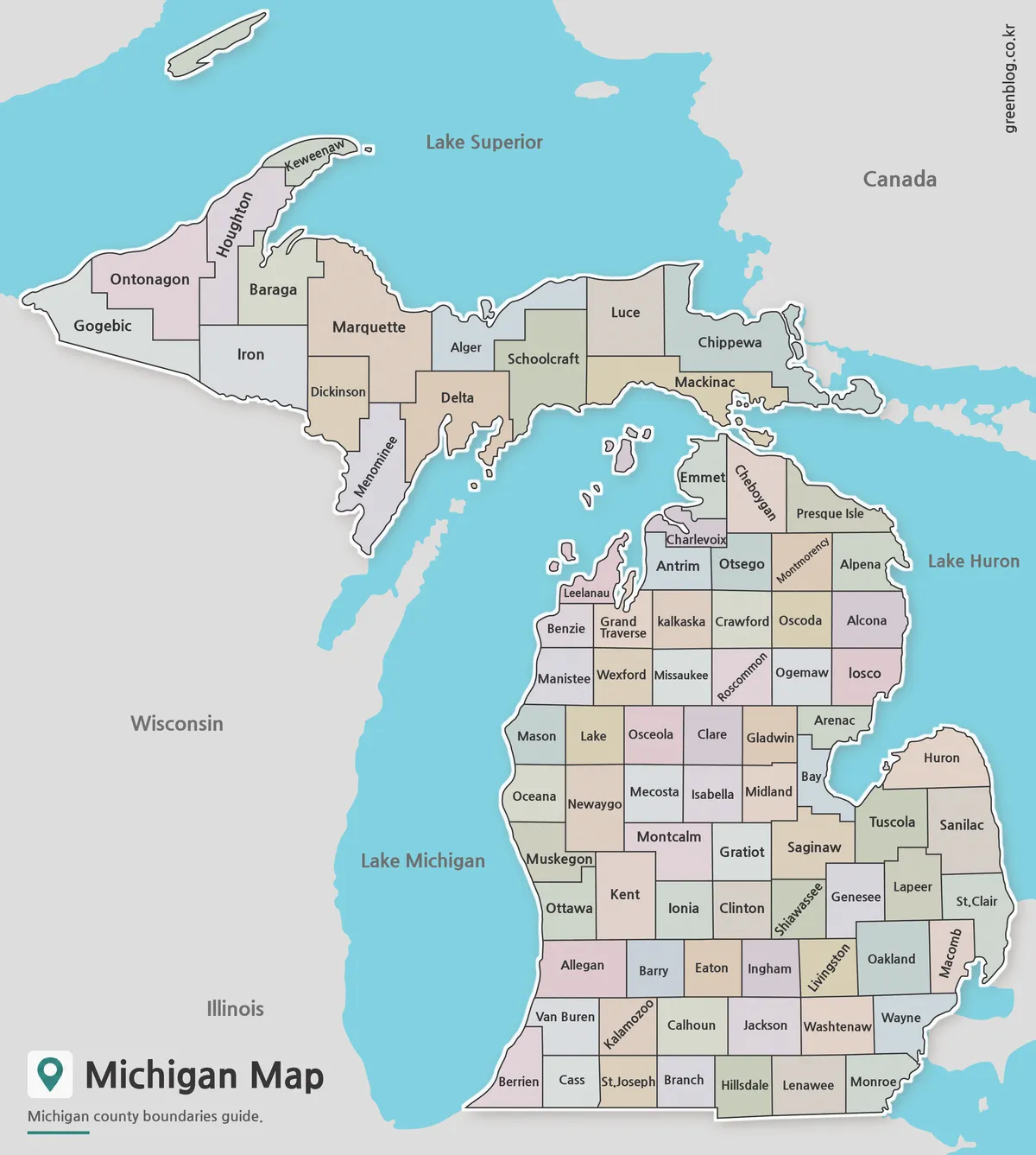
A Michigan Map has to organize 83 counties across two peninsulas while leaving enough room for Great Lakes shorelines, offshore
Reading Two Peninsulas and 83 Counties on a Michigan Map Read More »
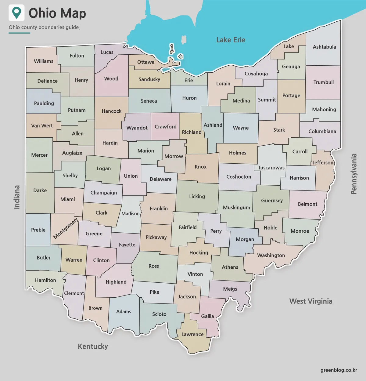
An Ohio Map makes the state’s 88-county pattern easier to read than a simple state silhouette. This collection presents that
A Reader’s Ohio Map Guide to All 88 County Boundaries Read More »
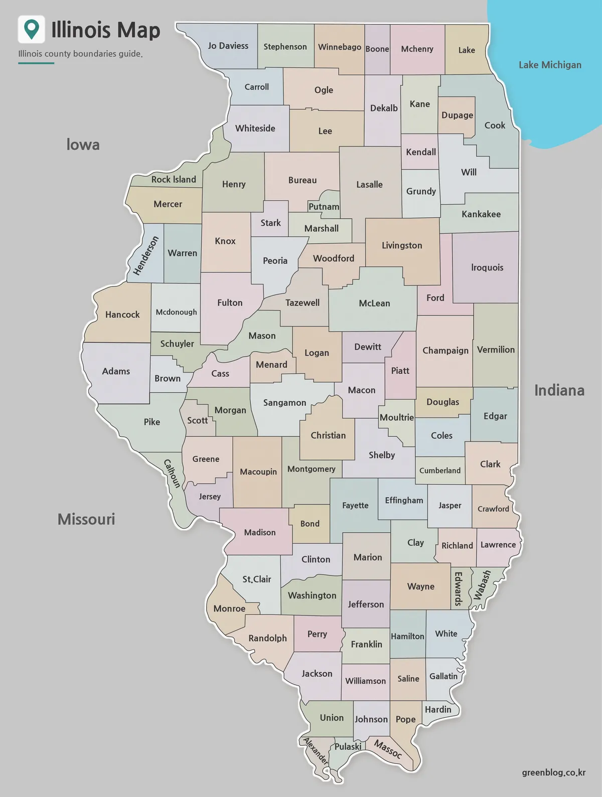
This Illinois County Map fits all 102 counties into a tall state portrait, from the six-county northern row beside Iowa
From Cook to Alexander: Reading an Illinois County Map Read More »
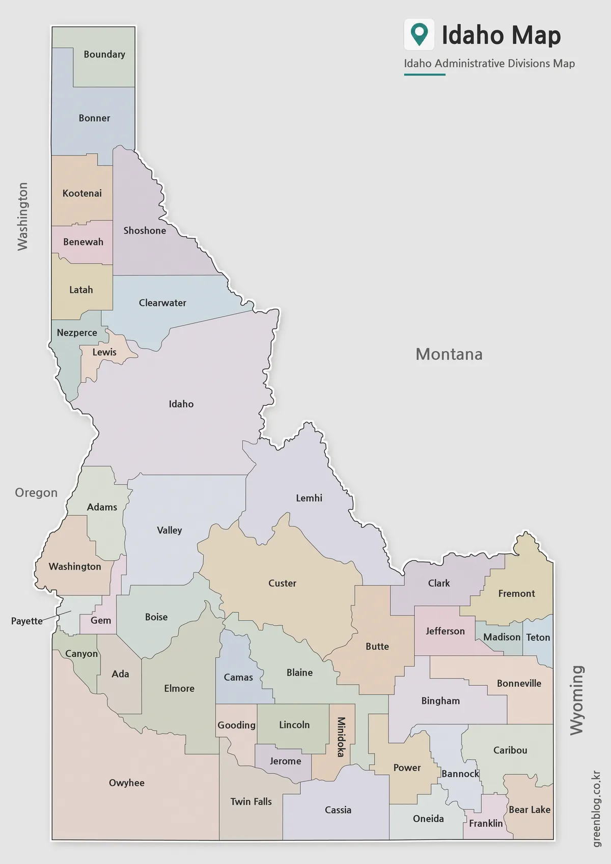
An Idaho County Map works best in a vertical format because the state extends from the Canadian border through a
Why the Idaho County Map Works Best in a Vertical Layout Read More »
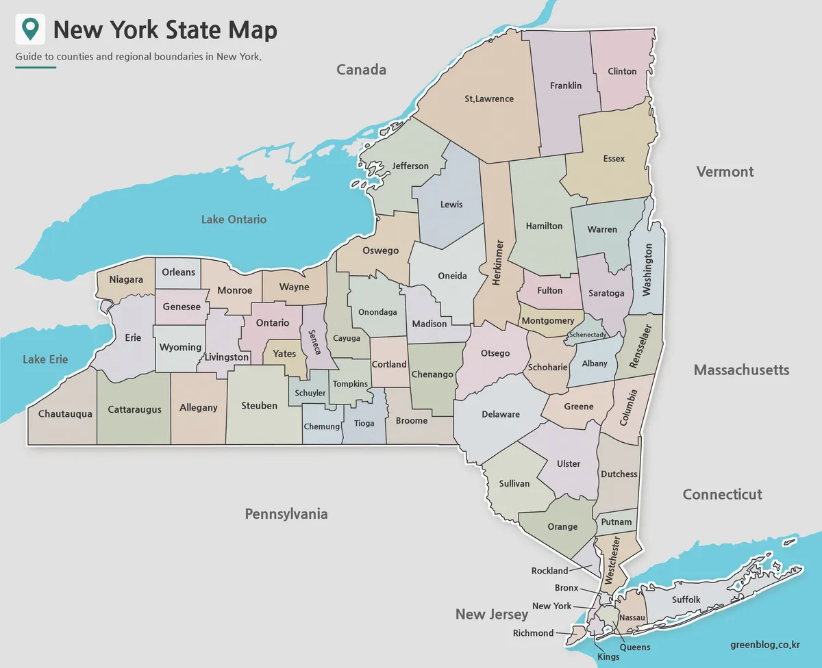
A New York State County Map has to fit several very different geographic patterns onto one page: the broad western
New York State County Map: A Visual Guide to All 62 Counties Read More »
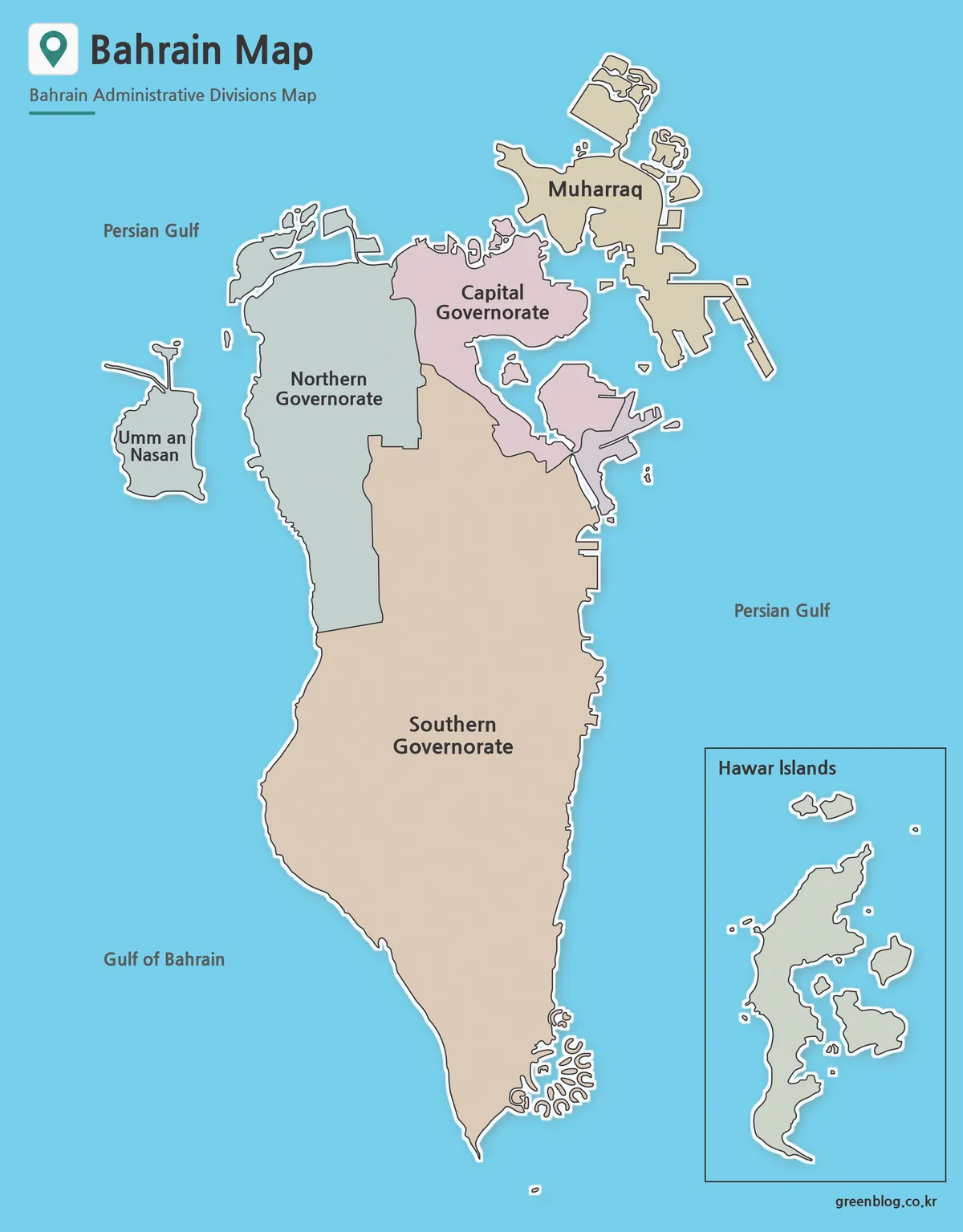
A Bahrain Map has to balance two very different visual patterns: a dense cluster of islands and coastal pieces in
North Is Fragmented, South Is Long on This Bahrain Map Read More »
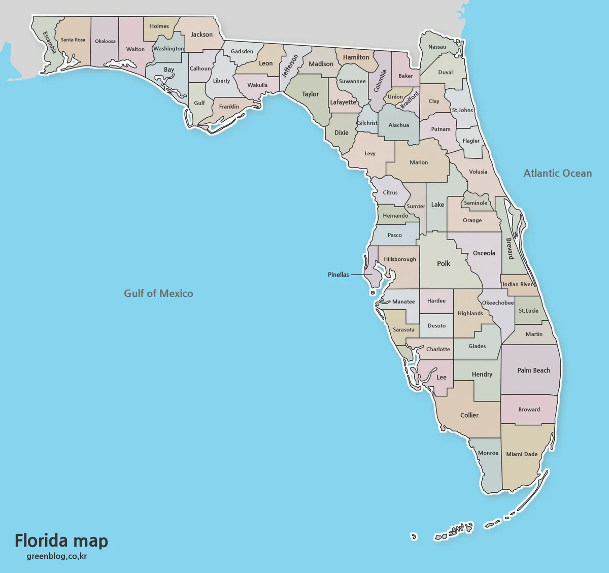
A Florida Map has to explain more than a familiar peninsula. The state extends west through the Panhandle, narrows between
Florida Map Guide to Counties, Coasts and Regional Orientation Read More »
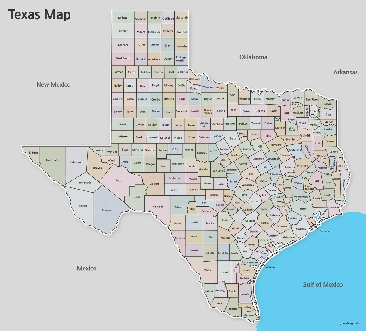
A Texas Map at county scale turns one familiar state outline into a demanding reading exercise: 254 internal areas must
Two Corrections Hidden in a Texas Map of 254 Counties Read More »