This Louisiana Parish Map collection was created for users who need a clear and printable reference of Louisiana’s administrative divisions. Whether you are preparing classroom materials, building a presentation, creating blog graphics, or organizing regional comparison data, having multiple map styles available often makes the process much easier.
Located along the Gulf Coast of the southern United States, Louisiana borders Mississippi to the east, Texas to the west, and Arkansas to the north. The state covers roughly 135,000 square kilometers and has a population of about 4.6 million people. Major cities such as Baton Rouge, New Orleans, Shreveport, and Lafayette are distributed across very different geographic regions, making regional maps especially useful when explaining population patterns, transportation networks, economic activity, or cultural areas.
This printable Louisiana Parish Map collection includes three map styles: a color parish map, a labeled black and white map, and a blank outline version. All maps were prepared in high resolution for A3 printing and are suitable for educational worksheets, presentation slides, infographic projects, travel planning resources, and graphic editing work.
While organizing the map collection, special attention was given to the complex parish boundaries found in southeastern Louisiana. Several coastal and wetland areas contain irregular administrative divisions, so readability was reviewed carefully to ensure that parish boundaries remain visible when printed or enlarged.
Table of Contents
Included Map Versions
The collection includes:
- Color parish map
- Labeled parish map
- Blank outline map
- High-resolution printable format
- Parish boundary reference
- Major city labeling
- Presentation-ready layout
Each version serves a different purpose depending on how the map will be used.
Regional Color Map
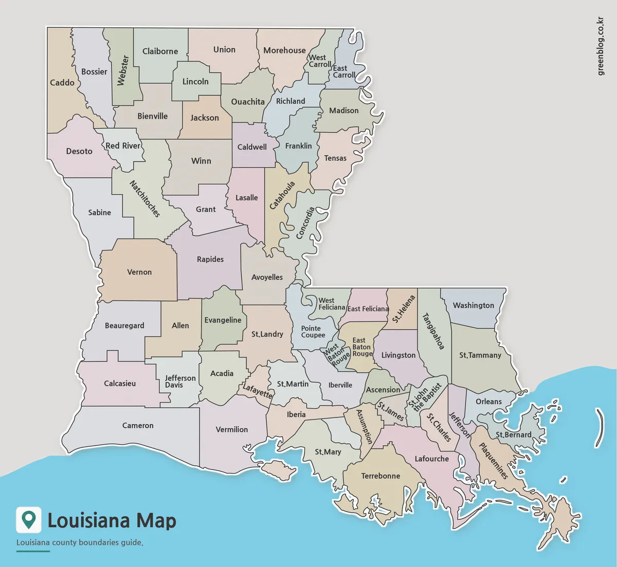
The color version is designed for quick visual identification of Louisiana’s parish structure. Adjacent parishes use contrasting colors to improve boundary recognition, making regional comparisons easier during presentations and classroom discussions.
Louisiana is unique because it uses parishes rather than counties. With dozens of parish divisions spread across coastal wetlands, river systems, and urban centers, a color-coded layout helps users understand the overall administrative structure without needing to zoom in excessively.
This version works particularly well for educational materials, blog illustrations, regional studies, and infographic design projects.
Labeled Printable Version
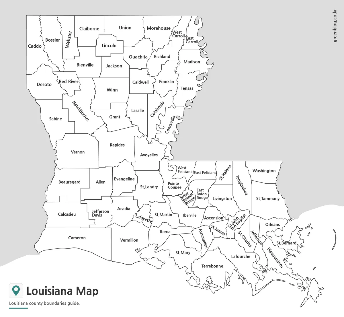
The labeled black and white version focuses on readability and printing efficiency. Parish names and boundaries are presented without heavy color usage, making the map suitable for reports, handouts, research documents, and presentation materials.
During preparation, labels were reviewed at large print sizes to verify that important locations remained readable. Baton Rouge, New Orleans, Shreveport, Lafayette, and other major population centers can be identified easily while still preserving a clean overall layout.
Because the design avoids excessive visual elements, users can also add their own statistics, notes, or regional information directly onto the map.
Blank Outline Map for Editing
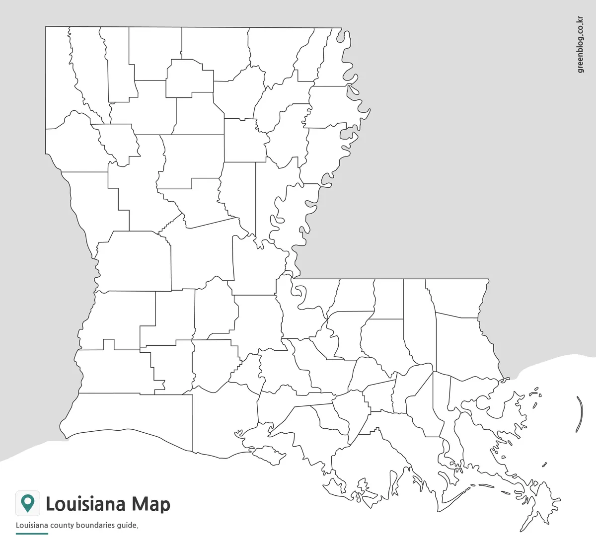
The outline version removes labels and color fills, leaving only the parish boundary structure. This format is often preferred for custom graphic projects, educational worksheets, and data visualization work.
Designers can apply their own color schemes, researchers can highlight selected parishes, and teachers can create geography exercises without needing to modify an existing labeled map.
The simplified layout also makes the file useful for regional planning graphics, tourism maps, transportation studies, and presentation diagrams.
Designed for Practical Use
A printable Louisiana Parish Map can be useful in many different situations:
- Classroom geography lessons
- State and regional studies
- Travel presentations
- Blog graphics
- Infographic projects
- Administrative boundary reference
- Population distribution maps
- Transportation and infrastructure presentations
- Educational worksheets
- Regional comparison reports
The availability of multiple map styles allows users to choose the version that best matches their project requirements.
Frequently Asked Questions
What makes a Louisiana Parish Map different from maps in other states?
Louisiana uses parishes instead of counties, making its administrative structure unique within the United States.
Can I print the Louisiana Parish Map in A3 size?
Yes. The maps were prepared in high resolution and are suitable for large-format printing.
Which version is best for presentations?
The color map is usually the easiest option for visual presentations and regional comparisons.
Is the outline map editable?
Yes. The outline version is designed for annotation, custom coloring, and graphic editing projects.
Does the Louisiana Parish Map include parish boundaries?
Yes. All versions include Louisiana parish boundary information.
Louisiana Parish Map Download
Choose the version that fits your project. Color, labeled, and outline maps are included for printing, education, and graphic editing work.
- File Format: JPG / ZIP
- Print Size: A3 High Resolution
- Included Versions: Color, Labeled, Outline
- Usage: Printing, Education, Presentations, Editing
Related Maps
- Free Colorado Map with County Boundaries for Printing and Editing
- Printable Alaska Map Collection for Education, Travel, and Design
- Printable Tennessee Map Download | County Boundaries and Outline Maps
- Printable Utah Map Collection | Color, Black & White, Outline Maps
Additional Resources
- National Map Viewer (USGS) – Federal mapping resources for geography and boundary reference.
Green Map creates custom-edited map images using open geographic data sources such as geoBoundaries, Natural Earth, OpenStreetMap, and government open data.
These maps are edited visual materials, not raw data files, and are provided for education, documents, presentations, and graphic reference.