Download the high-resolution A3 JPG ZIP for the Giles County Tennessee Map directly from this page; it contains the county, city, water, and elevation maps used below. Pulaski is the main central city, Lynnville lies to the north, Minor Hill is to the southwest, and Elkton and Ardmore sit in the southeastern part of the county. The maps also show a strong terrain contrast between lower central and southern valleys and the more closely spaced ridges toward the north and along parts of the county edge.
Giles County is easiest to understand by starting at Pulaski and then following three broad directions. North leads toward Lynnville, southwest toward Minor Hill, and southeast toward Elkton and Ardmore near the southern state line. The water and elevation layers add an important second pattern: Clear Creek Lake and Roberts Fork Creek occupy the northern half, Richland Creek crosses the central-southern area, and Elk River forms the strongest named water reference near the south.
Table of Contents
Pulaski connects four outer city references across Giles County
The city map labels Pulaski at 8,285 residents, Ardmore at 1,073, Minor Hill at 706, Elkton at 469, and Lynnville at 465. Pulaski is clearly the largest of the ranked places, but the map is most useful for showing how widely the other cities are spaced around it. Lynnville occupies the northern side, Minor Hill the southwest, Elkton the southeast, and Ardmore the far southeastern edge.
The connector distances on the city map are straight-line distances rather than driving mileage. Pulaski to Ardmore is shown at about 17 miles, Pulaski to Lynnville at about 13 miles, and Pulaski to both Minor Hill and Elkton at about 12 miles. Those values provide a simple scale for the county: Ardmore is the most distant of the ranked outer cities, while Lynnville, Minor Hill, and Elkton form a roughly similar ring at different compass directions.
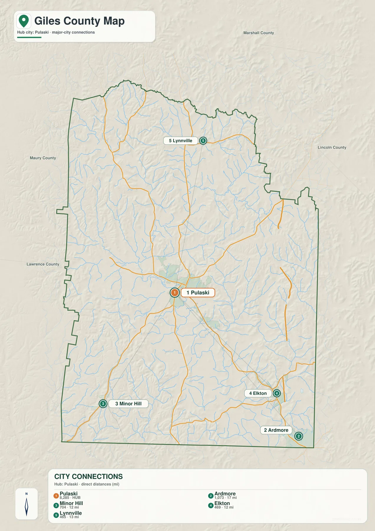
Marshall, Lincoln, Lawrence, and Maury counties appear around the outside of the city map and provide useful orientation. Lynnville is close to the northern side, Minor Hill is a southwestern reference, and Elkton and Ardmore help define the southeastern part of Giles County. Starting with one of those outer directions is often easier than trying to read every local road at once.
Roads split from Pulaski toward Lynnville, Minor Hill, Elkton, and Ardmore
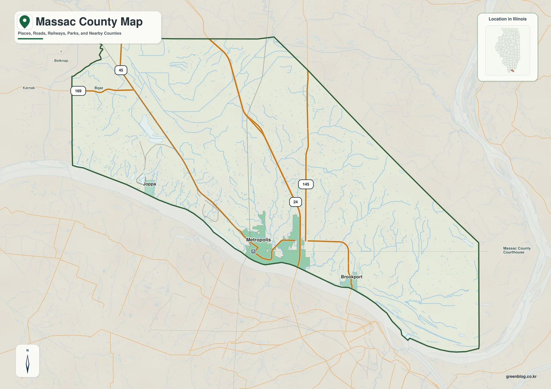
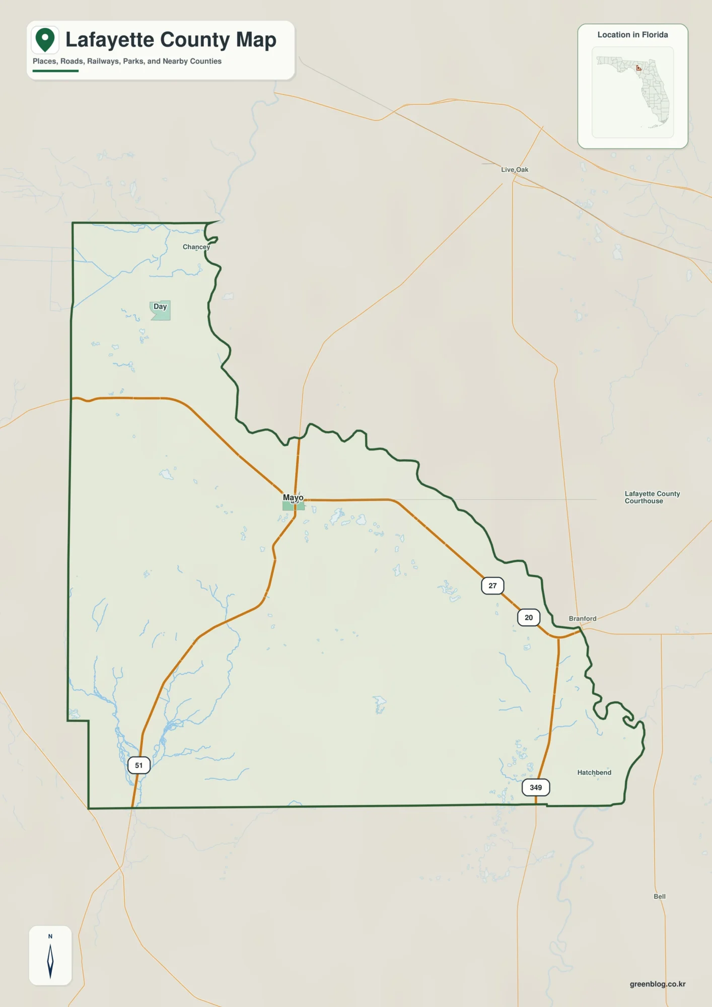
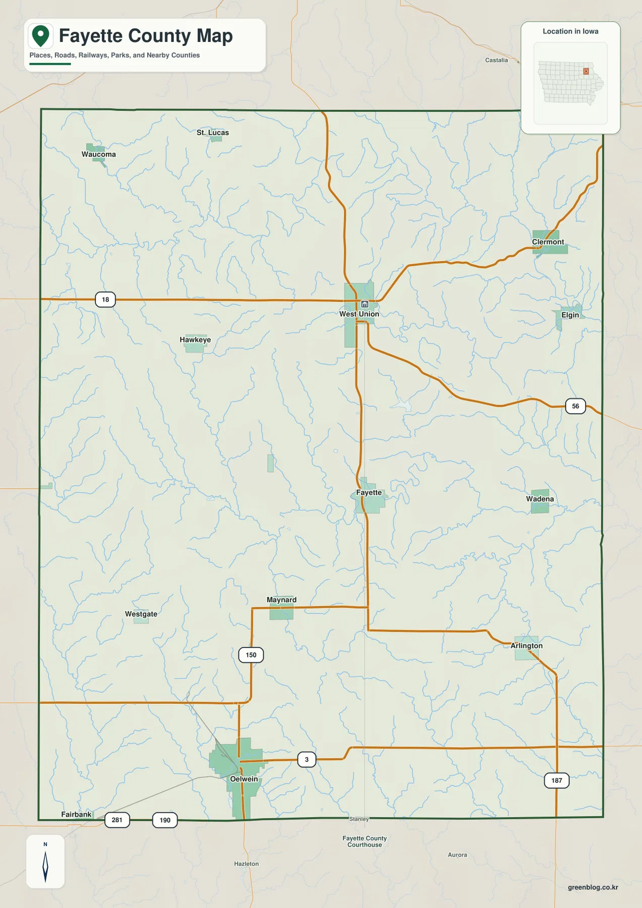
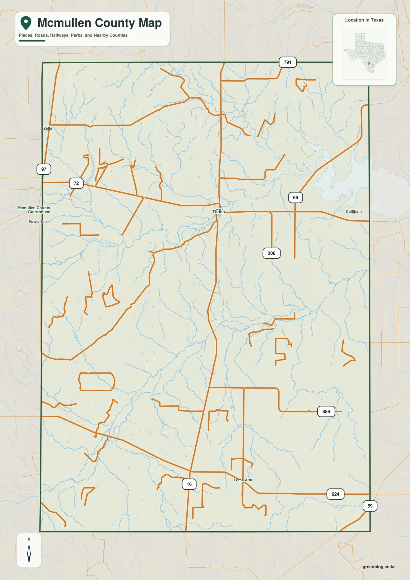
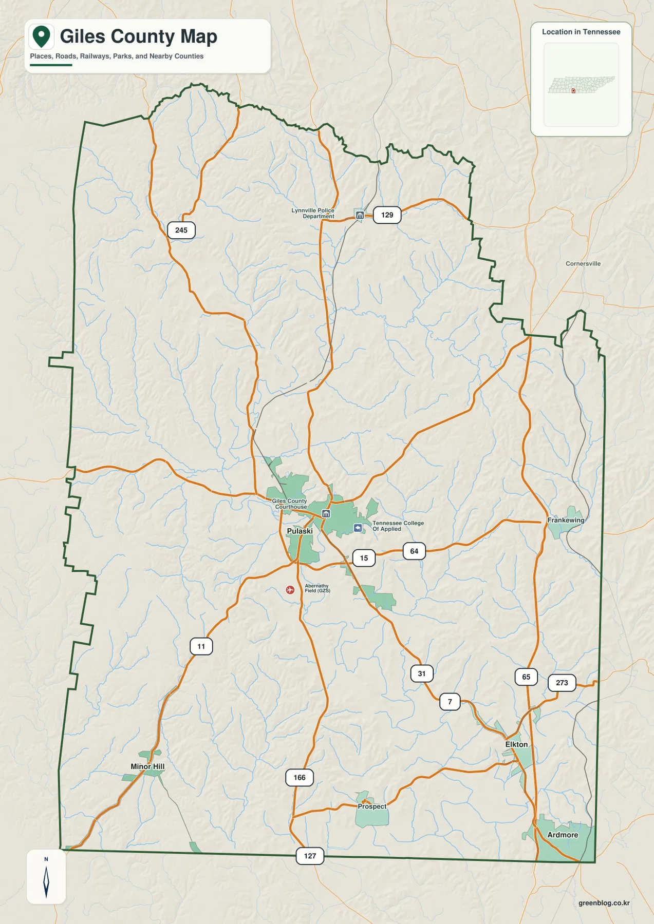
The base map shows Routes 15 and 64 near Pulaski, providing strong central references. South of Pulaski, Routes 31 and 7 continue toward the Elkton side, while Routes 65 and 273 serve the southeastern portion of the county. Routes 127 and 166 appear near the southern edge, and Route 11 provides a clear southwestern line toward Minor Hill.
In the north, Routes 245 and 129 help locate the Lynnville area. The map is easier to read if those roads are grouped by destination rather than memorized as a list: north from Pulaski toward Lynnville, southeast toward Elkton and Ardmore, and southwest toward Minor Hill. Pulaski works as the point where the directions can be reset because several routes meet near the center.
Smaller place names add detail to the road pattern. Frankewing appears close to the eastern county line near the Route 65 side, and Prospect provides a reference in the southern interior near Route 166. The central road network around Pulaski is more closely connected than many of the long outer links, especially in the southern and eastern parts of the county.
Clear Creek Lake, Richland Creek, and Elk River organize the drainage
Clear Creek Lake is the strongest named water reference in the northern-central part of the water map. Roberts Fork Creek continues north of the lake, while Sanders Lake sits farther west. Echo Lake and Abernathy Lake appear closer together in the central-western area, adding smaller water references between the northern tributaries and the Pulaski side of the county.
Richland Creek becomes a major reference through the central-southern area. Pigeon Roost Creek approaches from the northwest, while Buchanan Creek follows a separate lower corridor farther east. Bradshaw Creek lies close to the eastern county edge, showing that the interior and eastern drainages do not all follow the same line.
The southern half contains another useful set of features. West Fork Shoal Creek and East Fork Shoal Creek run through the southwest, Elk River is the boldest named water line near the southern boundary, and Lake Logan sits in the southeast. Instead of memorizing every tributary, it is usually enough to begin with Clear Creek Lake, Richland Creek, and Elk River and then add the smaller creek nearest the town or road being discussed.
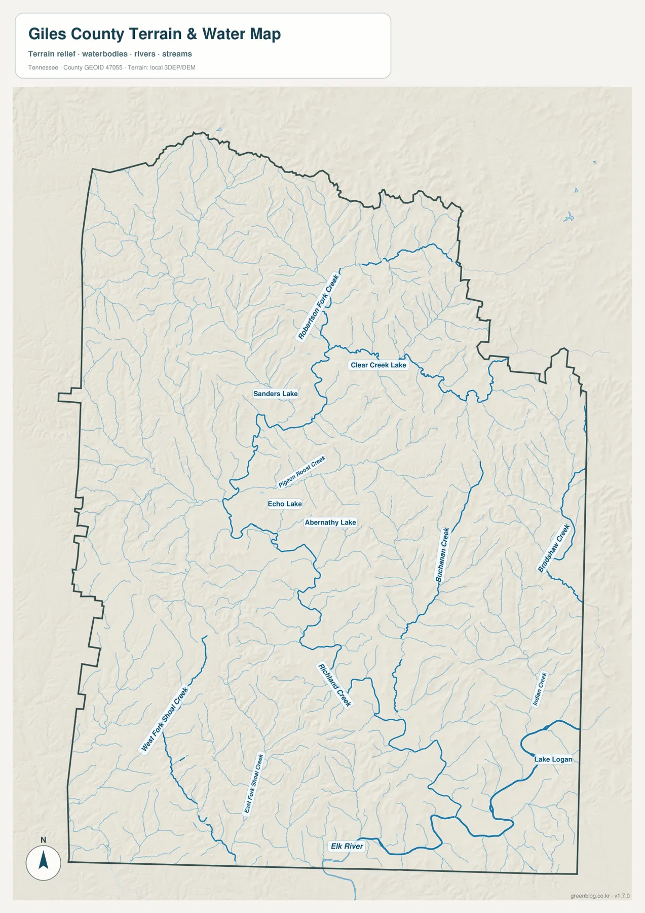
This water layer is designed for geographic reference. It does not establish current water levels, flood limits, navigable channels, or property boundaries. Its value here is showing where the larger creek valleys and lakes sit in relation to Pulaski, outer towns, roads, and the changing terrain.
A 155–354 m range separates broad valleys from tightly spaced ridges
The elevation map shows an actual range of about 155 to 354 meters, with a mean near 251 meters. Lower green corridors spread through much of the center and continue toward the south, while higher brown ridges are more closely packed in the northern half. Additional higher ground appears along parts of the western and eastern edges, giving the county a strongly dissected outline of ridges and drainage valleys.
The north is especially textured. Stream valleys cut through high ridges near the Lynnville side, creating narrow green corridors between brown slopes. That pattern helps explain why northern roads do not simply run as long straight lines across the county. The base map and elevation layer make more sense when those valleys and ridges are viewed together.
Central and southern Giles County contains broader lower areas, especially along the Richland Creek and southern drainage corridors. The southeast also includes substantial lower ground, although higher ridges return along the outer edges. The county therefore does not slope evenly in one direction; it alternates between broader valleys and narrow upland ridges from north to south.
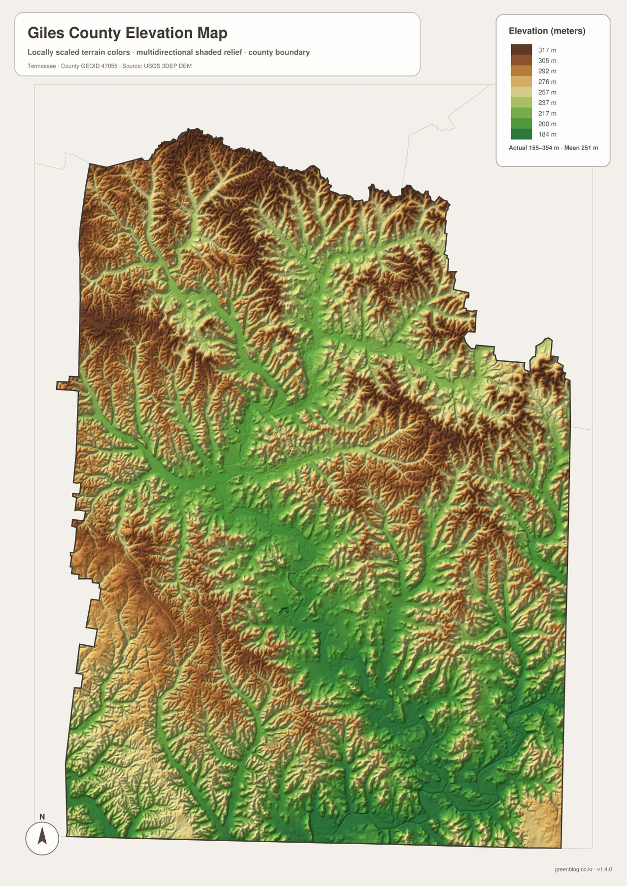
The elevation colors are intended for relative comparison across Giles County. They are not a survey-grade elevation record for a specific property, but they are useful for seeing how creek valleys line up with lower terrain and why roads often bend around steeper ridge sections.
From Pulaski to the southern state line, towns and valleys tell the same story
The city map establishes Pulaski as the center and places Lynnville to the north, Minor Hill to the southwest, and Elkton and Ardmore to the southeast. The base map adds the route network that links those places. The water map then shows how Richland Creek, the Shoal Creek branches, and Elk River occupy lower corridors between the higher ridges visible on the elevation layer.
Traveling north from Pulaski leads into more closely spaced ridge-and-valley terrain near Lynnville. Heading toward the southern state line reaches broader lower corridors, especially near the Richland and Elk River side, although uplands still reappear along the margins. The two directions are different not only in distance but also in the shape of the terrain and drainage network.
Choose the map that fits the question. The city map is the cleanest for the Pulaski-centered straight-line distances. The county map is better for routes and smaller place names, the water map is best for Clear Creek Lake, Richland Creek, and Elk River, and the elevation map makes the lower-valley versus higher-ridge pattern easiest to see.
Choosing and downloading the A3 JPG maps
The WebP images in the article are convenient for quick viewing, while the JPG originals in the ZIP are better for printing, enlargement, and offline reference. For a route-focused page, mark Pulaski and only the destination towns needed on the county map. Use the city map separately when the direct-distance comparison is more important than local roads.
For water-focused work, begin with Clear Creek Lake, Richland Creek, and Elk River, then add Roberts Fork Creek or the Shoal Creek branches only when they are relevant to the location being discussed. The elevation map is most useful in color because the lower valleys and higher ridges are distinguished by terrain shading. A3 output also leaves more room for the smaller creek names and route numbers than the web preview.
The downloadable ZIP contains the high-resolution A3 JPG originals for the county, city, water, and elevation maps shown on this page. They can be used for classroom comparison, presentations, route notes, regional study, or personal offline storage when a larger image is more useful than the browser preview.
Frequently Asked Questions
What do the Pulaski-to-city distance labels mean?
The city map uses straight-line distances, not driving mileage. Pulaski to Ardmore is shown at about 17 miles, Pulaski to Lynnville at about 13 miles, and Pulaski to both Minor Hill and Elkton at about 12 miles.
Where are Elk River and the main lakes and creeks on the map?
Elk River is the boldest named water line near the southern boundary. Clear Creek Lake and Roberts Fork Creek are in the northern-central area, Richland Creek runs through the central-southern part, the Shoal Creek branches are in the southwest, and Lake Logan is in the southeast.
Sources and reference data
County boundaries and general location can be compared with U.S. Census Bureau TIGER/Line. Local county reference material is available from the Tennessee State Library and Archives Giles County fact sheet, and current county water-monitoring locations can be checked through USGS Water Data for Giles County.
For broader hydrography reference, see USGS National Hydrography. Elevation data can be compared with the USGS 3D Elevation Program. The descriptions on this page are based on the towns, roads, water features, and elevation patterns visible in the supplied Giles County maps.
Map File Information
Download the high-resolution A3 JPG originals for the Giles County county, city, water, and elevation maps shown in this article.
- Included Files: County map, city map, water map, elevation map
- File Type: ZIP containing 4 JPG files
Related Maps
Green Map creates custom-edited map images using open geographic data sources such as geoBoundaries, Natural Earth, OpenStreetMap, and government open data. These maps are edited visual materials, not raw data files, and are provided for education, documents, presentations, and graphic reference.