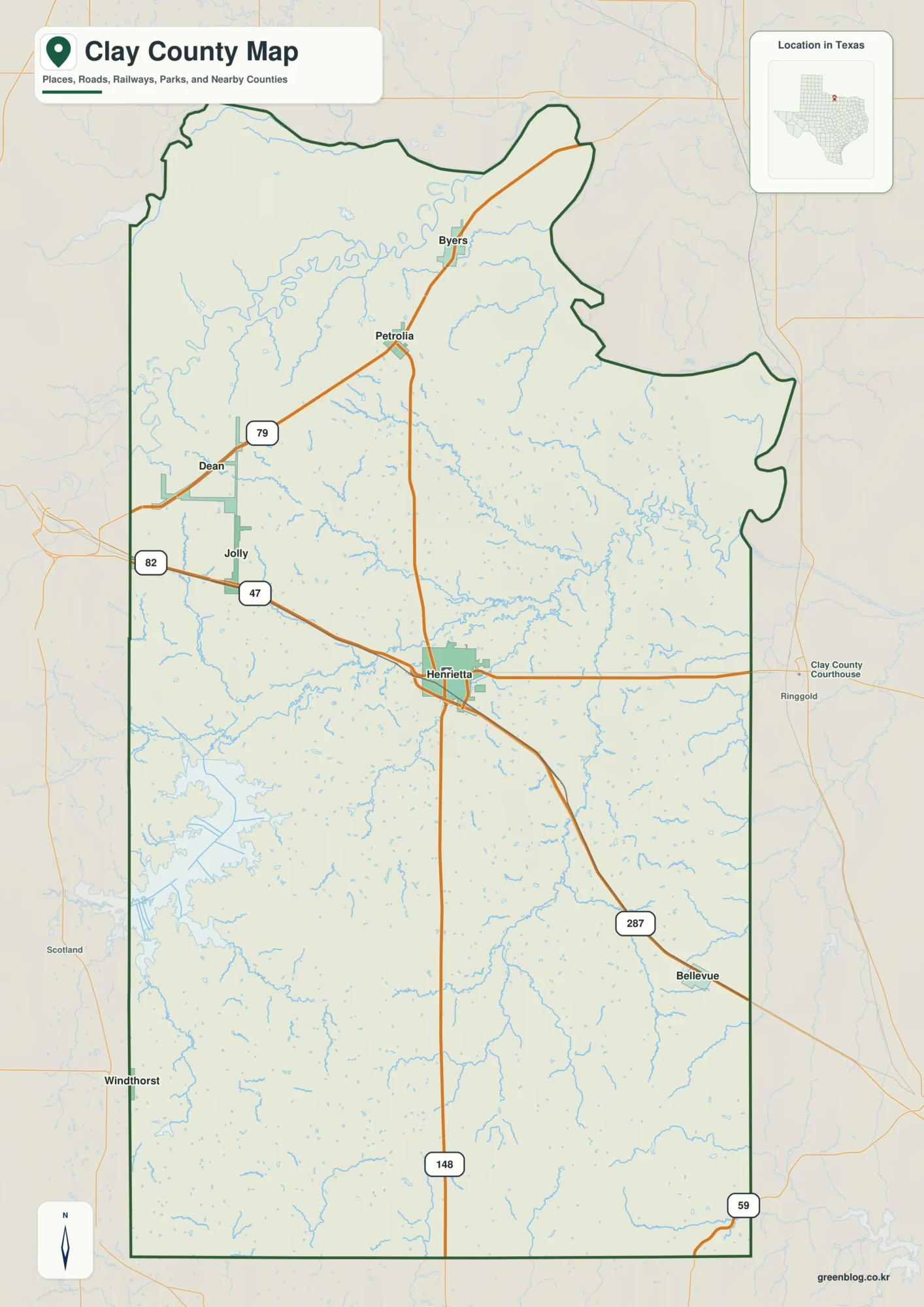
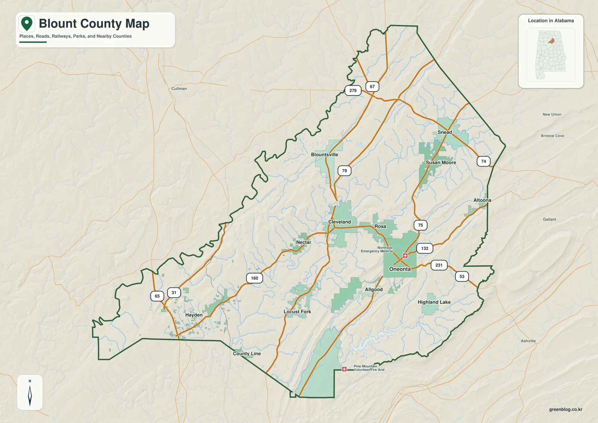
Anchorage Municipality combines a concentrated urban edge with a much larger mountain-and-water landscape. The supplied maps place Anchorage near the western side of the municipality, show Eklutna toward the north and Alyeska along the southern side, and then open eastward into a broad area with far fewer road and place labels. This Anchorage Municipality Map page includes a general county-equivalent map, a one-city index, and a terrain-and-water sheet. The same three subjects are also available as high-resolution JPG files in the downloadable ZIP near the end of the article.
The contrast between the built-up western side and the much larger interior is the main idea to keep in mind. On the general map, roads and named facilities cluster around Anchorage, while the eastern half of the boundary is dominated by open terrain. The water map adds another layer: Cook Inlet lies to the west, Turnagain Arm runs along the south, and rivers such as Eagle River, Eklutna River, Ship Creek, and Twentymile River cut through or emerge from the mountainous interior. Reading the three sheets together makes the municipality easier to understand than treating it as only a city map.
Table of Contents
Anchorage sits on the western edge while the municipality extends far into the mountains
Begin with the general map and locate the large Anchorage label near the western side of the outlined municipality. The greatest concentration of road and facility labels appears around that area. From Anchorage, the highlighted road corridor continues north toward Eklutna, which is labeled close to the upper boundary. Follow the same broad orientation south and Alyeska appears near the Turnagain Arm side of the municipality. Those three points create a useful north-to-south frame before the reader tries to interpret the much larger eastern interior.
The eastern portion of the boundary looks very different from the city edge. It covers a large block with relatively few road labels, and the terrain background suggests extensive mountainous country rather than a continuous urban street network. The municipality also reaches along a long southern edge beside Turnagain Arm. This shape explains why a close-up map of downtown Anchorage would give a very incomplete impression of the county-equivalent. The administrative outline includes far more than the dense western city area that most visitors associate with the name Anchorage.
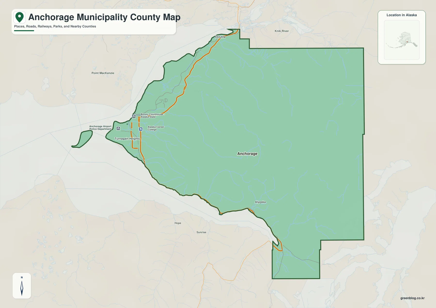
Several outside labels help with orientation but should not be mistaken for places inside the municipality. Point MacKenzie appears west of the boundary, Knik River is labeled near the north, and Hope and Sunrise are visible across the Turnagain Arm side. These surrounding names are useful because they show where Anchorage Municipality sits relative to neighboring parts of south-central Alaska. When the exact administrative extent matters, follow the dark green outline rather than assuming that every nearby place label belongs to the municipality.
The city index has one ranked city, making Anchorage the single reference point
The city sheet is deliberately simpler than the general map. Its CITY INDEX contains one major city: Anchorage, with a printed value of 288,976. That number is reported here only as the value shown on the supplied map; it has not been replaced with a separate population estimate from another source. A single number-one marker appears inside the municipality, so the sheet works primarily as a location reference for the dominant city rather than as a ranking of several municipalities or towns.
A one-city index does not mean the entire mapped area is urban. In fact, the same sheet shows extensive drainage lines across the eastern and southern interior, while the Anchorage marker sits well west of the geometric center of the outlined area. The general map also includes names such as Eklutna and Alyeska that are not repeated in the ranked city index. The difference comes from map purpose: the general sheet carries more reference labels, whereas the city sheet intentionally narrows attention to the selected major-city marker.
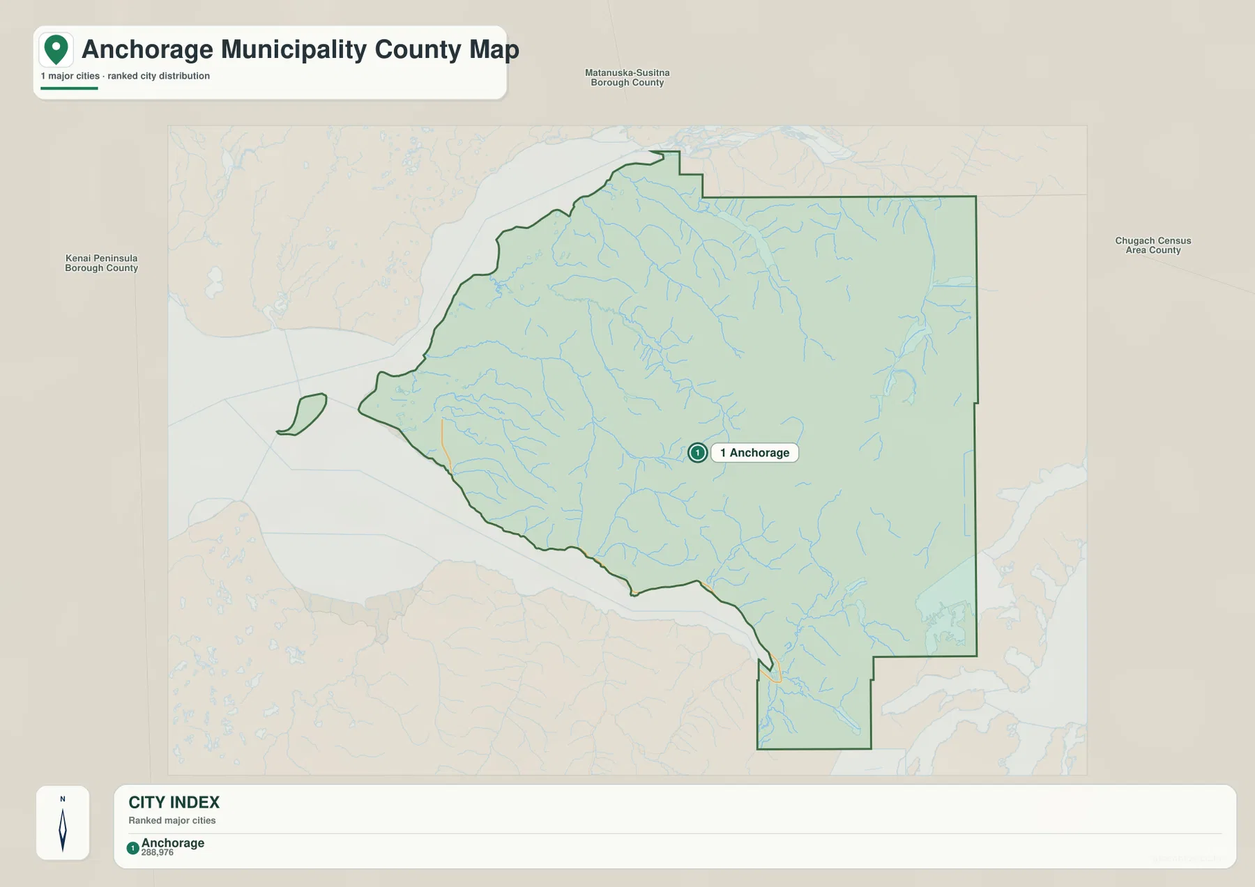
This makes the city map useful for a different question than the other two sheets. If you only need to show where the main urban center sits inside the municipality, the one-marker display is clean and easy to read. If you need Eklutna, Alyeska, nearby roads, or coastal orientation, the general map is more informative. If the goal is to explain why so much of the municipality remains visually open outside the city area, the terrain-and-water sheet provides the clearest answer.
Cook Inlet and Turnagain Arm frame the west and south, while rivers drain the mountain interior
The terrain-and-water map gives Anchorage Municipality its strongest geographic context. Cook Inlet fills the western side, while Turnagain Arm forms the long water corridor along the southern edge. Near the north, Eklutna River is labeled as it approaches the upper part of the municipality, and Knik River appears farther east and north. Eagle River and South Fork Eagle River run through the mountain terrain north and east of the main Anchorage area. Ship Creek is labeled closer to the city side, providing another connection between the interior drainage network and the western urban edge.
Farther south, Twentymile River stands out as it runs toward Turnagain Arm. The lower-right part of the map also labels surrounding coastal waters and inlets including Harriman Fiord, Passage Canal, Blackstone Bay, and Cochrane Bay. Some of these names sit at or beyond the municipal outline, so they are best used as regional reference points rather than treated as a list of features wholly contained inside Anchorage Municipality. Their value on this sheet is to show how the southern boundary connects to a deeply indented mountain coast.
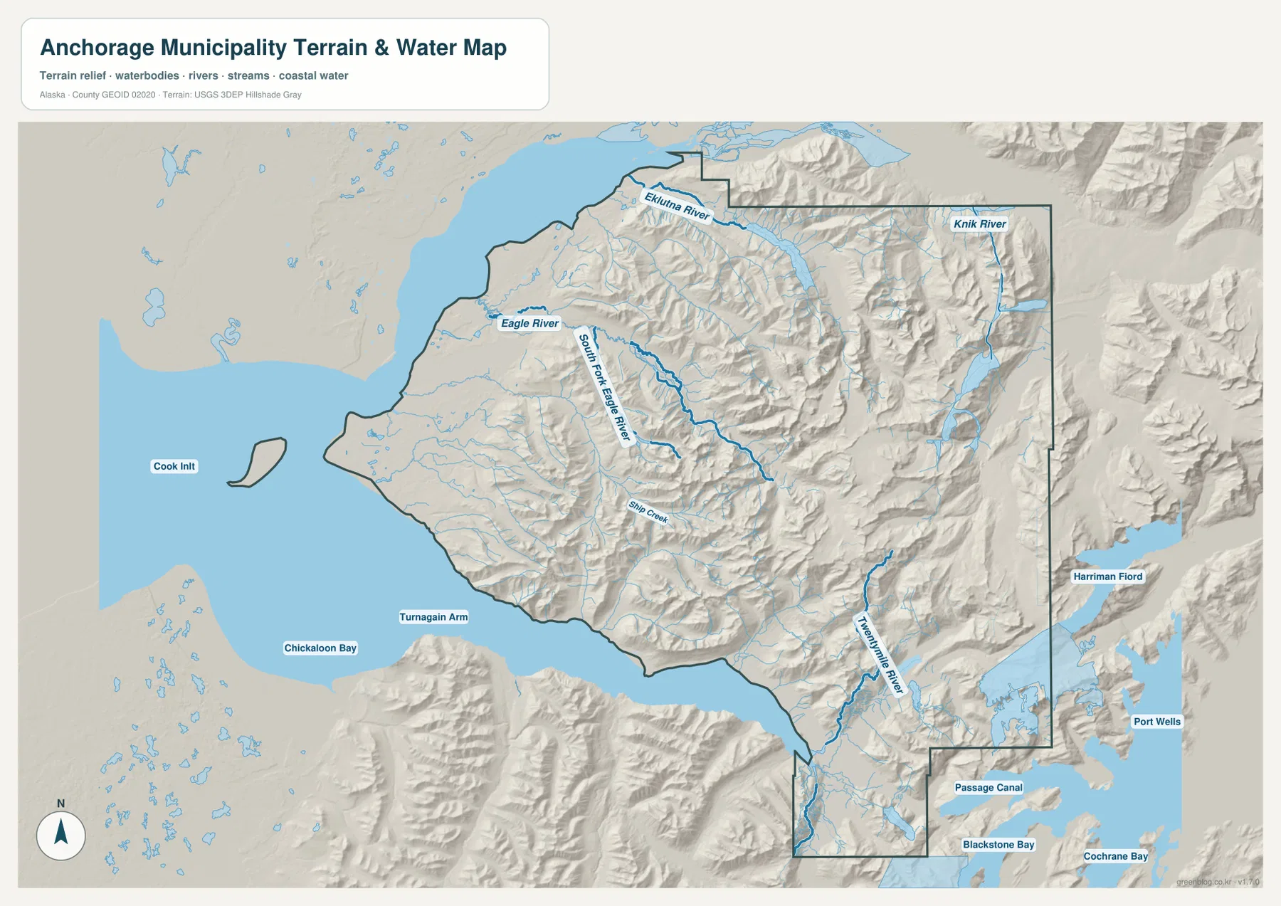
Shaded relief makes the eastern and southeastern interior look markedly rougher than the low, built-up western edge. Valleys and drainage lines cut through the mountains and lead toward the inlet or arm, which helps explain why the water labels are so useful for orientation. The relief is a broad visual aid, not a survey-grade elevation surface, and the water map is not a nautical chart. It contains no depth soundings, navigation markers, tide information, or current hazard notices, so marine or engineering decisions require the appropriate current official products.
A practical way to read the map is to anchor on Anchorage, then move north and south
For a first-time reader, Anchorage is the obvious starting point. It is the largest place label on the general map, the only ranked city on the city sheet, and the part of the municipality where the most visible road and facility labels gather. Once that western reference point is fixed, move north toward Eklutna and then south toward Alyeska. That simple sequence establishes the long north-south reach of the developed side before the reader turns attention to the much broader eastern mountains.
The next step is to switch to the water map and use large named waters as anchors. Cook Inlet explains the western edge, and Turnagain Arm provides a long, unmistakable southern line. Eklutna River and Knik River help orient the north, while Eagle River, South Fork Eagle River, and Ship Creek connect the mountain interior to the Anchorage side. This method is easier than trying to memorize every river at once because each name is tied to a direction and a visible piece of the larger landscape.
On the southern side, Alyeska and Turnagain Arm work as another paired reference. The general map places Alyeska near the coastal corridor, while the terrain-and-water sheet shows that the surrounding setting is strongly mountainous. Continue toward Twentymile River and the Passage Canal–Blackstone Bay side of the regional view and the difference between the western urban edge and the southeastern mountain coast becomes even clearer. Comparing the same area on two sheets is more useful here than asking one map to carry every road, place, river, and terrain detail at once.
Choose the sheet by the question you need the map to answer
Only the three map subjects listed in the manifest are used on this page. Each is most effective when matched to a specific task. The general map is the quickest choice for administrative outline, named places, and the visible road corridor. The city index is intentionally minimal and works well when the reader only needs to place Anchorage within the full boundary. The terrain-and-water sheet is the strongest option for explaining how the city edge relates to Cook Inlet, Turnagain Arm, mountain valleys, and the major named rivers.
- For boundary and place orientation: start with the general map to locate Anchorage, Eklutna, Alyeska, nearby roads, and the municipal outline.
- For the main city reference: use the city index when a clean one-marker view of Anchorage is more useful than a dense place map.
- For coast, rivers, and mountain terrain: use the terrain-and-water map to compare Cook Inlet, Turnagain Arm, Eagle River, Eklutna River, Ship Creek, Twentymile River, and the eastern relief.
A classroom or presentation sequence can begin with the general map, move to the city index to emphasize where Anchorage sits, and then use the terrain-and-water view to explain the much larger natural landscape inside the same boundary. The downloadable ZIP provides higher-resolution JPG versions for printing or offline reference. These maps are regional explanatory resources, not substitutes for legal boundary surveys, official navigation charts, or current hazard products.
Frequently Asked Questions
Why does the city map show only Anchorage?
The supplied CITY INDEX selects one major city and labels it Anchorage. The general map still includes other reference names such as Eklutna and Alyeska, but the ranked city sheet is not intended to repeat every place label. Its simpler purpose is to show the selected major-city marker inside the full municipal boundary.
Which map best shows Cook Inlet and Turnagain Arm?
The terrain-and-water sheet is the clearest choice. Cook Inlet fills the western side of the map and Turnagain Arm follows the south, while named rivers such as Eagle River, Eklutna River, Ship Creek, and Twentymile River are shown against shaded mountain relief. This makes the relationship between the urban edge, coast, rivers, and interior terrain much easier to see.
What is included in the downloadable ZIP?
The archive contains three high-resolution JPG files matching the subjects used in the article: the general county-equivalent map, the city index map, and the terrain-and-water map. It does not include an extra fourth map, a survey product, or a nautical chart. The larger files are intended for printing, offline viewing, classroom use, and presentations.
Sources and reference data
The article is based on the supplied Anchorage Municipality map package and the visible boundary, place, river, coastal, and terrain labels in those maps. The following federal sources provide official reference systems for U.S. boundary, hydrography, and elevation data.
Map File Information
Anchorage Municipality Map Files
- Included Files: 3 high-resolution JPG images
Related Maps
Green Map creates custom-edited map images using open geographic data sources such as geoBoundaries, Natural Earth, OpenStreetMap, and government open data.
These maps are edited visual materials, not raw data files, and are provided for education, documents, presentations, and graphic reference.