The Croatia Map collection brings the country’s inland counties, long Adriatic frontage, and island-dotted coast into one readable landscape layout. Three versions are included: a color administrative map, a labeled black-and-white map, and an unlabeled outline map with internal boundaries. Together, they provide different starting points for geographic reference, classroom activities, travel-route planning, presentations, and custom data graphics.
Croatia is unusually challenging to fit on a single page. Its territory curves from the Pannonian plains in the northeast through the Zagreb area and then follows the coast south toward Dubrovnik. Istria projects into the northern Adriatic, while chains of islands run beside the mainland for much of the coastal section. The maps retain this recognizable shape while leaving enough open water around the islands to keep them distinct.
The collection is organized for A3 output. The on-page previews may appear smaller or more compressed than the original downloadable images, so the archive is the better choice when coastlines, county boundaries, or labels need to remain clear in a printed handout.
Table of Contents
Croatia Map at a Glance
- Official name: Republic of Croatia
- Capital: Zagreb
- Location: Central and Southeast Europe, on the eastern side of the Adriatic Sea
- Area: Approximately 56,594 square kilometers
- First-level divisions shown: 20 counties and the City of Zagreb
- Land neighbors: Slovenia, Hungary, Serbia, Bosnia and Herzegovina, and Montenegro
- Other visible context: Italy and the Adriatic Sea
- Map versions: Color, labeled black-and-white, and outline
- Print layout: A3 landscape
Reading Croatia’s Curved Territory
A Croatia Map makes more sense when it is read as a connection between three broad settings rather than as a compact block of land. Northern and eastern Croatia extend toward Slovenia, Hungary, and Serbia, where the counties form a wider inland zone. The central section narrows through mountainous terrain, and the southern section follows the Adriatic in a long coastal band.
The Istrian Peninsula creates the large western projection near Slovenia and Italy. Farther south, the coast passes the areas around Zadar, Šibenik, Split, and Dubrovnik, with islands positioned between the mainland and the open Adriatic. Krk, Cres, Brač, Hvar, and Korčula are among the better-known islands, but Croatia also has more than a thousand islands, islets, and reefs. A national map must simplify the smallest features without erasing the island pattern that defines the coast.
The far south needs particular attention. The Neum corridor of Bosnia and Herzegovina reaches the Adriatic and separates the Dubrovnik area territorially from the rest of Croatia’s mainland. Dubrovnik-Neretva County therefore appears beyond a short interruption in the national land border. Showing Bosnia and Herzegovina and Montenegro around it prevents this real border arrangement from looking like a drawing error.
Counties, Zagreb, and Regional Orientation
Croatia’s first-level administrative structure consists of 20 counties plus the City of Zagreb, which has county-level status. The capital should not be confused with Zagreb County: the City of Zagreb is a separate unit enclosed by the surrounding county on several sides. On the labeled maps, a star locates the capital and helps readers identify this compact administrative relationship.
County shapes vary greatly across the page. Međimurje, Varaždin, and Krapina-Zagorje occupy relatively small areas in the north, while Osijek-Baranja and Vukovar-Syrmia extend across the east. Along the Adriatic side, Istria, Primorje-Gorski Kotar, Lika-Senj, Zadar, Šibenik-Knin, Split-Dalmatia, and Dubrovnik-Neretva follow a much longer and more fragmented visual pattern. Color and leader lines are especially helpful where narrow coastal territory, islands, and short labels compete for space.
Neighbor labels add another layer of orientation. Slovenia lies to the northwest, Hungary to the north, Serbia to the east, and Bosnia and Herzegovina occupies much of the inner side of Croatia’s curved shape. Montenegro borders the far southeast, while Italy is shown across the Adriatic rather than as a land neighbor.
Color-Coded Counties and Coastal Regions
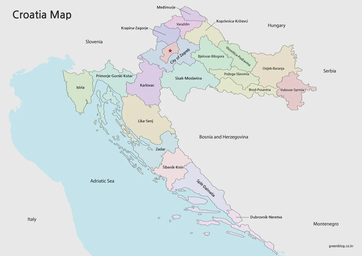
The color Croatia Map separates adjacent administrative units with soft contrasting fills. This treatment makes the cluster of smaller northern counties easier to distinguish and lets the eye follow the sequence of coastal counties from Istria toward Dubrovnik-Neretva. The City of Zagreb has its own fill and a capital marker, so it remains visible inside the more complex northwestern area.
The sea uses a pale blue background, while neighboring countries remain neutral. That contrast keeps the islands readable without allowing them to compete with county colors. Choose this version for presentation slides, country profiles, or lessons comparing inland Croatia with the Adriatic counties.
Labeled Black-and-White Reference Map
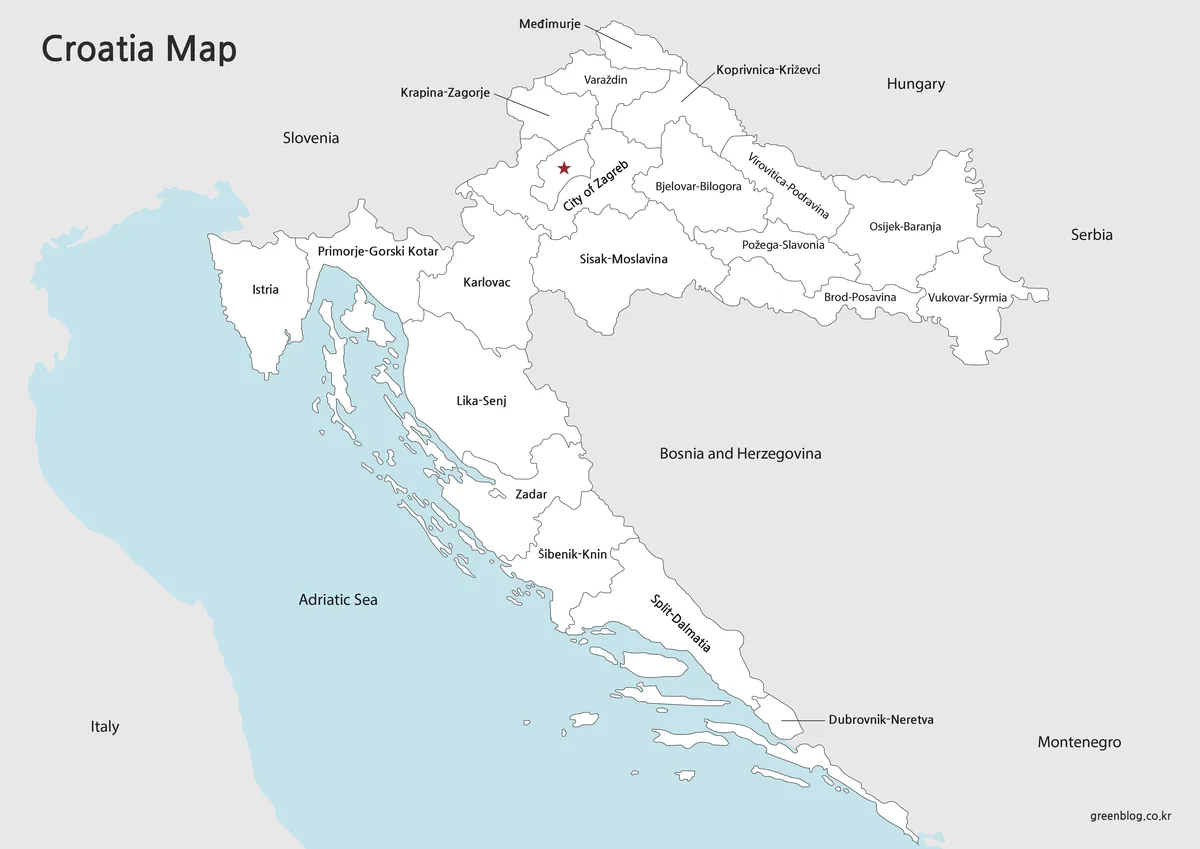
The labeled Croatia Map removes the county fills but retains boundaries, names, the Zagreb marker, surrounding countries, and the Adriatic Sea. With less color competition, it is easier to concentrate on spelling and relative position. Leader lines guide several northern and southern labels into open areas rather than squeezing them into narrow county shapes.
This version suits monochrome documents, study sheets, and travel notes in which readers need place names before adding their own marks. The light-blue sea still separates water from land, which is important along Dalmatia where many islands sit close to the mainland.
Outline Base with Islands and Internal Boundaries
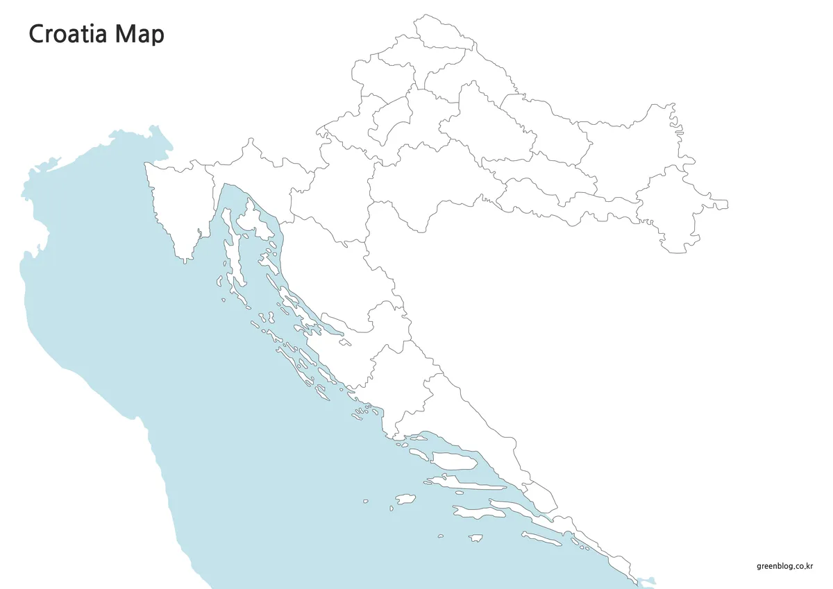
The outline Croatia Map removes place names, the capital symbol, and county colors while preserving the national coastline, internal divisions, and major islands. It can serve as a labeling exercise, a county-coloring activity, or a clean background for data placed by the reader. Students might identify the City of Zagreb and the coastal counties, while travelers could add Rijeka, Zadar, Split, Dubrovnik, ferry routes, or a sequence of overnight stops.
For infographic work, the blank areas can hold regional statistics without covering printed labels. Because the islands remain separate from the mainland, users can also build a coastal comparison rather than treating the Adriatic side as one continuous land strip. The supplied image is a raster map, so it should not be described as a vector or source drawing.
Choosing the Most Suitable Version
Use the color Croatia Map when immediate county separation is more important than writing space. Select the labeled black-and-white version when names and borders must remain visible in a restrained worksheet or report. Start with the outline when the reader will supply the labels, categories, routes, or colors.
The A3 landscape arrangement is particularly helpful for Croatia because a portrait layout would either shrink the northern counties or compress the long Dalmatian coast. When printing at a smaller paper size, check the northern labels and the Dubrovnik-Neretva callout first. For slides, keep the map wide enough that small islands do not merge visually into the mainland.
Practical Ways to Use the Maps
A geography lesson can compare the compact counties around Zagreb with the elongated coastal pattern and the wider eastern counties. Another activity can ask students to identify which countries touch Croatia by land and why Italy appears on the page without sharing a land border.
For travel planning, the labeled Croatia Map provides a regional frame for a route from Istria through Zadar and Split to Dubrovnik. The outline version can carry ferry connections, ports, national parks, or visitor totals by coastal county. Designers can use the color edition as a ready reference, then use the blank edition for a simplified regional chart that separates inland, mountain, peninsula, island, and southern coastal areas.
Frequently Asked Questions
Does the Croatia Map show all 20 counties and the City of Zagreb?
Yes. The administrative boundaries represent Croatia’s 20 counties and the separate county-level City of Zagreb. The labeled versions identify the divisions, although compact areas use careful label placement or leader lines. The capital is marked with a star so it can be distinguished from the surrounding Zagreb County.
Are all Croatian islands included?
No national A3 map can show every small island, islet, and reef at equal detail. The layout preserves the major visible islands and the overall offshore chain so readers can understand the character of the Adriatic coast without allowing tiny features to overwhelm county boundaries and labels.
Why does the Dubrovnik area look separated from the rest of the country?
Bosnia and Herzegovina reaches the Adriatic at Neum, creating a territorial break between most of Croatia and its far south. Dubrovnik-Neretva County therefore appears beyond this corridor. The surrounding country labels help readers recognize that the gap reflects the international border rather than a missing part of the drawing.
Which version is best for a classroom labeling activity?
Choose the outline Croatia Map when students need to add county names, Zagreb, neighboring countries, or coastal cities themselves. Use the black-and-white map as an answer reference or for an activity that begins with labels already supplied. The color version is better for introducing the administrative pattern on a screen.
Can the files be used for route or statistics graphics?
Yes. The outline offers the cleanest base for adding city markers, ferry or driving routes, county-level values, and regional color groups. The labeled version is preferable when the finished graphic must retain geographic names. Since the files are image resources, additions can be made in a compatible image or presentation editor.
Map File Information
This collection provides three Croatia map images for printing, study, presentations, route notes, and custom regional graphics.
- Included Versions: Color map, labeled black-and-white map, and outline map
- Printable Size: A3 landscape
- File Type: Image files
- Intended Use: Classroom reference, presentations, travel planning, annotation, and infographic projects
Related Maps
- Slovenia Map A3 Printable Reference
- Italy Map with Regions and Outline Version
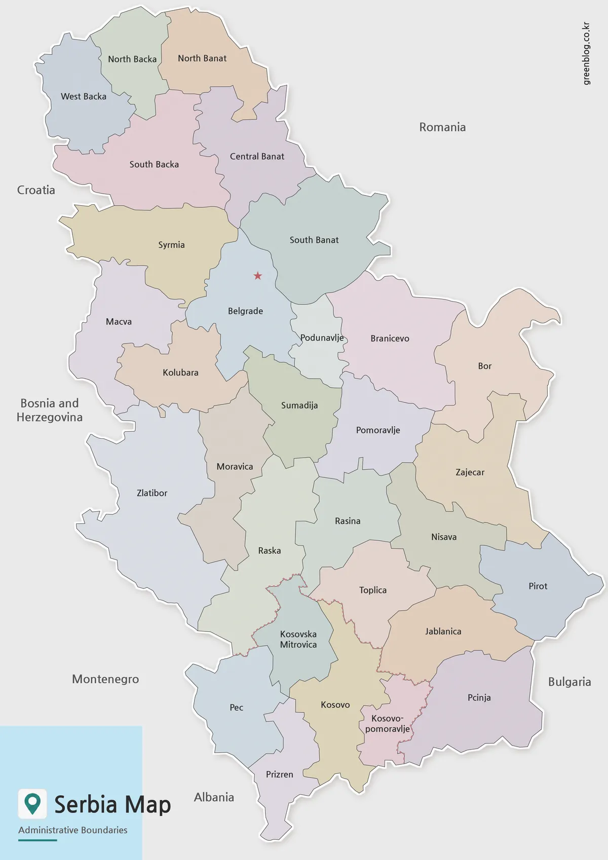
- Serbia Map with Color, Basic, and Outline Versions
- Montenegro Map for Adriatic Coast Reference
Additional Resources
- Croatia.eu: Geography and Population: Explore an official overview of Croatia’s landforms, regional position, population, coastline, and islands.
Green Map creates custom-edited map images using open geographic data sources such as geoBoundaries, Natural Earth, OpenStreetMap, and government open data.
These maps are edited visual materials, not raw data files, and are provided for education, documents, presentations, and graphic reference.