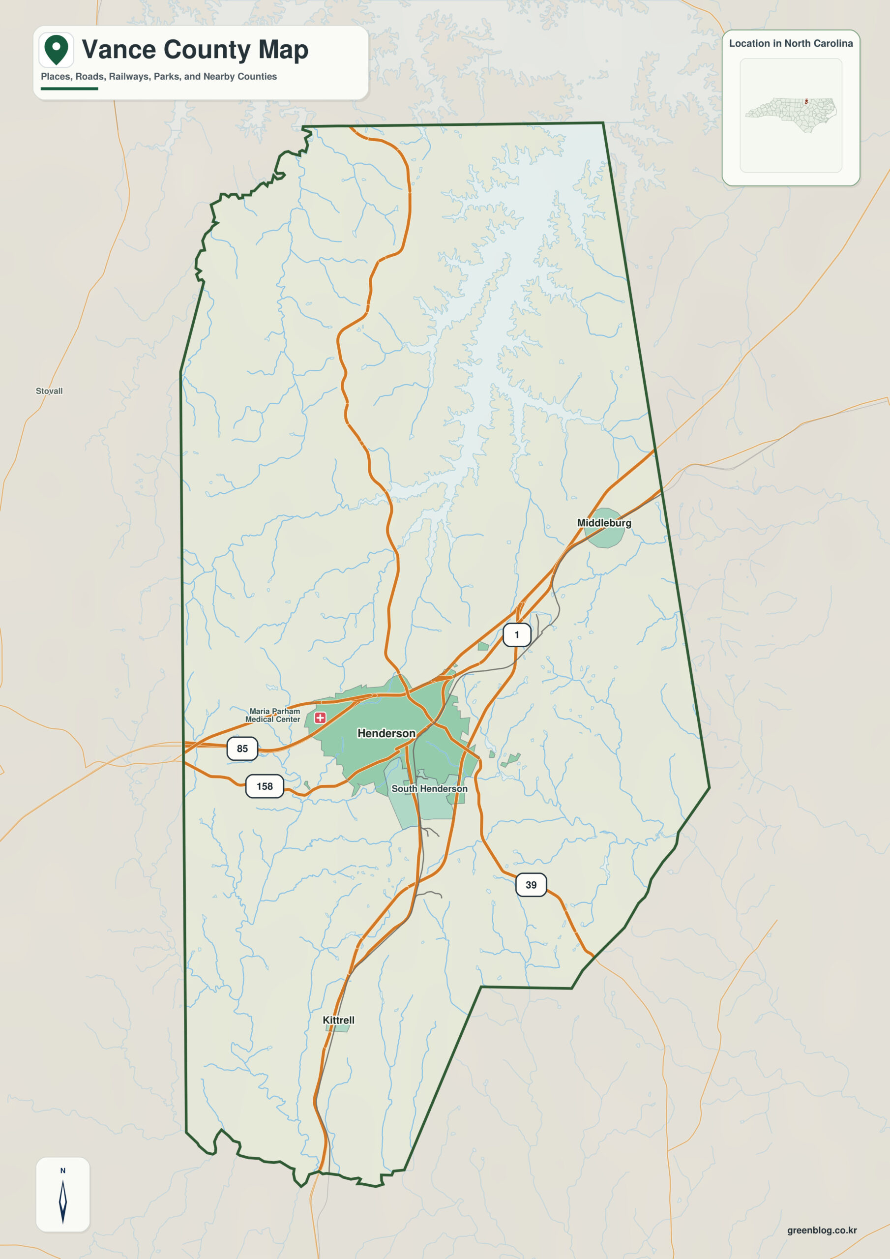
Vance County North Carolina map is best read as a compact Piedmont county centered on Henderson, with Kerr Lake to the northeast and smaller rural communities around Kittrell and Middleburg. Henderson, Kittrell, and Kerr Lake should be treated as separate orientation anchors rather than one center-and-suburb hierarchy.
Use Henderson as the administrative reference, then keep Kittrell and Middleburg as separate settlement anchors. Reading those places against Kerr Lake and Roanoke basin makes it easier to distinguish functional geography from the county boundary itself.
Vance County quick facts
- County seat: Henderson
- North Carolina setting: north-central Piedmont
- Place references: Henderson, Kittrell, Middleburg
- Physical references: Kerr Lake, Roanoke basin, Tar-Pamlico basin
- Neighboring counties: Franklin, Granville, Warren
Henderson versus the Kerr Lake side
Henderson is the dominant administrative and commercial center, while Kittrell and Middleburg provide southern and northern rural references.
Two river basins in a compact county
Vance spans both the Roanoke and Tar-Pamlico basins, with Kerr Lake forming the strongest northeastern water reference. The lake side differs clearly from the Franklin-facing south.
North and south rural directions
Vance was formed in 1881 from Granville, Warren, and Franklin Counties. Its compact area still contains a clear contrast between the Henderson urban center and Kerr Lake recreation/water-resource geography.
Henderson works as the administrative reference, while Kittrell provides a second settlement perspective. Keeping Kerr Lake and Roanoke basin as physical references prevents municipal information and landscape information from being treated as the same thing.
Using city, lake, and basin together
For Vance, use Henderson for the urban core, Kerr Lake for the northeastern water zone, and Kittrell/Middleburg for southern and northern rural references. Keep the two river-basin contexts as a separate physical layer.
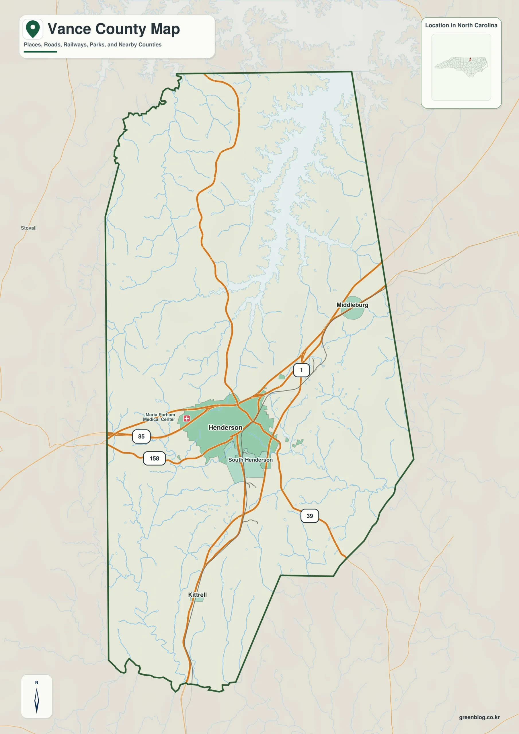
Vance County single map file
The image above is a web preview; the button is reserved for the separate original map asset.
Download the Vance County map fileFrequently Asked Questions
How does Kerr Lake connect physical geography with the named communities?
Kerr Lake is used as a physical anchor rather than a decorative label. Read alongside Henderson, Kittrell, and Middleburg, it helps separate settlement geography from the county’s natural structure.
How does Kittrell improve orientation away from the county seat?
Henderson carries the county-seat role, while Kittrell is useful as a separate settlement or functional-area reference. Keeping both visible makes the county less dependent on a single administrative center.
Sources
Related County Maps
Green Map creates custom-edited map images using open geographic data sources such as geoBoundaries, Natural Earth, OpenStreetMap, and government open data.
These maps are edited visual materials, not raw data files, and are provided for education, documents, presentations, and graphic reference.