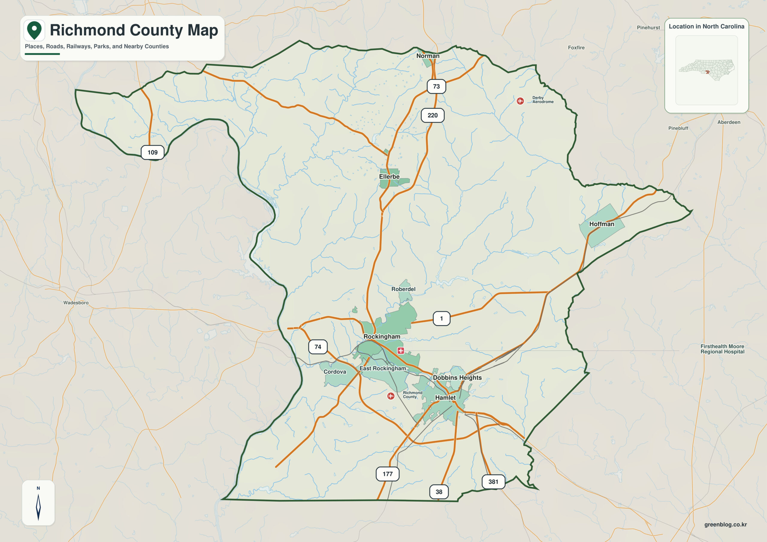
Richmond County North Carolina map has a paired Rockingham–Hamlet urban core rather than one dominant city. Ellerbe adds a northern rural reference, and the Pee Dee/Blewett Falls system fixes the western edge of the Sandhills county.
Keep urban or administrative information around Rockingham separate from physical information around Pee Dee River. Hamlet and Ellerbe then work as intermediate anchors that show how the rest of the county differs from the center.
Richmond County quick facts
- County seat: Rockingham
- North Carolina setting: Sandhills / Pee Dee border
- Place references: Rockingham, Hamlet, Ellerbe
- Physical references: Pee Dee River, Sandhills, Blewett Falls Lake
- Neighboring counties: Anson, Moore, Montgomery, Scotland
Rockingham and Hamlet form a two-city core
Rockingham is the county seat and Hamlet is a separate southeastern railroad city nearby. Ellerbe provides a northern rural reference beyond the two-city core.
Pee Dee and Blewett Falls define the west
The Pee Dee River and Blewett Falls Lake define the western side toward Anson, while Sandhills terrain continues toward Moore and Scotland on the other sides.
Urban and rural Sandhills zones
Richmond was formed from Anson County in 1779. Rockingham and Hamlet developed through different industrial and transportation histories, so they should remain separate map anchors.
Placing Hamlet and Ellerbe beside Rockingham makes the outer county visible rather than leaving the seat to represent every local condition. Pee Dee River adds the physical frame needed to interpret those settlement differences at county scale.
Reading railroad city and river boundary together
Treat Rockingham and Hamlet as a paired southern urban core while preserving their different roles. Ellerbe works as the northern rural anchor and the Pee Dee as the western physical edge, giving industrial, rail, lake, and agricultural information distinct locations.
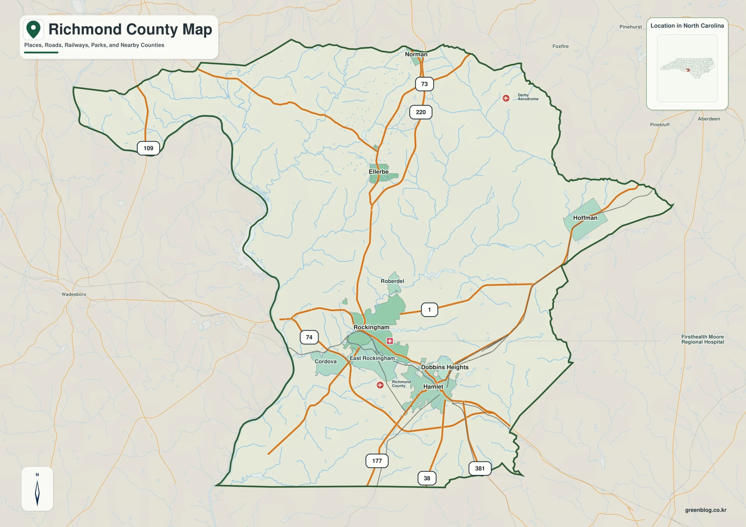
Richmond County single map file
The image above is a web preview; the button is reserved for the separate original map asset.
Download the Richmond County map fileFrequently Asked Questions
What does Pee Dee River reveal that town labels alone do not?
Keeping Pee Dee River visible gives the map a stable non-municipal reference. With Sandhills, it makes the outer county easier to interpret without assuming that every area behaves like Rockingham.
What becomes clearer when Hamlet is kept separate from Rockingham?
Treating Hamlet as only a minor label under Rockingham would hide part of the county’s internal geography. The map keeps them separate so different local functions and directions remain visible.
Sources
Related County Maps
Green Map creates custom-edited map images using open geographic data sources such as geoBoundaries, Natural Earth, OpenStreetMap, and government open data.
These maps are edited visual materials, not raw data files, and are provided for education, documents, presentations, and graphic reference.