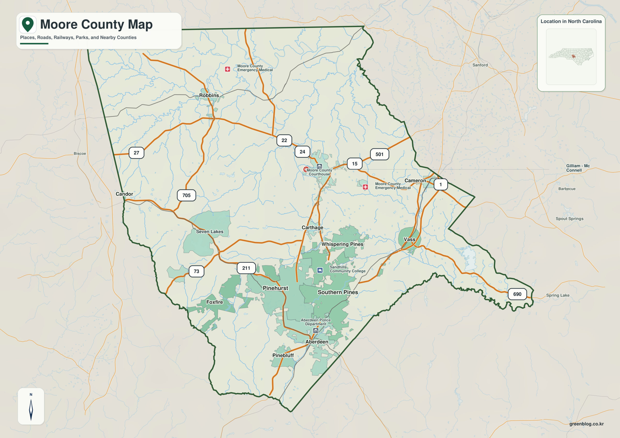
Moore County North Carolina map is best read as a Sandhills county where Carthage is the seat but Pinehurst and Southern Pines create the stronger resort and urban corridor. Carthage alone does not explain the county; Pinehurst and Sandhills provide equally important orientation.
Carthage, Pinehurst, and Southern Pines do not need to perform the same map role. When Sandhills and Drowning Creek basin are treated as a second, physical layer, settlement pattern and natural geography remain clearly separated.
Moore County quick facts
- County seat: Carthage
- North Carolina setting: Sandhills / Piedmont-Coastal Plain transition
- Place references: Carthage, Pinehurst, Southern Pines
- Physical references: Sandhills, Drowning Creek basin, Pinehurst resort landscape
- Neighboring counties: Chatham, Cumberland, Harnett, Lee, Montgomery, Randolph, Richmond
The county seat is not the functional center
Carthage is the administrative center, but Pinehurst and Southern Pines form the stronger southern resort and service corridor. Treating all three as equivalent town labels would hide the functional geography of Moore County.
Pinehurst and Southern Pines versus the rural north
Northern Moore remains more rural around places such as Robbins and Cameron, while the Pinehurst–Southern Pines–Aberdeen side concentrates resort, retirement, health, and service activity. Sandhills terrain is shared, but land use is not.
How resort geography changed the Sandhills
NCpedia highlights tourism and recreation centered on Pinehurst and Southern Pines. County census data also show those communities are much larger than Carthage, reinforcing the distinction between seat and functional center.
This county is clearer when settlement references (Carthage, Pinehurst, Southern Pines) and physical references (Sandhills, Drowning Creek basin) remain separate. The distinction improves both geographic interpretation and later use of demographic, transport, or recreation layers.
Comparing tourism, retirement, and rural zones
Moore County is especially useful for comparing the formal seat with the county’s larger resort-oriented functional center. Golf, retirement, health care, and rural land can then be layered without collapsing everything into one city hierarchy.
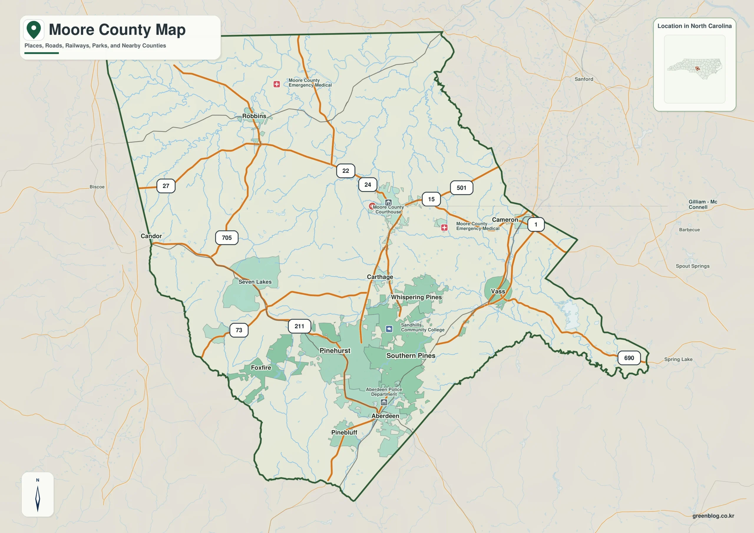
Moore County single map file
The image above is a web preview; the button is reserved for the separate original map asset.
Download the Moore County map fileFrequently Asked Questions
How does Sandhills help explain the county's internal direction?
The value of Sandhills is that it explains physical orientation while the named communities explain settlement. Using both layers together produces a more accurate county-scale reading.
How does Pinehurst help separate the county seat from another local corridor?
Carthage and Pinehurst do not need to have the same administrative status to be equally useful for orientation. One marks the seat; the other helps represent a different part of the county.
Sources
Related County Maps
Green Map creates custom-edited map images using open geographic data sources such as geoBoundaries, Natural Earth, OpenStreetMap, and government open data.
These maps are edited visual materials, not raw data files, and are provided for education, documents, presentations, and graphic reference.