Few Texas counties combine a very small land area, a major reservoir edge, and rapid suburban growth as clearly as Rockwall County. This Rockwall County Texas map places the county east of Dallas and shows how Rockwall, Fate, Heath, and Royse City fit between Lake Ray Hubbard and the Hunt County line. Three map styles are provided for regional reference, printing, and custom labeling.
The county had an estimated 137,044 residents in 2024, up from 109,202 in 2020. That gain of 27,842 people, or about 25.5 percent, occurred within only 127.21 square miles of land. Water covers another 21.72 square miles, so the lake is not a minor background feature; it is a major part of the county’s western shape and local identity.
Table of Contents
A compact county shaped by a reservoir
Lake Ray Hubbard forms much of Rockwall County’s western reference edge and separates the county from Dallas County. Rockwall sits near the center-west side of the county, while Heath occupies the southwest lakeside area. Fate extends east of Rockwall, and Royse City reaches across the eastern county line into Hunt County.
This layout makes the county feel different from a broad rural county with widely separated towns. Communities are close enough to share major roads, schools, shopping areas, and commuting patterns, yet the reservoir and county lines still create distinct geographic breaks. Collin County lies to the north, Kaufman County to the south, Hunt County to the east, and Dallas County to the west.
The I-30 corridor and regional movement
Interstate 30 crosses Lake Ray Hubbard from the Dallas side, enters Rockwall, continues through Fate, and runs toward the Hunt County line. The corridor is the county’s clearest east-west transportation spine, linking local neighborhoods with employment and services across the Dallas-Fort Worth region. TxDOT’s expansion work along this route also reflects the pressure created by sustained population and traffic growth.
For map users, I-30 provides a practical way to understand the settlement pattern even when the road itself is added later as a custom annotation. Rockwall developed as the county seat near the lake crossing, Fate expanded along the eastern approach, and Royse City anchors the transition toward Hunt County. Heath and McLendon-Chisholm sit south of the main interstate corridor and represent a different, more residential side of the county.
Population growth in a limited footprint
Between 2020 and 2024, Rockwall County’s estimated population grew by more than one quarter. Because the county’s land footprint is small, new subdivisions and commercial areas can quickly change the visual relationship between neighboring communities. A Rockwall County Texas map is therefore useful not only for locating the county, but also for separating city names, county limits, and the lake boundary in an increasingly continuous suburban landscape.
The water share is approximately 14.6 percent of the county’s total mapped area. Removing the reservoir from the land calculation makes the concentration of residents and development even more apparent. This is one reason Rockwall County often appears geographically tiny on a statewide map while functioning as a densely connected part of the eastern Dallas metropolitan area.
How the county was formed
The area passed through several county jurisdictions during the nineteenth century. It was associated with Nacogdoches County, later Henderson County, and then Kaufman County. Residents considered the Kaufman county seat inconveniently distant, and Rockwall County was created in 1873 as a separate local government.
That history helps explain why the county is unusually small by Texas standards. Its boundaries were designed around a compact local service area rather than a vast stretch of open territory. Rockwall became the administrative center, while later growth produced a network of neighboring municipalities with strong connections to Dallas and the lake.
Color Map
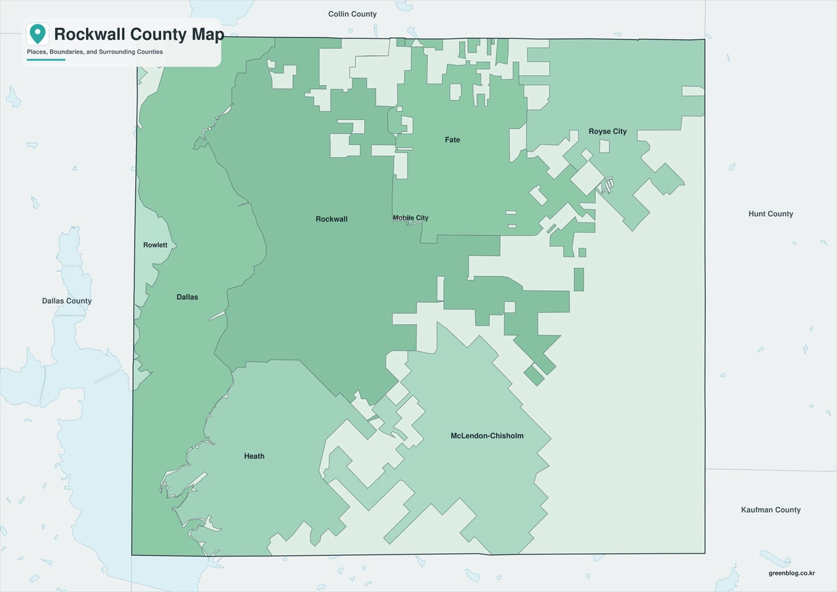
The color version separates Rockwall County from Dallas, Collin, Hunt, and Kaufman counties so its compact outline remains easy to identify. Rockwall and Heath appear near the Lake Ray Hubbard side, while Fate and Royse City establish the eastward sequence toward Hunt County. The reservoir provides a broad western geographic reference, and the community colors help prevent closely spaced local boundaries from blending together.
Black-and-White Map
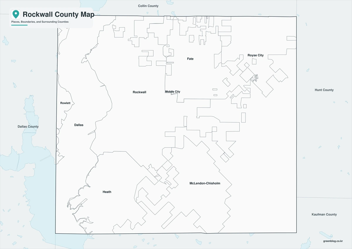
In the monochrome version, Rockwall and Royse City remain readable through labels and boundary lines even after color fills are removed. The lake-facing western edge can still be compared with the straighter eastern transition toward Hunt County. This format works well when color printing is unavailable or when the map must sit beside text, tables, or grayscale graphics.
Outline Map
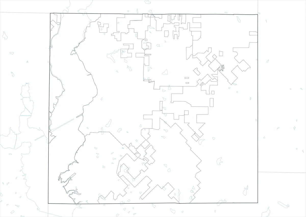
The outline file removes place labels and colored areas, leaving the county boundary and included internal linework. Users can add the county seat, mark Fate and Heath, trace the I-30 direction, or label Lake Ray Hubbard without competing with preprinted text. It is also suitable for showing commuting routes, school service areas, or growth zones as separate overlays.
Download the printable county maps
The three A3 JPG versions support different tasks: visual comparison, clean monochrome printing, and custom annotation. Place labels are retained in the color and black-and-white editions, while the outline edition provides a simplified base.
County Map File Information
This download includes three A3 JPG versions of the Rockwall County map. The labeled maps use selected place names for readability, while the outline version contains boundary lines without labels or color fills.
- Included Versions: Color, Black and White, Outline
- File Type: JPG
- Printable Size: A3 high-resolution layout
- Map Detail: County boundary, selected place boundaries, and surrounding county reference
- Intended Use: Printing, classroom materials, presentations, documents, blog graphics, and custom annotations
Frequently Asked Questions
Why is Rockwall County so small?
Rockwall County was created in 1873 after residents sought a closer county seat than Kaufman. Its compact boundaries were formed around a smaller local service area, making it one of the smallest Texas counties by land area.
Which communities are near Lake Ray Hubbard?
Rockwall and Heath are the principal county communities associated with the reservoir’s eastern shore. The lake also creates the western geographic break between Rockwall County and the Dallas County side.
Can the outline map be used for route planning?
Yes. The outline version leaves room to add I-30, local roads, lake access points, community names, or a custom travel route without overlapping existing labels.
Sources and official references
- Rockwall County History — The official county summary explains the jurisdictional changes that preceded the county’s formation in 1873.
- U.S. Census Bureau QuickFacts — This federal data tool provides county population, geography, housing, and economic statistics.
- TxDOT I-30 Expansion Fact Sheet — The transportation document identifies the I-30 improvement corridor across Lake Ray Hubbard and toward the Hunt County line.
Related Maps
- Wilson County Texas map|Floresville, La Vernia, Poth, and Stockdale
- Van Zandt County Texas map|Canton, Grand Saline, Van, and Lake Tawakoni
- Victoria County Texas map|Victoria, the Guadalupe River, and Coleto Creek Reservoir
- Schleicher County Texas map|Eldorado, Three Watersheds, Ranching, and Wind Energy
- Tarrant County Texas map|Fort Worth, Arlington, Airport Cities, and Trinity Lakes
Green Map creates custom-edited map images using open geographic data sources such as geoBoundaries, Natural Earth, OpenStreetMap, and government open data.
These maps are edited visual materials, not raw data files, and are provided for education, documents, presentations, and graphic reference.