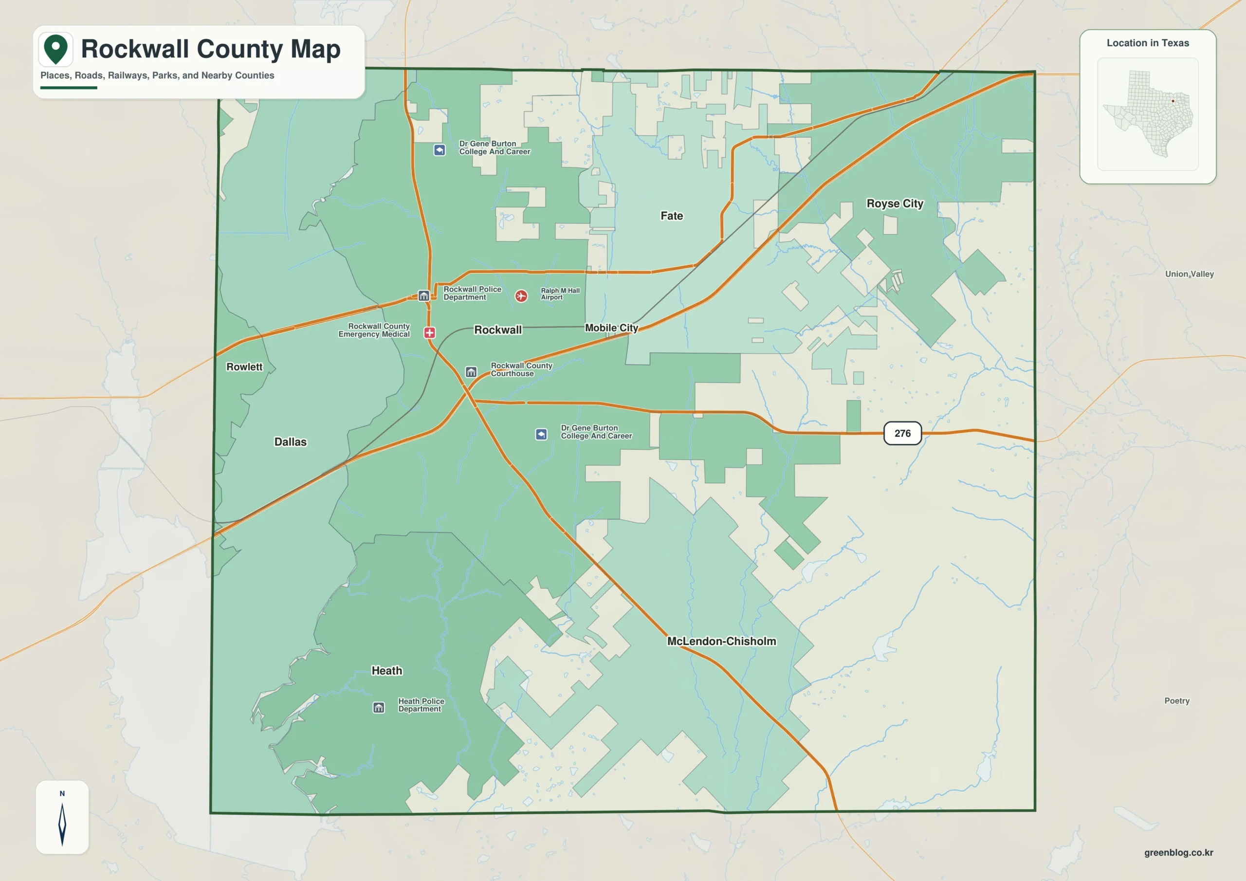
Rockwall County Texas map — Rockwall County is a compact suburban county extending east from Lake Ray Hubbard along Interstate 30.
Download the Rockwall County map
- Map file: County reference map
- File format: ZIP
Table of Contents
Quick Facts
- State: Texas
- County: Rockwall County
- County seat: Rockwall
- Mapped places: Rockwall, Royse City, Heath, Fate
- Natural features: Lake Ray Hubbard, East Fork Trinity River, Blackland Prairie
- Main routes: Interstate 30, State Highway 205
What the Map Shows
Rockwall sits on the western lake edge, Heath southwest, Fate east-central, and Royse City farther east.
County Layout and Location
Interstate 30 links Rockwall, Fate, and Royse City after crossing the lake. State Highway 205 serves the Rockwall-Heath side.
Local Context
Dallas commuting, housing, and retail growth strongly shape the county. Rockwall is the civic-commercial center, Heath the lake-residential side, and eastern towns the newest growth corridor.
Ways to Use This Map
- Trace the Interstate 30 sequence
- Compare lake-side and inland suburbs
- Locate Heath south of Rockwall
Frequently Asked Questions
Which town lies farthest east on Interstate 30?
Royse City is east of both Fate and Rockwall.
What distinguishes Heath?
It lies southwest near the Lake Ray Hubbard shoreline.
Green Map creates custom-edited map images using open geographic data sources such as geoBoundaries, Natural Earth, OpenStreetMap, and government open data.
These maps are edited visual materials, not raw data files, and are provided for education, documents, presentations, and graphic reference.