A compact county can contain an unusually wide range of landmarks. Glen Rose serves as the courthouse town, the Paluxy River exposes internationally significant dinosaur trackways, and limestone uplands rise around a landscape that also supports ranches, wildlife tourism, and a major power facility. A Somervell County Texas map brings those features into one geographic frame without treating the county as simply an extension of the Dallas–Fort Worth metropolitan area.
The Census Bureau estimated 10,261 residents on July 1, 2025, an increase of 11.5 percent from the 2020 estimate base of 9,205. Most civic services and visitor activity cluster around Glen Rose, while communities such as Nemo, Rainbow, Glass, and Chalk Mountain provide reference points across the county’s rural edges.
Table of Contents
A Small County Organized Around One River Corridor
The Paluxy River crosses the central portion of the county and passes through Glen Rose before joining the Brazos River system. Its channel, tributary creeks, and adjacent roads organize much of the local landscape. U.S. Highway 67 connects Glen Rose with Cleburne to the east and Stephenville to the west, while State Highway 144 runs north toward Granbury and south toward Meridian.
County lines place Hood County to the north, Johnson County to the east, Bosque County to the south, and Erath County to the west. Glen Rose sits near the center rather than along an outer border, which helps explain its long role as the administrative and commercial hub. The surrounding settlements are smaller and more dispersed, so road direction and neighboring counties are often more useful for orientation than a continuous urban street pattern.
Tracks in the Paluxy Changed Scientific Understanding
A major flood in 1908 scoured parts of the Paluxy River bed, and local residents soon recognized three-toed tracks in the exposed limestone. In 1937, fossil collector Roland T. Bird investigated the area and documented a sauropod trackway. The evidence helped demonstrate that these large dinosaurs walked on four legs rather than relying on deep water to support their bodies.
Dinosaur Valley State Park now protects several track sites as well as more than 20 miles of trails. Track visibility is not constant because water levels, sediment, and weather alter what can be seen in the riverbed. The park also includes limestone ledges, cedar brakes, oak woodland, grassland, and habitat for species such as the golden-cheeked warbler and black-capped vireo.
Glen Rose Grew from a Mill Settlement
Charles Barnard established a trading post in the area during the late 1840s and later built a gristmill and store beside the Paluxy. The settlement was known as Barnard’s Mill before residents adopted the name Glen Rose in 1872. When Somervell County was created from part of Hood County in 1875, Glen Rose became the county seat.
Mineral springs and health resorts helped the town attract visitors in the late nineteenth and early twentieth centuries. The courthouse square, Barnard’s Mill, petrified-wood buildings, and local museums preserve parts of that history. Modern tourism draws on both this built heritage and the much older geologic record found along the river.
Tourism, Conservation, and Power Generation
Visitor activity extends beyond the state park. Fossil Rim Wildlife Center uses broad pastures and wooded hills for conservation programs and drive-through wildlife viewing, while Glen Rose supports lodging, restaurants, museums, and outdoor recreation. These destinations make tourism more economically visible here than in many counties of similar population.
Comanche Peak Nuclear Power Plant adds a very different employment and tax base near the county’s northern side. Ranching, construction, public services, and small businesses remain part of the local economy as well. The close proximity of a power station, protected dinosaur tracks, wildlife facilities, and a historic county seat gives Somervell County a regional identity that is not captured by population size alone.
County Reference Table
| Reference | Detail |
|---|---|
| County seat | Glen Rose |
| 2025 population estimate | 10,261 |
| Created | 1875 from part of Hood County |
| Main highway junction | U.S. 67 and State Highway 144 in Glen Rose |
| Major waterway | Paluxy River, part of the Brazos River basin |
| Adjacent counties | Hood, Johnson, Bosque, and Erath |
Color Map
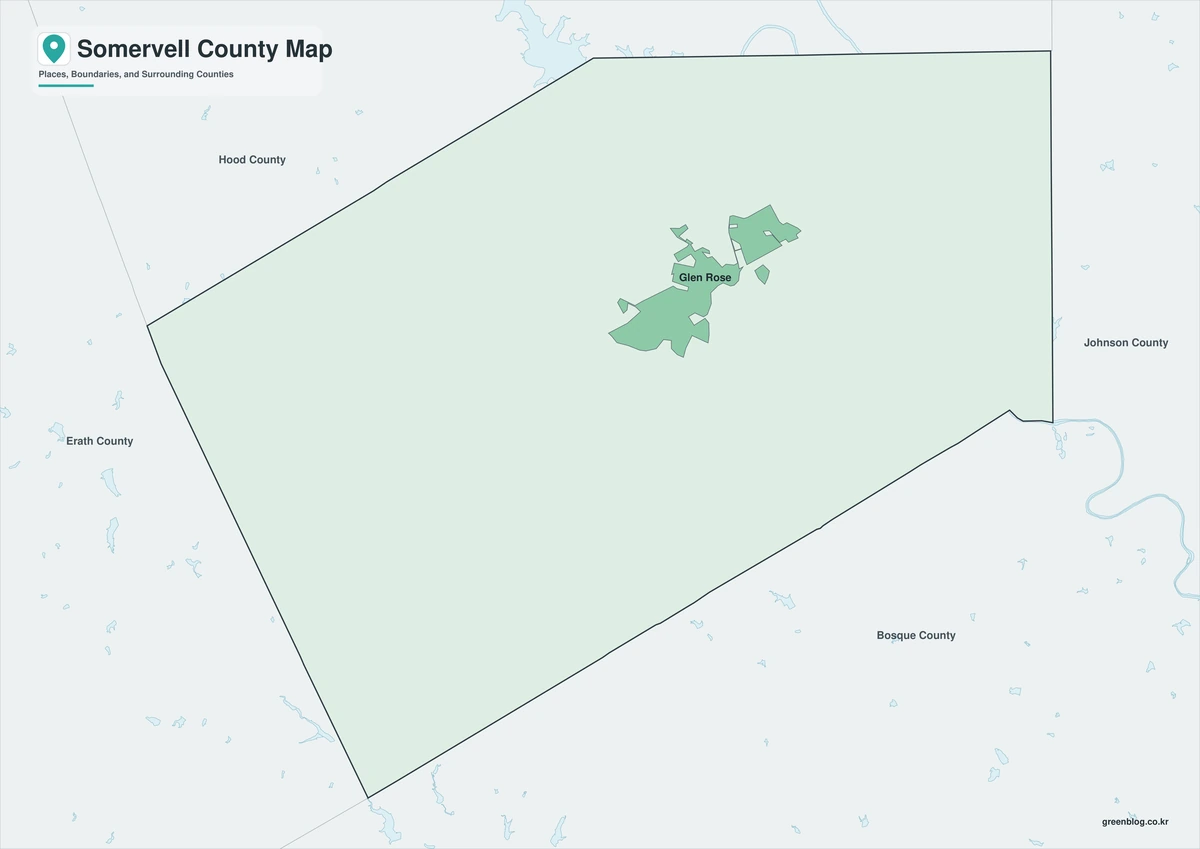
The color version separates Somervell County from Hood, Johnson, Bosque, and Erath counties while keeping the compact central shape easy to follow. Glen Rose can be compared with Glass and Chalk Mountain toward the western side and with Nemo and Rainbow farther east. The arrangement helps readers connect the Paluxy River corridor with the county seat and the more widely spaced rural communities.
Black-and-White Map
This version removes the color fills but retains boundary lines and selected labels. The position of Glen Rose relative to Rainbow and the Hood–Bosque county axis remains clear in monochrome. It works well in reports, worksheets, and documents where color reproduction is limited.
Outline Map
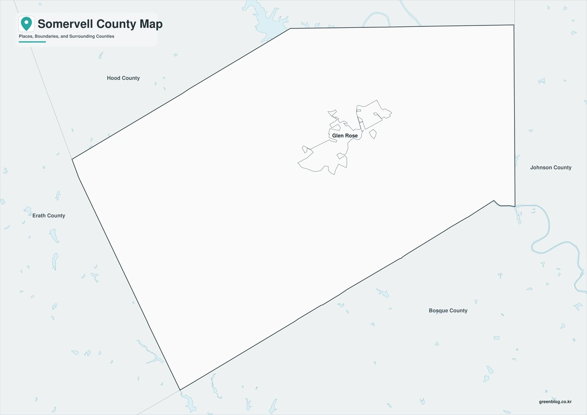
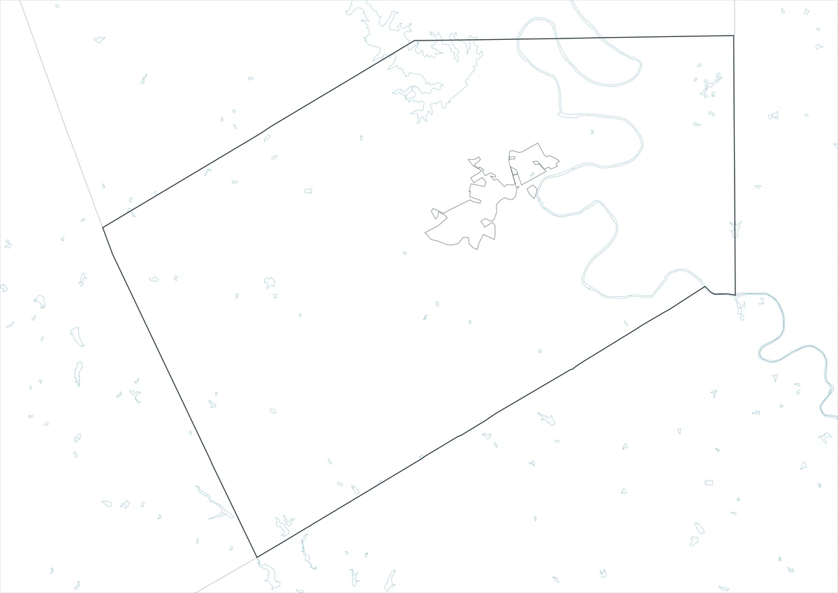
The outline file removes both labels and colored areas, leaving the county and surrounding boundary framework. Users can add Glen Rose and Nemo, trace the Paluxy River, or mark Dinosaur Valley State Park and routes toward neighboring counties. The open layout also supports custom classroom legends or project-specific symbols.
Download the Somervell County Maps
The set contains labeled color and monochrome maps plus an unlabeled outline base. Each JPG is arranged for an A3 print layout and can also be placed in presentations or digital documents.
County Map File Information
This download includes three A3 JPG versions of the Somervell County map. The labeled maps use selected place names for readability, while the outline version contains boundary lines without labels or color fills.
- Included Versions: Color, Black and White, Outline
- File Type: JPG
- Printable Size: A3 high-resolution layout
- Map Detail: County boundary, selected place boundaries, and surrounding county reference
- Intended Use: Printing, classroom materials, presentations, documents, blog graphics, and custom annotations
Frequently Asked Questions
Why is Glen Rose associated with dinosaur tracks?
Flooding exposed tracks in the Paluxy River’s limestone bed, and later scientific work documented important theropod and sauropod trackways. Several sites are protected within Dinosaur Valley State Park.
Is Somervell one of the smaller Texas counties?
Yes. Its total area is roughly 192 square miles, making it one of the state’s smallest counties by area. The compact size makes Glen Rose, the river corridor, and the outer county lines relatively close together.
Does the outline map include attraction labels?
No. The outline version removes place names and color fills so users can add their own labels. The color and black-and-white files retain selected community names for orientation.
Sources and Further Reading
U.S. Census Bureau QuickFacts provides the 2020 population base, 2025 estimate, and recent percentage change.
The Handbook of Texas entry for Somervell County covers county formation, physical setting, and historical development. Its separate Glen Rose entry documents the mill settlement and the county seat’s growth.
Texas Parks and Wildlife Department maintains official information on Dinosaur Valley State Park, the Paluxy River track sites, trails, and natural resources.
Regional Information
Continent: North America
Country: United States
State: Texas
County: Somervell County
Location in State: North-central Texas southwest of Fort Worth
Adjacent Counties: Hood County, Johnson County, Bosque County, Erath County
Major Places: Glen Rose, Nemo, Rainbow, Glass, Chalk Mountain
Geographic Features: Paluxy River, Brazos River basin, limestone ridges
Related Maps
- Sherman County Texas map|Stratford, Texhoma, and the High Plains Border
- Zavala County Texas map|Crystal City, La Pryor, Batesville, and the Nueces River
- Wise County Texas map|Decatur, Bridgeport, and Lake Bridgeport
- Tarrant County Texas map|Fort Worth, Arlington, Airport Cities, and Trinity Lakes
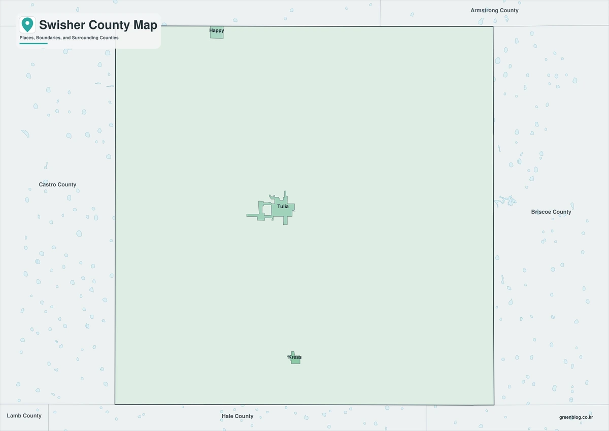
- Swisher County Texas map|Tulia, I-27 Farm Towns, and Tule Canyon
Green Map creates custom-edited map images using open geographic data sources such as geoBoundaries, Natural Earth, OpenStreetMap, and government open data.
These maps are edited visual materials, not raw data files, and are provided for education, documents, presentations, and graphic reference.