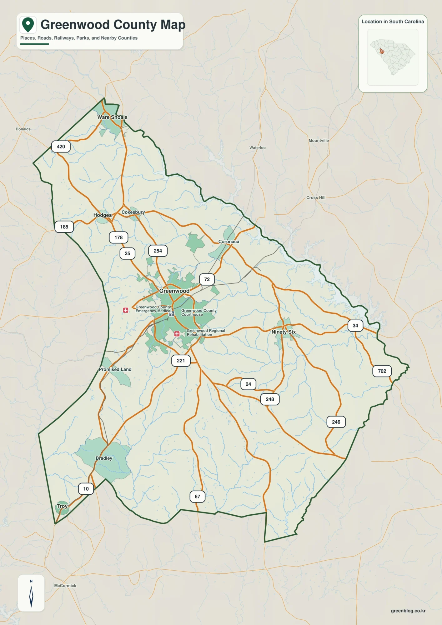
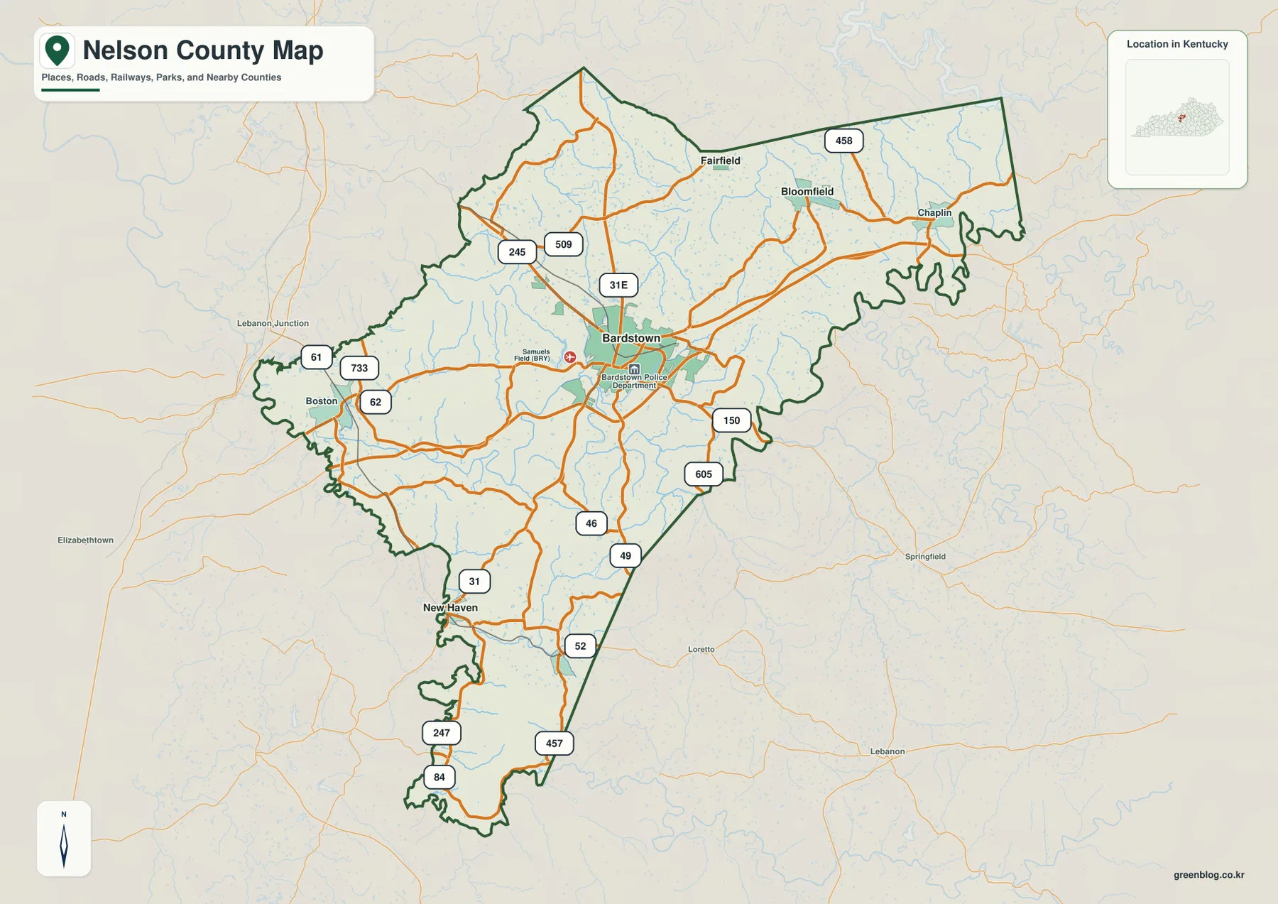
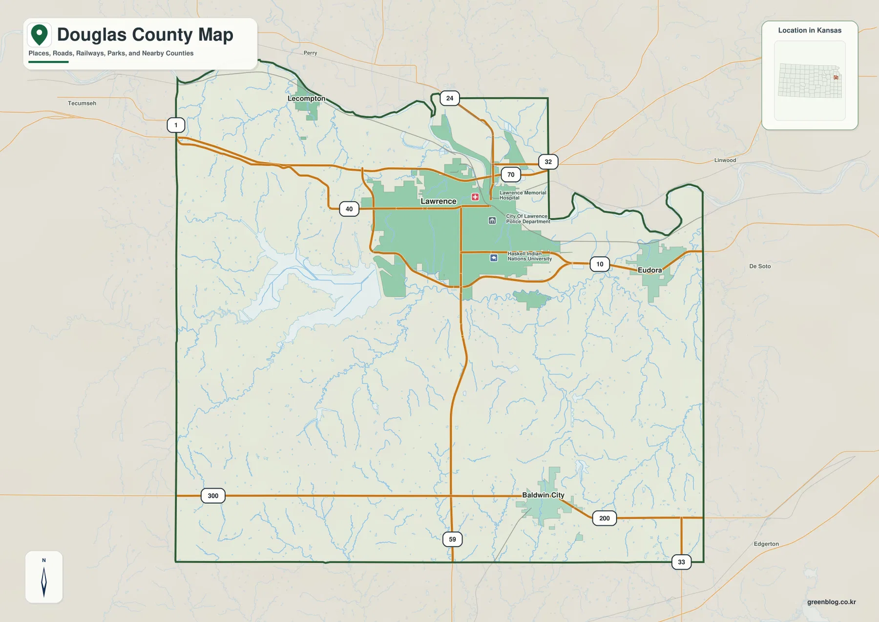
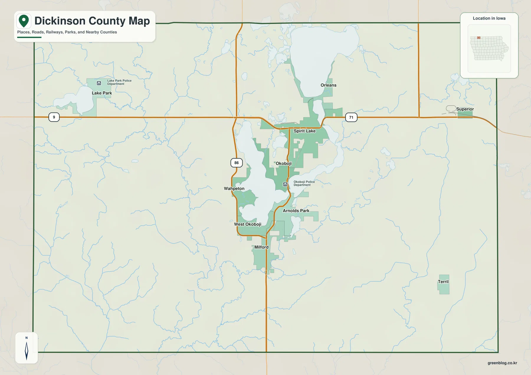
Butts County sits in central Georgia where a compact county seat, a nearby interstate, three small municipalities, and a lake-and-river landscape fit into a relatively small area. Jackson is the county seat and the main road reference point. Jenkinsburg is a short distance to the north, while Flovilla lies southeast toward Indian Springs. West of Jackson, I-75 carries long-distance traffic between the Atlanta and Macon directions; east of town, Jackson Lake and the upper Ocmulgee system give the county a very different physical edge.
The maps on this page separate those layers so they are easier to use. You can view the county boundary and road network, compare the direct-distance positions of Jackson, Jenkinsburg, and Flovilla, follow the lake and creek system, and examine the county’s elevation pattern. The downloadable ZIP contains four original A3 high-resolution JPG maps, while the WebP images in the article are lighter previews for quick reference.
Table of Contents
Where Butts County sits in central Georgia
| State | Georgia |
|---|---|
| County / FIPS | Butts County / 13035 |
| County seat | Jackson |
| Created | 1825 from parts of Henry and Monroe counties |
| 2020 population | 25,434 |
| July 1, 2025 estimate | 27,218 |
| 2020 land area | 183.69 square miles |
| Incorporated municipalities | Jackson, Flovilla, and Jenkinsburg |
| Major water references | Jackson Lake, Ocmulgee River, and local creeks |
| Download package | Four A3 high-resolution JPG maps in one ZIP |
The county is bordered by Henry County to the north, Newton County at the northeast, Jasper County to the east, Monroe County to the south, Lamar County at the southwest, and Spalding County to the west. That places Butts County between metropolitan Atlanta and Macon without making either city part of the county. On a statewide map, the easiest mental reference is the space between the I-75 corridor on the west and the Jackson Lake–Ocmulgee side on the east.
Population figures also help explain why transportation access matters here. The county had 23,655 residents in the 2010 census and 25,434 in 2020; the supplied Census-based material gives a 2025 estimate of 27,218. With 183.69 square miles of land, growth is concentrated into a relatively compact county. The map therefore makes more sense when Jackson’s historic center, the smaller incorporated towns, and the interstate access points are treated as connected but distinct parts of the local geography.
Jackson and the road network on the county map
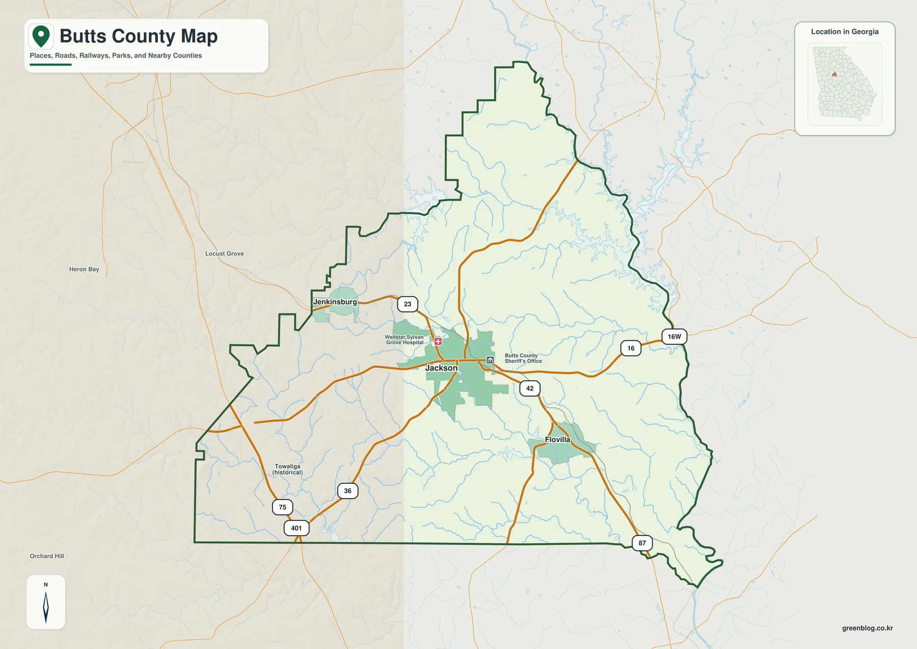
Jackson is the visual anchor of the county map because several important routes meet in or near the city. U.S. 23 and State Route 42 form a north–south route through the Jackson–Jenkinsburg–Flovilla sequence. State Route 16 crosses Jackson and runs toward the lake side of the county, while SR 36 provides another connection between the I-75 side and the county seat. SR 87 is also shown on the southeastern side. This combination makes Jackson the practical point for switching from regional travel to local roads.
I-75 is important, but it does not run through downtown Jackson. It passes to the west, with county interchanges reached by connecting state routes. That distinction matters for anyone using a small county map for orientation: an interstate exit and the Jackson city label should not be treated as the same place. The western side is organized around high-speed north–south travel, while Jackson itself sits farther east within the local road network.
The boundary map also helps with neighboring-county orientation. Jenkinsburg is close to the Henry County side, Flovilla is positioned toward the southeastern part of the county, and the irregular eastern edge approaches the Jackson Lake and Jasper County area. The map is intended as a county-scale reference, not a parcel or municipal-boundary product. It should not be used to decide which side of a city limit, tax parcel, shoreline restriction, or flood zone contains a specific address.
Three municipalities and their direct-distance connections
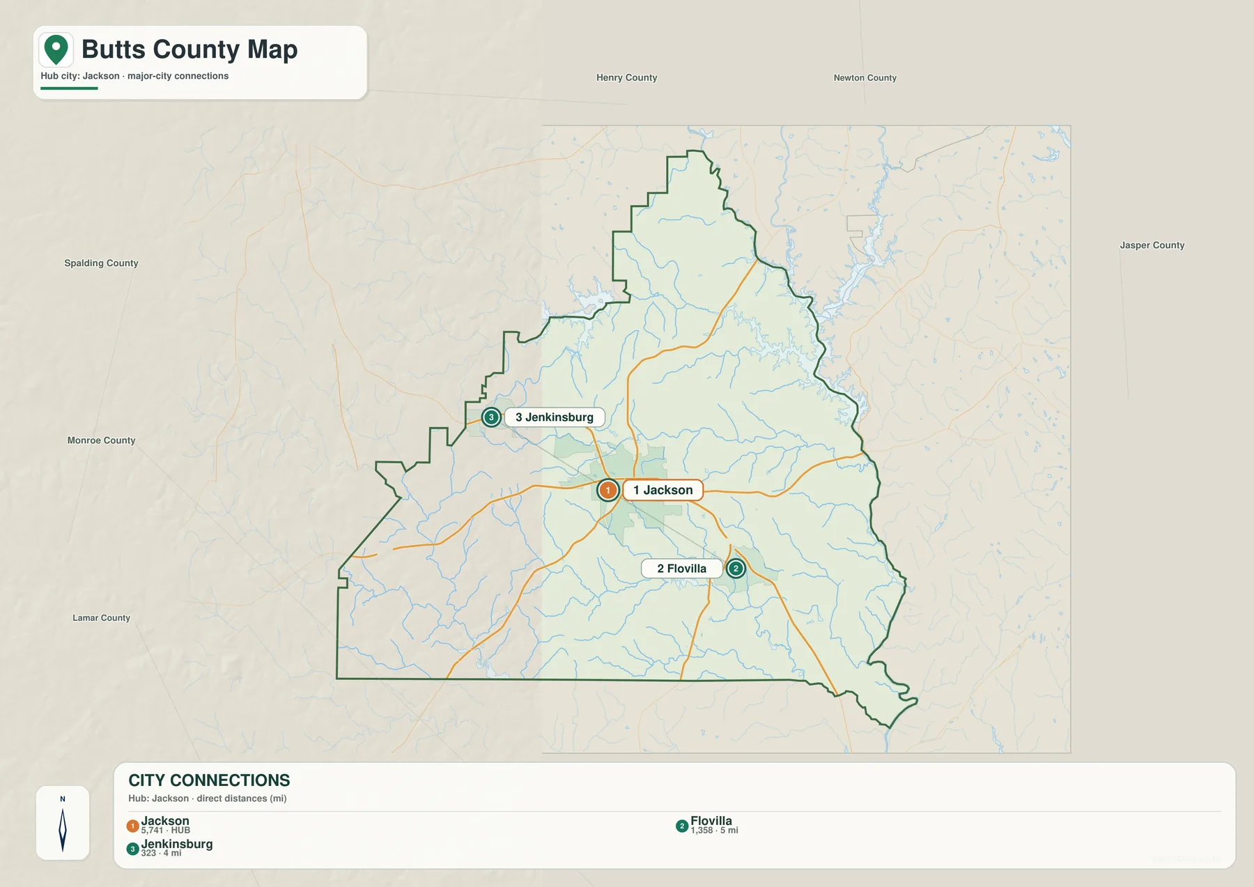
The city-connections map removes much of the background detail and makes the settlement pattern easy to compare. Jackson is marked as the hub. Jenkinsburg is shown roughly four miles away to the northwest, and Flovilla roughly five miles away to the southeast. Those values are direct, straight-line distances between the mapped points; they are not driving distances. A road trip will usually cover more mileage because streets and highways do not follow a perfect straight line.
The short distances can make the three places look like one continuous town, but they are separate incorporated municipalities. Jackson has the county government role and the largest concentration of services. Jenkinsburg lies toward the Henry County direction, while Flovilla is the useful reference for the Indian Springs side of the county. Indian Springs itself is historically important and appears in local place descriptions, but it is not a fourth incorporated municipality in the supplied city map.
This simplified view is especially useful before opening a street-level navigation app. A visitor can first establish the order of Jenkinsburg, Jackson, and Flovilla, then use the detailed road map for the final route. It also works well in classroom or presentation material because the numbered labels show the relative placement of the towns without forcing the reader to sort through every road and creek at the same time.
Jackson Lake and the creek network
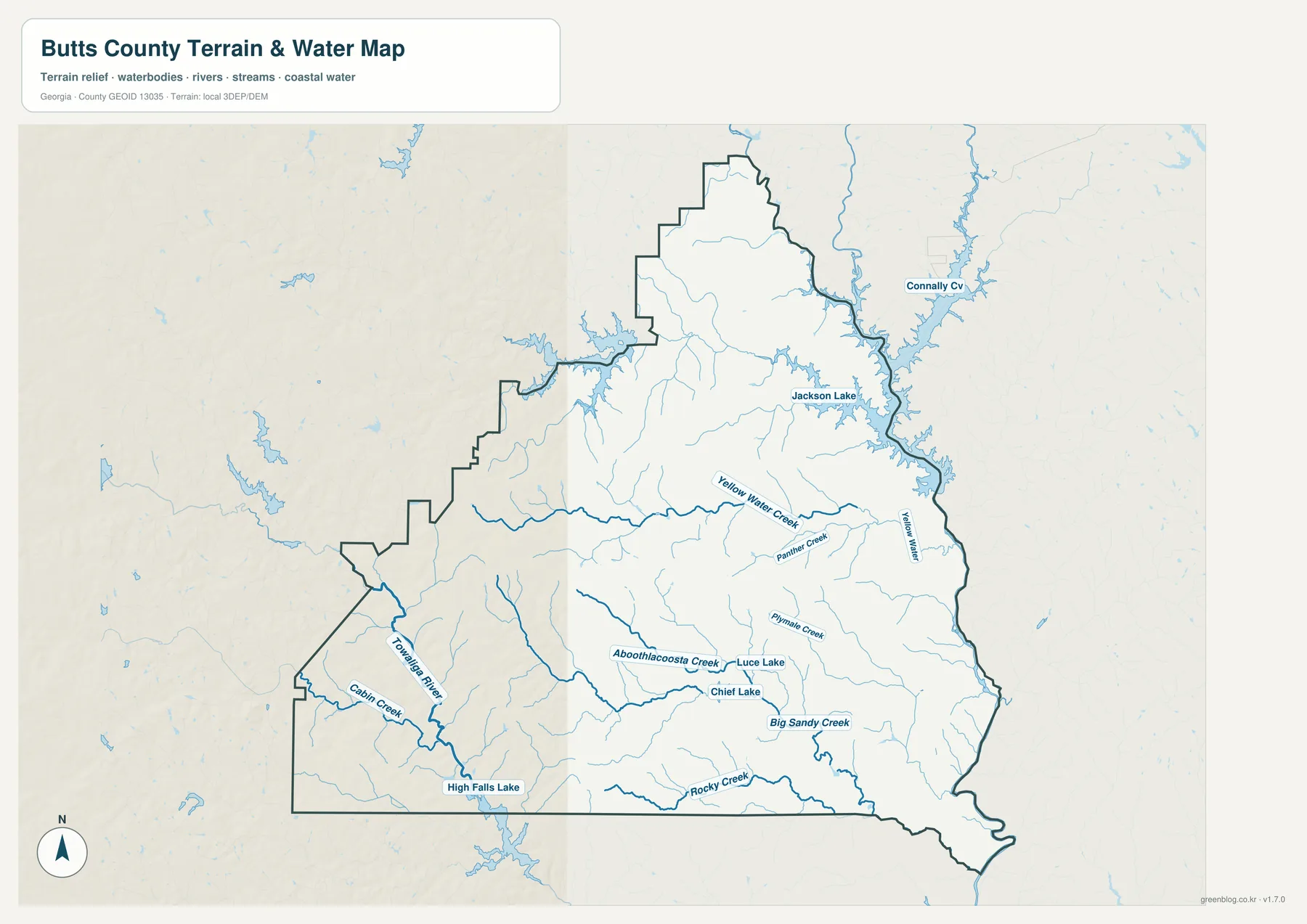
The water map changes the emphasis completely. Jackson Lake occupies the northeastern and eastern side of the reference area, while a branching network of creeks crosses the county. Yellow Water Creek and Panther Creek are labeled in the central-to-eastern portion, and Rocky Creek and Big Sandy Creek appear farther south. On the southwestern side, the Towaliga River and Cabbin Creek are visible, with High Falls Lake near the southern edge. Smaller named waters such as Luce Lake and Chief Lake add local detail without changing the broader pattern.
Jackson Lake is not contained entirely within Butts County. The supplied county material describes the reservoir as extending across Butts, Jasper, Henry, and Newton counties. It was formed where the South, Yellow, and Alcovy rivers meet, and water below Lloyd Shoals Dam continues into the Ocmulgee River. That explains why the eastern side of the county looks more irregular than the simpler western boundary and why water features are central to understanding this part of the map.
This is a water-reference map, not a flood-risk, boating, parcel, or legal-jurisdiction map. A creek line on the page does not tell you the flood elevation of a property, whether a channel is navigable, or what rules apply to a particular shoreline lot. For those decisions, use current county GIS, FEMA or agency products, and site-specific information. The purpose here is to show which named waters are near one another and how the drainage network relates to the county shape.
Elevation from higher western ridges to lower drainage corridors
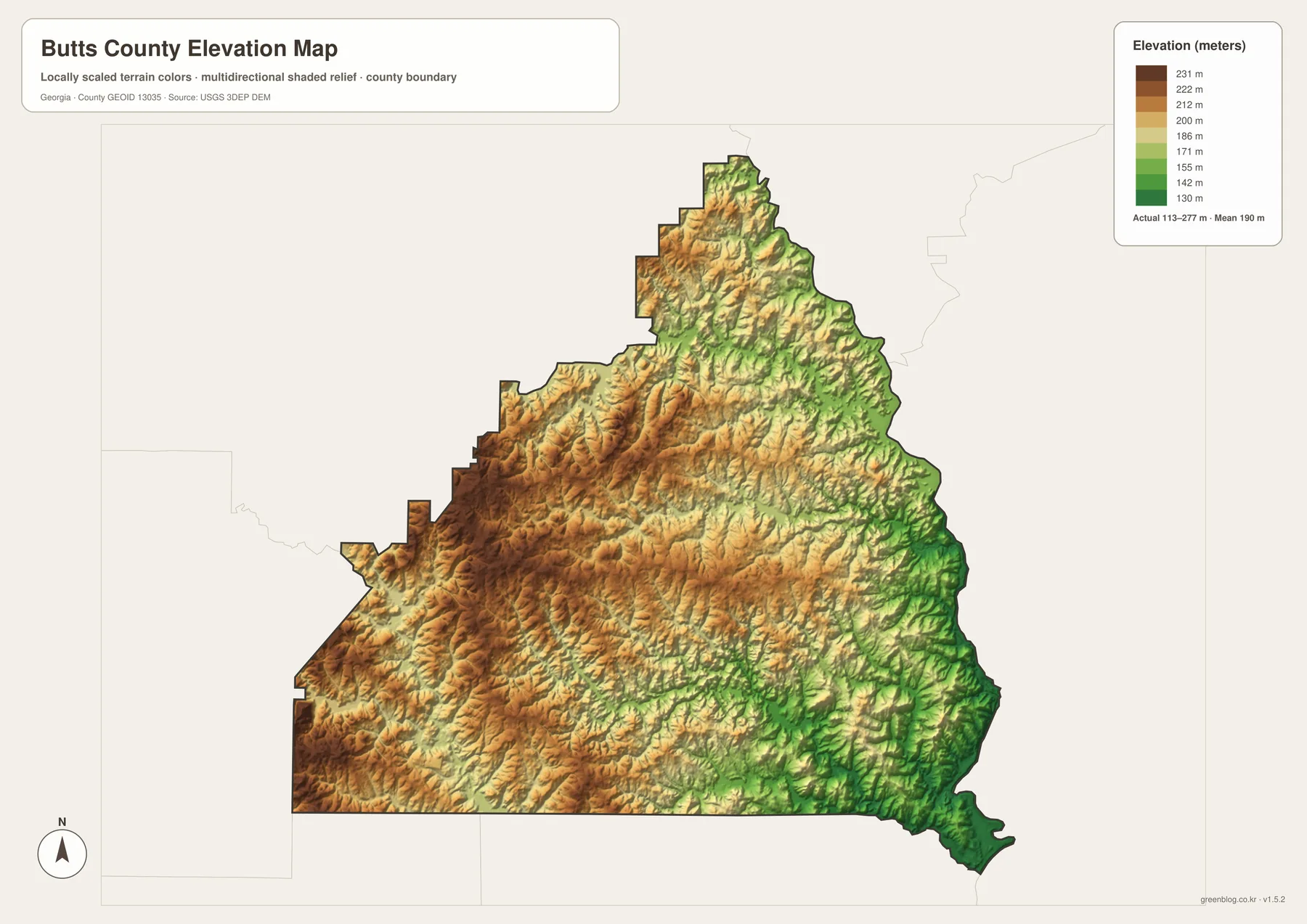
The elevation map strips away road labels and uses terrain color and shaded relief to make the county’s surface visible. Its legend reports an actual range of roughly 113 to 277 meters and a mean elevation near 190 meters. Brown and tan areas are more common across the western and southwestern interior, while greener low areas become more noticeable toward the eastern and southeastern drainage corridors. The north also contains repeated ridges and valleys rather than a single flat surface.
The most useful way to interpret the relief is beside the water map. Lower green corridors often align with creek valleys, while the warmer-toned ridges stand between those drainage lines. The eastward and southeastward descent toward the Jackson Lake and Ocmulgee system is easier to recognize when the two maps are compared together. This does not mean every green strip is a major named river or every brown patch is a mountain; the map is showing county-scale differences in rolling Piedmont terrain.
The elevation surface is generalized for regional comparison. It is not survey-grade or engineering-grade data and should not be used to determine a building pad elevation, exact road grade, drainage design, or precise hiking ascent. The downloadable map is best for understanding the broad relief of the county and for connecting that relief to the visible stream network. Detailed work should use the underlying USGS elevation products or professional survey data.
Local places that give the map more context
The labels around Jackson and Flovilla have a deeper history than a modern road map alone can show. Georgia created Butts County in 1825 from parts of Henry and Monroe counties. Jackson, named for Andrew Jackson, became the county seat, and its courthouse square remains the strongest civic reference point in the county. Jenkinsburg incorporated in the nineteenth century after railroad development, and Flovilla also developed along the corridor that linked the smaller communities with Jackson.
Near Flovilla, Indian Springs State Park is one of the county’s best-known destinations. The supplied Georgia Department of Natural Resources material describes a landscape associated with a mineral spring, Muscogee history, later resort use, and state-park development. This gives the southeastern part of the county a recreation and history reference that is different from the interstate-oriented west side. When Indian Springs appears in an address or travel description, it is useful to remember that Flovilla is the incorporated municipality used as the nearby map reference.
Jackson Lake adds another layer. Lloyd Shoals began commercial hydroelectric operation in 1911 according to the supplied Georgia Power material, tying the eastern water system to power production as well as recreation and shoreline development. The county therefore has several overlapping geographies: the government and commercial center around Jackson, smaller municipalities along the north–south road and rail corridor, interstate access to the west, and water-oriented communities and recreation toward the lake.
Choosing the right map for the task
Start with the county map when you need one page that answers the basic orientation questions: Where is Jackson? Which side is I-75 on? How do Jenkinsburg and Flovilla relate to the county seat? Which neighboring counties surround the boundary? Switch to the city-connections map when the three municipalities and their relative spacing are the main subject. It is deliberately simpler, so the town labels are easier to compare.
Use the water map when the question involves Jackson Lake, a creek, a river connection, or the difference between the west and east sides of the county. Use the elevation map when you want to understand why some drainage lines sit in lower terrain and why the county is better described as rolling Piedmont than as a flat plain. For a classroom handout or a local-history presentation, combining two maps often works better than forcing every topic onto one crowded graphic.
- General orientation: county boundary, major roads, Jackson, Jenkinsburg, Flovilla, and neighboring areas.
- Town-to-town comparison: straight-line position and direction from Jackson to the other incorporated municipalities.
- Water geography: Jackson Lake and the named creek and river network, with the limits of a reference map kept in mind.
- Terrain: generalized relief and elevation differences across the Piedmont landscape.
- Printing and documents: use the downloadable A3 JPG files when the lighter WebP previews are not large enough.
The four maps are complementary rather than interchangeable. A straight-line city distance does not replace a driving route; the water map does not replace a flood study; and the elevation map does not replace survey data. Used within those limits, the set gives a clear county-scale picture without requiring the reader to work through a full GIS system.
Frequently Asked Questions
Does Interstate 75 run through downtown Jackson?
No. I-75 passes west of Jackson. State routes connect the interstate side of the county with the city, so the Jackson label and the interstate corridor should be treated as separate locations on the map.
Are the 4-mile and 5-mile city distances driving distances?
No. The city-connections map uses straight-line distances from Jackson to the mapped points for Jenkinsburg and Flovilla. Actual road mileage depends on the route and will usually be longer.
Is Jackson Lake entirely inside Butts County?
No. The reservoir extends into Butts, Jasper, Henry, and Newton counties. A county-scale reference map is useful for orientation, but a specific shoreline address or parcel should be checked against current jurisdiction and parcel information.
Map File Information
Butts County map files
- Printable Size: 3638 × 2572 pixels for each JPG
Related Maps
Sources and reference material
- U.S. Census Bureau QuickFacts: Butts County population, area, density, and FIPS
- Butts County government: location, roads, municipalities, and natural resources
- Georgia Department of Community Affairs: Butts County and municipal comprehensive plans
- New Georgia Encyclopedia: Butts County and town history
- Georgia Department of Natural Resources: Indian Springs State Park
- Georgia Power: Jackson Lake and Lloyd Shoals Hydroelectric Project
- USGS 3D Elevation Program: elevation data reference
Green Map creates custom-edited map images using open geographic data sources such as geoBoundaries, Natural Earth, OpenStreetMap, and government open data. These maps are edited visual materials, not raw data files, and are provided for education, documents, presentations, and graphic reference.