A county with one incorporated town, broad ranches, and two watershed directions benefits from a map focused on land rather than urban features. A Sterling County Texas map places Sterling City near the east-central part of the county, historic Broome farther southeast, and the North Concho River across a sparsely settled West Texas landscape.
The Census Bureau estimated 1,349 residents on July 1, 2025, down 1.6 percent from the 2020 estimate base. Sterling City contains nearly all county government, schools, retail, and service functions, serving as both the county seat and the practical center of daily life.
Table of Contents
Why Nearly Everything Centers on Sterling City
Sterling City stands where U.S. Highway 87 meets State Highway 158, about forty-three miles northwest of San Angelo and forty-two miles southeast of Big Spring. Those distances explain its role as a small service stop between larger regional cities. County offices, schools, and local businesses remain concentrated in Sterling County due to its lack of a second modern population center.
The townsite was laid out in 1891, the same year Sterling County organized. It won a competitive county-seat election against nearby Cummins, and the losing settlement soon faded. Sterling City later incorporated in 1955, but its scale has remained that of a small courthouse and ranching town rather than a regional urban center.
Rivers, Creeks, and Two Drainage Directions
The North Concho River is the county’s most important watercourse. It runs southeast through Glasscock and Sterling counties before continuing through Coke and Tom Green counties toward San Angelo. Sterling, Ross, Crystal, and Mulberry creeks feed the river across rolling ranch country, and Broome developed beside this corridor.
Not all water leaves the county by the same route. The Middle Concho originates in southern Sterling County and flows towards Irion and Tom Green counties, while Willow Creek in the north drains into the Colorado River. This divide adds geographic interest to a county often described simply as open prairie surrounded by hills.
Ranching Won Where Cotton Struggled
Large cattle ranches appeared after the frontier period, followed by sheep and goat operations. The county’s dry climate, variable soils, and broad native range favored grazing more than intensive cultivation. Wheat, barley, hay, pecans, and small areas of cotton were produced, but crops never displaced livestock as the basic agricultural use.
The Santa Fe reached Sterling City in 1910 during a period when local boosters hoped farming and cotton would expand. Cotton acreage and gins later declined as the limitations of the land became clear. Sheep numbers increased significantly in the early 20th century, shaping property sizes, road spacings, and the county’s sparse population distribution.
Broome and the Short Railroad Era
Broome was founded in 1924 as a station on the Panhandle and Santa Fe Railway ten miles southeast of Sterling City. Named for rancher C. A. Broome, it briefly had a post office and later a combined store and filling station. The community never became a second town of comparable size, and its post office closed in 1939.
Today Broome is best treated as a historic map reference rather than an active incorporated municipality. Its location is still useful because it marks the North Concho and U.S. 87 corridor toward Coke County. The survival of Sterling City contrasts with Broome’s decline, highlighting how county government and highway access have been more influential than a small railroad stop over time.
Oil Added Revenue Without Creating a City
Oil was discovered in 1947 and became a major addition to the local economy. Production rose sharply in the following decades and helped offset agricultural decline, while natural gas also became important. Energy development increased property value and public revenue, but it did not produce a large new town or a dense network of settlements.
Modern Sterling County therefore combines ranching, petroleum activity, and a very small population. Individual wells, leases, pipelines, and ranch boundaries may require checking through current regulatory, appraisal, and GIS sources for a general county map.
Map Reference Points
| County seat and only incorporated town | Sterling City |
|---|---|
| Historic southeastern place | Broome |
| 2025 population estimate | 1,349 |
| Main transportation axis | U.S. 87 with State Highways 158 and 163 |
| Primary river corridor | North Concho River |
| Other drainage context | Middle Concho headwaters and Willow Creek |
Color Map
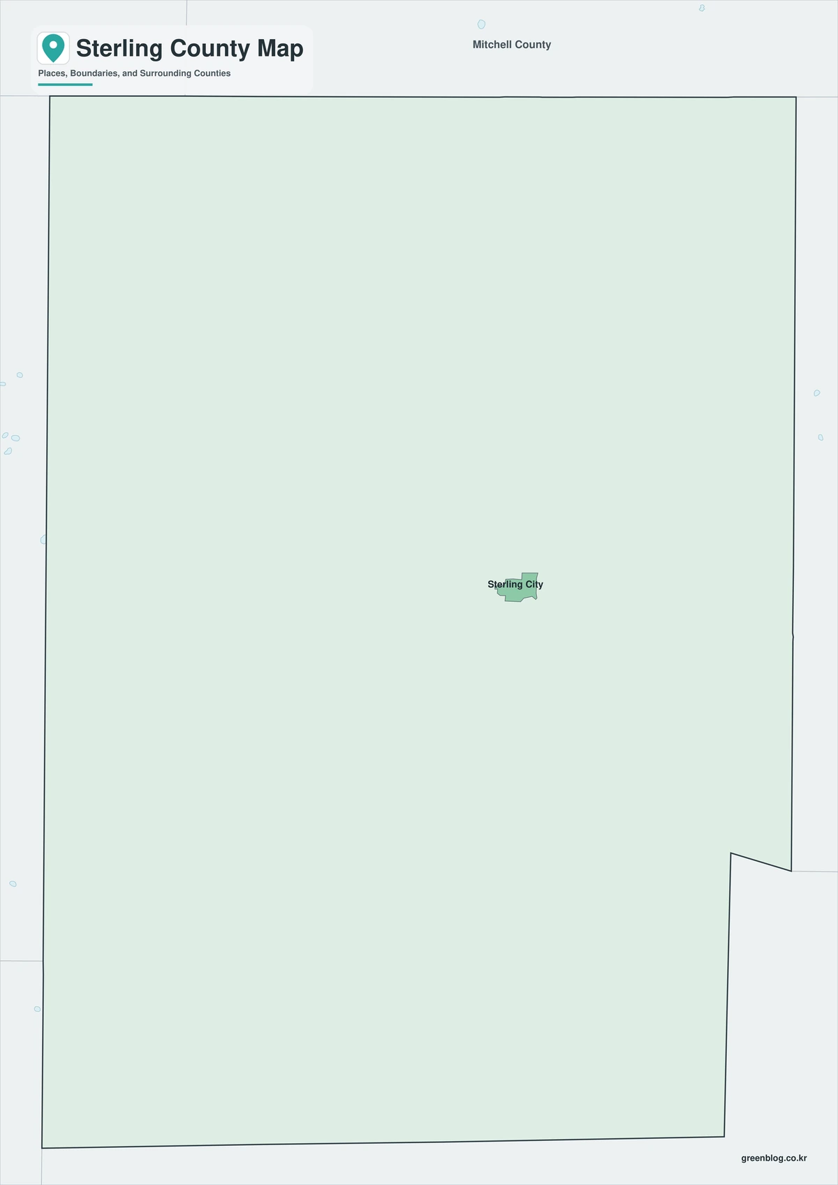
The color edition separates Sterling County from Howard, Mitchell, Coke, Tom Green, Reagan, and Glasscock counties. Sterling City anchors the east-central highway junction, while Broome marks the southeastern North Concho corridor toward Coke County. The colored framework shows how Sterling Creek and Mulberry Creek traverse ranchland towards the North Concho, with the southern edge housing the Middle Concho’s headwaters.
Black-and-White Map
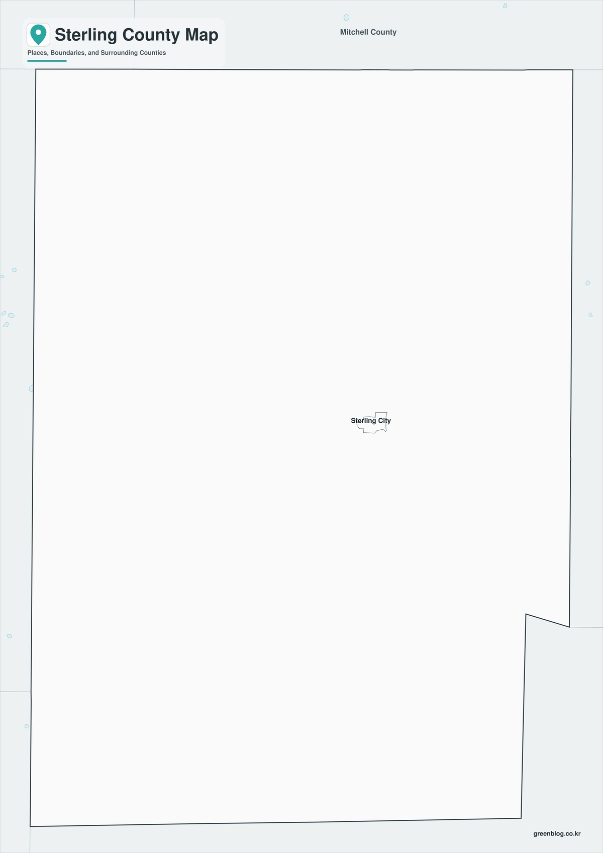
County fills are removed from this edition, leaving boundaries and selected labels. The position of Sterling City between Big Spring and San Angelo remains easy to read, and its southeast direction toward Broome and Coke County is clear on a monochrome page suitable for reports or classroom printing.
Outline Map
The outline file removes colors and place names while preserving Sterling County and its adjacent-county framework. Users can add the North Concho River, mark the Middle Concho headwaters, trace U.S. 87, identify ranching zones, or plot oil and gas themes from current official data.

Download the Printable County Maps
The Sterling County Texas map set contains color, black-and-white, and outline A3 JPG sheets. The labeled files support quick county orientation, while the blank framework allows custom watershed, transportation, ranching, history, or energy annotations.
County map information
This download contains color, black-and-white, and outline versions of the Sterling County map. Selected place and geographic labels appear on the first two sheets, while the outline file keeps county boundaries without fills or names.
- Included Versions: Color, Black and White, Outline
- File Type: JPG
- Printable Size: A3 high-resolution layout
- Map Coverage: County boundary, surrounding counties, selected places, and river context
- Intended Use: Printing, teaching, reports, presentations, and custom annotations
Frequently Asked Questions
Why is Sterling City the only major place on the map?
County government, highways, schools, and ranch services are concentrated in the area, with early settlements like Cummins and Broome failing to grow into significant population centers.
Does the North Concho River flow directly to San Angelo?
It continues southeast through Coke and Tom Green counties before joining the Middle and South Concho branches in the San Angelo area to form the Concho River.
Can the outline map be used for oil-field locations?
It serves as a blank base, with current well, lease, pipeline, and regulatory data needing to be sourced from official state and county datasets, not the general map.
Sources and Further Reading
Population figures come from the U.S. Census Bureau QuickFacts profile. The Handbook of Texas county entry supports the county history, physical setting, ranching, railroad, and petroleum discussion. Separate entries for Sterling City, Broome, and the North Concho River provide local place and river details.
This is a general geographic reference. Current county GIS should be utilized for legal boundaries, parcels, flood decisions, and operational planning. Appraisal, transportation, water, environmental, and energy-agency GIS can also be used as needed.
Related Maps
- Throckmorton County Texas map|Cow Country, Throckmorton, and the Brazos Forks
- Titus County Texas map|Mount Pleasant, Pine Country, and Two Lakes
- Travis County Texas map|Austin, Lake Travis, and the Colorado River
- Upshur County Texas map|Gilmer, Big Sandy, and Lake O’ the Pines
- Terry County Texas map|Brownfield, Cotton Country, and the South Plains
Green Map creates custom-edited map images using open geographic data sources such as geoBoundaries, Natural Earth, OpenStreetMap, and government open data.
These maps are edited visual materials, not raw data files, and are provided for education, documents, presentations, and graphic reference.