A Kinmen County map needs more than the familiar outline of Kinmen’s main island. Four townships divide that central landform, Lieyu sits separately to the west, and distant Wuqiu requires its own inset. Without all three pieces—the main island, Lieyu, and Wuqiu—the county’s six-township structure is easy to misunderstand.
Kinmen is administered as a county by Taiwan and lies in the Taiwan Strait near the coast of Fujian Province. Its position is far from Taiwan’s main island, but the supplied graphics focus tightly on county territory rather than showing the surrounding coast. They are administrative reference maps, not general Taiwan locator maps or cross-strait navigation charts.
The collection includes a labeled color edition, a labeled black-and-white edition, and an unlabeled outline. Each WebP preview measures 1,200 × 849 pixels and shares the same landscape composition. The maps support township comparison, classroom exercises, report illustrations, slides, and simple annotations, while omitting roads, villages, ports, terrain, scale information, and neighboring shorelines.
Table of Contents
How to Read the Kinmen County map
The main island has two broad ends joined through a narrower middle. Jincheng occupies the southwest, Jinning spans much of the west-central and northwestern area, Jinhu reaches across the southeast, and Jinsha fills the large eastern and northeastern end. The internal lines make the four areas easier to compare than an undivided island silhouette would.
Lieyu appears as a separate island shape to the west of the main island. It is not joined by a line or route, and the map gives no distance scale, so readers should understand only its relative placement within the page. The labeled editions identify the township but do not show settlements, transport connections, or smaller local administrative units.
Wuqiu is even more detached from the main Kinmen group. The Kinmen County map handles that separation with a framed inset in the upper-left corner, where two principal island shapes and smaller pieces are shown. The inset confirms administrative inclusion but does not establish the islands’ real distance, direction, or scale relative to the main panel.
Together, Jincheng, Jinning, Jinhu, Jinsha, Lieyu, and Wuqiu form the six townships represented by the collection. Jincheng serves as the county’s administrative center, yet no capital marker or municipal symbol appears. The visible labels identify township areas rather than settlement locations, which is an important distinction for teaching and publication.
The map title describes “Taiwan Administrative Boundaries,” but it does not include Taiwan’s main island or a broader national locator. Add a separate regional map whenever readers need cross-strait context. For a township lesson, the focused frame is an advantage because it gives the irregular coastlines and internal divisions more room.
Color Map for Island and Township Comparison
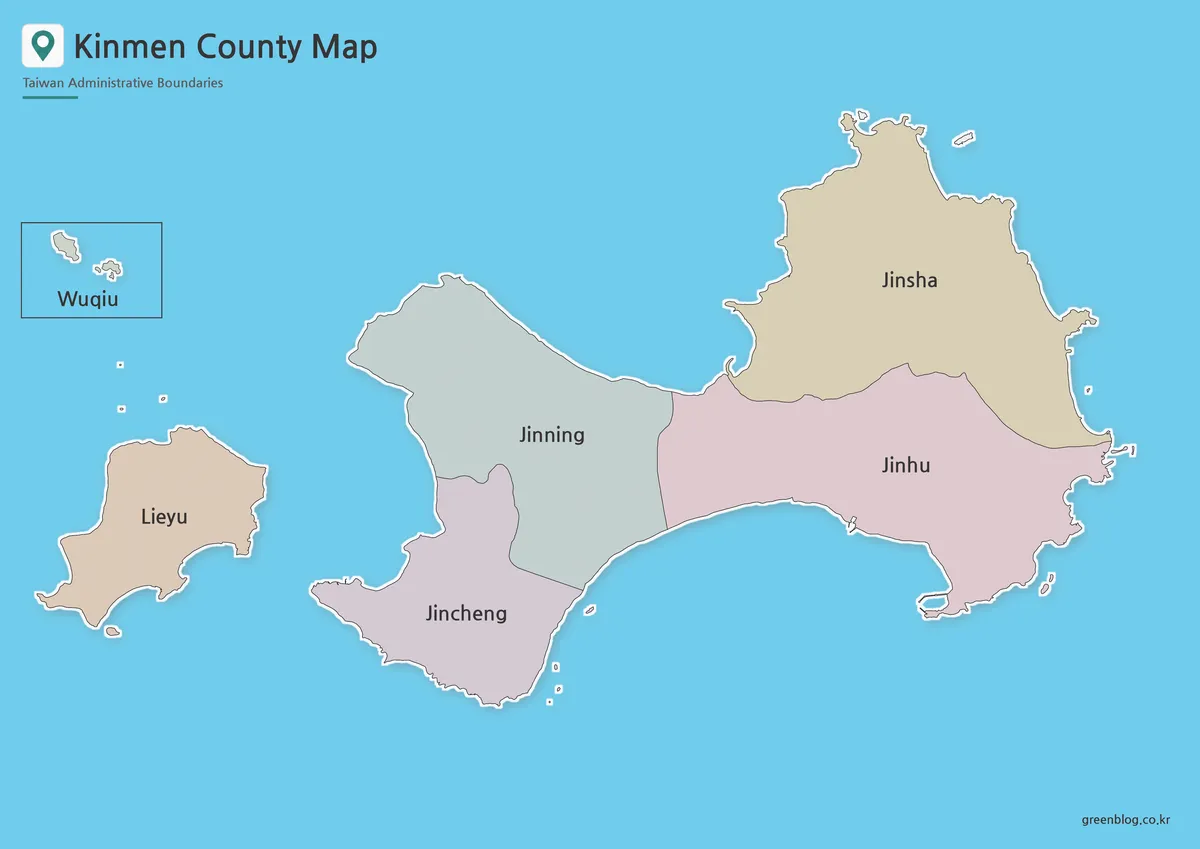
The color Kinmen County map uses muted pink, gray-green, tan, and blue-gray fills to separate adjacent townships. Color is most helpful near the main island’s narrow center, where Jincheng, Jinning, and Jinhu approach one another. Jinsha’s eastern extent and Lieyu’s detached form are also immediately recognizable.
These fills are administrative categories only. They do not represent population, terrain, political affiliation, tourism zones, or land use. If a teacher or designer adds data, the new values need a separate legend, source, units, and date so readers do not confuse the original colors with a statistical scale.
Use the color edition as an opening reference, presentation graphic, or answer sheet beside a blank exercise. A useful sequence is to identify the four main-island townships first, then move west to Lieyu and finally to the Wuqiu inset. This order follows the map’s visual hierarchy without implying a travel route.
Black and White Kinmen County map for Printing
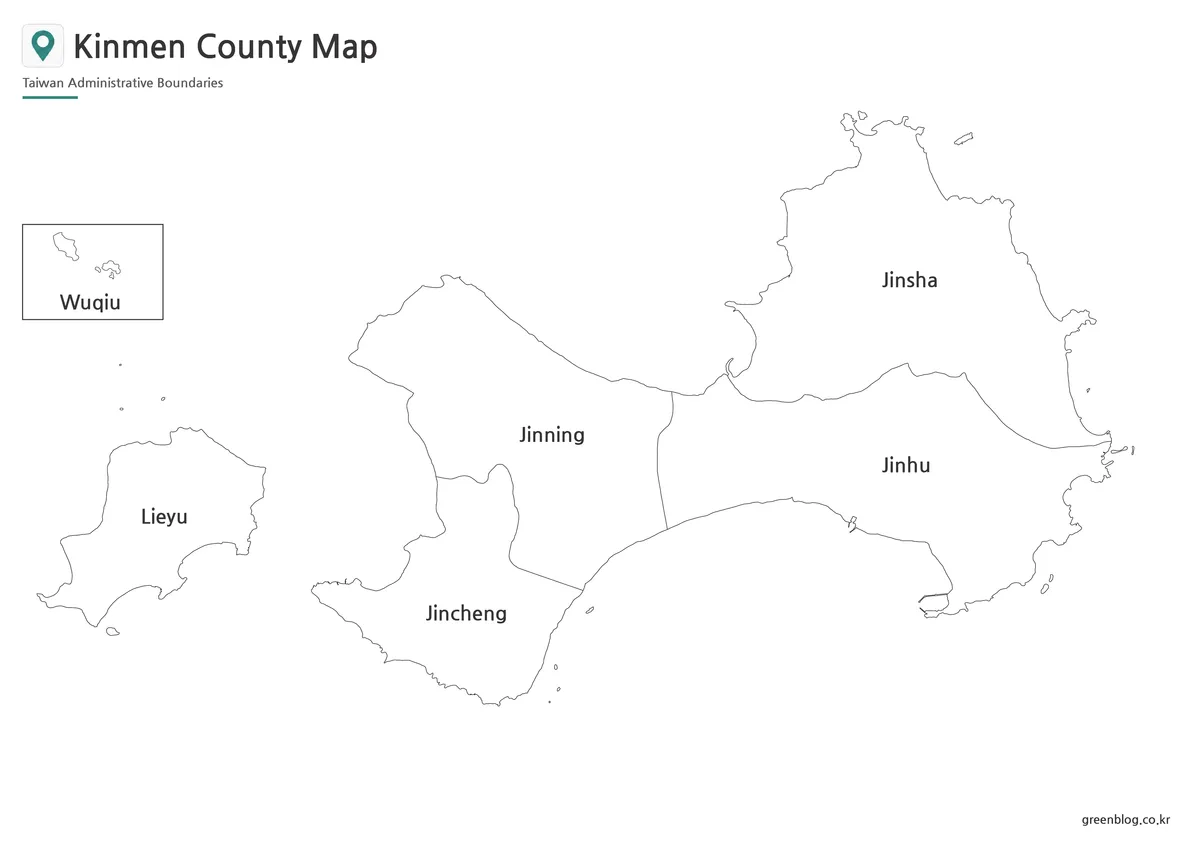
The monochrome version retains all six township names while removing blue water and regional fills. Coastlines and internal boundaries become the main visual structure, which makes the sheet suitable for black-and-white reports, photocopied handouts, and reference pages placed beside text or tables.
This is still a labeled guide rather than a recall-only worksheet. Students can check which township occupies the eastern end, compare Jincheng and Jinning, or identify the two detached township presentations. For independent labeling, use the outline edition rather than covering names on this sheet.
Before printing a Kinmen County map class set, test one page at the intended size. Inspect the fine eastern coastline, the small offshore shapes south of Jincheng and east of Jinhu, the Wuqiu inset, and the narrow divisions near the island center. Preserve the landscape ratio so the main island and Lieyu are not stretched.
Outline Map for Labels and Custom Overlays
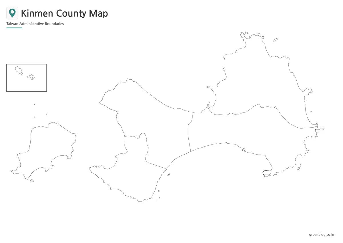
The outline Kinmen County map removes township names and color fills while retaining island coastlines, the four main-island divisions, Lieyu, and the Wuqiu inset. Learners can write all six names, color the townships according to a teacher’s key, or identify which units are presented outside the main island.
Designers can add selected points, categories, or sourced statistics, but every new symbol needs an explanation. The base image contains no verified road network, ferry line, tourist site, village position, or distance scale. A line drawn between islands is a user annotation and should not be presented as information supplied by the original map.
“Outline” refers to the uncluttered geographic field, not to a vector or layered source file. The title, subtitle, location-pin graphic, Wuqiu frame, and site mark remain on the raster canvas. Keep an untouched original, work at the final output size, and avoid enlarging the 1,200-pixel preview far beyond its native dimensions.
Choosing a Version for a Discontinuous County
The best version depends on whether readers need answers or open space. Choose color for rapid township separation, monochrome when labels must remain visible in a restrained document, and outline when users will supply names or data. Matching geometry makes it easy to move from explanation to practice.
A Kinmen County map is particularly valuable when a project must avoid reducing the county to its main island. Lieyu and Wuqiu are not optional decorative pieces; they represent two of the six townships. Captions and surrounding text should state that the Wuqiu panel is an inset so its placement is not mistaken for literal proximity.
For slides, enlarge the inset or northern and eastern coastlines on a follow-up frame if the audience cannot read them. For reports, numbered callouts can identify small features without covering the shore. For classroom work, ask students to explain why one county needs both a main panel and a remote inset rather than only memorizing six names.
Use a current official source for legal boundaries, transportation, emergency planning, or detailed local administration. Coastlines and public infrastructure can change, while the supplied map does not state a survey scale or boundary date. Its appropriate role is broad township orientation, educational comparison, and simplified visual communication.
Frequently Asked Questions
Is Kinmen County located on Taiwan’s main island?
No. Kinmen County is in the Taiwan Strait, west of Taiwan’s main island and close to the coast of Fujian Province in China.
How many administrative areas are included in the Kinmen County map?
The county has six townships: Jincheng, Jinhu, Jinsha, Jinning, Lieyu, and Wuqiu.
Why is Wuqiu missing from some maps?
Wuqiu is far from the main Kinmen island group, so simplified tourist maps often leave it out. A complete administrative map should still include it.
Which version should I choose?
Use the color version for visual comparison, the black and white version for printing, and the outline version for editing, worksheets, or infographic projects.
Download Information
Map File Information
The ZIP archive contains three coordinated township maps with the main island, Lieyu, and a Wuqiu inset.
- Included Versions: Color labeled, black-and-white labeled, and blank outline maps
- Printable Size: A3 layout
- File Type: Image files
- Intended Use: Lessons, reports, presentations, printing, labeling, and annotations
Related Maps
Additional Resources
- Kinmen County Government — Consult the county’s official English portal for current public information and local-government references.
Green Map creates custom-edited map images using open geographic data sources such as geoBoundaries, Natural Earth, OpenStreetMap, and government open data.
These maps are edited visual materials, not raw data files, and are provided for education, documents, presentations, and graphic reference.