A Saudi Arabia Map has to balance some of the Arabian Peninsula’s largest administrative areas with a tight chain of smaller regions in the southwest. Riyadh occupies a broad central space, Eastern Province extends across much of the east, and Northern Borders spans the upper interior. By contrast, Al Bahah and Jazan need compact labels within narrow shapes near the Red Sea side.
The three supplied sheets use the same 13-region framework on a 1200-by-848-pixel landscape canvas. One map separates the regions with muted colors, one keeps the names on white fills, and one removes all names for annotation. The composition is arranged for A3 use and supports regional study, print handouts, presentation graphics, label exercises, and custom visual projects.
These are administrative-region maps rather than general reference atlases. They do not label the Red Sea, the Gulf, neighboring countries, roads, terrain, or cities. Riyadh, Makkah, and Al Madinah appear as names of their respective regions; no symbol identifies a city or the national capital. Recognizing that scope prevents a regional label from being mistaken for a city marker.
Table of Contents
Included Map Versions
Saudi Arabia covers most of the Arabian Peninsula and has coastlines on two different bodies of water. Jordan, Iraq, and Kuwait lie along the northern side; Qatar and the United Arab Emirates are to the east; and Oman and Yemen border the south. The map artwork isolates Saudi Arabia from that wider setting so the 13 first-level administrative regions can fill the page.
The regional pattern changes noticeably from north to south. Tabuk, Al Jawf, Northern Borders, and Hail shape the upper half; Al Qassim sits between Hail and Riyadh; and the vast Eastern Province meets Riyadh along a long internal line. On the western and southwestern side, Al Madinah, Makkah, Al Bahah, Asir, Jazan, and Najran form a more closely divided sequence.
All three maps preserve that geometry, making them easy to compare. The color sheet establishes the whole arrangement, the labeled monochrome sheet emphasizes names and lines, and the blank sheet provides an answer-free base. A reader can move between them without learning a different scale or regional placement.
- Pastel regional map with all 13 English labels
- Black-and-white map with the same names and boundary network
- Blank outline retaining the outer border and regional divisions
English romanization varies across publications. The artwork uses Al Jawf, Hail, Al Qassim, Al Bahah, Asir, and Jazan; other official English materials may use forms such as Al-Jouf, Al-Baha, or Aseer. When a project requires an institutional naming standard, compare the displayed labels with the source specified by the project.
Color Saudi Arabia Regional Map
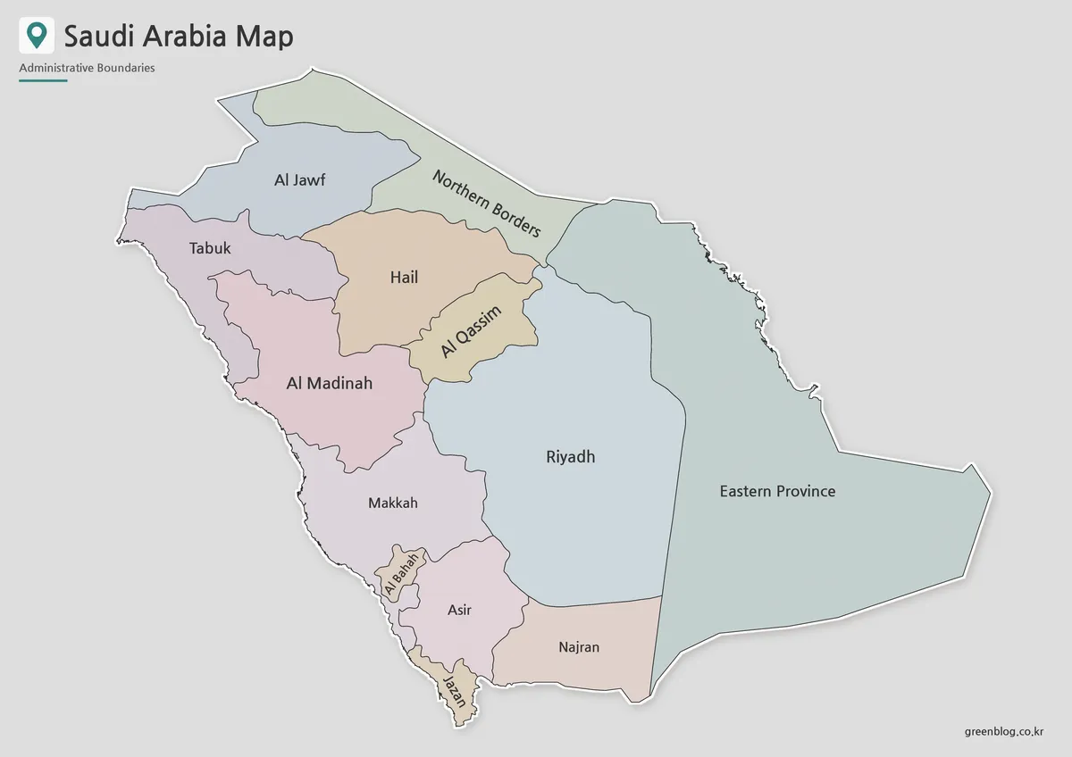
Pastel fills make neighboring regions visually distinct without implying population, climate, resources, or another data scale. The treatment is especially helpful where Al Bahah, Asir, Jazan, Makkah, and Najran meet in the southwest. Those smaller or narrower shapes could blend together if they shared a single fill.
The large interior regions create a different reading problem. Riyadh and Eastern Province occupy much of the map, so their labels can sit horizontally with ample space, while Northern Borders and Al Qassim use angled text to fit their forms. The Saudi Arabia Map therefore demonstrates how label orientation can respond to shape rather than follow one fixed direction.
Use color when the audience needs to distinguish the entire regional structure quickly. It can introduce a lesson about the 13 regions, serve as a visual overview in a report, or provide a presentation reference before a speaker discusses selected areas. The colors should not be interpreted as official regional colors.
Black and White Saudi Arabia Map
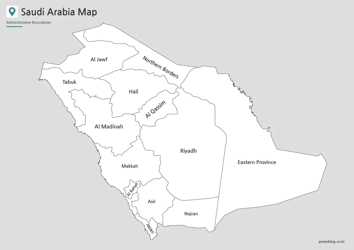
Without color fills, the second sheet turns attention toward line work and naming. This is useful when the map must sit beside colored charts or when a worksheet asks students to underline, number, or shade selected regions. The same irregular western edge and long east-central boundary remain visible against white interiors.
Printing scale matters most around Al Bahah and Jazan, where narrow spaces require smaller or rotated labels. Preserve the landscape ratio and inspect a print preview before reducing the page. A3 placement gives the names more room, but actual clarity still depends on the printer, application, compression, and margin settings.
A classroom activity can use this Saudi Arabia Map as both reference and answer sheet. Learners might identify the four northern regions, trace the west-side chain from Tabuk to Jazan, or compare the extent of Riyadh with Eastern Province. Because cities are not marked, tasks should ask about regions unless a separate city layer is provided.
Blank Saudi Arabia Outline Map
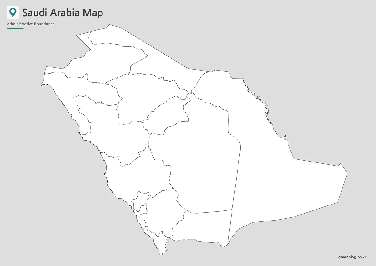
The outline sheet removes every region name and color while keeping the same 13 internal shapes. It can function as a recall exercise after students study the labeled version, or as a graphic base when a project needs its own legend. Large blank interiors in Riyadh and Eastern Province leave room for notes, symbols, or project-specific labels.
Relevant annotation tasks include marking the two coastal sides, adding a capital symbol within Riyadh Region, grouping northern and southwestern regions, or tracing a route defined by the user. These additions are not supplied map features. The image contains no city coordinates, transport network, elevation, climate zones, or resource data to verify such marks automatically.
Keep an untouched duplicate before editing digitally. Thin southwestern divisions are easier to miscolor than the broad eastern shapes, and a new label can cover a border if placed without reference to the named map. Comparing both sheets side by side reduces those errors while preserving the blank Saudi Arabia Map for another activity.
Practical Uses for This Saudi Arabia Map
For a regional geography lesson, begin with the color map and ask readers to notice unequal region sizes. Follow with the black-and-white sheet for name recognition, then use the outline for recall. The shared geometry lets a teacher compare completed work with a labeled reference without changing the page orientation.
Report and presentation creators should choose the version according to visual role. Color provides immediate separation; monochrome supports a restrained document; and the outline accepts a custom classification. If the subject is cities, highways, topography, or neighboring states, add a separate verified layer rather than implying that those details are already included.
The administrative name Riyadh requires particular care. On the Saudi Arabia Map, it occupies the central region and does not point to the capital’s exact location. The same distinction applies to Makkah and Al Madinah: the labels identify regions, even though cities with those names exist within them.
For general regional reference, the supplied boundary framework matches Saudi Arabia’s 13 first-level administrative regions. A current official source remains appropriate when a project depends on formal spellings, subregional divisions, or legal boundary detail. The Saudi Arabia Map is best treated as a clean educational overview rather than a cadastral or navigation document.
Frequently Asked Questions
The following answers cover file selection and printing. They also clarify that each Saudi Arabia Map shows administrative regions, not city points or transport routes.
What is included in this Saudi Arabia map collection?
The collection includes a color map, a black and white map, and an outline map of Saudi Arabia. Each version is intended for a different use, including printing, classroom reference, presentation design, and graphic editing.
Can I print the Saudi Arabia map in A3 size?
Yes. The map set is prepared for A3 layout printing, making it suitable for classroom posters, large handouts, presentation boards, and reference sheets.
Which version is best for editing?
The outline map is the best choice for editing. It provides the regional boundary layout without color, so users can add labels, highlights, icons, routes, or data overlays.
Is the black and white map useful for worksheets?
Yes. The black and white version is useful for classroom worksheets, printed assignments, document inserts, and simple reference materials where color is not needed.
Does the map include Saudi Arabia’s regional divisions?
Yes. The map is based on Saudi Arabia’s 13 administrative regions, including Riyadh, Makkah, Al Madinah, Eastern Province, Tabuk, Al Jawf, and other regional divisions.
Map File Information
The download contains the three Saudi Arabia regional map views displayed on this page, all using the same 13-region boundary layout.
- Included Versions: Color labeled map, black-and-white labeled map, and blank outline map
- Printable Size: Maps arranged for A3 landscape use
- File Type: Image files
- Intended Use: Regional study, worksheets, presentations, reports, and annotation projects
Related Maps
Additional Resources
- Saudi General Authority for Statistics: Regional List: Review an official table using all 13 administrative-region names and current English spellings.
Green Map creates custom-edited map images using open geographic data sources such as geoBoundaries, Natural Earth, OpenStreetMap, and government open data.
These maps are edited visual materials, not raw data files, and are provided for education, documents, presentations, and graphic reference.