A Sudan Map becomes much more useful when its boundary choices are explained rather than treated as neutral. The supplied collection shows 18 state-level areas, six neighboring countries by name, the Red Sea, Saudi Arabia across the water, and a dotted box for the Abyei Area. It also draws the northeast coast according to a boundary portrayal that differs from maps using Egypt’s position. Those details make the graphics valuable for careful geographic reading, but they also mean that a date, source note, and boundary disclaimer belong beside any formal reuse.
This Sudan Map set contains three coordinated 1,200 × 849-pixel WebP previews: a labeled color state map, a labeled monochrome version, and an unlabeled outline. A fourth 900 × 450-pixel image presents the national flag. The source package is described as an A3-oriented image collection. The maps can support state-recognition lessons, comparison slides, country profiles, and custom labeling exercises, but they are not road, terrain, population, locality, river-network, or city maps.
The images require several corrections in surrounding text. South Kordofan is printed as “S. Lordofan” in both labeled versions, and River Nile State is shortened to “Nile.” The map does not mark Khartoum city with a point even though Khartoum State is labeled. Central African Republic, which shares a land border with Sudan, is not named, while Saudi Arabia is shown across the Red Sea and must not be counted as a land neighbor.
Table of Contents
Sudan Map Overview
Sudan occupies a broad part of northeastern Africa and reaches the Red Sea on its eastern side. Its land neighbors are Egypt, Libya, Chad, Central African Republic, South Sudan, Ethiopia, and Eritrea. The artwork labels all except Central African Republic. It also places Saudi Arabia beyond the sea to provide regional orientation. The two “Red Sea” labels serve different purposes: one identifies Red Sea State inside Sudan, and the other identifies the body of water outside the coast.
The 18-state structure visible on this Sudan Map consists of Northern, River Nile, Red Sea, Kassala, Gedaref, Sennar, Blue Nile, White Nile, Al Jazirah, Khartoum, North Kordofan, South Kordofan, West Kordofan, and the five Darfur states: North, West, Central, South, and East Darfur. Sudanese government materials also describe the country as comprising 18 states. Abyei is drawn separately in a dotted box and should not be added as a nineteenth state.
Read the dotted Abyei box separately
The small dashed feature on the south-central border is labeled “ABYEI AREA.” Its final status between Sudan and South Sudan remains unresolved, and a separate referendum anticipated during the process that led to South Sudan’s independence was not held. The dotted treatment is therefore meaningful: it warns that Abyei should not be colored automatically as an ordinary Sudanese state or silently merged into South Sudan for a legal or political presentation.
The northeast outline reflects a disputed claim
At the Red Sea end of the Egypt border, the national outline rises north of the long straight boundary. This treatment corresponds to Sudan’s claim to the Hala’ib Triangle. Egypt rejects that claim, so maps following the two governments’ positions do not always use the same outline. The supplied image is suitable for discussing that cartographic difference, but it should not be described as a settled international boundary or used as the sole source for legal, diplomatic, navigation, or operational work.
Included Map Versions
The Sudan Map files share one extent and state geometry, allowing users to move from reference to practice without changing the base. Their differences are visual rather than geographic.
- Color state map: pastel state fills, labels, neighboring-country context, Red Sea water, and the marked Abyei Area
- Monochrome state map: the same labels and boundaries without colored state fills
- Blank outline: state divisions and external context without state or country names
- Flag image: a 2:1 raster graphic with red, white, and black horizontal bands and a green hoist triangle
The three map previews measure 1,200 × 849 pixels, while the flag is 900 × 450 pixels. Because these are raster previews, enlarging far beyond the native dimensions may soften thin boundary lines. The package information identifies an A3 layout, but users should still test label size and line contrast on the actual printer before producing a full set of handouts.
Sudan Color State Map
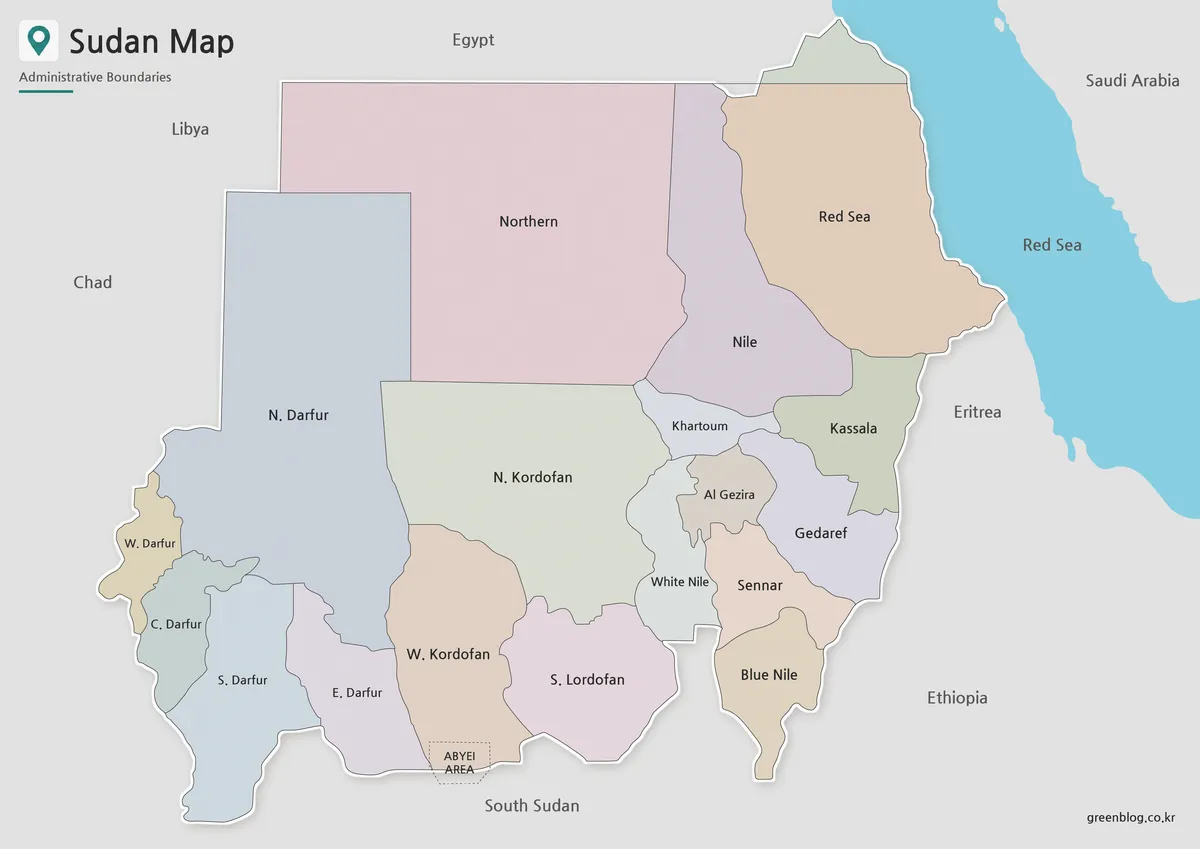
The color Sudan Map is the strongest option for first-pass state recognition. Alternating pastel fills separate neighboring units without requiring a heavy legend, and gray surrounding land keeps the national area visually dominant. The large western and northern states are easy to identify, while color is especially helpful in the dense central group around Khartoum, Al Jazirah, White Nile, Sennar, Kassala, and Gedaref.
Color does not repair the text. Change “S. Lordofan” to South Kordofan in any accompanying key or caption, and explain that “Nile” refers to River Nile State. The label “Al Gezira” is a common variant of Al Jazirah, and “Gedaref” is also rendered Al Qadarif in other English references. Select one verified naming convention and use it consistently rather than mixing spellings copied from multiple sources.
Basic Sudan Map for Printing
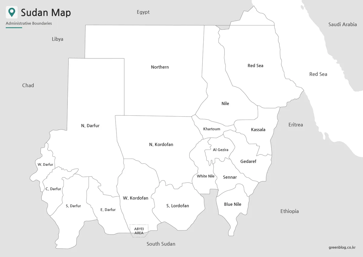
The monochrome version retains the names and fine boundary lines while removing state fills. It is a practical reference for grayscale reports, low-ink handouts, and worksheets that ask readers to underline, number, or shade selected states. The open interiors also make handwritten notes more visible than they would be on the pastel version.
The informational limitations remain unchanged. Khartoum is a state label, not a capital marker; the White Nile and Blue Nile names identify states rather than drawn river channels; Central African Republic is still missing from the neighbor labels; and the printed South Kordofan error remains visible. If those distinctions are central to a lesson, provide a corrected key next to the image instead of expecting students to infer them.
Blank Sudan Outline Map for Editing
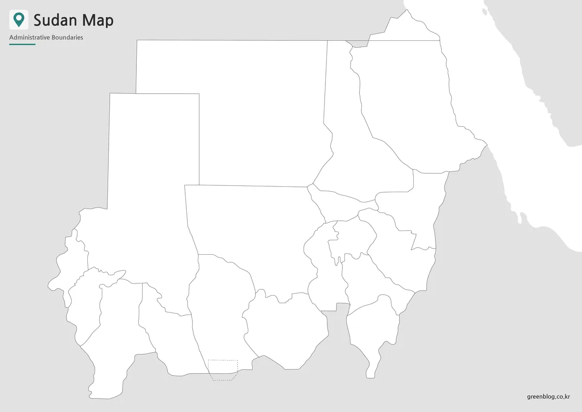
The blank Sudan Map removes labels and fills while keeping the same 18 internal divisions, coastal context, and dotted Abyei feature. It can become a recall sheet, a color-by-region exercise, or a base for a simple presentation overlay. Because the state geometry matches the labeled versions, users can switch between the color reference and blank exercise without realigning the page.
Do not assume that “blank” means politically neutral or technically editable. The northeast claim line and Abyei treatment remain embedded in the raster geometry, and the WebP preview is not a vector dataset with selectable boundaries. Add labels and fills on separate layers, preserve an untouched copy, and obtain a current authoritative boundary source when accuracy is more important than a classroom-scale visual.
Sudan Flag Image
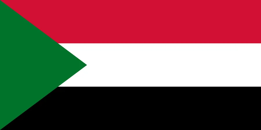
The flag image provides a clean national identifier for a title panel or country profile. Its simple 2:1 composition fits presentation headers, although it should not replace a map legend, date, or boundary note.
Practical Uses for the Sudan Map Collection
- State identification: use the color map to introduce the 18 states, then move to the blank outline for recall.
- Regional grouping: compare the five Darfur states, three Kordofan states, central Nile-area states, and eastern coastal or border states.
- Cartographic discussion: examine why Abyei uses a dotted box and why the northeast outline differs among published maps.
- Document design: select color for quick visual separation, monochrome for print, outline for custom labels, and the flag for identification.
A reliable workflow starts with the intended date and purpose. Verify whether the project needs administrative states, physical geography, cities, transport, humanitarian boundaries, or internationally recognized legal lines. Correct the visible spelling issues, identify omitted Central African Republic in surrounding text, and state that Saudi Arabia lies across the Red Sea. If the finished work includes statistics or operational information, match those data to a boundary source from the same period.
Frequently Asked Questions
What does this Sudan map collection include?
It includes a color Sudan map, a basic map, and a blank outline map. A Sudan flag image is also included for country reference materials.
Is the Sudan map suitable for printing?
Yes. The files are prepared in an A3 layout, making them suitable for classroom handouts, reports, worksheets, and presentation materials.
Which Sudan map version is best for reports?
The basic map is the best option for reports because it keeps labels and boundaries clear without using heavy background color.
Can I use the Sudan outline map for editing?
Yes. The outline version works well for adding custom labels, regional colors, data markers, routes, or infographic elements.
Why are Sudan’s regional divisions important on a map?
Sudan is a large country with several major regional areas, including Darfur, Kordofan, Khartoum, the Nile region, and the Red Sea area. Showing state boundaries makes these areas easier to compare.
Does this Sudan Map show settled international borders?
No. The image shows Abyei in a dotted box and uses Sudan’s claimed northeast outline around the Hala’ib Triangle. Those areas require separate political and legal context. Use a current authoritative source for official, diplomatic, navigation, emergency, or operational purposes.
Map File Information
This Sudan map collection includes color, monochrome, blank outline, and flag images for state-reference and labeling projects.
- Included Files: Use only the versions confirmed in the article and supplied images
- File Type: Use the confirmed download contents
- Intended Use: Printing, education, presentations, and map-based projects
Related Maps
Additional Resources
- United Nations Abyei Background — Learn why Abyei received special administrative treatment and why its final status remains unresolved.
Green Map creates custom-edited map images using open geographic data sources such as geoBoundaries, Natural Earth, OpenStreetMap, and government open data.
These maps are edited visual materials, not raw data files, and are provided for education, documents, presentations, and graphic reference.