A Guatemala Map is useful for more than identifying one country in Central America. Guatemala borders Mexico, Belize, Honduras, and El Salvador, so its location often needs to be explained together with nearby countries. A clear map helps readers understand where Guatemala sits between the Pacific coast, the Caribbean side, and the wider Central American region.
This printable Guatemala Map collection includes color, black and white, and outline versions prepared for A3-size high-resolution use. The files are provided in JPG, PNG, and ZIP format, making them suitable for classroom handouts, travel planning materials, blog graphics, presentation slides, and editable design projects. Instead of using a single general map, users can choose the version that fits their purpose: a color map for fast regional reading, a basic black and white map for printing, or a blank outline map for custom editing.
Guatemala is often discussed in connection with Mayan history, Tikal, Lake Atitlán, coffee-growing areas, travel routes, and Central American geography. In those cases, a simple country outline is not always enough. Administrative boundaries make it easier to compare regions, mark important places, or explain how destinations are spread across the country. The capital, Guatemala City, also plays an important role in travel and national reference materials, so a readable layout is especially helpful.
During the map preparation process, the focus was placed on regional separation rather than only the outer national border. Some areas needed stronger color contrast after print checking because similar tones could become less distinct on paper. Boundary lines were also reviewed at larger sizes so the map could remain useful when inserted into a document, printed as a worksheet, or used as a presentation visual.
Table of Contents
Guatemala Map Collection Overview
This Guatemala Map set was created as a practical printable resource for users who need a clean country map with multiple usage options. It can support educational content, travel-related posts, country comparison materials, and graphic projects where a simple but readable layout is needed.
Included versions:
- Color Guatemala Map
- Black and white Guatemala Map
- Blank Guatemala outline map
- Guatemala flag image
- JPG, PNG, and ZIP file support
- A3 high-resolution layout
The collection is designed for both print and digital use. Teachers may use it in geography or history lessons, bloggers may add it to Central America travel content, and designers may use the outline version as a base for custom infographics.
Choosing the Right Guatemala Map Version
The best version depends on how the map will be used. For a quick visual explanation of the country’s administrative structure, the color map is the easiest option. For printed worksheets or documents where notes may be added, the black and white version keeps the page cleaner. For custom design work, the outline version gives the most flexibility because it removes labels and colors.
Guatemala’s position between Mexico, Belize, Honduras, and El Salvador makes it useful in regional comparison materials. A map with administrative boundaries helps users explain more than just the country’s outline, especially when discussing travel routes, Mayan heritage sites, tourism areas, or Central American geography.
Color Guatemala Map for Regional Understanding
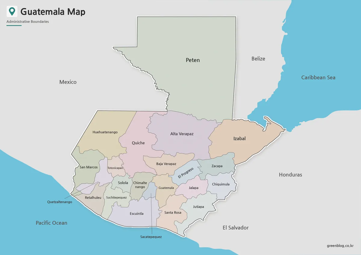
Designed with color-coded administrative areas, the color Guatemala Map makes the country’s internal layout easier to read at a glance. This is helpful when the map is used in blog posts, classroom slides, or country introduction materials where readers need to understand regional placement quickly.
Guatemala has access to both the Pacific Ocean and the Caribbean side, so the coastline and surrounding regional context matter. The color layout helps separate inland areas from coastal sides and makes the overall country shape easier to understand in relation to neighboring countries. When introducing locations such as Guatemala City, Tikal, or Lake Atitlán, this version provides a strong visual starting point.
Recommended uses:
- Central America geography lessons
- country profile graphics
- travel presentation slides
- blog posts about Guatemala
- educational reference materials
The color version works best when visual clarity is more important than note-taking space.
Black and White Guatemala Map for Printing
For printed materials, a simplified design is often more practical. The black and white Guatemala Map removes strong color fills while keeping administrative boundaries visible. This makes it easier to print in reports, classroom packets, worksheets, and presentation handouts.
Because Guatemala has several neighboring countries and a mix of inland and coastal geography, a clean line-based layout helps prevent the page from feeling crowded. It also gives users space to add notes, highlight routes, mark cities, or circle areas related to a lesson or travel plan. The map was checked at enlarged size so the boundary lines remain readable when scaled for A3 or reduced for smaller paper sizes.
This version is suitable for:
- A4 and A3 printing
- classroom worksheets
- report inserts
- geography study materials
- simple travel route marking
If the goal is to print, annotate, or use the map in a document, the black and white version is usually the most convenient choice.
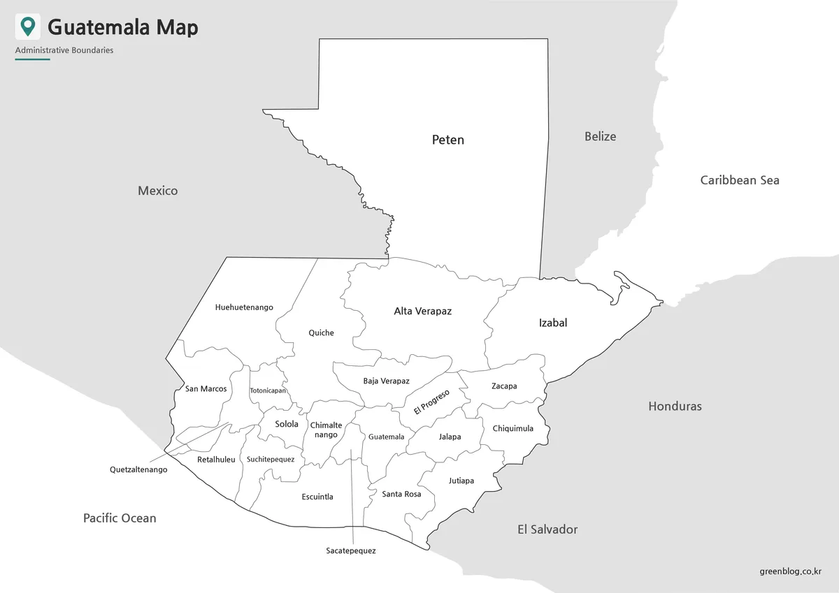
Blank Guatemala Outline Map for Editing
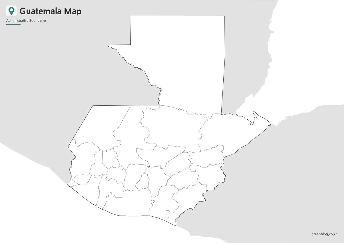
The blank outline version leaves only the country shape and administrative boundary lines. Without labels or colors, it works as a clean base map for editing in design software, presentation tools, or worksheet layouts.
This format is useful when users want to add their own information. For example, a teacher might create a labeling activity about Central America, while a designer might color regions based on travel routes, population data, agricultural areas, tourism points, or infographic categories. Since the map is not visually crowded, custom labels and markers can be added without competing with existing colors.
Possible editing uses include:
- marking Mayan heritage sites
- adding Guatemala City and travel points
- creating classroom coloring activities
- building regional comparison graphics
- visualizing tourism or geography data
- preparing custom presentation maps
The outline map is the best choice when the map needs to become part of a larger design project.
Guatemala Flag Reference
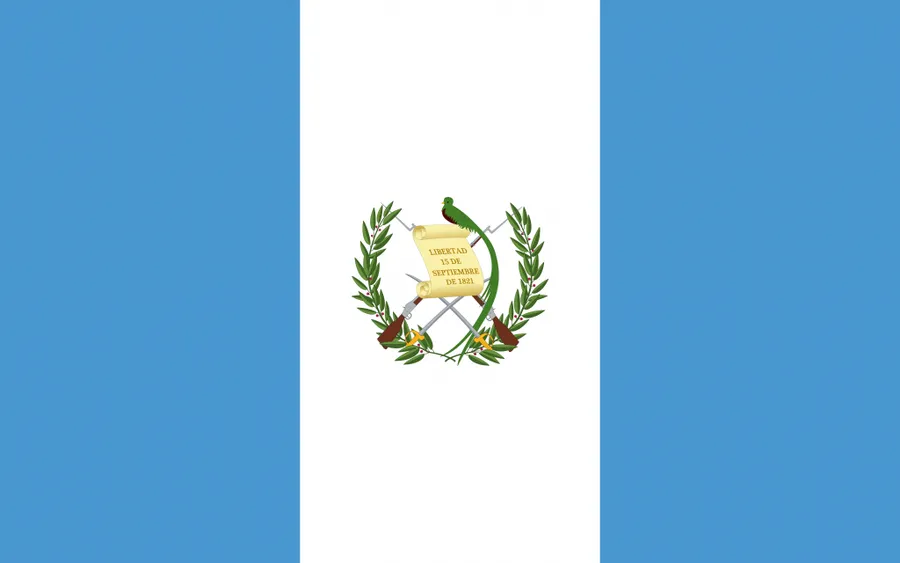
The Guatemala flag is included as a supporting visual element for country reference materials. Its vertical blue and white design is useful when creating educational layouts, country profile pages, travel graphics, or presentation slides.
Pairing the flag with the Guatemala Map can help readers connect the country’s location with its national symbol. This is especially helpful in classroom resources or blog posts that introduce several Central American countries together.
Practical Uses for a Guatemala Map
A Guatemala Map can be used in many different contexts. In education, it supports lessons about Central America, Mayan civilization, regional geography, and neighboring countries. In travel content, it helps explain where major destinations are located and how routes may connect across the country.
For blog posts and presentations, the map gives readers a visual reference before moving into details about tourism, history, culture, or geography. For design projects, the outline version provides a flexible base for icons, arrows, color fills, and custom labels.
Common use cases include:
- Central America comparison materials
- Mayan history and culture lessons
- travel route planning
- blog graphics and country profiles
- school reports and worksheets
- infographic and presentation design
Because Guatemala’s points of interest are spread across different parts of the country, a readable map makes the information easier to follow.
Frequently Asked Questions
Can I print the Guatemala Map on A4 paper?
Yes. The original layout is prepared for A3 high-resolution use, but it can also be reduced for A4 printing.
What file formats are included?
The map files are prepared in JPG and PNG formats, with files provided together in a ZIP archive.
Which Guatemala Map is best for classroom use?
The black and white map is best for worksheets and handouts. The outline map is useful for labeling or coloring activities.
Is the outline version editable?
Yes. The blank outline map is designed for editing, coloring, annotations, and infographic projects.
Guatemala Map Download
Download the printable Guatemala Map collection with color, black and white, and outline versions for classroom materials, travel content, presentations, and graphic editing.
Image Size: A3 high-resolution layout
Included Maps: Color map, black and white map, outline map, flag image
Intended Usage: Printing, education, presentations, blog graphics, infographic editing
Additional Resources
- Perry-Castañeda Library Map Collection – Guatemala Maps : A useful map archive for users looking for historical, political, and reference maps of Guatemala.
Related Maps
- 5 United States Maps for Download (Color, Black & White, Outline)
- Panama Map Collection – Color, Labeled, and Outline Maps for Printing
- Printable New York City Map Collection – Color, Black and White & Outline Maps
- Jamaica Map Download Pack for Printing, Education and Design Projects