A Burkina Faso Map needs a date as well as a title. The three supplied images show the country’s former 13-region arrangement, which was superseded by a national administrative reorganization announced in July 2025. They remain useful for studying the earlier framework, building a historical comparison, or preparing a lesson about territorial change, but they should not be presented as a current official administrative map.
The set contains a labeled color map, a labeled monochrome map, and an unlabeled outline. All three WebP previews measure 1,200 × 849 pixels and share the same regional geometry. The downloadable source package is identified as an A3-oriented JPG collection. None of the views includes provinces, departments, cities, roads, relief, population data, or a capital marker, so their strongest use is regional identification rather than detailed geographic reference.
Burkina Faso is landlocked in West Africa. The color image places Mali and Niger across the north and east, with Benin, Togo, Ghana, and Côte d’Ivoire along the southern side. These surrounding labels establish national context, while the internal lines focus attention on the older regions. Users should read the artwork carefully: one regional name is misspelled, and some neighboring-country labels on the monochrome version appear displaced.
Table of Contents
Printable Burkina Faso Map Collection
The Burkina Faso Map collection records the 13 regions used before the July 2025 change: Cascades, Hauts-Bassins, Sud-Ouest, Boucle du Mouhoun, Nord, Sahel, Centre-Nord, Centre-Ouest, Centre, Plateau-Central, Centre-Sud, Centre-Est, and Est. The central cluster is comparatively compact, while Est occupies a broad eastern area and Sahel spans much of the north. The color fills make that contrast particularly easy to see.
This is a first-level regional map only. It does not show the lower-level provincial or departmental divisions that a contemporary administrative project may require. It also omits Ouagadougou, even though the city is the national capital, and it has no scale bar, north arrow, coordinate grid, source date, or legend. Treat the boundary lines as a simplified visual framework rather than a surveying or navigation product.
A critical July 2025 boundary note
The national government’s territorial reorganization notice, published on July 7, 2025, describes a structure of 17 regions, 47 provinces, and 350 departments. The supplied artwork predates that framework and therefore does not display the four additional regions or the complete current set of administrative names and boundaries.
That date distinction determines whether the graphics are suitable. They work for a “before” panel, a discussion of administrative reform, archival illustration, or a worksheet explicitly labeled “former 13-region framework.” They are not appropriate for current government reporting, emergency planning, present-day regional statistics, electoral work, or any task in which an outdated boundary could change the meaning of the data. Pair them with a verified current source whenever recency matters.
Color Administrative Map
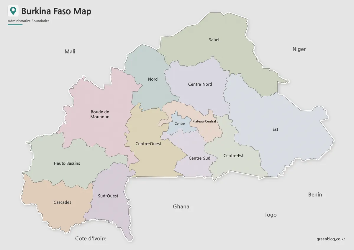
This Burkina Faso Map is the clearest reference in the set. Contrasting pastel fills separate adjacent regions, gray surrounding land distinguishes neighboring countries, and blue is reserved for the small visible water area beyond the southern neighbors. Labels are large enough for slides or classroom display, although some crowding remains around Centre, Centre-Sud, Plateau-Central, and Centre-Est.
Check the text before publishing the image. The western region Boucle du Mouhoun is printed as “Boude de Mouhoun,” replacing the correct cl with d. Côte d’Ivoire also appears without its accents. A caption or accompanying key can correct both spellings without altering the original preview. Because no capital symbol appears, do not claim that the map locates Ouagadougou.
Black and White Printable Version
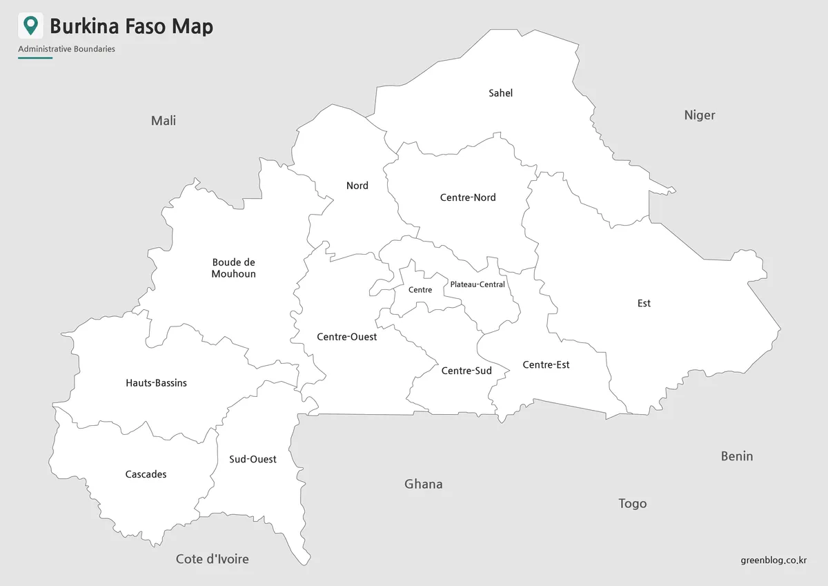
The monochrome Burkina Faso Map removes the regional fills while retaining the internal names and outlines. It uses less ink and leaves more room for pencil notes, numbered prompts, hatching, or a student-created color key. The fine boundary lines are readable at the original preview size, but test a sample before reducing it substantially because the compact central labels can become difficult to distinguish.
Use the internal region labels with the same historical caveat as the color view. In addition, the lower neighboring-country names do not align reliably with their geographic positions in this version. They should not be used to teach the exact west-to-east order of Côte d’Ivoire, Ghana, Togo, and Benin. For surrounding-country orientation, the color view is the more coherent of the two labeled images, and a current atlas should remain the authority.
Blank Outline Map for Editing
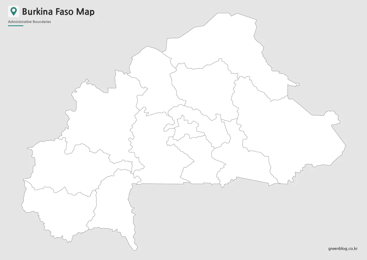
The blank Burkina Faso Map removes both the names and fills but preserves the same 13-region divisions. It is the best starting point for a recall worksheet: learners can label the former regions, shade a selected area, or compare the old framework with a separately sourced current map. Designers can also add a legend, timeline, callouts, or custom data, provided the finished graphic is clearly dated.
Because the file is a raster preview rather than an editable vector, enlarging it beyond its native dimensions may soften the lines. Add overlays on a separate layer and keep an untouched copy. If the task needs exact geometry, live boundaries, or publication-quality scaling at any size, obtain a current authoritative vector dataset instead of tracing this outline.
Practical Uses
- Historical comparison: place the former 13-region Burkina Faso Map beside a verified post-July-2025 map and ask readers to identify structural changes.
- Classroom recall: introduce the old names with the color image, supply the monochrome reference, and use the blank outline as the assessment sheet.
- Presentation design: use the color view for quick separation, the monochrome view for restrained documents, and the outline for custom overlays.
- Editorial context: illustrate an article about the earlier administrative framework, with the date and limitation stated in the caption.
A simple workflow prevents accidental misrepresentation. First decide whether the project concerns the former or current framework. Next verify names, dates, and boundaries against the relevant official source. Choose the image whose visual treatment fits the medium, correct the visible spelling issues in nearby text, and add a caption such as “Former 13-region arrangement, before July 2025.” Finally, proof the output at its actual print or slide size.
Frequently Asked Questions
What map versions are included?
The collection includes a color administrative map, a black and white printable map, and a blank outline map.
Is this Burkina Faso Map suitable for classroom use?
Yes. The black and white version is especially useful for classroom printing, worksheets, and geography lessons.
Can I edit the outline version?
Yes. The outline map is designed for editing, labeling activities, infographics, and custom design work.
What is the best version for presentations?
The color administrative map is usually the best choice for presentation slides because the regional divisions are easier to see.
Important: the protected FAQ describes the three supplied versions, but “administrative map” here refers to the former 13-region arrangement. For any current administrative use, consult the official 17-region framework rather than relying on these images alone.
Map File Information
This Burkina Faso Map collection provides color, black-and-white, and blank outline views of the former 13-region framework.
- Included Files: Use only the versions confirmed in the article and supplied images
- File Type: Use the confirmed download contents
- Intended Use: Printing, education, presentations, and map-based projects
Related Maps
Additional Resources
- Official Territorial Reorganization Notice — The Burkina Faso government explains the July 2025 change and the resulting administrative counts.
Green Map creates custom-edited map images using open geographic data sources such as geoBoundaries, Natural Earth, OpenStreetMap, and government open data.
These maps are edited visual materials, not raw data files, and are provided for education, documents, presentations, and graphic reference.