A Maine Map is useful for much more than identifying the northeastern corner of the United States. Teachers frequently use county maps when introducing New England geography, while students, bloggers, and presentation creators often need clear administrative boundary maps for reports and visual projects. Maine covers a large geographic area compared to many eastern states, and its combination of rugged coastline, forested interior, and scattered population centers makes county-level maps especially valuable when explaining regional patterns.
Located at the northeastern edge of the U.S., Maine borders New Hampshire to the west and Canada to the north and east. The Atlantic Ocean stretches along its southern and southeastern coastline, creating one of the most recognizable coastal landscapes in North America. Although the state has a population of roughly 1.4 million people, it covers more than 91,000 square kilometers, resulting in large areas of sparsely populated land. Major cities such as Portland, Augusta, Bangor, and Lewiston are concentrated in only a small portion of the state, making a detailed Maine Map helpful for understanding how communities are distributed across the region.
This printable Maine Map collection includes three versions designed for different purposes: a color county map, a labeled map, and a blank outline map. All files are provided as high-resolution JPG images prepared for A3 printing. Whether the goal is to create classroom handouts, infographic materials, travel presentations, educational worksheets, or editable graphics, each version offers a different level of detail.
During preparation, additional attention was given to Maine’s highly irregular coastline. Numerous bays, peninsulas, and offshore islands can make boundaries difficult to read when reduced in size. The layout was reviewed at enlarged print sizes to ensure county names remained readable and coastal details remained clear.
Table of Contents
Maine Map Versions Included
The collection contains:
- Color county map
- Labeled county map
- Blank outline map
- High-resolution JPG files
- A3 printable format
- County boundary information
Maine contains 16 counties, including large counties such as Aroostook, Somerset, Penobscot, and Oxford. Because several counties cover extensive geographic areas, county boundaries play an important role in understanding the overall layout of the state.
Maine Map Color Version
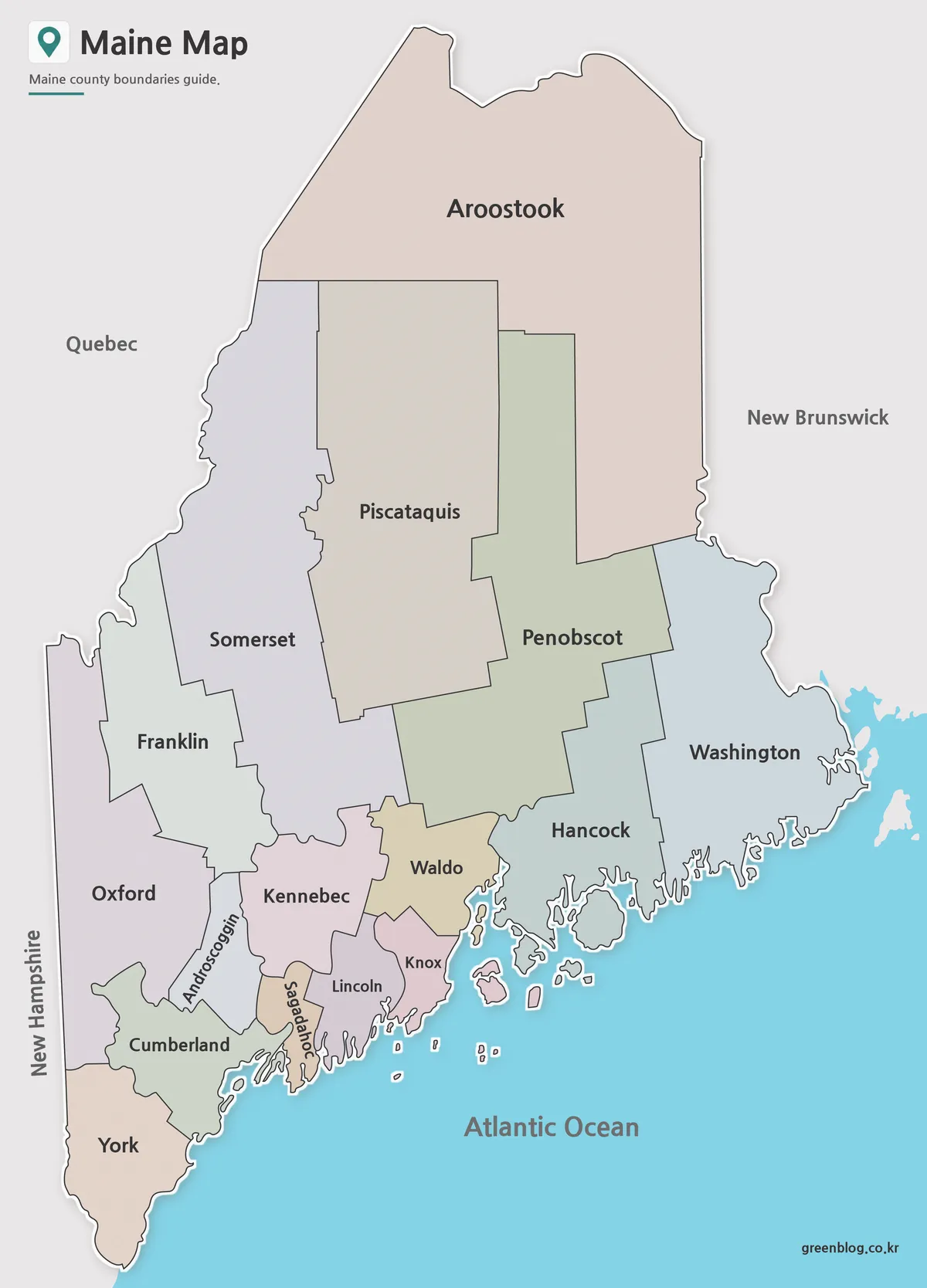
The color version separates counties using contrasting colors that make regional boundaries easy to identify. This format works particularly well for regional comparison projects, demographic studies, classroom activities, and presentations where viewers need to distinguish counties quickly.
Northern Maine contains some of the largest counties in the eastern United States, while southern counties contain much of the state’s population and economic activity. The color scheme was adjusted to ensure neighboring counties remain visually distinct when viewed both digitally and in print. Readability was checked during A3 print testing to confirm that boundaries remained easy to recognize.
Labeled Version for Reports and Presentations
Designed for users who need place names without relying on color, the labeled map highlights county boundaries along with major cities including Portland, Bangor, Augusta, and Lewiston.
Large-format print reviews were used to verify that county names remained readable even when viewed from presentation distance. Because Maine includes an unusually complex coastline, labels and boundary lines were repositioned where necessary to reduce overlap and improve clarity. The result works well for classroom reference materials, regional reports, travel planning documents, and educational presentations.
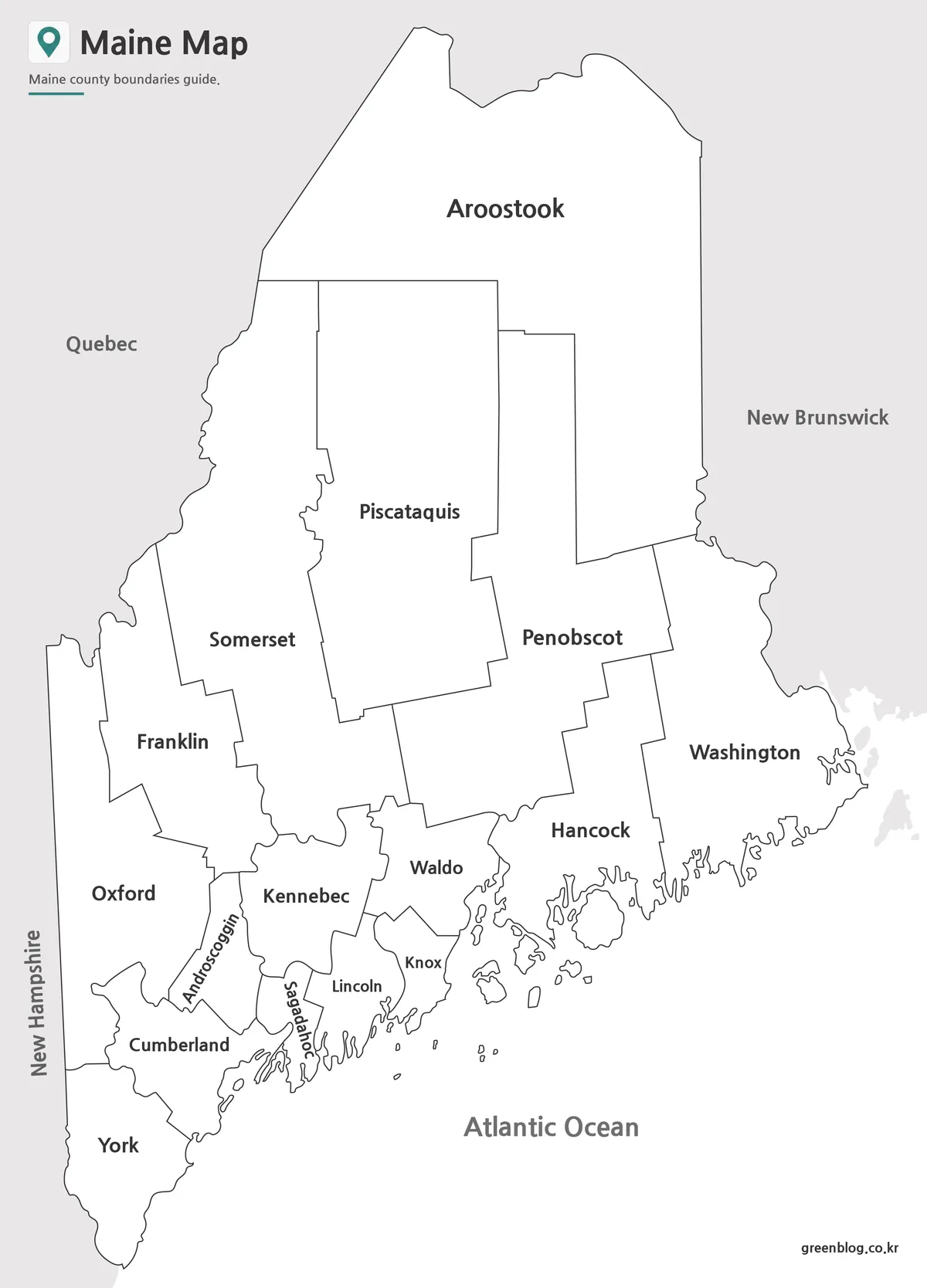
Outline Map for Editing and Custom Projects
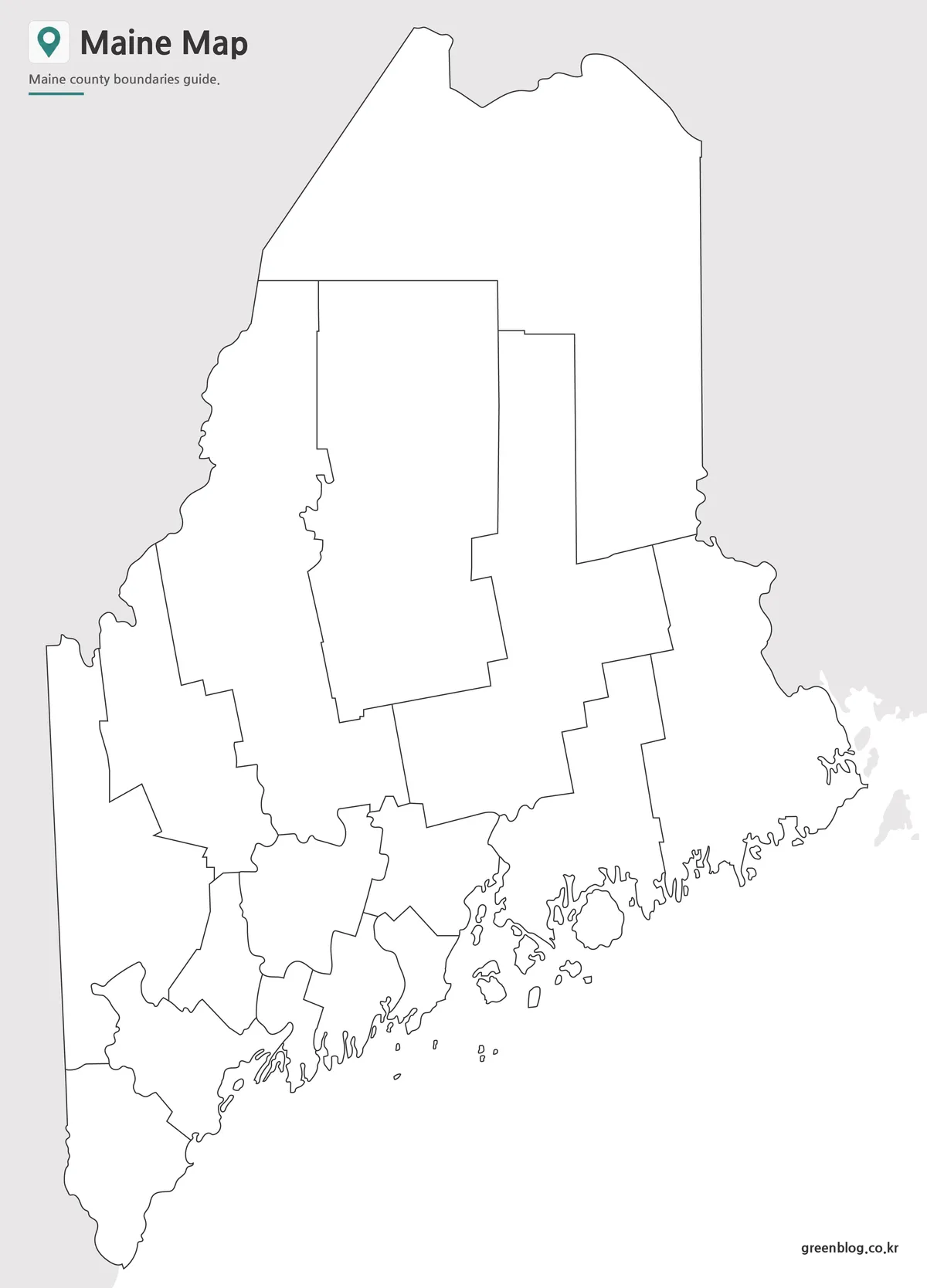
The outline version removes colors and labels while preserving county boundaries. Many users prefer this format when creating educational worksheets, tourism maps, infographic projects, population studies, or custom visualizations.
Maine’s coastal geography required several rounds of refinement to ensure shoreline details remained recognizable without creating unnecessary visual clutter. The simplified layout provides a clean canvas for adding custom information while maintaining accurate county boundaries.
Common uses include:
- Educational worksheets
- County coloring activities
- Population analysis projects
- Tourism planning materials
- Presentation graphics
- Regional comparison studies
Designed for Education and Regional Analysis
A Maine Map often becomes useful when explaining how population centers relate to the state’s large rural areas. Educators can use the labeled version for geography lessons, while researchers may prefer the color version when presenting regional statistics. Designers and content creators frequently choose the outline version because it allows custom information to be added without distractions.
One challenge during preparation involved balancing coastal detail with readability. The final layout was reviewed at enlarged sizes and adjusted to remain clear in both digital presentations and printed materials. As a result, the Maine Map collection works equally well for classroom reference, infographic production, blog graphics, and presentation slides.
Frequently Asked Questions
Does the Maine Map include county boundaries?
Yes. All versions include Maine county boundaries.
Can the Maine Map be printed in A3 size?
Yes. The files were prepared in high resolution for A3 printing.
Which Maine Map version is best for editing?
The outline version is the best choice for annotations, graphic editing, and custom projects.
Is the labeled Maine Map useful for classroom activities?
Yes. It includes county names and major cities while maintaining a clean layout for educational use.
Maine Map Download
Choose the version that best fits your project. Color, labeled, and outline maps are included for printing, classroom use, presentations, and editing work.
- File Format: JPG
- Print Size: A3 High Resolution
- Included Maps: Color Map · Labeled Map · Outline Map
- Usage: Printing · Education · Presentation · Editing
Additional Resources
- Maine Office of GIS — Provides official geographic data and mapping services for Maine.
Related Maps
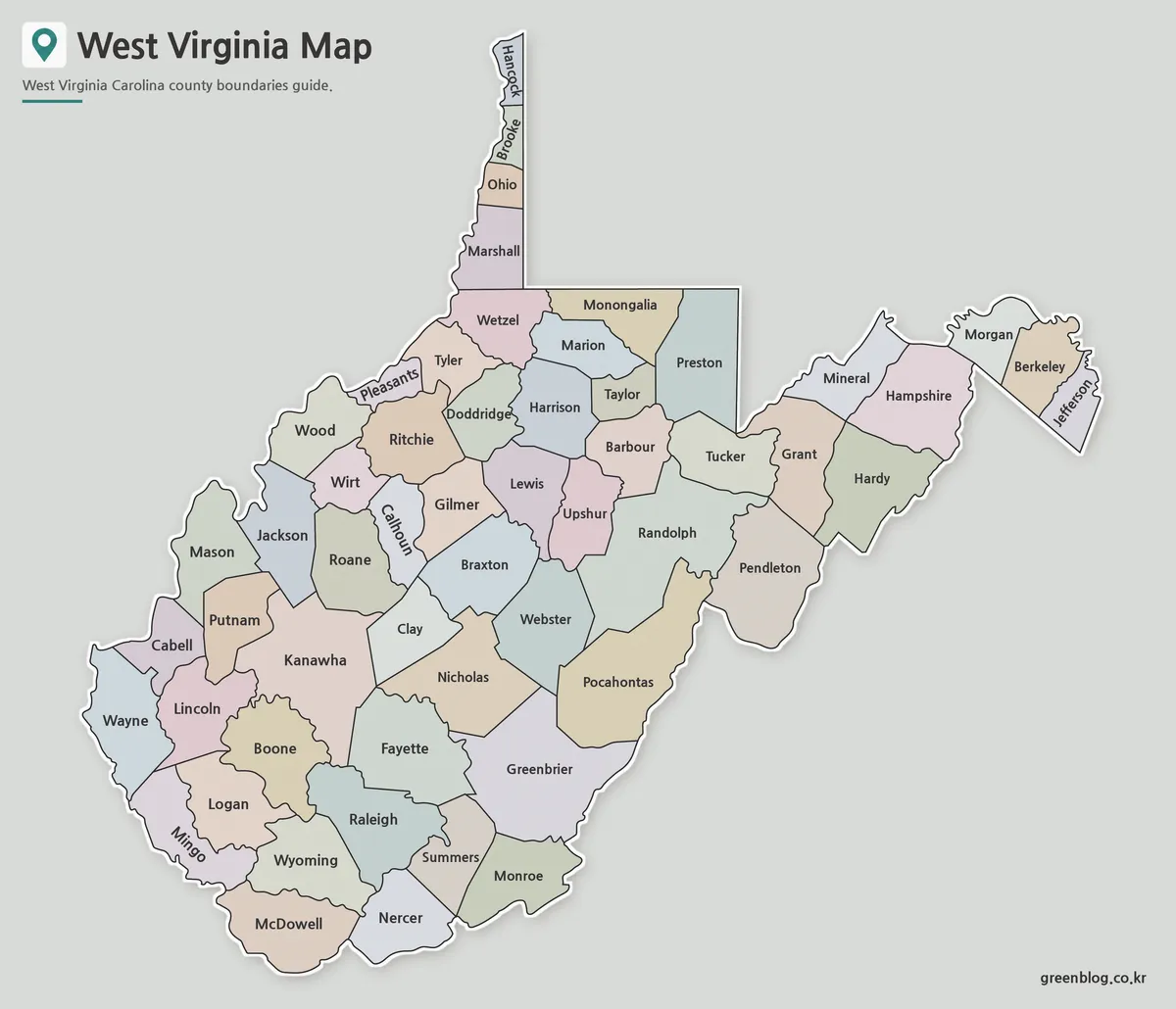
- West Virginia Map Download – Printable County Map Collection
- Massachusetts Map Collection | Printable County Maps in High Resolution
- South Carolina Map Download | Printable County Map Collection
- Mississippi Map Download | Printable County Map Collection