A Wisconsin Map has to make room for 72 counties within a state outline shaped by two Great Lakes, a long western river boundary, and the narrow Door Peninsula. The large northern counties look very different from the compact southeastern group near Lake Michigan, while islands and coastal edges add detail at the top and east of the page. A county map makes these relationships visible without requiring readers to assemble them from a list.
The three supplied views use the same county framework. One map separates counties with soft colors and includes names, a second retains the names in black and white, and a third removes both labels and color to create a blank outline. All are portrait-format, high-resolution A3 resources supplied as JPG files in a ZIP archive. They are intended for county reference, lessons, presentations, worksheets, and user-added annotations.
Wisconsin sits in the north-central United States. Lake Superior meets the state in the northwest, Lake Michigan forms much of the eastern side, and Michigan’s Upper Peninsula borders the northeast. Minnesota and Iowa lie to the west across sections of the St. Croix and Mississippi river system, while Illinois borders the south. This position gives the Wisconsin Map a recognizable outline that includes the Apostle Islands area, Green Bay, and the Door Peninsula.
The images focus strictly on county boundaries. They do not show cities, highways, rivers, terrain, or physical relief, and the color fills do not define official regions or data categories. Madison, Milwaukee, Green Bay, and other cities can be added by a user when a project needs them, but they should not be assumed to be part of the downloaded county maps.
Table of Contents
Why a Wisconsin Map Is Useful for Regional Understanding
Wisconsin’s 72 counties are all functioning governmental entities, but their shapes and sizes vary considerably. Douglas, Bayfield, Ashland, Vilas, and other northern counties occupy broad areas, whereas Milwaukee, Ozaukee, Racine, Kenosha, Waukesha, and neighboring southeastern counties form a tighter pattern. Marathon stands prominently near the center of the state, creating an easy visual reference between the northern and southern groups.
Water strongly influences the outer boundary. Door County projects between Green Bay and Lake Michigan, Bayfield County reaches the Apostle Islands area on Lake Superior, and a curved western edge follows the river corridor past counties such as St. Croix, Pierce, Pepin, Buffalo, La Crosse, Vernon, and Crawford. The maps do not label these water features, yet their influence is visible in the coastline and border shapes.
County boundaries also provide a neutral base for comparing different regional systems. A teacher may group northern forest counties, western river counties, central counties, and the Lake Michigan corridor, but those groupings must be explained separately because the supplied maps show counties rather than ecological, tourism, economic, or planning regions. Keeping that distinction clear prevents decorative colors from being mistaken for data.
Included File Information
| Item | Details |
|---|---|
| File Format | JPG files in a ZIP archive |
| Print Size | A3 High Resolution |
| Included Maps | Color labeled · Black-and-white labeled · Blank outline |
| Boundary Level | All 72 Wisconsin counties |
| Intended Use | Printing · Education · Presentations · Annotation |
The labeled versions name every county and use leader lines where the narrow Lake Michigan shoreline leaves limited room, including Milwaukee and Ozaukee. Other slim or compact counties, such as Pepin, Menominee, and Kewaunee, rely on careful text placement or rotated labels. The blank version preserves the same geometry, making it possible to compare a completed reference with an unlabeled activity sheet.
Color County Map for Regional Comparison
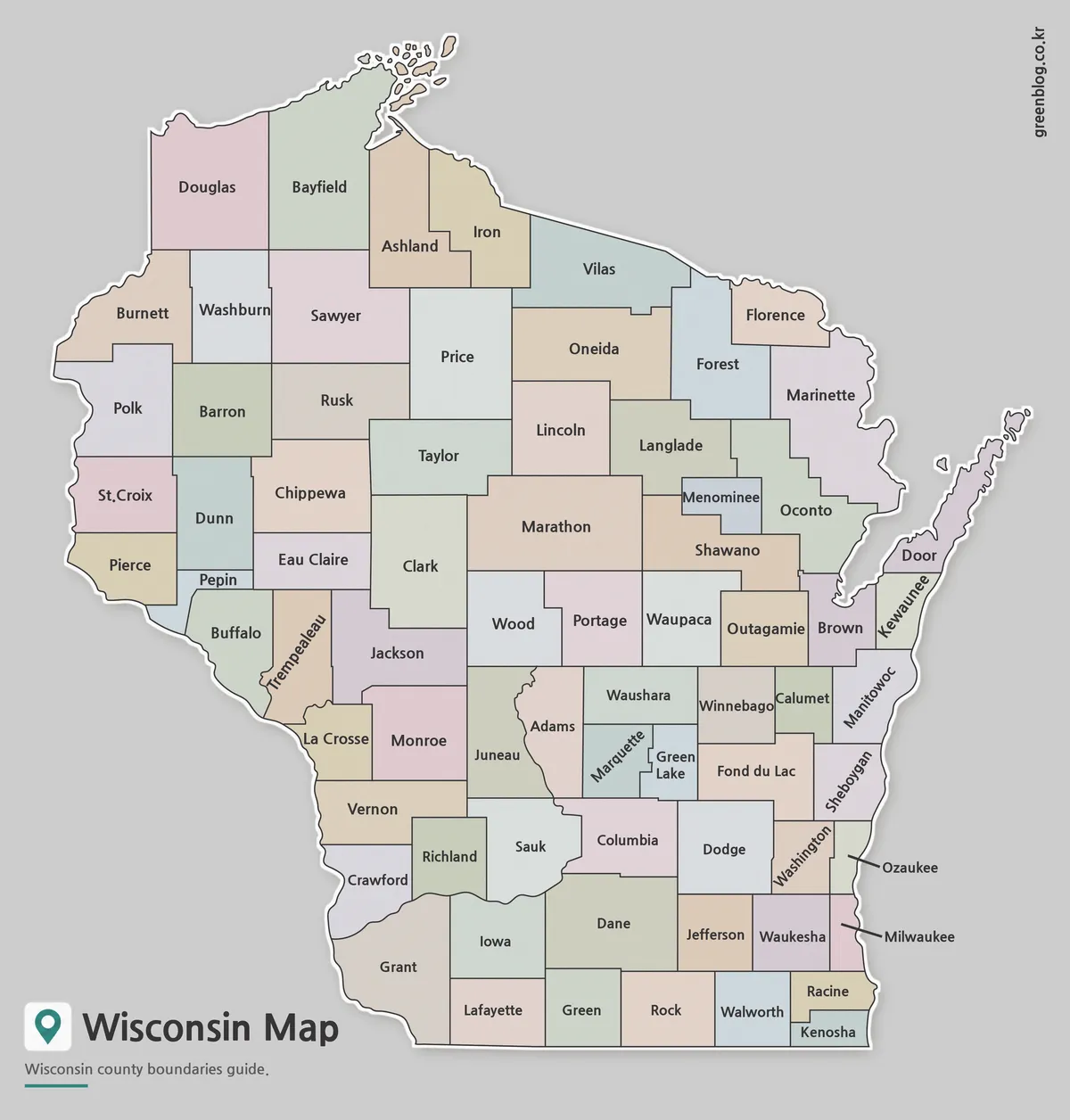
Soft pastel fills make shared boundaries easier to trace across the Wisconsin Map without suggesting a statistical ranking. This is most noticeable where several counties meet around central Wisconsin and along the densely divided eastern side. The contrast also helps readers separate small shapes such as Pepin from larger neighbors and follow the county sequence around Green Bay.
Choose the color view for a projected slide, a regional orientation handout, or a graphic in which county identification must be quick. Because names are already present, added information should be restrained. A few city markers or highlighted counties can be placed above the image, but heavy patterns and long notes may compete with the existing labels and pastel areas.
The color treatment is categorical decoration, not a legend. Adjacent counties with different fills are not necessarily different in population, land use, politics, or climate. Anyone using the map for a thematic project should add a separate legend and apply a consistent color scale based on cited data rather than interpreting the original palette.
Black and White Wisconsin Map for Printing
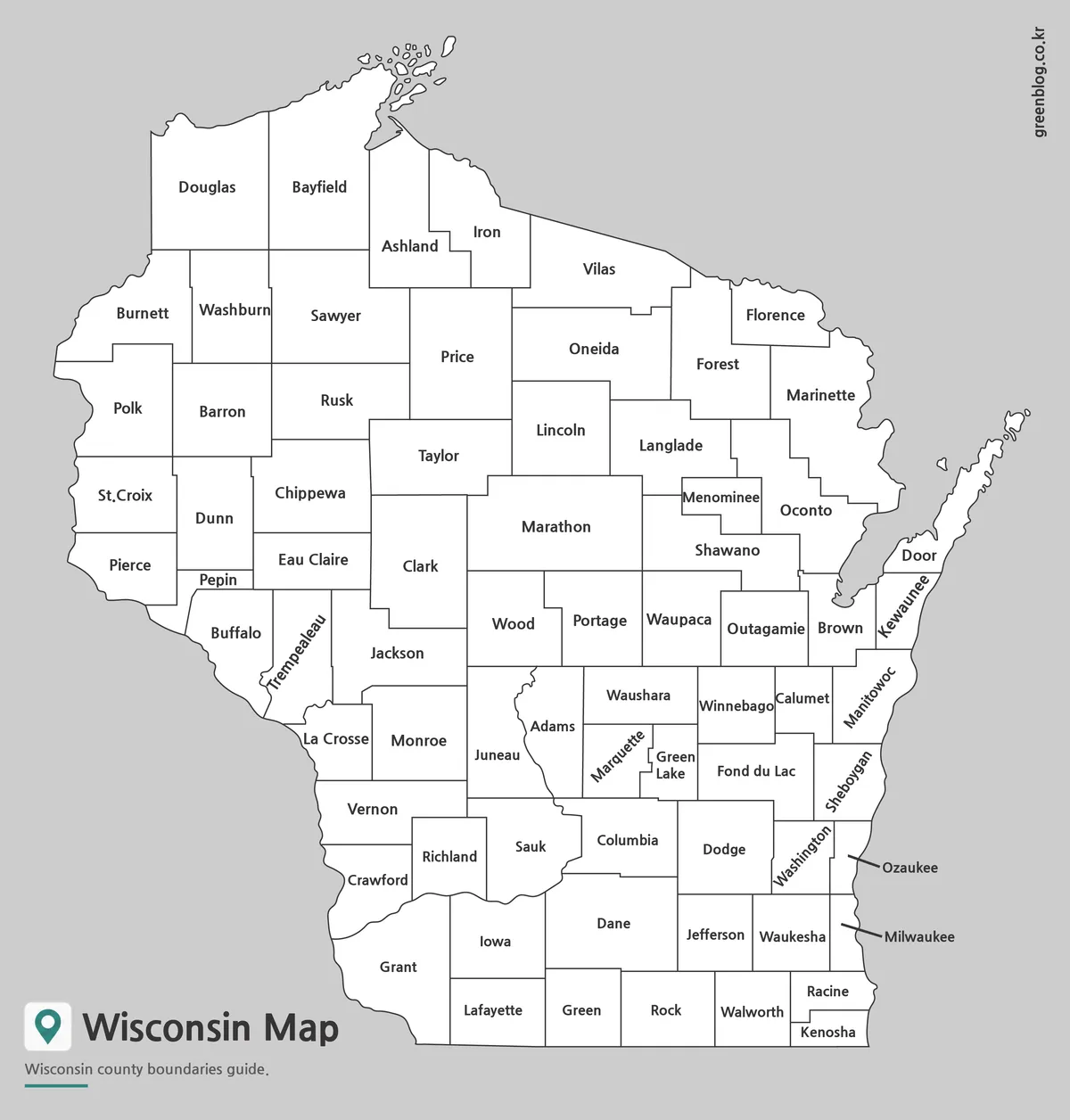
The monochrome version keeps county names and boundary lines while replacing the pastel interiors with white. It fits naturally into reports, worksheets, and study packets where a colored map would distract from surrounding material. The cleaner background also leaves room for light pencil marks, numbered references, or a small number of symbols without removing the county labels.
This view is suited to identification tasks in which learners need the answer labels available—for example, finding counties on Lake Superior, following the eastern shore from Door toward Kenosha, or comparing Marathon with the smaller counties around Milwaukee. It is not a blank quiz map, since all county names remain visible. Use the outline version when the names themselves are what students must supply.
Blank Outline Map for Editing Projects
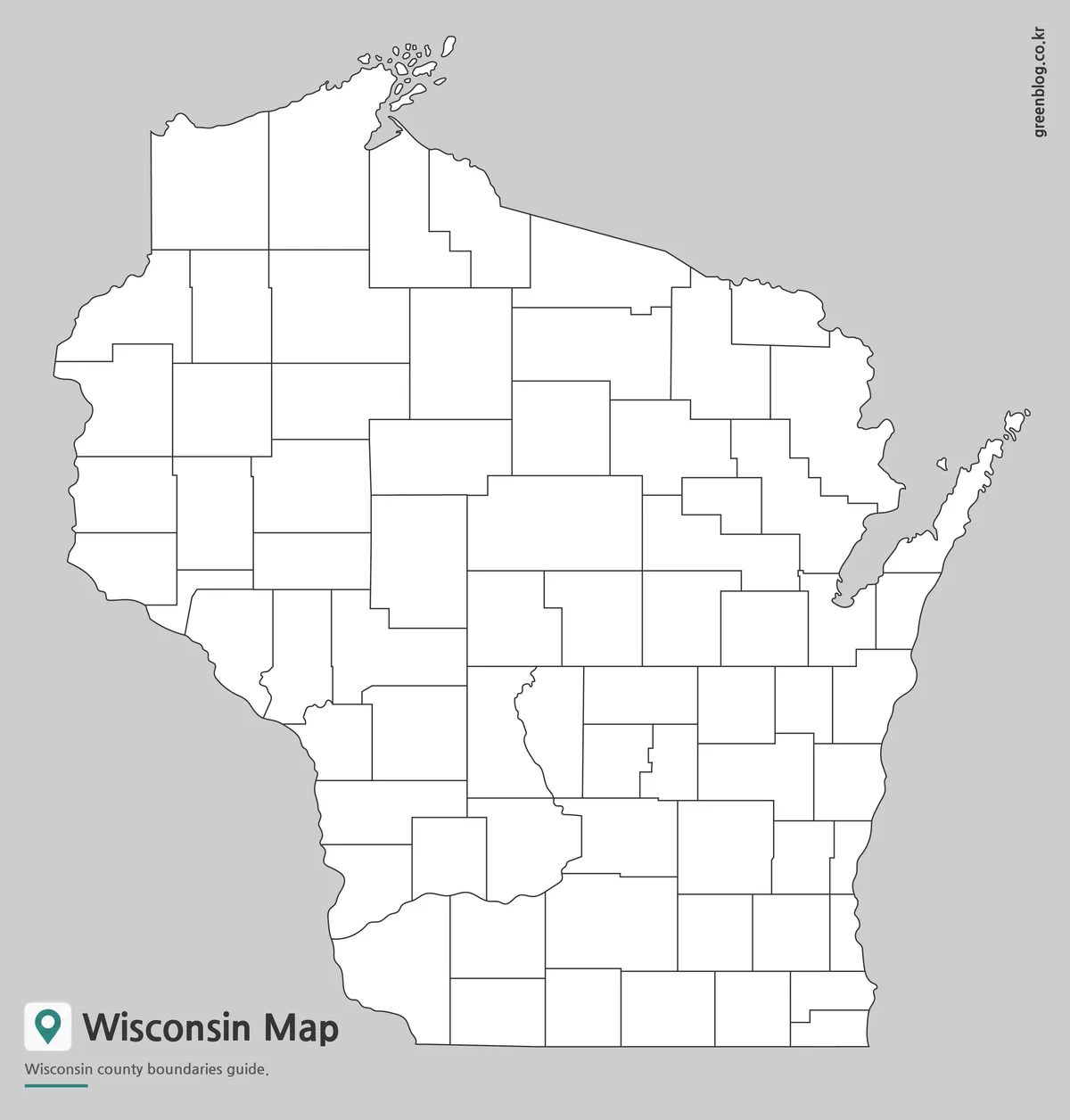
The blank Wisconsin Map removes every county name and color fill while retaining the full boundary framework. Its open interiors support labeling exercises, regional coloring, service-area planning, coverage tracking, and county-based data displays. The file is a JPG image rather than a vector source, so edits should be made as raster annotations or added in a document and presentation program.
For a classroom activity, students can label the Great Lakes shoreline counties, identify the counties along the Mississippi side, or use the labeled map as an answer key. A designer can add city points for Madison, Milwaukee, Green Bay, Eau Claire, and La Crosse, then connect those points with routes while keeping the original county geometry visible. Data-driven coloring should include a title, date, legend, and source.
The narrowest areas require special care. Short labels or numbered keys are more readable than full annotations inside Pepin, Menominee, Ozaukee, and Milwaukee counties. On the Door Peninsula and Lake Superior coast, keep notes away from the outer line so the shoreline remains recognizable. These choices preserve the geographic character that distinguishes Wisconsin from a generic county grid.
Choosing the Right Wisconsin Map
Use the color map when fast visual separation is the priority, the black-and-white labeled map when county reference must sit cleanly in a document, and the outline when users need to supply labels or build their own categories. The three versions should not be treated as different geographic datasets; they are alternate presentations of the same county arrangement.
Keep the portrait proportions when printing at A3 size. Shrinking the page is possible, but names in southeastern Wisconsin and around Green Bay become harder to read before the large northern labels do. For slides, crop only unused gray margin and retain the peninsula, island shapes, and curved western border because those features provide orientation even without neighboring-state labels.
These resources are general-purpose visual maps rather than legal, surveying, navigation, or emergency-management documents. A boundary-sensitive project should confirm the relevant date and geography through an authoritative source. For teaching, presentations, and custom county comparisons, the consistent layout lets readers move from a labeled reference to an unlabeled working copy without learning a new design.
Frequently Asked Questions
Can I print the Wisconsin Map in A3 size?
Yes. The files were prepared as high-resolution A3 resources for printing.
Does the map include county boundaries?
Yes. All versions include Wisconsin county boundary lines.
Which Wisconsin Map is best for editing?
The outline version is the most flexible choice for editing, custom coloring, and data visualization.
Map File Information
The archive contains three county-map views for labeled reference, monochrome printing, and user-added annotations.
- Included Versions: Color labeled · Black-and-white labeled · Blank outline
- Printable Size: A3 High Resolution
- File Type: JPG / ZIP
- Intended Use: Printing · Lessons · Presentations · Annotation
Additional Resources
- Wisconsin DNR Great Waters – Learn about Lake Superior, Lake Michigan, and the Mississippi River as major waters of Wisconsin.
Related Maps
Green Map creates custom-edited map images using open geographic data sources such as geoBoundaries, Natural Earth, OpenStreetMap, and government open data.
These maps are edited visual materials, not raw data files, and are provided for education, documents, presentations, and graphic reference.